Aurora | |
---|---|
Motto: | |
Coordinates: 47°32′N92°14′W / 47.533°N 92.233°W | |
Country | United States |
State | Minnesota |
County | Saint Louis |
Government | |
• Mayor | Doug Gregor |
Area | |
• Total | 3.91 sq mi (10.13 km2) |
• Land | 3.70 sq mi (9.57 km2) |
• Water | 0.21 sq mi (0.56 km2) |
Elevation | 1,470 ft (450 m) |
Population (2020) | |
• Total | 1,678 |
• Density | 453.88/sq mi (175.27/km2) |
Time zone | UTC−6 (Central (CST)) |
• Summer (DST) | UTC−5 (CDT) |
ZIP Code | 55705 |
Area code | 218 |
FIPS code | 27-02872 |
GNIS feature ID | 0660700 [4] |
Website | City of Aurora |
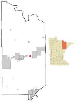
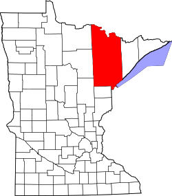
Aurora is a city in Saint Louis County, Minnesota, United States. The population was 1,678 at the 2020 census. [5]
Saint Louis County Highways 100 and 110 and Minnesota State Highway 135 are three of the main routes in Aurora.
Aurora was laid out in 1898. [6] A post office has been in operation at Aurora since 1903. [7] The city was incorporated in 1903. [6]
According to the United States Census Bureau, the city has a total area of 3.86 square miles (10.00 km2); 3.74 square miles (9.69 km2) is land and 0.12 square miles (0.31 km2) is water. [8] Aurora is surrounded by mixed coniferous/deciduous forest and is near many lakes.
Aurora is on northeastern Minnesota's Mesabi Range. This area produced a large quantity of the nation's iron and taconite ore.
The Northern Lights Music Festival is presented each summer and includes music concerts. [1] The festival is one of Minnesota's largest and presents professional opera, chamber music and symphonic concerts, in addition to student performances. It takes place in the first three weeks of July in six Iron Range cities.
Aurora is on the edge of the Superior National Forest, two miles (3 km) from Giants Ridge Golf and Ski Resort. Popular recreational activities include hunting, fishing, boating, four-wheeling, skiing, and snowboarding. There are many ATV and snowmobile trails on Aurora's outskirts, some of which extend all the way to Lake Superior.
Census | Pop. | Note | %± |
---|---|---|---|
1910 | 1,919 | — | |
1920 | 2,809 | 46.4% | |
1930 | 1,463 | −47.9% | |
1940 | 1,528 | 4.4% | |
1950 | 1,371 | −10.3% | |
1960 | 2,799 | 104.2% | |
1970 | 2,531 | −9.6% | |
1980 | 2,670 | 5.5% | |
1990 | 1,965 | −26.4% | |
2000 | 1,850 | −5.9% | |
2010 | 1,682 | −9.1% | |
2020 | 1,678 | −0.2% | |
U.S. Decennial Census [9] 2013 Estimate [10] |
As of the census [11] of 2010, there were 1,682 people, 777 households, and 438 families living in the city. The population density was 449.7 inhabitants per square mile (173.6/km2). There were 887 housing units at an average density of 237.2 per square mile (91.6/km2). The racial makeup of the city was 98.2% White, 0.2% African American, 0.5% Native American, 0.1% Asian, and 1.0% from two or more races. Hispanic or Latino of any race were 0.5% of the population.
There were 777 households, of which 24.1% had children under the age of 18 living with them, 41.3% were married couples living together, 11.2% had a female householder with no husband present, 3.9% had a male householder with no wife present, and 43.6% were non-families. 37.8% of all households were made up of individuals, and 18.1% had someone living alone who was 65 years of age or older. The average household size was 2.09 and the average family size was 2.70.
The median age in the city was 48.4 years. 19.3% of residents were under the age of 18; 6.7% were between the ages of 18 and 24; 20.2% were from 25 to 44; 29.5% were from 45 to 64; and 24.4% were 65 years of age or older. The gender makeup of the city was 48.9% male and 51.1% female.
As of the census of 2000, there were 1,850 people, 812 households, and 495 families living in the city. The population density was 487.4 inhabitants per square mile (188.2/km2). There were 893 housing units at an average density of 235.3 per square mile (90.8/km2). The racial makeup of the city was 98.38% White, 0.05% African American, 0.43% Native American, 0.38% Asian, 0.05% from other races, and 0.70% from two or more races. Hispanic or Latino of any race were 0.32% of the population. 17.4% were of Finnish, 13.2% German, 10.5% Norwegian, 9.1% Slovene, 7.3% Swedish, 6.6% Italian and 5.4% English ancestry according to Census 2000.
There were 812 households, out of which 22.2% had children under the age of 18 living with them, 48.6% were married couples living together, 8.4% had a female householder with no husband present, and 39.0% were non-families. 34.6% of all households were made up of individuals, and 17.4% had someone living alone who was 65 years of age or older. The average household size was 2.19 and the average family size was 2.79.
In the city, the population was spread out, with 19.8% under the age of 18, 7.2% from 18 to 24, 22.6% from 25 to 44, 26.4% from 45 to 64, and 23.9% who were 65 years of age or older. The median age was 45 years. For every 100 females, there were 95.6 males. For every 100 females age 18 and over, there were 93.4 males.
The median income for a household in the city was $32,094, and the median income for a family was $43,095. Males had a median income of $41,413 versus $20,625 for females. The per capita income for the city was $17,442. About 8.5% of families and 11.9% of the population were below the poverty line, including 26.0% of those under age 18 and 4.7% of those age 65 or over.
State Highway 135 (MN 135), County Highway 100, and County Highway 110 are three of the main routes in Aurora.
Chickamaw Beach is a city in Cass County, Minnesota, United States. The population was 128 at the 2020 census. It is part of the Brainerd Micropolitan Statistical Area.
Forada is a city in Douglas County, Minnesota, United States. The population was 170 at the 2020 census.
Kenyon is a city in southwestern Goodhue County, Minnesota, United States, located along the North Fork of the Zumbro River. It was founded in 1856 and named in honor of Kenyon College. It is known for the Boulevard of roses on main street, which is the namesake of the town festival "Rosefest" held every August. The population was 1,815 at the 2010 census.
Isanti is a city in Isanti County, Minnesota, United States. The population was 6,804 at the 2020 census. The name Isanti is composed of two Dakota words: isan ("knife") and ati ("camp"), and refers to the Santee Dakota people.
Oslo is a city in Marshall County, Minnesota, United States. The population was 239 at the 2020 census.
Deer Creek is a city in Otter Tail County, Minnesota, United States. The population was 330 at the 2020 census.
Henning is a city in Otter Tail County, Minnesota, United States. The population was 854 at the 2020 census.
Vergas is a city in northern Otter Tail County, Minnesota, United States. The population was 348 at the 2020 census.
Long Beach is a city in Pope County, Minnesota, United States. The population was 338 at the 2020 census.
Maplewood is a city in Ramsey County, Minnesota, United States. The population was 42,088 at the 2020 census. Maplewood is ten minutes' drive from downtown Saint Paul. It stretches along the northern and eastern borders of Saint Paul.
Arlington is a city in Sibley County, Minnesota, United States. The population was 2,233 at the 2010 census.
Biwabik Township is a township in Saint Louis County, Minnesota, United States. Biwabik is a name derived from the Ojibwe language meaning "iron". The population was 804 at the 2010 census.
Cook is a city in Saint Louis County, Minnesota, United States. The population was 534 at the 2020 census.
Hoyt Lakes is a city in Saint Louis County, Minnesota. The population was 2,020 at the time of the 2020 census.
Kinney is a city in Saint Louis County, Minnesota, United States. The population was 152 at the time of the 2020 census.
McKinley is a city in Saint Louis County, Minnesota, United States; located within the Iron Range region of Minnesota. The population was 103 at the 2020 census.
Aurora Township is a township in Steele County, Minnesota, United States. The population was 625 at the 2000 census.
Genola is a city in Morrison County, Minnesota, United States. The population was 70 at the 2020 census.
Minnesota Lake is a city in Blue Earth and Faribault counties in the State of Minnesota. The population was 661 at the 2020 census. The bulk of the city is in Faribault County; a small part extends into Blue Earth County.
Eden Valley is a city in Meeker and Stearns counties in the U.S. state of Minnesota. The population was 1,027 at the 2020 census. Most of Eden Valley is in Meeker County; the Stearns County portion is part of the St. Cloud Metropolitan Statistical Area.