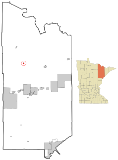
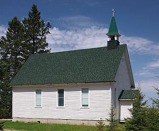
| Idington, Minnesota | |
|---|---|
| Unincorporated community | |
| Coordinates: 47°44′00″N92°39′07″W / 47.73333°N 92.65194°W Coordinates: 47°44′00″N92°39′07″W / 47.73333°N 92.65194°W | |
| Country | United States |
| State | Minnesota |
| County | Saint Louis |
| Township | Angora Township |
| Elevation | 1,352 ft (412 m) |
| Population | |
| • Total | 30 |
| Time zone | Central (CST) (UTC-6) |
| • Summer (DST) | CDT (UTC-5) |
| ZIP code | 55703 |
| Area code(s) | 218 |
| GNIS feature ID | 661527 [1] |
Idington is an unincorporated community in Angora Township, Saint Louis County, Minnesota, United States; located within the Sturgeon River State Forest.

In law, an unincorporated area is a region of land that is not governed by a local municipal corporation; similarly an unincorporated community is a settlement that is not governed by its own local municipal corporation, but rather is administered as part of larger administrative divisions, such as a township, parish, borough, county, city, canton, state, province or country. Occasionally, municipalities dissolve or disincorporate, which may happen if they become fiscally insolvent, and services become the responsibility of a higher administration. Widespread unincorporated communities and areas are a distinguishing feature of the United States and Canada. In most other countries of the world, there are either no unincorporated areas at all, or these are very rare; typically remote, outlying, sparsely populated or uninhabited areas.

Angora Township is a township in Saint Louis County, Minnesota, United States. The population was 249 at the 2010 census. Angora Township was named after Angora, in Turkey.

St. Louis County is a county located in the northeastern part of the U.S. state of Minnesota. As of the 2010 census, the population was 200,226. Its county seat is Duluth. It is the largest county by total area in Minnesota, and the largest in the United States east of the Mississippi River.
The community is located between Cook and Virginia at the intersection of U.S. Highway 53 and Saint Louis County Road 936 (Hannula Road).

Cook is a city in Saint Louis County, Minnesota, United States. The population was 574 at the 2010 census.

Virginia is a city in Saint Louis County, Minnesota, United States, on the Mesabi Iron Range. The population was 8,712 at the 2010 census. According to a water tower in the middle of town, the city's nickname is the "Queen City", or "Queen City of the North". Despite its relatively small size, Virginia ranks among the most dangerous cities in Minnesota when measured by violent and property crimes per capita.
U.S. Route 53, or U.S. Highway 53 (U.S. 53), is a north–south U.S. highway that runs for 403 miles (649 km) from La Crosse, Wisconsin to International Falls, Minnesota. It is the primary north–south route in northwestern Wisconsin, serving as a vital link between I-94 at Eau Claire, Wisconsin and the city of Duluth, Minnesota. The entire route from Eau Claire to the city limits of Superior, Wisconsin is a four lane divided highway. The highway's northern terminus is at the Fort Frances-International Falls Bridge in International Falls, Minnesota, at the Canada–US border. Its southern terminus is in La Crosse, Wisconsin, at U.S. Highway 14.
County Road 467 (Heino Road) is also in the area.


