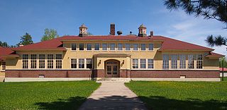
Colvin Township, Minnesota | |
---|---|
Coordinates: 47°19′4″N92°13′22″W / 47.31778°N 92.22278°W | |
Country | United States |
State | Minnesota |
County | Saint Louis |
Area | |
• Total | 35.9 sq mi (93.0 km2) |
• Land | 33.6 sq mi (87.1 km2) |
• Water | 2.3 sq mi (6.0 km2) |
Elevation | 1,447 ft (441 m) |
Population (2010) | |
• Total | 317 |
• Density | 8.8/sq mi (3.4/km2) |
Time zone | UTC-6 (Central (CST)) |
• Summer (DST) | UTC-5 (CDT) |
Colvin Township is a township in Saint Louis County, Minnesota, United States. The population was 317 at the 2010 census. [1]
Vermilion Trail (County 4) serves as a main route in the township.
The unincorporated community of Markham is located within Colvin Township.
Colvin Township was named for Frank S. Colvin, a businessperson in the lumber industry. [2]
According to the United States Census Bureau, the township has a total area of 35.9 square miles (93 km2); 33.6 square miles (87 km2) is land and 2.3 square miles (6.0 km2), or 6.40%, is water.
The Paleface River flows through the southwest and south–central parts of Colvin Township.
The Water Hen River flows through the west–central and north–central portions of the township.
The South Branch of the Water Hen River flows through the central and northeast portions of the township.
The Whiteface Reservoir is partially located within Colvin Township.
The following are adjacent to Colvin Township:
Townline Road–County Highway 16 (CR 16) runs east–west along Colvin Township's northern boundary line with adjacent White Township.
At the 2000 census there were 354 people, 149 households, and 102 families living in the township. The population density was 10.5 people per square mile (4.1/km2). There were 298 housing units at an average density of 8.9/sq mi (3.4/km2). The racial makeup of the township was 97.74% White, 0.85% Native American, 1.13% from other races, and 0.28% from two or more races. Hispanic or Latino of any race were 0.28%. [3]
Of the 149 households 26.2% had children under the age of 18 living with them, 61.7% were married couples living together, 5.4% had a female householder with no husband present, and 30.9% were non-families. 26.2% of households were one person and 12.8% were one person aged 65 or older. The average household size was 2.38 and the average family size was 2.90.
The age distribution was 21.2% under the age of 18, 6.8% from 18 to 24, 23.2% from 25 to 44, 31.1% from 45 to 64, and 17.8% 65 or older. The median age was 44 years. For every 100 females, there were 128.4 males. For every 100 females age 18 and over, there were 119.7 males.
The median household income was $39,821 and the median family income was $44,583. Males had a median income of $40,500 versus $17,500 for females. The per capita income for the township was $17,359. About 13.0% of families and 16.4% of the population were below the poverty line, including 30.8% of those under age 18 and 4.1% of those age 65 or over.
Alango Township is a township in Saint Louis County, Minnesota, United States. The population was 258 at the 2010 census. Saint Louis County Roads 22 and 25 are two of the main routes in the township. Heino Road and Samuelson Road also pass through the township. Cook is nearby.
Angora Township is a township in Saint Louis County, Minnesota, United States. The population was 249 at the 2010 census. Angora Township was named after Angora, in Turkey.
Ault Township is a township in Saint Louis County, Minnesota, United States. The population was 109 at the 2010 census.
Bassett Township is a township in Saint Louis County, Minnesota, United States. The township was named for William Bassett, a businessperson in the lumber industry. The population was 41 at the 2010 census.
Beatty Township is a township in Saint Louis County, Minnesota, United States. Beatty Township bears the name of a family of pioneer settlers. The population was 372 at the 2010 census.
Biwabik Township is a township in Saint Louis County, Minnesota, United States. Biwabik is a name derived from the Ojibwe language meaning "iron". The population was 804 at the 2010 census.
Ellsburg Township is a township in Saint Louis County, Minnesota, United States. The population was 219 at the 2010 census.
Fairbanks Township is a township in Saint Louis County, Minnesota, United States. The population was 63 at the 2010 census.
Fayal Township is an urban township in Saint Louis County, Minnesota, United States. The population was 1,809 at the 2010 census.
French Township is a township in Saint Louis County, Minnesota, United States. The population was 567 at the 2010 census.
Greenwood Township is a township in Saint Louis County, Minnesota, United States. The population was 939 at the 2010 census.
Morcom Township is a township in Saint Louis County, Minnesota, United States. The population was 94 at the 2010 census.
Morse Township is a township in Saint Louis County, Minnesota, United States. The population was 1,213 at the 2010 census.
Owens Township is a township in Saint Louis County, Minnesota, United States. The population was 263 at the 2010 census.
Pike Township is a township in Saint Louis County, Minnesota, United States. The population was 417 at the 2010 census.
Sandy Township is a township in Saint Louis County, Minnesota, United States. The population was 356 at the 2010 census.
Sturgeon Township is a township in Saint Louis County, Minnesota, United States. The population was 140 at the 2010 census.
White Township is an urban township in Saint Louis County, Minnesota, United States. The population was 3,229 at the 2010 census.
Wuori Township is a township in Saint Louis County, Minnesota, United States. The population was 572 at the 2010 census.
Whiteface Reservoir is an unorganized territory in Saint Louis County, Minnesota, United States. The population was 292 at the 2000 census.