Wakemup, Minnesota

Last updated

Wakemup
USA Minnesota location map.svg
Red pog.svg
Wakemup
Location of the community of Wakemup
within Beatty Township, Saint Louis County
Usa edcp location map.svg
Red pog.svg
Wakemup
Wakemup (the United States)
Coordinates: 47°55′27″N92°38′43″W / 47.92417°N 92.64528°W / 47.92417; -92.64528
Country United States
State Minnesota
County Saint Louis
Township Beatty Township
Elevation
1,371 ft (418 m)
Population
  Total130
Time zone UTC-6 (Central (CST))
  Summer (DST) UTC-5 (CDT)
Area code 218
GNIS feature ID662731 [1]

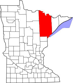
Wakemup is an unincorporated community in Beatty Township, Saint Louis County, Minnesota, United States.

The community is located six miles north of Cook, near Saint Louis County Road 24 (Vermilion Drive).

Wakemup is located within the Kabetogama State Forest.

Related Research Articles

Beatty Township is a township in Saint Louis County, Minnesota, United States. Beatty Township bears the name of a family of pioneer settlers. The population was 372 at the 2010 census.

Field Township is a township in Saint Louis County, Minnesota, United States. The population was 391 at the 2010 census.

Owens Township is a township in Saint Louis County, Minnesota, United States. The population was 263 at the 2010 census.

Rollins is an unincorporated community in Ault Township, Saint Louis County, Minnesota, United States.

Forbes is an unincorporated community in Saint Louis County, Minnesota, United States.

Fairbanks is an unincorporated community in Fairbanks Township, Saint Louis County, Minnesota, United States; located within the Superior National Forest.

Independence is an unincorporated community in New Independence Township, Saint Louis County, Minnesota, United States.

Bassett is an unincorporated community in Bassett Township, Saint Louis County, Minnesota, United States located within the Superior National Forest.

Peary is an unincorporated community in Saint Louis County, Minnesota, United States.

Silica is an unincorporated community in Saint Louis County, Minnesota, United States.

Payne is an unincorporated community in Meadowlands Township, Saint Louis County, Minnesota, United States.

Shaw is an unincorporated community in Saint Louis County, Minnesota, United States; located on Saint Louis County Road 15, near Saint Louis County Road 49.

Taft is an unincorporated community in Grand Lake Township, Saint Louis County, Minnesota, United States.

Toivola is an unincorporated community in Toivola Township, Saint Louis County, Minnesota, United States.

Celina is an unincorporated community in Saint Louis County, Minnesota, United States.

Bear River is an unincorporated community in Itasca and Saint Louis counties in the U.S. state of Minnesota.

Whiteface is an unincorporated community in Cotton Township, Saint Louis County, Minnesota, United States.

Vermilion Dam is an unincorporated community in Saint Louis County, Minnesota, United States.

Florenton is an unincorporated community in Wuori Township, Saint Louis County, Minnesota, United States; located near Britt.

Wahlsten is an unincorporated community in Kugler Township, Saint Louis County, Minnesota, United States.

References

  1. "Wakemup, Minnesota". Geographic Names Information System . United States Geological Survey, United States Department of the Interior.