Cotton, Minnesota

Last updated

Cotton
USA Minnesota location map.svg
Red pog.svg
Cotton
Location of the community of Cotton
within Cotton Township, Saint Louis County
Usa edcp location map.svg
Red pog.svg
Cotton
Cotton (the United States)
Coordinates: 47°10′10″N92°28′35″W / 47.16944°N 92.47639°W / 47.16944; -92.47639
Country United States
State Minnesota
County Saint Louis
Township Cotton Township
Elevation
1,329 ft (405 m)
Population
  Total60
Time zone UTC-6 (Central (CST))
  Summer (DST) UTC-5 (CDT)
ZIP code
55724
Area code 218
GNIS feature ID661050 [1]

Cotton is an unincorporated community in Cotton Township, Saint Louis County, Minnesota, United States.

Contents

The community is located 36 miles (58 km) north of the city of Duluth at the junction of U.S. Highway 53 (U.S. 53) and Saint Louis County Road 52 (CR 52). Cotton is located 27 miles south of the city of Virginia.

Cotton is generally considered the half way point between the cities of Duluth and Virginia.

The Whiteface River flows through the community.

Climate

The Köppen Climate Classification subtype for this climate is "Dfb" (Warm Summer Continental Climate). [2] Cotton's weather is noteworthy for having the lowest recorded temperature in the lower 48 states in the last ten years, −56 °F (−48.9 °C), on January 31, 2019. [3]

Climate data for Cotton, Minnesota, 1991–2020 normals, extremes 1962–present
MonthJanFebMarAprMayJunJulAugSepOctNovDecYear
Record high °F (°C)52
(11)
59
(15)
72
(22)
87
(31)
93
(34)
96
(36)
100
(38)
100
(38)
97
(36)
85
(29)
72
(22)
59
(15)
100
(38)
Mean maximum °F (°C)39.2
(4.0)
45.2
(7.3)
56.8
(13.8)
71.1
(21.7)
81.6
(27.6)
86.9
(30.5)
87.9
(31.1)
86.6
(30.3)
81.7
(27.6)
72.9
(22.7)
55.2
(12.9)
41.9
(5.5)
90.0
(32.2)
Average high °F (°C)18.2
(−7.7)
24.9
(−3.9)
36.9
(2.7)
50.4
(10.2)
63.7
(17.6)
73.0
(22.8)
77.8
(25.4)
75.5
(24.2)
67.2
(19.6)
52.2
(11.2)
36.5
(2.5)
24.2
(−4.3)
50.0
(10.0)
Daily mean °F (°C)6.4
(−14.2)
10.5
(−11.9)
24.6
(−4.1)
37.5
(3.1)
50.8
(10.4)
60.6
(15.9)
64.9
(18.3)
62.8
(17.1)
55.3
(12.9)
41.9
(5.5)
27.2
(−2.7)
13.6
(−10.2)
38.0
(3.3)
Average low °F (°C)−5.5
(−20.8)
−3.9
(−19.9)
12.3
(−10.9)
24.6
(−4.1)
38.0
(3.3)
48.2
(9.0)
52.1
(11.2)
50.2
(10.1)
43.4
(6.3)
31.6
(−0.2)
17.9
(−7.8)
3.0
(−16.1)
26.0
(−3.3)
Mean minimum °F (°C)−34.3
(−36.8)
−30.6
(−34.8)
−17.5
(−27.5)
7.7
(−13.5)
22.9
(−5.1)
30.8
(−0.7)
39.3
(4.1)
38.2
(3.4)
26.7
(−2.9)
15.3
(−9.3)
−5.9
(−21.1)
−27.1
(−32.8)
−37.3
(−38.5)
Record low °F (°C)−56
(−49)
−56
(−49)
−40
(−40)
−14
(−26)
8
(−13)
24
(−4)
30
(−1)
23
(−5)
16
(−9)
−2
(−19)
−30
(−34)
−44
(−42)
−56
(−49)
Average precipitation inches (mm)0.73
(19)
0.85
(22)
1.13
(29)
2.30
(58)
3.21
(82)
4.48
(114)
4.19
(106)
3.61
(92)
3.38
(86)
2.71
(69)
1.50
(38)
1.09
(28)
29.18
(743)
Average snowfall inches (cm)7.9
(20)
6.3
(16)
5.4
(14)
2.8
(7.1)
0.0
(0.0)
0.0
(0.0)
0.0
(0.0)
0.0
(0.0)
0.0
(0.0)
1.4
(3.6)
10.6
(27)
8.8
(22)
43.2
(109.7)
Average extreme snow depth inches (cm)14.5
(37)
17.2
(44)
14.3
(36)
5.4
(14)
0.1
(0.25)
0.0
(0.0)
0.0
(0.0)
0.0
(0.0)
0.0
(0.0)
0.4
(1.0)
5.8
(15)
8.9
(23)
18.3
(46)
Average precipitation days (≥ 0.01 in)6.65.36.87.810.410.812.210.410.89.06.68.4105.1
Average snowy days (≥ 0.1 in)6.34.22.81.50.00.00.00.00.00.84.36.826.7
Source 1: NOAA [4]
Source 2: National Weather Service [3]

See also

Related Research Articles

<span class="mw-page-title-main">St. Louis County, Minnesota</span> County in Minnesota, United States

St. Louis County is a county located in the Arrowhead Region of the U.S. state of Minnesota. As of the 2020 census, the population was 200,231. Its county seat is Duluth. It is the largest county in Minnesota by land area, and the largest in the United States by total area east of the Mississippi River, ahead of Aroostook County, Maine.

Canosia Township is an urban township in Saint Louis County, Minnesota, United States. Canosia is a name derived from the Algonquian language meaning "pike fish". The population was 2,158 at the 2010 census.

Cotton Township is a township in Saint Louis County, Minnesota, United States. The population was 445 at the 2010 census.

<span class="mw-page-title-main">Embarrass Township, St. Louis County, Minnesota</span> Township in Minnesota, United States

Embarrass Township is a township in Saint Louis County, Minnesota, United States. The population was 607 at the 2010 census.

Kabetogama Township is a township in Saint Louis County, Minnesota, United States. The population was 135 at the 2010 census. A portion of the township is located within the Kabetogama State Forest.

Brimson is an unincorporated community in Ault Township, Saint Louis County, Minnesota, United States.

Alborn is an unincorporated community in Alborn Township, Saint Louis County, Minnesota, United States.

<span class="mw-page-title-main">U.S. Route 53</span> U.S. Highway in Minnesota and Wisconsin

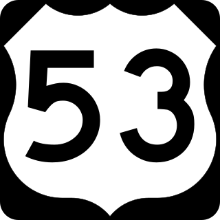
U.S. Route 53, or U.S. Highway 53 (U.S. 53), is a north–south U.S. highway that runs for 404 miles (650 km) from La Crosse, Wisconsin to International Falls, Minnesota. It is the primary north–south route in northwestern Wisconsin, serving as a vital link between I-94 at Eau Claire, Wisconsin and the Twin Ports of Superior, Wisconsin, and Duluth, Minnesota. The entire route from Eau Claire to the city limits of Superior is a four lane divided highway. The highway's northern terminus is at the Fort Frances–International Falls International Bridge in International Falls, Minnesota, at the Canada–US border. Its southern terminus is in La Crosse, Wisconsin, at U.S. Highway 14.

<span class="mw-page-title-main">Embarrass, Minnesota</span> Unincorporated community in Minnesota, United States

Embarrass is an unincorporated community in Embarrass Township, Saint Louis County, Minnesota, United States.

Makinen is an unincorporated community in St. Louis County, Minnesota, United States.

Markham is an unincorporated community in Colvin Township, Saint Louis County, Minnesota, United States.

Twig is an unincorporated community in Grand Lake Township, Saint Louis County, Minnesota, United States.

Saginaw is an unincorporated area in Saint Louis County, Minnesota, United States. Although unincorporated, Saginaw has a post office with the ZIP code 55779.

Canyon is an unincorporated community in Northland Township, Saint Louis County, Minnesota, United States.

Central Lakes is an unincorporated community in Saint Louis County, Minnesota, United States.

Britt is an unincorporated area in Saint Louis County, Minnesota, United States.

Independence is an unincorporated community in New Independence Township, Saint Louis County, Minnesota, United States.

Florenton is an unincorporated community in Wuori Township, Saint Louis County, Minnesota, United States; located near Britt.

Four Corners is an unincorporated community in Saint Louis County, Minnesota, United States; located 10 miles northwest of the city of Duluth at the junction of U.S. Highway 53 and Saint Louis County Road 13.

References

  1. "Cotton, Minnesota". Geographic Names Information System . United States Geological Survey, United States Department of the Interior.
  2. Climate Summary for Cotton, Minnesota
  3. 1 2 "NOAA Online Weather Data – NWS Duluth". National Weather Service. Retrieved February 1, 2023.
  4. "U.S. Climate Normals Quick Access – Station:". National Oceanic and Atmospheric Administration. Retrieved February 1, 2023.