Bear River | |
---|---|
Coordinates: 47°46′40″N93°04′59″W / 47.77778°N 93.08306°W Coordinates: 47°46′40″N93°04′59″W / 47.77778°N 93.08306°W | |
Country | United States |
State | Minnesota |
County | Itasca and Saint Louis |
Township | Bearville Township and Morcom Township |
Elevation | 1,283 ft (391 m) |
Population | |
• Total | 10 |
Time zone | UTC-6 (Central (CST)) |
• Summer (DST) | UTC-5 (CDT) |
ZIP code | 55723 |
Area code(s) | 218 |
GNIS feature ID | 660745 [1] |
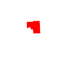
Bear River is an unincorporated community in Itasca and Saint Louis counties in the U.S. state of Minnesota.
The community is located 24 miles west of Cook at the intersection of County Road 22 and County Road 916 (Saint Louis–Itasca Judicial Road). Bear River is located 31 miles east of Effie.
The Bear River, a tributary of the Sturgeon River, flows through the community.
Saint Louis County Highway 5 and Minnesota State Highway 65 are both nearby.
Bear River is 26 miles north of Chisholm; and 31 miles north of Hibbing.
Bear River is located within Morcom Township in Saint Louis County; and also located within Bearville Township in Itasca County.
The communities of Togo, Celina, and Side Lake are nearby.
Bear River is the home town of the Minnesota Twins mascot TC Bear.
Headquarters of Team Ugly Racing.
Bowstring is an unincorporated community in Bowstring Township, Itasca County, Minnesota, United States.
Alborn is an unincorporated community in Alborn Township, Saint Louis County, Minnesota, United States.
Togo is an unincorporated community in Carpenter Township, Itasca County, Minnesota, United States.
Florenton is an unincorporated community in Wuori Township, Saint Louis County, Minnesota, United States; located near Britt.
Craigville is an unincorporated community in Koochiching County, Minnesota, United States; located within the Koochiching State Forest.
Goodland is an unincorporated community in Goodland Township, Itasca County, Minnesota, United States.
Max is an unincorporated community in Max Township, Itasca County, Minnesota, United States; located within the Chippewa National Forest and the Leech Lake Indian Reservation.
Wirt is an unincorporated community in Wirt Township, Itasca County, Minnesota, United States; located within the Chippewa National Forest.
Mack is an unincorporated community in Itasca County, Minnesota, United States; located within the Chippewa National Forest. The community is located between Deer River and Talmoon; at the junction of State Highway 6 and Mac Road.
Wawina is an unincorporated community in Wawina Township, Itasca County, Minnesota, United States.
Blackberry is an unincorporated community in Blackberry Township, Itasca County, Minnesota, United States.
Alvwood is an unincorporated community in Alvwood Township, Itasca County, Minnesota, United States.
Bergville is an unincorporated community in Ardenhurst Township, Itasca County, Minnesota, United States; located within the Chippewa National Forest.
Rauch is an unincorporated community in Koochiching County, Minnesota, United States.
Dunbar is an unincorporated community in Good Hope Township, Itasca County, Minnesota, United States. The community is located northwest of Squaw Lake at the junction of Itasca County Roads 32 and 149. State Highway 46 is nearby.
Dora Lake is an unincorporated community in Kinghurst Township, Itasca County, Minnesota, United States; located within the Chippewa National Forest. The community is located near Wirt at the junction of Itasca County Roads 29 and 145.
Orth is an unincorporated community in Nore Township, Itasca County, Minnesota, United States; located in the northwest corner of the county.
Suomi is an unincorporated community in Itasca County, Minnesota, United States.
Jessie Lake is an unincorporated community in Lake Jessie Township, Itasca County, Minnesota, United States; located within the Chippewa National Forest. The community is located between Wirt and Talmoon; along Itasca County Road 4.
Pomroy is an unincorporated community in Pomroy Township, Itasca County, Minnesota, United States.