
Itasca County is a county located in the Iron Range region of the U.S. state of Minnesota. As of the 2020 census, the population was 45,014. Its county seat is Grand Rapids. The county is named after Lake Itasca, which is in turn a shortened version of the Latin words veritas caput, meaning 'truth' and 'head', a reference to the source of the Mississippi River. Portions of the Bois Forte and Leech Lake Indian reservations are in the county.

The Leech Lake Reservation is an Indian reservation located in the north-central Minnesota counties of Cass, Itasca, Beltrami, and Hubbard. The reservation forms the land base for the federally recognized Leech Lake Band of Ojibwe, one of six bands comprising the Minnesota Chippewa Tribe, organized in 1934. The Leech Lake Reservation has the second highest population of any reservation in Minnesota with White Earth Nation being the largest Minnesota Ojibwe tribe, Leech Lake Nation has a resident population of 11,388 indicated by the 2020 census.
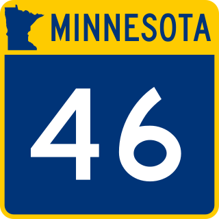
Minnesota State Highway 46 (MN 46) is a 46.377-mile-long (74.637 km) highway in north-central Minnesota, which runs from its intersection with U.S. Highway 2 near Deer River and continues northwest to its northern terminus at its intersection with State Highway 1 in Northome.
Craigville is an unincorporated community in Koochiching County, Minnesota, United States; it is located within the Koochiching State Forest.
Goodland is an unincorporated community in Goodland Township, Itasca County, Minnesota, United States.
Spring Lake is an unincorporated community in Lake Jessie Township, Itasca County, Minnesota, United States; located within the Chippewa National Forest.
Max is an unincorporated community in Max Township, Itasca County, Minnesota, United States; located within the Chippewa National Forest and the Leech Lake Indian Reservation.
Wirt is an unincorporated community in Wirt Township, Itasca County, Minnesota, United States; located within the Chippewa National Forest.
Alvwood is an unincorporated community in Alvwood Township, Itasca County, Minnesota, United States.
Bergville is an unincorporated community in Ardenhurst Township, Itasca County, Minnesota, United States; located within the Chippewa National Forest.
Gemmell is an unincorporated community in Koochiching County, Minnesota, United States; located near Mizpah and Northome.
Wildwood is an unincorporated community in Koochiching County, Minnesota, United States; located within the Pine Island State Forest.
Bass Lake is an unincorporated community in Wirt Township, Itasca County, Minnesota, United States; located within the Chippewa National Forest. The community is located between Wirt and Talmoon at the junction of Itasca County Roads 29 and 127.
Dunbar is an unincorporated community in Good Hope Township, Itasca County, Minnesota, United States. The community is located northwest of Squaw Lake at the junction of Itasca County Roads 32 and 149. State Highway 46 is nearby.
Dora Lake is an unincorporated community in Kinghurst Township, Itasca County, Minnesota, United States; located within the Chippewa National Forest. The community is located near Wirt at the junction of Itasca County Roads 29 and 145.
Grattan is an unincorporated community in Grattan Township, Itasca County, Minnesota, United States.
Houpt is an unincorporated community in Nore Township, Itasca County, Minnesota, United States, located in the northwest corner of the county.
Orth is an unincorporated community in Nore Township, Itasca County, Minnesota, United States, located in the northwestern corner of the county.

Suomi is an unincorporated community in Itasca County, Minnesota, United States.
Pomroy is an unincorporated community in Pomroy Township, Itasca County, Minnesota, United States.


