Bigfork, Minnesota

Last updated

Bigfork
Main Street - Bigfork, Minnesota (35097018354).jpg
Main Street - Bigfork, Minnesota
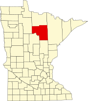
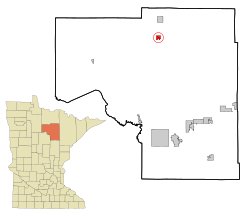
Itasca County Minnesota Incorporated and Unincorporated areas Bigfork Highlighted.svg
Location of the city of Bigfork
within Itasca County, Minnesota
Coordinates: 47°44′49″N93°39′18″W / 47.74694°N 93.65500°W / 47.74694; -93.65500
Country United States
State Minnesota
County Itasca
Area
[1]
  Total1.89 sq mi (4.90 km2)
  Land1.86 sq mi (4.81 km2)
  Water0.03 sq mi (0.09 km2)
Elevation
1,309 ft (399 m)
Population
 (2020)
  Total400
  Density215.17/sq mi (83.09/km2)
Time zone UTC-6 (Central (CST))
  Summer (DST) UTC-5 (CDT)
ZIP codes
56628, 56639
Area code 218
FIPS code 27-05698 [2]
GNIS feature ID0655384 [3]
Website www.cityofbigfork.com

Bigfork is a city in Itasca County, Minnesota, United States. The population was 446 at the 2010 census. [4] Scenic State Park is nearby.

Contents

Minnesota State Highway 38 serves as a main route in the community. State Highways 1 and 6 are nearby.

History

Bigfork originally began as a settlement when Damase "Uncle Tom" Neveaux built a log cabin on the Big Fork River, claiming the stand of pine there, and began logging activities. Though Neveaux reached the area in 1887, and the settlement began in 1892, officially, he was a squatter until the land was opened for settlement in 1900. [5]

By 1902, a post office was established, [6] and in 1906, a station was added to the Minneapolis and Rainy River Railway.

On January 17, 1907, less than a year after the railway stop was completed, Bigfork was incorporated as a village. [5] Bigfork Village Hall, built in 1936 with WPA funds, is listed on the National Register of Historic Places. [7]

Geography

According to the United States Census Bureau, the city has a total area of 1.80 square miles (4.66 km2), of which 1.77 square miles (4.58 km2) is land and 0.03 square miles (0.08 km2) is water. [8]

Demographics

Historical population
CensusPop.Note
1910 167
1920 160−4.2%
1930 29584.4%
1940 38229.5%
1950 46321.2%
1960 4640.2%
1970 399−14.0%
1980 45714.5%
1990 384−16.0%
2000 46922.1%
2010 446−4.9%
2020 400−10.3%
U.S. Decennial Census [9]

2010 census

As of the census [10] of 2010, there were 446 people, 195 households, and 102 families living in the city. The population density was 252.0 inhabitants per square mile (97.3/km2). There were 241 housing units at an average density of 136.2 per square mile (52.6/km2). The racial makeup of the city was 97.1% White, 0.7% African American, 1.1% Native American, 0.4% Asian, and 0.7% from two or more races. Hispanic or Latino of any race were 0.4% of the population.

There were 195 households, of which 23.6% had children under the age of 18 living with them, 37.9% were married couples living together, 9.7% had a female householder with no husband present, 4.6% had a male householder with no wife present, and 47.7% were non-families. 42.1% of all households were made up of individuals, and 29.2% had someone living alone who was 65 years of age or older. The average household size was 2.01 and the average family size was 2.74.

The median age in the city was 51.3 years. 17.9% of residents were under the age of 18; 5.2% were between the ages of 18 and 24; 17.8% were from 25 to 44; 25.1% were from 45 to 64; and 34.1% were 65 years of age or older. The gender makeup of the city was 48.2% male and 51.8% female.

2000 census

As of the census of 2000, there were 469 people, 208 households, and 110 families living in the city. [2] The population density was 263.5 inhabitants per square mile (101.7/km2). There were 226 housing units at an average density of 127.0 per square mile (49.0/km2). The racial makeup of the city was 97.65% White, 1.71% Native American, 0.21% from other races, and 0.43% from two or more races. Hispanic or Latino of any race were 1.07% of the population.

There were 208 households, out of which 21.2% had children under the age of 18 living with them, 38.0% were married couples living together, 10.1% had a female householder with no husband present, and 47.1% were non-families. 42.8% of all households were made up of individuals, and 24.0% had someone living alone who was 65 years of age or older. The average household size was 2.00 and the average family size was 2.68.

In the city, the population was spread out, with 16.8% under the age of 18, 9.6% from 18 to 24, 21.5% from 25 to 44, 20.5% from 45 to 64, and 31.6% who were 65 years of age or older. The median age was 47 years. For every 100 females, there were 80.4 males. For every 100 females age 18 and over, there were 85.7 males.

The median income for a household in the city was $24,167, and the median income for a family was $36,250. Males had a median income of $32,083 versus $19,886 for females. The per capita income for the city was $14,455. About 6.0% of families and 12.3% of the population were below the poverty line, including 14.3% of those under age 18 and 6.6% of those age 65 or over.

Media

Television

ChannelCallsignAffiliationBrandingSubchannelsOwner
(Virtual)ChannelProgramming
13.1K23KZ-D
(WIRT Translator)
ABC WDIO13.2
13.3
MeTV
Ion Television
EZ-TV, Inc.
21.1K21KY-D
(KQDS Translator)
FOX FOX 2121.2 Antenna TV EZ-TV, Inc.

Related Research Articles

<span class="mw-page-title-main">Monroe, Adams County, Indiana</span> Town in Indiana, United States

Monroe is a town in Washington and Monroe townships, Adams County, Indiana, United States. The population of the town was 945 residents at the 2019 census. Adams Central Community Schools is located in Monroe.

<span class="mw-page-title-main">Kelliher, Minnesota</span> Town in Minnesota, United States

Kelliher is a city in Beltrami County, Minnesota, United States. The population was 258 at the 2020 census. Minnesota State Highway 72 is the primary route through Kelliher.

<span class="mw-page-title-main">Bagley, Minnesota</span> City in Minnesota, United States

Bagley is a city in Clearwater County, Minnesota, United States. The population was 1,285 at the 2020 census. It is the county seat of Clearwater County.

Bigfork Township is a township in Itasca County, Minnesota, United States. The population was 321 at the 2010 census.

<span class="mw-page-title-main">Coleraine, Minnesota</span> City in Minnesota, United States

Coleraine is a city in Itasca County, Minnesota, United States. The population was 1,970 at the 2010 census. The community was named after Thomas F. Cole, President of the Oliver Iron Mining Company.

<span class="mw-page-title-main">Deer River, Minnesota</span> City in Minnesota, United States

Deer River is a city in Itasca County, Minnesota, United States. The population was 930 at the 2010 census.

<span class="mw-page-title-main">Nashwauk, Minnesota</span> City in Minnesota, United States

Nashwauk is a city in Itasca County, Minnesota, United States. The population was 983 at the 2010 census.

<span class="mw-page-title-main">Oslo, Minnesota</span> City in Minnesota, United States

Oslo is a city in Marshall County, Minnesota, United States. The population was 239 at the 2020 census.

<span class="mw-page-title-main">Deer Creek, Minnesota</span> City in Minnesota, United States

Deer Creek is a city in Otter Tail County, Minnesota, United States. The population was 330 at the 2020 census.

<span class="mw-page-title-main">Vining, Minnesota</span> City in Minnesota, United States

Vining is a city in Otter Tail County, Minnesota, United States. The population was 62 at the 2020 census.

<span class="mw-page-title-main">McIntosh, Minnesota</span> City in Minnesota, United States

McIntosh is a city in Polk County, Minnesota, United States. It is part of the Grand Forks, ND-MN Metropolitan Statistical Area. The population was 606 at the 2020 census.

<span class="mw-page-title-main">Mentor, Minnesota</span> City in Minnesota, United States

Mentor is a city in Polk County, Minnesota, United States. It is part of the Grand Forks-ND-MN Metropolitan Statistical Area. The population was 104 at the 2020 census. The city is near Maple Lake.

<span class="mw-page-title-main">Nielsville, Minnesota</span> City in Minnesota, United States

Nielsville is a city in Polk County, Minnesota, United States. It is part of the Grand Forks, ND-MN Metropolitan Statistical Area. The population was 78 at the 2020 census.

<span class="mw-page-title-main">Buhl, Minnesota</span> City in Minnesota, United States

Buhl is a city in Saint Louis County, Minnesota, United States. Its population was 1,000 at the 2010 census.

<span class="mw-page-title-main">Cook, Minnesota</span> City in Minnesota, United States

Cook is a city in Saint Louis County, Minnesota, United States. The population was 515 at the 2010 census.

<span class="mw-page-title-main">Hoyt Lakes, Minnesota</span> City in Minnesota, United States

Hoyt Lakes is a city in Saint Louis County, Minnesota. The population was 2,017 at the time of the 2010 census.

<span class="mw-page-title-main">Winton, Minnesota</span> City in Minnesota, United States

Winton is a city in Saint Louis County, Minnesota, United States. The population was 172 at the 2010 census. The city is home to a small hydroelectric dam on the edge of Garden Lake, one of 11 stations owned by Minnesota Power.

<span class="mw-page-title-main">Lake Henry, Minnesota</span> City in Minnesota, United States

Lake Henry is a city in Stearns County, Minnesota, United States. The population was 103 at the 2010 census. It is part of the St. Cloud Metropolitan Statistical Area.

<span class="mw-page-title-main">Minnesota City, Minnesota</span> City in Minnesota, United States

Minnesota City is a city in Winona County, Minnesota, United States. The population was 202 at the 2020 census.

<span class="mw-page-title-main">Chest Township, Clearfield County, Pennsylvania</span> Township in Pennsylvania, United States

Chest Township is a township in Clearfield County, Pennsylvania, United States. The population was 511 at the 2020 census.

References

  1. "2020 U.S. Gazetteer Files". United States Census Bureau. Retrieved July 24, 2022.
  2. 1 2 "U.S. Census website". United States Census Bureau . Retrieved January 31, 2008.
  3. "US Board on Geographic Names". United States Geological Survey. October 25, 2007. Retrieved January 31, 2008.
  4. "2010 Census Redistricting Data (Public Law 94-171) Summary File". American FactFinder. U.S. Census Bureau, 2010 Census. Retrieved April 23, 2011.[ dead link ]
  5. 1 2 Northern Itasca Joint Powers Board (2010). "Bigfork: When Dinner was Big Game". Archived from the original on July 26, 2011. Retrieved January 1, 2011.
  6. Warren Upham (2001). Minnesota Place Names: A Geographical Encyclopedia. Minnesota Historical Society Press. pp. 260–261. ISBN   0-87351-396-7 . Retrieved January 1, 2011.
  7. Faucher, Laura (April 30, 2005). "Existing Conditions Assessment and Preservation Plan for: Bigfork City Hall" (PDF). Archived (PDF) from the original on January 18, 2017. Retrieved January 17, 2017.
  8. "US Gazetteer files 2010". United States Census Bureau. Archived from the original on January 12, 2012. Retrieved November 13, 2012.
  9. "Census of Population and Housing". Census.gov. Retrieved June 4, 2015.
  10. "U.S. Census website". United States Census Bureau . Retrieved November 13, 2012.

47°44′40″N93°39′15″W / 47.74444°N 93.65417°W / 47.74444; -93.65417