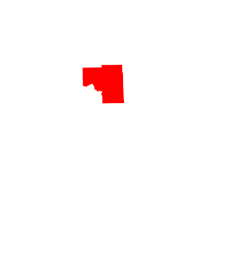
Ball Club | |
---|---|
Coordinates: 47°19′33″N93°56′10″W / 47.32583°N 93.93611°W Coordinates: 47°19′33″N93°56′10″W / 47.32583°N 93.93611°W | |
Country | United States |
State | Minnesota |
County | Itasca |
Area | |
• Total | 2.76 sq mi (7.16 km2) |
• Land | 2.76 sq mi (7.16 km2) |
• Water | 0.00 sq mi (0.00 km2) |
Elevation | 1,302 ft (397 m) |
Population (2020) | |
• Total | 354 |
• Density | 128.08/sq mi (49.45/km2) |
Time zone | UTC-6 (Central (CST)) |
• Summer (DST) | UTC-5 (CDT) |
Area code | 218 |
GNIS feature ID | 655201 [2] |
Ball Club is an unincorporated community and census-designated place (CDP) in Itasca County, Minnesota, United States; located within the Leech Lake Indian Reservation. As of the 2010 census, its population was 342. [3] Ball Club is located between Zemple and Bena.
The center of Ball Club is generally considered at the junction of U.S. Highway 2 and Itasca County Road 39. Ball Club is located 21 miles west of Grand Rapids.
Ball Club received its name from a type of Native American lacrosse stick. [4] The majority of the community is populated by Native Americans of the Leech Lake Band of Ojibwe.
Ball Club's small economy includes a general store and gas station. The community also includes two churches, a clinic, a Headstart office, a community center, a water tower, and a Cordell.
The Mississippi River surrounds Ball Club on both the East and West side of the community. The boundary line between Itasca and Cass counties is in the vicinity.
Rosanna Catherine Payne served as the postmistress for Ball Club; Payne served in the Minnesota House of Representatives from 1927 to 1932. [5]
Historical population | |||
---|---|---|---|
Census | Pop. | %± | |
2020 | 354 | — | |
U.S. Decennial Census [6] |
St. Louis County is a county located in the Arrowhead Region of the U.S. state of Minnesota. As of the 2020 census, the population was 200,231. Its county seat is Duluth. It is the largest county in Minnesota by land area, and the largest in the United States by total area east of the Mississippi River, ahead of Aroostook County, Maine.
Itasca County is located in the State of Minnesota. As of the 2020 census, the population was 45,014. Its county seat is Grand Rapids. The county is named after Lake Itasca, which is in turn a shortened version of the Latin words veritas caput, meaning 'truth' and 'head', a reference to the source of the Mississippi River. Portions of the Bois Forte and Leech Lake Indian reservations are in the county.
Clearwater County is a county in the northwestern part of the U.S. state of Minnesota. As of the 2020 census, the population was 8,524. Its county seat is Bagley.
Cass County is a county in the central part of the U.S. state of Minnesota. As of the 2020 census, the population was 30,066. Its county seat is Walker. The county was formed in 1851, and was organized in 1897.
Aitkin County is a county in the U.S. state of Minnesota. As of the 2020 census, the population was 15,697. Its county seat is Aitkin. Part of the Mille Lacs Indian Reservation is in the county. The county was created in 1857 and organized in 1871.
Cedar Valley Township is a township in Saint Louis County, Minnesota, United States. Cedar Valley Township was named for the white cedar in the valley of the Floodwood River. The population was 195 at the 2010 census.
Bowstring is an unincorporated community in Bowstring Township, Itasca County, Minnesota, United States.
Central Minnesota is the central part of the state of Minnesota. No definitive boundaries of the region exist, but most definitions would include the land north of Interstate 94, east of U.S. Highway 59, south of U.S. Highway 2, and west of U.S. Highway 169.
The Leech Lake Reservation is an Indian reservation located in the north-central Minnesota counties of Cass, Itasca, Beltrami, and Hubbard. The reservation forms the land base for the federally recognized Leech Lake Band of Ojibwe, one of six bands comprising the Minnesota Chippewa Tribe, organized in 1934. The Leech Lake Reservation has the highest population of any reservation in Minnesota, with a resident population of 11,388 indicated by the 2020 census.
Inger is an unincorporated community and census-designated place (CDP) in Itasca County, Minnesota, United States, along the Bowstring River of the Leech Lake Indian Reservation. As of the 2010 census, its population was 212.
Bear River is an unincorporated community in Itasca and Saint Louis counties in the U.S. state of Minnesota.
Mahtowa is an unincorporated community and census-designated place (CDP) in Mahtowa Township, Carlton County, Minnesota, United States. As of the 2010 census, its population was 370.
Warsaw is an unincorporated community and census-designated place (CDP) in Warsaw Township, Rice County, Minnesota, United States. As of the 2010 census, its population was 627.
Goodland is an unincorporated community in Goodland Township, Itasca County, Minnesota, United States.
Lake George is an unincorporated community and census-designated place (CDP) in Lake George Township, Hubbard County, Minnesota, United States. As of the 2010 census, its population was 230.
Max is an unincorporated community in Max Township, Itasca County, Minnesota, United States; located within the Chippewa National Forest and the Leech Lake Indian Reservation.
Wirt is an unincorporated community in Wirt Township, Itasca County, Minnesota, United States; located within the Chippewa National Forest.
Nett Lake is an unincorporated community and census-designated place (CDP) in Nett Lake Territory, Saint Louis County, Minnesota, United States; located on the shore of Nett Lake. As of the 2010 census, its population was 284.
Blackberry is an unincorporated community in Blackberry Township, Itasca County, Minnesota, United States.
Jessie Lake is an unincorporated community in Lake Jessie Township, Itasca County, Minnesota, United States, located within the Chippewa National Forest. The community is located between Wirt and Talmoon; along Itasca County Road 4.