Nashwauk, Minnesota

Last updated • 3 min readFrom Wikipedia, The Free Encyclopedia

Nashwauk
Itasca County Minnesota Incorporated and Unincorporated areas Nashwauk Highlighted.svg
Location of the town of Nashwauk
within Itasca County, Minnesota
Coordinates: 47°22′35″N93°9′36″W / 47.37639°N 93.16000°W / 47.37639; -93.16000
Country United States
State Minnesota
County Itasca
Area
[1]
  Total15.51 sq mi (40.17 km2)
  Land14.81 sq mi (38.36 km2)
  Water0.70 sq mi (1.81 km2)
Elevation
[2]
1,483 ft (452 m)
Population
 (2020)
  Total970
  Density65.50/sq mi (25.29/km2)
Time zone UTC-6 (Central (CST))
  Summer (DST) UTC-5 (CDT)
ZIP code
55769
Area code 218
FIPS code 27-44980 [3]
GNIS feature ID0648428 [2]

Nashwauk ( /ˈnæʃwɔːk/ NASH-wawk) [4] is a town in Itasca County, Minnesota, United States. The population was 983 at the 2010 census. [5]

Contents

U.S. Highway 169 and Minnesota State Highway 65 are two of the main routes in Nashwauk.

Geography

According to the United States Census Bureau, the town has a total area of 15.30 square miles (39.63 km2), of which 14.58 square miles (37.76 km2) is land and 0.72 square miles (1.86 km2) is water. [6]

Demographics

Historical population
CensusPop.Note
1910 2,080
1920 2,41416.1%
1930 2,5555.8%
1940 2,228−12.8%
1950 2,029−8.9%
1960 1,712−15.6%
1970 1,341−21.7%
1980 1,4195.8%
1990 1,026−27.7%
2000 935−8.9%
2010 9835.1%
2020 970−1.3%
U.S. Decennial Census

2010 census

As of the census [7] of 2010, there were 983 people, 452 households, and 258 families living in the town. The population density was 67.4 inhabitants per square mile (26.0/km2). There were 551 housing units at an average density of 37.8 per square mile (14.6/km2). The racial makeup of the town was 96.4% White, 0.9% Native American, 0.1% Asian, 0.1% from other races, and 2.4% from two or more races. Hispanic or Latino of any race were 0.8% of the population.

There were 452 households, of which 25.7% had children under the age of 18 living with them, 40.3% were married couples living together, 9.3% had a female householder with no husband present, 7.5% had a male householder with no wife present, and 42.9% were non-families. 37.8% of all households were made up of individuals, and 21.1% had someone living alone who was 65 years of age or older. The average household size was 2.17 and the average family size was 2.79.

The median age in the town was 42.4 years. 21.8% of residents were under the age of 18; 6.8% were between the ages of 18 and 24; 23.7% were from 25 to 44; 27.1% were from 45 to 64; and 20.5% were 65 years of age or older. The gender makeup of the town was 47.4% male and 52.6% female.

2000 census

As of the census [3] of 2000, there were 935 people, 434 households, and 266 families living in the town. The population density was 165.8 inhabitants per square mile (64.0/km2). There were 467 housing units at an average density of 82.8 per square mile (32.0/km2). The racial makeup of the town was 98.82% White, 0.53% Native American, 0.11% Asian, and 0.53% from two or more races. Hispanic or Latino of any race were 0.21% of the population. 24.1% were of German, 13.9% Italian, 9.9% Finnish, 8.9% Norwegian, 5.3% French and 5.2% American ancestry according to Census 2000.

There were 434 households, out of which 23.3% had children under the age of 18 living with them, 48.8% were married couples living together, 9.9% had a female householder with no husband present, and 38.7% were non-families. 35.5% of all households were made up of individuals, and 21.2% had someone living alone who was 65 years of age or older. The average household size was 2.15 and the average family size was 2.74.

In the town, the population was spread out, with 20.2% under the age of 18, 8.8% from 18 to 24, 23.0% from 25 to 44, 23.6% from 45 to 64, and 24.4% who were 65 years of age or older. The median age was 43 years. For every 100 females, there were 90.4 males. For every 100 females age 18 and over, there were 88.4 males.

The median income for a household in the town was $26,146, and the median income for a family was $31,938. Males had a median income of $31,136 versus $20,000 for females. The per capita income for the town was $15,954. About 11.5% of families and 14.6% of the population were below the poverty line, including 19.9% of those under age 18 and 11.0% of those age 65 or over.

Notable person

Related Research Articles

<span class="mw-page-title-main">Taylor, Alabama</span> Town in Alabama, United States

Taylor is a town in Geneva and Houston counties in the U.S. state of Alabama. Taylor was first settled in the 1870s, named after an early family that helped secure the first post office. It was not incorporated until almost a century later in June 1967. It is part of the Dothan, Alabama Metropolitan Statistical Area. At the 2010 census the population was 2,375, up from 1,898 in 2000.

<span class="mw-page-title-main">Kelliher, Minnesota</span> Town in Minnesota, United States

Kelliher is a city in Beltrami County, Minnesota, United States. The population was 258 at the 2020 census. Minnesota State Highway 72 is the primary route through Kelliher.

<span class="mw-page-title-main">Georgetown, Minnesota</span> City in Minnesota, United States

Georgetown is a city in Clay County, Minnesota, United States, along the Buffalo River near its confluence with the Red River of the North. The population was 86 at the 2020 census.

<span class="mw-page-title-main">Evansville, Minnesota</span> City in Minnesota, United States

Evansville is a city in Douglas County, Minnesota, United States. The population was 603 at the 2020 census.

<span class="mw-page-title-main">Whalan, Minnesota</span> City in Minnesota, United States

Whalan is a city in Fillmore County, Minnesota, United States. The population was 63 at the 2010 census.

Carpenter Township is a township in Itasca County, Minnesota, United States. The population was 179 at the 2010 census.

<span class="mw-page-title-main">Keewatin, Minnesota</span> City in Minnesota, United States

Keewatin is a city in Itasca County, Minnesota, United States. The population was 1,068 at the 2010 census.

Nashwauk Township is a township in Itasca County, Minnesota, United States. The population was 1,681 at the 2010 census.

<span class="mw-page-title-main">Middle River, Minnesota</span> City in Minnesota, United States

Middle River is a city in Marshall County, Minnesota, United States, along the Middle River, from which the city took its name. The population was 304 at the 2020 census.

<span class="mw-page-title-main">Urbank, Minnesota</span> City in Minnesota, United States

Urbank is a city in Otter Tail County, Minnesota, United States. The population was 52 at the 2020 census.

<span class="mw-page-title-main">Nielsville, Minnesota</span> City in Minnesota, United States

Nielsville is a city in Polk County, Minnesota, United States. It is part of the Grand Forks, ND-MN Metropolitan Statistical Area. The population was 78 at the 2020 census.

<span class="mw-page-title-main">Kenneth, Minnesota</span> City in Minnesota, United States

Kenneth is a city in Rock County, Minnesota, United States. The population was 68 at the 2010 census.

Louisville Township is a township in Scott County, Minnesota, United States. The population was 1,359 at the 2000 census.

<span class="mw-page-title-main">Buhl, Minnesota</span> City in Minnesota, United States

Buhl is a city in Saint Louis County, Minnesota, United States. Its population was 952 at the 2020 census.

<span class="mw-page-title-main">Winton, Minnesota</span> City in Minnesota, United States

Winton is a city in Saint Louis County, Minnesota, United States. The population was 172 at the 2010 census. The city is home to a small hydroelectric dam on the edge of Garden Lake, one of 11 stations owned by Minnesota Power.

<span class="mw-page-title-main">Plainview, Minnesota</span> City in Minnesota, United States

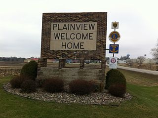
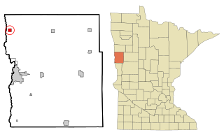
Plainview is a city in Wabasha County, Minnesota, United States. The population was 3,483 at the 2020 census, up from 3,340 at the 2010 census. The author Jon Hassler was raised in Plainview and some of the places in his writing are based on the town.

<span class="mw-page-title-main">Campbell, Minnesota</span> City in Minnesota, United States

Campbell is a city in Wilkin County, Minnesota, United States. The population was 164 at the 2020 census. It is part of the Wahpeton, ND-MN Micropolitan Statistical Area.

<span class="mw-page-title-main">Thompson, North Dakota</span> City in North Dakota, United States

Thompson is a city in Grand Forks County, North Dakota, United States. It is part of the "Grand Forks, ND-MN Metropolitan Statistical Area" or "Greater Grand Forks". It is located on the border of Allendale and Walle townships, with Walle on the east and Allendale on the west. The population was 1,101 at the 2020 census. Thompson was founded in 1881.

<span class="mw-page-title-main">Dunnstable Township, Pennsylvania</span> Township in Pennsylvania, United States

Dunnstable Township is a township in Clinton County, Pennsylvania, United States. The population was 1,002 at the 2020 census.

<span class="mw-page-title-main">Belmont, West Virginia</span> Town in West Virginia, United States

Belmont is a town in Pleasants County, West Virginia, United States. It is part of the Parkersburg–Vienna metropolitan area. The population was 872 at the 2020 census. Belmont was incorporated on April 19, 1946 by the Circuit Court of Pleasants County. The city was named for the beautiful hills in the area.

References

  1. "2020 U.S. Gazetteer Files". United States Census Bureau. Retrieved July 24, 2022.
  2. 1 2 U.S. Geological Survey Geographic Names Information System: Nashwauk, Minnesota
  3. 1 2 "U.S. Census website". United States Census Bureau . Retrieved January 31, 2008.
  4. "Minnesota Pronunciation Guide". Associated Press . Archived from the original on July 22, 2011. Retrieved July 4, 2011.
  5. "2010 Census Redistricting Data (Public Law 94-171) Summary File". American FactFinder. U.S. Census Bureau, 2010 Census. Retrieved April 23, 2011.[ dead link ]
  6. "US Gazetteer files 2010". United States Census Bureau. Archived from the original on July 2, 2012. Retrieved November 13, 2012.
  7. "U.S. Census website". United States Census Bureau . Retrieved November 13, 2012.

47°22′49″N93°10′06″W / 47.38028°N 93.16833°W / 47.38028; -93.16833