Inger Chi-achaabaaning | |
---|---|
Coordinates: 47°33′15″N93°59′7″W / 47.55417°N 93.98528°W Coordinates: 47°33′15″N93°59′7″W / 47.55417°N 93.98528°W | |
Country | United States |
State | Minnesota |
County | Itasca |
Area | |
• Total | 1.91 sq mi (4.94 km2) |
• Land | 1.88 sq mi (4.86 km2) |
• Water | 0.03 sq mi (0.08 km2) |
Elevation | 1,332 ft (406 m) |
Population (2020) | |
• Total | 200 |
• Density | 106.55/sq mi (41.14/km2) |
Time zone | UTC-6 (CST) |
• Summer (DST) | UTC-5 (CDT) |
ZIP code | 56636 |
Area Code | 218 |
GNIS ID | 656702 [2] |
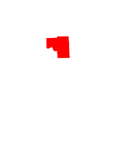
Inger is an unincorporated community and census-designated place (CDP) in Itasca County, Minnesota, United States, along the Bowstring River of the Leech Lake Indian Reservation. As of the 2010 census, its population was 212. [3]
The center of Inger is generally considered as being at the junction of Itasca County Roads 35 and 146. State Highway 46 (MN 46) is also in the vicinity. Inger is located 22 miles northwest of Deer River.
In Ojibwe, the community is called Chi-achaabaaning, meaning "by the Big Bowstring" due to its location along the Bowstring River. The village is located in the former Inger Township, which reverted to being unorganized. Named for one of its pioneer settlers, [4] a post office was in operation from 1912 until 1955. [5]
Located nine miles south of Inger is the Winnibigoshish Lake Dam, which is listed on the National Register of Historic Places.
Historical population | |||
---|---|---|---|
Census | Pop. | %± | |
2020 | 200 | — | |
U.S. Decennial Census [6] |
Itasca County is located in the State of Minnesota. As of the 2020 census, the population was 45,014. Its county seat is Grand Rapids. The county is named after Lake Itasca, which is in turn a shortened version of the Latin words veritas caput, meaning 'truth' and 'head', a reference to the source of the Mississippi River. Portions of the Bois Forte and Leech Lake Indian reservations are in the county.
Cedar Valley Township is a township in Saint Louis County, Minnesota, United States. Cedar Valley Township was named for the white cedar in the valley of the Floodwood River. The population was 195 at the 2010 census.
Bowstring is an unincorporated community in Bowstring Township, Itasca County, Minnesota, United States.
Marcell is an unincorporated community in Marcell Township, Itasca County, Minnesota, United States.
Bear River is an unincorporated community in Itasca and Saint Louis counties in the U.S. state of Minnesota.
Talmoon is an unincorporated community in Itasca County, Minnesota, United States.
Swan River is an unincorporated community in southeast Itasca County, Minnesota, United States.
Goodland is an unincorporated community in Goodland Township, Itasca County, Minnesota, United States.
Ball Club is an unincorporated community and census-designated place (CDP) in Itasca County, Minnesota, United States; located within the Leech Lake Indian Reservation. As of the 2010 census, its population was 342. Ball Club is located between Zemple and Bena.
Spring Lake is an unincorporated community in Lake Jessie Township, Itasca County, Minnesota, United States; located within the Chippewa National Forest.
Max is an unincorporated community in Max Township, Itasca County, Minnesota, United States; located within the Chippewa National Forest and the Leech Lake Indian Reservation.
Wirt is an unincorporated community in Wirt Township, Itasca County, Minnesota, United States; located within the Chippewa National Forest.
Mack is an unincorporated community in Itasca County, Minnesota, United States, located within the Chippewa National Forest. The community is located between Deer River and Talmoon, at the junction of State Highway 6 and Mac Road.
Alvwood is an unincorporated community in Alvwood Township, Itasca County, Minnesota, United States.
Bergville is an unincorporated community in Ardenhurst Township, Itasca County, Minnesota, United States; located within the Chippewa National Forest.
Dunbar is an unincorporated community in Good Hope Township, Itasca County, Minnesota, United States. The community is located northwest of Squaw Lake at the junction of Itasca County Roads 32 and 149. State Highway 46 is nearby.
Dora Lake is an unincorporated community in Kinghurst Township, Itasca County, Minnesota, United States; located within the Chippewa National Forest. The community is located near Wirt at the junction of Itasca County Roads 29 and 145.
Orth is an unincorporated community in Nore Township, Itasca County, Minnesota, United States, located in the northwestern corner of the county.
Suomi is an unincorporated community in Itasca County, Minnesota, United States.
Jessie Lake is an unincorporated community in Lake Jessie Township, Itasca County, Minnesota, United States, located within the Chippewa National Forest. The community is located between Wirt and Talmoon; along Itasca County Road 4.