
Itasca County is a county located in the State of Minnesota. As of the 2010 United States Census, the population was 45,058. Its county seat is Grand Rapids. The county is named after Lake Itasca, which is in turn a shortened version of the Latin words veritas caput, meaning 'truth' and 'head', a reference to the source of the Mississippi River. Portions of the Bois Forte and Leech Lake Indian reservations are in the county.

Northern Township is a township in Beltrami County, Minnesota, United States. The population was 4,657 as of the 2010 census.
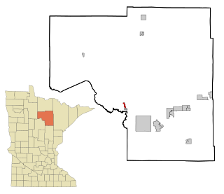
Deer River is a city in Itasca County, Minnesota, United States. The population was 930 at the 2010 census.
Bowstring Lake is an unorganized territory in Itasca County, Minnesota, United States. The population was 1,166 at the 2010 census.
Bowstring is an unincorporated community in Bowstring Township, Itasca County, Minnesota, United States.
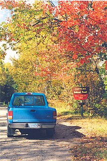
The Cut Foot Sioux Trail is a 22-mile (35 km) loop trail in the Chippewa National Forest of Minnesota, United States. It follows gravel and sand forestry roads that are now used for hiking, biking, cross-country skiing and horse back riding. The trail passes by several lakes.
The Blackduck River is a 33.2-mile-long (53.4 km) tributary of Red Lake in northwestern Minnesota in the United States.

The Boy River is a river in Cass County, Minnesota. The river took its name from Boy Lake.
The Dunbar River is a river of Minnesota.
The Gull River is a river of Minnesota. It is a tributary of the Turtle River, a tributary of the Mississippi River.
The Kabekona River is a river of Minnesota. It empties into the Kabekona Bay of Leech Lake.
The Necktie River is a river of Minnesota.
The Pigeon River is a river of Minnesota. It is a tributary of the Mississippi River.
The Popple River (Minnesota) is a river of Minnesota.
The Shingobee River is a river in Cass and Hubbard counties, Minnesota.
The Swift River (Minnesota) is a river of Minnesota.
The Turtle River is a river of Minnesota. It is a tributary of the Bowstring River.
The Turtle River is a river of Minnesota. It is a tributary of the Mississippi River.

Suomi is an unincorporated community in Itasca County, Minnesota, United States.

The Steamboat River is a stream in Cass County, Minnesota, in the United States. The Steamboat River was so named from the fact steamboats navigated this stream.
