Fulda, Minnesota

Last updated

Fulda, Minnesota
Fulda MN Water Tower.jpg
The water tower in Fulda
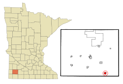
Murray County Minnesota Incorporated and Unincorporated areas Fulda Highlighted.svg
Location in Murray County and the state of Minnesota
Coordinates: 43°52′12″N95°36′0″W / 43.87000°N 95.60000°W / 43.87000; -95.60000
Country United States
State Minnesota
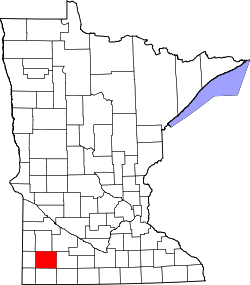
County Murray
Founded1879
Government
  TypeMayor Council
  MayorJohn Maertens
Area
[1]
  Total1.09 sq mi (2.82 km2)
  Land1.01 sq mi (2.62 km2)
  Water0.08 sq mi (0.20 km2)  7.21%
Elevation
1,532 ft (464 m)
Population
 (2020) [2]
  Total1,371
  Density1,354.74/sq mi (523.17/km2)
Time zone UTC-6 (CST)
  Summer (DST) UTC-5 (CDT)
ZIP code
56131
Area code 507
FIPS code 27-22958 [3]
GNIS feature ID0643984 [4]
Website fuldamn.com

Fulda is a city in Murray County, Minnesota, United States. The population was 1,371 at the 2020 census, [2] up from 1,318 in 2010. [5]

Contents

History

Fulda's Milwaukee Road depot, built c. 1901 Fulda Depot.jpg
Fulda's Milwaukee Road depot, built c. 1901

The city of Fulda was founded in 1881 along the Milwaukee Road primarily by German settlers, though also by Scandinavians and Irish. It was named for Fulda in Hessen, Germany. [6] Fulda is still predominantly an agricultural community.

Although the rail line was discontinued in 1980, the two-story train depot, along with a section of track, has been preserved and is listed on the National Register of Historic Places. The lower level of the depot is currently used as an antiques museum and store. The other building in the city on the National Register is the former Citizens State Bank.

Fulda has a Civil War cannon in its city park. It is a three-inch (76 mm) rifled gun and was purchased for $155 on June 25, 1892, by the Zach Taylor Post No. 42 of the Grand Army of the Republic.

Geography

Fulda is in southeastern Murray County, surrounded by Bondin Township. U.S. Highway 59 runs along the eastern border of the city, leading northwest 13 miles (21 km) to Slayton, the Murray county seat, and south 17 miles (27 km) to Worthington. Minnesota State Highway 62 has its western terminus at US 59 in Fulda and leads east 25 miles (40 km) to Windom.

According to the U.S. Census Bureau, Fulda has an area of 1.09 square miles (2.82 km2), of which 1.01 square miles (2.62 km2) are land and 0.08 square miles (0.21 km2), or 6.99%, are water. [1] The city is on the north end of Fulda Lake and is in the watershed of the Des Moines River.

Neighboring communities

  • Lime Creek, 2 miles (3.2 km) northeast
  • Wirock, 5 miles (8.0 km) west
  • Avoca, 6 miles (9.7 km) northwest
  • Dundee, 6 miles (9.7 km) east
  • Kinbrae, 6 miles (9.7 km) southeast
  • Iona, 9 miles (14 km) northwest
  • Slayton, 11 miles (18 km) northwest
  • Dovray, 13 miles (21 km) north
  • Reading, 13 miles (21 km) southwest
  • Brewster, 13 miles (21 km) southeast

Demographics

Historical population
CensusPop.Note
1880 150
1890 348132.0%
1900 886154.6%
1910 743−16.1%
1920 89320.2%
1930 818−8.4%
1940 98420.3%
1950 1,14916.8%
1960 1,2024.6%
1970 1,2262.0%
1980 1,3086.7%
1990 1,212−7.3%
2000 1,2835.9%
2010 1,3182.7%
2020 1,3714.0%
U.S. Decennial Census

2010 census

As of the census [7] of 2010, there were 1,318 people, 566 households, and 324 families residing in the city. The population density was 1,279.6 inhabitants per square mile (494.1/km2). There were 615 housing units at an average density of 597.1 per square mile (230.5/km2). The racial makeup of the city was 91.7% White, 0.8% African American, 0.2% Native American, 4.2% Asian, 1.5% from other races, and 1.5% from two or more races. Hispanic or Latino of any race were 3.3% of the population.

There were 566 households, of which 23.3% had children under the age of 18 living with them, 47.5% were married couples living together, 6.7% had a female householder with no husband present, 3.0% had a male householder with no wife present, and 42.8% were non-families. 38.5% of all households were made up of individuals, and 22.5% had someone living alone who was 65 years of age or older. The average household size was 2.17 and the average family size was 2.90.

The median age in the city was 46.8 years. 21.8% of residents were under the age of 18; 6.3% were between the ages of 18 and 24; 19.6% were from 25 to 44; 25.9% were from 45 to 64; and 26.5% were 65 years of age or older. The gender makeup of the city was 46.1% male and 53.9% female.

2000 census

As of the census [3] of 2000, there were 1,283 people, 528 households, and 328 families residing in the city. The population density was 1,328.3 inhabitants per square mile (512.9/km2). There were 568 housing units at an average density of 588.1 per square mile (227.1/km2). The racial makeup of the city was 96.10% White, 0.08% African American, 0.55% Native American, 0.23% Asian, 2.18% from other races, and 0.86% from two or more races. Hispanic or Latino of any race were 3.27% of the population.

There were 528 households, out of which 26.5% had children under the age of 18 living with them, 54.5% were married couples living together, 4.5% had a female householder with no husband present, and 37.7% were non-families. 35.0% of all households were made up of individuals, and 24.4% had someone living alone who was 65 years of age or older. The average household size was 2.28 and the average family size was 2.94.

In the city, the population was spread out, with 24.0% under the age of 18, 4.8% from 18 to 24, 23.4% from 25 to 44, 18.2% from 45 to 64, and 29.6% who were 65 years of age or older. The median age was 44 years. For every 100 females, there were 83.0 males. For every 100 females age 18 and over, there were 80.2 males.

The median income for a household in the city was $30,000, and the median income for a family was $37,500. Males had a median income of $26,469 versus $18,750 for females. The per capita income for the city was $15,184. About 4.1% of families and 6.1% of the population were below the poverty line, including 4.7% of those under age 18 and 11.2% of those age 65 or over.

Notable people

Community and culture

Local churches include First Presbyterian Church (PCUSA), Saint Gabriel's Catholic Church, Solid Rock Assembly, and Saint Paul's (LCMS) and Immanuel American (ELCA) Lutheran churches.

Local organizations include American Legion post 318, Boy Scout troop 123, Fish and Game Club, Jaycees, VFW post 9017.

Education

Fulda High School
Fulda raider marching band 2006 woodduck days.jpg
The FHS Marching Band (2006)
Location
Fulda, Minnesota
Fulda
,
USA
Information
Type Public
Established1900
PrincipalMichael Pagel
Enrollment124
Color(s)grey and Black
Team nameCoyotes
Rival Murray County Central High School
Affiliations Minnesota State High School League
Website www.fps.mntm.org

There are two schools in Fulda, Fulda Elementary and Fulda Secondary (also known as Fulda High School). Formerly operating in Fulda were St. Gabriel's Catholic School and Fulda Lutheran School.

Fulda Public Schools

Fulda Public Schools consists of Fulda Elementary School and Fulda Secondary School (or Fulda High School). It co-operates many sports with neighboring districts. These include football, girls' basketball, baseball, softball, track and field, and golf with Heron Lake-Okabena, known as the Heron Lake-Okabena/Fulda Coyotes, and wrestling with Murray County Central, known as the Fulda/MCC Warriors. In addition to the youth in Fulda, the school district has students from neighboring communities, including Avoca, Iona, Dundee, Kinbrae, Wilmont, and Reading.

Accomplishments

  • 2006 Class A Girls Basketball Champions
  • 2007 Class A Girls Basketball Champions

St. Paul's Lutheran School

Fulda's Lutheran school closed in 2018 and had been in existence since 1893. [8]

St. Gabriel's Catholic School

Library

Fulda Memorial Library is a member of the Plum Creek Library System. It was expanded in 2002.

The Library was founded in 1918 when it started to receive funding from the city, and was located in different businesses. On April 14, 1970, the library building was officially opened across from City Hall. In 1975 the library officially became a member of the Plum Creek Library System. In 1977 the Friends of the Library group was formed to raise funds for the library.

Politics

Fulda is in Minnesota's 7th congressional district, represented by Michelle Fischbach. At the state level, Fulda is in Senate District 21 and in House District 21A, represented by Joe Schomacker.

Related Research Articles

<span class="mw-page-title-main">Nobles County, Minnesota</span> County in Minnesota, United States

Nobles County is a county in the U.S. state of Minnesota. As of the 2020 census, the population was 22,290. Its county seat is Worthington. Nobles County comprises the Worthington, MN Micropolitan Statistical Area.

<span class="mw-page-title-main">Mayer, Minnesota</span> City in Minnesota, United States

Mayer is a community in Carver County, Minnesota, United States, along the South Fork of the Crow River. The population was 1,749 at the 2010 census.

<span class="mw-page-title-main">Storden, Minnesota</span> City in Minnesota, United States

Storden is a city in Cottonwood County, Minnesota, United States. The population was 219 at the 2010 census.

<span class="mw-page-title-main">Hayfield, Minnesota</span> City in Minnesota, United States

Hayfield is a city in Dodge County, Minnesota, United States. The population was 1,340 at the 2010 census.

<span class="mw-page-title-main">Cannon Falls, Minnesota</span> City in Minnesota, Goodhue County, United States

Cannon Falls is a city in Goodhue County, Minnesota, United States. The population was 4,083 at the 2010 census. Located along U.S. Route 52, southeast of the Twin Cities, Cannon Falls is the home of Pachyderm Studio, where many famous musicians have recorded, including Nirvana, which recorded its 1993 album In Utero there.

<span class="mw-page-title-main">Zumbrota, Minnesota</span> City in Minnesota, United States

Zumbrota is a city in Goodhue County, Minnesota, United States, along the North Fork of the Zumbro River. The population was 3,252 at the 2010 census. It promotes itself as "the only Zumbrota in the world."

<span class="mw-page-title-main">Caledonia, Minnesota</span> City in Minnesota, United States

Caledonia is a city and the county seat of Houston County, Minnesota, United States and is part of the La Crosse, Wisconsin Metropolitan Statistical Area. The population was 2,847 at the 2020 census.

<span class="mw-page-title-main">Okabena, Minnesota</span> City in Minnesota, United States

Okabena is a town in Jackson County, Minnesota, United States. The population was 188 at the 2010 census. The community's name is a Dakota term meaning "the nesting place of herons."

<span class="mw-page-title-main">Fairmont, Minnesota</span> City in Minnesota, United States

Fairmont is a city and the county seat of Martin County, Minnesota, United States. The population was 10,487 at the 2020 census.

<span class="mw-page-title-main">Trimont, Minnesota</span> City in Minnesota, United States

Trimont is a city in Martin County, Minnesota, United States. The population was 705 at the 2020 census. The small community is located in southern Minnesota between Sherburn and St. James on Minnesota State Highway 4.

<span class="mw-page-title-main">Welcome, Minnesota</span> City in Minnesota, United States

Welcome is a city in Martin County, Minnesota, United States. The population was 710 at the 2020 census.

<span class="mw-page-title-main">Slayton, Minnesota</span> City in Minnesota, United States

Slayton is a city in and the county seat of Murray County, Minnesota, United States. The population was 2,013 at the 2020 census.

<span class="mw-page-title-main">Kinbrae, Minnesota</span> City in Minnesota, United States

Kinbrae is a city in Nobles County, Minnesota, United States. The population was 10 at the 2020 census, making the city the least populous incorporated place in Minnesota.

<span class="mw-page-title-main">North St. Paul, Minnesota</span> City in Minnesota, United States

North Saint Paul is a city in Ramsey County, Minnesota, United States, located east-northeast of the city of Saint Paul. The population was 12,364 at the 2020 census.

<span class="mw-page-title-main">Arlington, Minnesota</span> City in Minnesota, United States

Arlington is a city in Sibley County, Minnesota, United States. The population was 2,233 at the 2010 census.

<span class="mw-page-title-main">Benson, Minnesota</span> City in Minnesota, United States

Benson is a city in Swift County, Minnesota, United States, along the Chippewa River. The population was 3,240 at the 2010 census. It is the county seat.

<span class="mw-page-title-main">Lewiston, Minnesota</span> City in Minnesota, United States

Lewiston is a city in Winona County, Minnesota, United States. The population was 1,620 at the 2010 census.

<span class="mw-page-title-main">Ortonville, Minnesota</span> City in Minnesota, United States

Ortonville is a city and the county seat of Big Stone County in the U.S. state of Minnesota at the southern tip of Big Stone Lake, along the border with South Dakota. The population was 2,021 at the 2020 census. Big Stone Lake State Park is nearby.

<span class="mw-page-title-main">Lake City, Minnesota</span> City in Minnesota, United States

Lake City is a city in Goodhue and Wabasha counties in the U.S. state of Minnesota. It lies along Lake Pepin, a wide portion of the Mississippi River. The population was 5,252 at the 2020 census. Most of Lake City is located within Wabasha County with only a small portion in Goodhue County. Lake City is part of the Rochester, Minnesota Metropolitan Statistical Area.

<span class="mw-page-title-main">Eden Valley, Minnesota</span> City in Minnesota, United States

Eden Valley is a city in Meeker and Stearns counties in the U.S. state of Minnesota. The population was 1,027 at the 2020 census. Most of Eden Valley is in Meeker County; the Stearns County portion is part of the St. Cloud Metropolitan Statistical Area.

References

  1. 1 2 "2023 U.S. Gazetteer Files: Minnesota". United States Census Bureau. Retrieved February 15, 2024.
  2. 1 2 "P1. Race – Fulda city, Minnesota: 2020 DEC Redistricting Data (PL 94-171)". U.S. Census Bureau. Retrieved February 15, 2024.
  3. 1 2 "U.S. Census website". United States Census Bureau . Retrieved January 31, 2008.
  4. "US Board on Geographic Names". United States Geological Survey. October 25, 2007. Retrieved January 31, 2008.
  5. "2010 Census Redistricting Data (Public Law 94-171) Summary File". American FactFinder. United States Census Bureau . Retrieved April 27, 2011.[ dead link ]
  6. Upham, Warren (1920). Minnesota Geographic Names: Their Origin and Historic Significance. Minnesota Historical Society. p.  366.
  7. "U.S. Census website". United States Census Bureau . Retrieved November 13, 2012.
  8. "St Paul's Lutheran Church — Church History".