Dovray, Minnesota

Last updated

Dovray, Minnesota
Flag of Norway.svg
Murray County Minnesota Incorporated and Unincorporated areas Dovray Highlighted.svg
Location in Murray County and the state of Minnesota
Coordinates: 44°03′16″N95°32′52″W / 44.05444°N 95.54778°W / 44.05444; -95.54778
Country United States
State Minnesota
County Murray
Government
  TypeMayor − Council
  MayorHerb Hansen
Area
[1]
  Total0.25 sq mi (0.64 km2)
  Land0.25 sq mi (0.64 km2)
  Water0.00 sq mi (0.00 km2)
Elevation
[2]
1,513 ft (461 m)
Population
 (2020) [3]
  Total58
  Density232.93/sq mi (90.00/km2)
Time zone UTC-6 (Central (CST))
  Summer (DST) UTC-5 (CDT)
ZIP code
56125
Area code 507
FIPS code 27-16300 [4]
GNIS feature ID2394556 [2]

Dovray is a city in Murray County, Minnesota, United States. The population was 58 at the 2020 census. [3]

Contents

History

Dovray was platted in 1904, and named from its location in Dovray Township. [5]

Geography

Dovray is in eastern Murray County, 14 miles (23 km) northeast of Slayton, the county seat. It is located within section 20 of Dovray Township but is an independent municipality. Minnesota State Highway 30 runs along the southern border of the city, leading west 6 miles (10 km) to Currie and east the same distance to Westbrook. County Road 42 runs along the eastern border of Dovray, and County Road 11 passes to the north of the city.

According to the U.S. Census Bureau, Dovray has a total area of 0.25 square miles (0.65 km2), all land. [6]

Demographics

Historical population
CensusPop.Note
1930 103
1940 12824.3%
1950 127−0.8%
1960 113−11.0%
1970 104−8.0%
1980 87−16.3%
1990 60−31.0%
2000 6711.7%
2010 57−14.9%
2020 581.8%
U.S. Decennial Census

2010 census

As of the census [7] of 2010, there were 57 people, 31 households, and 16 families residing in the city. The population density was 228.0 inhabitants per square mile (88.0/km2). There were 38 housing units at an average density of 152.0 per square mile (58.7/km2). The racial makeup of the city was 98.2% White and 1.8% from two or more races. Hispanic or Latino of any race were 1.8% of the population.

There were 31 households, of which 9.7% had children under the age of 18 living with them, 45.2% were married couples living together, 3.2% had a female householder with no husband present, 3.2% had a male householder with no wife present, and 48.4% were non-families. 32.3% of all households were made up of individuals, and 22.6% had someone living alone who was 65 years of age or older. The average household size was 1.84 and the average family size was 2.31.

The median age in the city was 59.5 years. 5.3% of residents were under the age of 18; 3.6% were between the ages of 18 and 24; 22.9% were from 25 to 44; 36.9% were from 45 to 64; and 31.6% were 65 years of age or older. The gender makeup of the city was 43.9% male and 56.1% female.

2000 census

As of the census [4] of 2000, there were 67 people, 33 households, and 23 families residing in the city. The population density was 268.0 inhabitants per square mile (103.5/km2). There were 36 housing units at an average density of 144.0 per square mile (55.6/km2). The racial makeup of the city was 95.52% White, and 4.48% from two or more races.

There were 33 households, out of which 18.2% had children under the age of 18 living with them, 60.6% were married couples living together, 3.0% had a female householder with no husband present, and 30.3% were non-families. 24.2% of all households were made up of individuals, and 15.2% had someone living alone who was 65 years of age or older. The average household size was 2.03 and the average family size was 2.35.

In the city, the population was spread out, with 13.4% under the age of 18, 7.5% from 18 to 24, 14.9% from 25 to 44, 28.4% from 45 to 64, and 35.8% who were 65 years of age or older. The median age was 54 years. For every 100 females, there were 81.1 males. For every 100 females age 18 and over, there were 81.3 males.

The median income for a household in the city was $37,500, and the median income for a family was $41,875. Males had a median income of $32,188 versus $16,875 for females. The per capita income for the city was $17,461. There were no families and 13.1% of the population living below the poverty line, including no under eighteens and 11.8% of those over 64.

Politics

Dovray is located in Minnesota's 7th congressional district, represented by Collin Peterson, a Democrat. At the state level, Dovray is located in Senate District 22, represented by Republican Doug Magnus, and in House District 22A, represented by Republican Joe Schomacker.

Related Research Articles

<span class="mw-page-title-main">Felton, Minnesota</span> City in Minnesota, United States

Felton is a city in Clay County, Minnesota, United States. The population was 177 at the 2020 census.

<span class="mw-page-title-main">Deerwood, Minnesota</span> City in Minnesota, United States

Deerwood is a city in Crow Wing County, Minnesota, United States. The population was 526 at the 2020 census. It is part of the Brainerd Micropolitan Statistical Area.

<span class="mw-page-title-main">Emily, Minnesota</span> City in Minnesota, United States

Emily is a city in Crow Wing County, Minnesota, United States. The population was 843 at the 2020 census. It is part of the Brainerd Micropolitan Statistical Area.

<span class="mw-page-title-main">Jenkins, Minnesota</span> City in Minnesota, United States

Jenkins is a city in Crow Wing County, Minnesota, United States. The population was 430 at the 2010 census. It is part of the Brainerd Micropolitan Statistical Area.

<span class="mw-page-title-main">Hartland, Minnesota</span> City in Minnesota, United States

Hartland is a city in Freeborn County, Minnesota, United States. The population was 315 at the 2010 census.

<span class="mw-page-title-main">Coleraine, Minnesota</span> City in Minnesota, United States

Coleraine is a city in Itasca County, Minnesota, United States. The population was 1,970 at the 2010 census. The community was named after Thomas F. Cole, President of the Oliver Iron Mining Company.

<span class="mw-page-title-main">Keewatin, Minnesota</span> City in Minnesota, United States

Keewatin is a city in Itasca County, Minnesota, United States. The population was 984 at the 2020 census.

<span class="mw-page-title-main">Lakefield, Minnesota</span> City in Minnesota, United States

Lakefield is a city in Jackson County, Minnesota, United States. The population was 1,694 at the 2010 census.

<span class="mw-page-title-main">Lake Bronson, Minnesota</span> City in Minnesota, United States

Lake Bronson is a city in Kittson County, Minnesota, United States. The population was 178 at the 2020 census. Lake Bronson State Park is nearby.

<span class="mw-page-title-main">Le Center, Minnesota</span> City in Minnesota, United States

Le Center is a city and the county seat of Le Sueur County, Minnesota, United States. The population was 2,517 at the 2020 census. The Le Sueur County Courthouse and Jail are listed on the National Register of Historic Places.

<span class="mw-page-title-main">Ivanhoe, Minnesota</span> City in Minnesota, United States

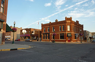
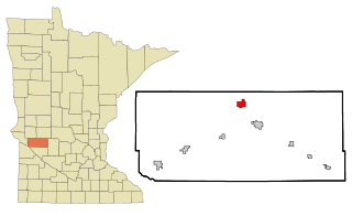
Ivanhoe is a city in Lincoln County, Minnesota, United States. The population was 559 at the 2010 census. Since 1902 it has been the county seat of Lincoln County and is now the least populous county seat in Minnesota.

<span class="mw-page-title-main">Northrop, Minnesota</span> City in Minnesota, United States

Northrop is a city in Martin County, Minnesota, United States. The population was 223 at the 2020 census.

<span class="mw-page-title-main">Harding, Minnesota</span> City in Minnesota, United States

Harding is a city in Morrison County, Minnesota, United States. The population was 123 at the 2020 census.

<span class="mw-page-title-main">Bluffton, Minnesota</span> City in Minnesota, United States

Bluffton is a city in Otter Tail County, Minnesota, United States, along the Leaf River. The population was 210 at the 2020 census.

<span class="mw-page-title-main">Dent, Minnesota</span> City in Minnesota, United States

Dent is a city in Otter Tail County, Minnesota, United States. The population was 173 at the 2020 census.

<span class="mw-page-title-main">Henriette, Minnesota</span> City in Minnesota, United States

Henriette, is a city in Pine County, Minnesota, United States. The population was 71 at the 2010 census.

<span class="mw-page-title-main">Sedan, Minnesota</span> City in Minnesota, United States

Sedan is a city in Pope County, Minnesota, United States. The population was 43 at the 2020 census.

<span class="mw-page-title-main">Winthrop, Minnesota</span> City in Minnesota, United States

Winthrop is a city in Sibley County, Minnesota, United States. The population was 1,399 at the 2010 census.

<span class="mw-page-title-main">Clontarf, Minnesota</span> City in Minnesota, United States

Clontarf is a city in Swift County, Minnesota, United States. The population was 164 at the 2010 census.

<span class="mw-page-title-main">Ormsby, Minnesota</span> City in Minnesota, United States

Ormsby is a city in Watonwan and Martin counties in the U.S. state of Minnesota. The population was 118 at the 2020 census.

References

  1. "2023 U.S. Gazetteer Files: Minnesota". United States Census Bureau. Retrieved February 14, 2024.
  2. 1 2 U.S. Geological Survey Geographic Names Information System: Dovray, Minnesota
  3. 1 2 "P1. Race – Dovray city, Minnesota: 2020 DEC Redistricting Data (PL 94-171)". U.S. Census Bureau. Retrieved February 14, 2024.
  4. 1 2 "U.S. Census website". United States Census Bureau . Retrieved January 31, 2008.
  5. Upham, Warren (1920). Minnesota Geographic Names: Their Origin and Historic Significance. Minnesota Historical Society. p. 365.
  6. "US Gazetteer files 2010". United States Census Bureau. Archived from the original on July 2, 2012. Retrieved November 13, 2012.
  7. "U.S. Census website". United States Census Bureau . Retrieved November 13, 2012.