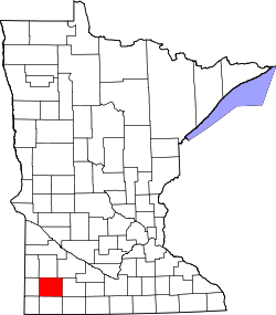
The Lakes, Minnesota

Last updated

The Lakes
Murray County Minnesota Incorporated and Unincorporated areas The Lakes Highlighted.svg
Location within Murray County and the state of Minnesota
Coordinates: 44°07′29″N95°42′07″W / 44.12472°N 95.70194°W / 44.12472; -95.70194
Country United States
State Minnesota
County Murray
Townships Lake Sarah
Shetek
Mason
Murray
Area
[1]
  Total43.45 sq mi (112.55 km2)
  Land33.70 sq mi (87.28 km2)
  Water9.76 sq mi (25.27 km2)
Elevation
[2]
1,483 ft (452 m)
Population
 (2020) [3]
  Total590
  Density17.51/sq mi (6.76/km2)
Time zone UTC-6 (Central (CST))
  Summer (DST) UTC-5 (CDT)
ZIP Codes
56132 (Garvin)
56175 (Tracy)
56172 (Slayton)
56123 (Currie)
FIPS code 27-64543 [4]
GNIS feature ID2393255 [2]

The Lakes is an unincorporated community and census-designated place (CDP) in Murray County, Minnesota, United States located north of Currie and south of Garvin. The population was 590 at the 2020 census. [3] The community is centered about Lake Shetek, the largest lake in southwestern Minnesota. The lake and the community are located in parts of four townships in Murray County: Lake Sarah, Shetek, Murray, and Mason.

Contents

Geography

The Lakes is in northern Murray County and extends north to the Lyon County line. The CDP includes all of Lake Shetek, as well as Lake Sarah and Lake Maria in the west. Several smaller lakes in the CDP are near Lake Shetek. According to the U.S. Census Bureau, the CDP has a total area of 43.4 square miles (112 km2), of which 33.7 square miles (87 km2) are land and 9.8 square miles (25 km2), or 22.45%, are water. [1] The outlet of Lake Shetek, at the southern end of the community, is the Des Moines River, flowing southward toward Iowa.

The unincorporated community of Owanka is in the eastern part of The Lakes, on the eastern shore of Lake Shetek. Lake Shetek State Park is on the southeast side of the lake.

U.S. Highway 59 runs through the western side of the CDP, leading south 10 miles (16 km) to Slayton, the Murray county seat, and north 23 miles (37 km) to Marshall. Minnesota State Highway 30 runs along the southern edge of the CDP, leading east toward Currie and Dovray.

Demographics

Historical population
CensusPop.Note
2000 619
2010 6677.8%
2020 590−11.5%
U.S. Decennial Census [5]

As of the census [4] of 2000, there were 619 people, 267 households, and 213 families residing in the CDP. The population density was 17.3 people per square mile (6.7/km2). There were 598 housing units at an average density of 16.7/sq mi (6.4/km2). The racial makeup of the CDP was 99.35% White, 0.16% Native American, and 0.48% from two or more races. Hispanic or Latino of any race were 0.16% of the population.

There were 267 households, out of which 19.1% had children under the age of 18 living with them, 76.8% were married couples living together, 2.2% had a female householder with no husband present, and 20.2% were non-families. 16.1% of all households were made up of individuals, and 3.7% had someone living alone who was 65 years of age or older. The average household size was 2.32 and the average family size was 2.59.

In the CDP, the population was spread out, with 16.6% under the age of 18, 3.9% from 18 to 24, 21.3% from 25 to 44, 42.6% from 45 to 64, and 15.5% who were 65 years of age or older. The median age was 49 years. For every 100 females, there were 107.7 males. For every 100 females age 18 and over, there were 107.2 males.

The median income for a household in the CDP was $43,250, and the median income for a family was $50,357. Males had a median income of $36,250 versus $22,083 for females. The per capita income for the CDP was $23,980. None of the families and 0.8% of the population were living below the poverty line, including no under eighteens and none of those over 64.

Politics

The Lakes is located in Minnesota's 1st congressional district, most recently represented by Republican Jim Hagedorn of Blue Earth until his death in 2022. At the state level, The Lakes is located in Senate District 22, represented by Republican Doug Magnus, and in House District 22A, represented by Republican Joe Schomacker.

Related Research Articles

<span class="mw-page-title-main">Murray County, Minnesota</span> County in Minnesota, United States

Murray County is a county in the U.S. state of Minnesota. The population was 8,179 at the 2020 census. Its county seat is Slayton.

<span class="mw-page-title-main">Lake of the Pines, California</span> Census-designated place in California, United States

Lake of the Pines is a census-designated place (CDP) and a gated residential community in Nevada County, California, United States. The population was 3,917 at the 2010 census.

<span class="mw-page-title-main">Lake Wildwood, California</span> Census-designated place in California, United States

Lake Wildwood is a census-designated place (CDP) in Nevada County, California, United States. The population was 4,991 at the 2010 census, up from 4,868 at the 2000 census.

<span class="mw-page-title-main">Simonton Lake, Indiana</span> Census-designated place in Indiana, United States

Simonton Lake is a census-designated place (CDP) in Elkhart County, Indiana, United States. The population was 4,678 at the 2010 census.

<span class="mw-page-title-main">Argentine, Michigan</span> Census-designated place & unincorporated community in Michigan, United States

Argentine is an unincorporated community and census-designated place (CDP) in Argentine Township, Genesee County, in the U.S. state of Michigan. The population was 2,685 as of the 2020 census, up from 2,525 at the 2010 census. It was first settled in 1836.

<span class="mw-page-title-main">Redby, Minnesota</span> Census-designated place in Minnesota, US

Redby Ojibwe: Madaabiimog) is a census-designated place (CDP) within the Lower Red Lake unorganized territory in Beltrami County, Minnesota, United States. The population was 1,334 at the 2010 census.

<span class="mw-page-title-main">Chandler, Minnesota</span> City in Minnesota, United States

Chandler is a town in Murray County, Minnesota, United States. The population was 279 at the 2020 census.

<span class="mw-page-title-main">Currie, Minnesota</span> City in Minnesota, United States

Currie is a city in Murray County, Minnesota, United States. The population was 224 at the 2020 census. Lake Shetek State Park is nearby. The city is known as the "Gateway to Lake Shetek". Currie is notable for its tourism, cuisine, and recreational opportunities.

<span class="mw-page-title-main">Dovray, Minnesota</span> City in Minnesota, United States

Dovray is a city in Murray County, Minnesota, United States. The population was 58 at the 2020 census.

Dovray Township is a township in Murray County, Minnesota, United States. The population was 167 at the 2000 census. Dovray is located in Southwest Minnesota on the eastern side of Murray County. It is five minutes from Currie, fifteen minutes from Lake Shetek State Park, and twenty minutes northeast of Slayton.

<span class="mw-page-title-main">Hadley, Minnesota</span> City in Minnesota, United States

Hadley is a city in Murray County, Minnesota, United States. The population was 54 at the 2020 census.

Lake Sarah Township is a township in Murray County, Minnesota, United States. The population was 348 at the 2000 census.

Shetek Township is a township in Murray County, Minnesota, United States. The population was 313 at the 2000 census.

<span class="mw-page-title-main">Slayton, Minnesota</span> City in Minnesota, United States

Slayton is a city in and the county seat of Murray County, Minnesota, United States. The population was 2,013 at the 2020 census.

<span class="mw-page-title-main">White Earth, Minnesota</span> Census-designated place in Minnesota, United States

White Earth is a census-designated place (CDP) in Becker County, Minnesota, United States. The population was 580 at the 2010 census.

<span class="mw-page-title-main">Little Rock, Beltrami County, Minnesota</span> Census-designated place in Minnesota, US

Little Rock is a census-designated place (CDP) within the Lower Red Lake unorganized territory in Beltrami County, Minnesota, United States. The population was 1,208 at the 2010 census.

Naytahwaush is a census-designated place (CDP) in Mahnomen County, Minnesota, United States. The population was 504 at the 2020 census.

<span class="mw-page-title-main">Treasure Lake, Pennsylvania</span> Census-designated place in Pennsylvania, United States

Treasure Lake is a census-designated place (CDP) in Clearfield County, Pennsylvania, United States. The population was 5,460 at the 2020 census. Treasure Lake is a semi-private, gated community centered around its namesake.

<span class="mw-page-title-main">Ames Lake, Washington</span> Census-designated place in Washington, United States

Ames Lake is an unincorporated community and census-designated place (CDP) in King County, Washington, United States. The population was 1,486 at the 2010 census.

Lower Red Lake is an unorganized territory in Beltrami County, Minnesota, United States.The territory is located on the Red Lake Indian Reservation, and the town of Red Lake is located in the area. The population of the Lower Red Lake territory was 5,790 at the 2010 census.

References

  1. 1 2 "2023 U.S. Gazetteer Files: Minnesota". United States Census Bureau. Retrieved February 15, 2024.
  2. 1 2 U.S. Geological Survey Geographic Names Information System: The Lakes, Minnesota
  3. 1 2 "P1. Race – The Lakes CDP, Minnesota: 2020 DEC Redistricting Data (PL 94-171)". U.S. Census Bureau. Retrieved February 15, 2024.
  4. 1 2 "U.S. Census website". United States Census Bureau . Retrieved January 31, 2008.
  5. "Census of Population and Housing". Census.gov. Retrieved June 4, 2016.