Current Lake, Minnesota | |
|---|---|
 Current Lake  Current Lake | |
| Coordinates: 44°08′19″N95°56′36″W / 44.13861°N 95.94333°W | |
| Country | United States |
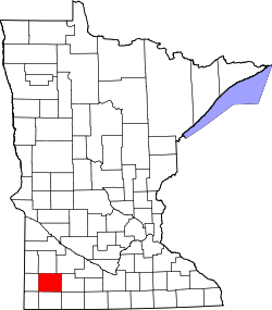
| State | Minnesota |
| County | Murray |
| Township | Ellsborough |
| Elevation | 1,667 ft (508 m) |
| Time zone | UTC-6 (Central (CST)) |
| • Summer (DST) | UTC-5 (CDT) |
| Area code | 507 |
| GNIS feature ID | 654660 [1] |
Current Lake is an unincorporated community in Ellsborough Township, Murray County, Minnesota, United States. [1] The most southwestern fur trading post in Minnesota was not far from here. [2]