This article needs additional citations for verification .(April 2012) |
Motorcycle lane is a term used for the special lane on a roadway that is designated for small vehicles such as motorcycles, scooters, bicycles and trishaw. It's usually situated between the other lanes, marked by 2 parallel yellow lines. Due to the popularity of such vehicles in several Asian countries, motorcycle lanes are commonly found there. [1]
In some parts of the expressways and highways in Malaysia, there is an additional lane designated for motorcycles. These lanes are usually about half the width of a normal lane on the North–South Expressway and are positioned on the extreme left side of the main carriageway for each direction of travel. These special lanes are found in Shah Alam Expressway, Butterworth–Kulim Expressway, Federal Highway, Guthrie Corridor Expressway, Putrajaya–Cyberjaya Expressway, Port of Tanjung Pelepas Highway, Sultan Mahmud Bridge Highway, Sultan Ismail Bridge and all major highways in Putrajaya.
Motorcycle lanes in Malaysia provide special shelter stations, providing protection for motorcyclists against heavy rain. Most motorcycle shelters are located below overhead bridges, but sometimes special booths are placed in the actual motorcycle lanes.
On Malaysian federal roads, the motorcycle lanes are placed at the far left side of each roadway regardless of direction, and are separated from the primary lanes by black-and-white stripes, enabling motorcyclists to overtake slower motorcycles and to exit the road by turning right.
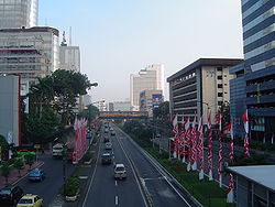
Generally, motorcyclists in Indonesia are not allowed to use the toll roads, they are to use the trunk roads instead. However, some urban toll roads, like those in Jakarta, are provided with collector lanes functioning as motorcycle lanes. Currently, the Suramadu Bridge is the only tollway that has a motorcycle lane and a special fee for motorcycles to enter the bridge. Another one is Bali Mandara Toll Road in Bali. The government is still on hold in agreement with toll road operators and contractors to construct motorcycle lanes to follow the new law about motorcycles going to toll roads across the country. The rule was signed in 2009 and discussions are still ongoing. Details to sort out will include the design and modification of toll roads for all motorcycles and mopeds, including the number of motorcycles per day on normal highways and toll roads in Indonesia.
A prominent motorcycle lane in the Philippines can be found on the Epifanio Delos Santos Avenue (EDSA). It is the fourth lane from the sidewalk and, whilst private light vehicles can also use it, they are only permitted to pass through the lane. Other roads with motorcycle lanes include Commonwealth Avenue and Quezon Avenue, both in Quezon City, Diosdado Macapagal Boulevard in Pasay and Parañaque and Circumferential Road 5.
This section is empty. You can help by adding to it. (February 2013) |
Generally, motorcycles are treated the same as any other vehicle. However, as of January 2012, Transport for London have made the numerous bus lanes in London permanently accessible to motorcyclists, after two trials were undertaken suggesting that this policy will lead to decreased congestion, decreased carbon emissions and safer city center journeys for motorcyclists. [2]
The examples and perspective in this article may not represent a worldwide view of the subject.(February 2013) |
This section possibly contains original research .(February 2013) |
While the design of the motorcycle lanes on some federal roads in Malaysia can be considered as acceptable, the design of motorcycle lanes on expressways is often criticized by Malaysian motorcyclists due to several issues.
The chief reason that had contributed to the design-related criticisms of the segregated motorcycle lanes on expressways is the adoption of the design standards of segregated bicycle lanes, namely the standards defined by Arahan Teknik (Jalan) 10/86: A Guide to the Design of Cycle Track by Malaysian Public Works Department. [3] According to Arahan Teknik (Jalan) 10/86: A Guide to the Design of Cycle Track, the typical design speed limit being applied on cycle tracks is as low as 60 km/h. [4] However, the design speed limit is too low, as the reported 85th percentile operating speeds of motorcyclists along the motorcycle lanes at the Federal Highway during peak hours and non-peak hours are 72 km/h and 80 km/h respectively. [5]
Due to the operating speeds almost the same as the speed limit of the main carriageways itself, T. H. Law et al. (2005) suggest that the minimum width of the segregated motorcycle lane at the Federal Highway should be set at 3.81 m. However, the average width the existing segregated motorcycle lanes, such as that which is located on the Federal Highway, is only two meters wide. The width of the motorcycle lane is too narrow for bigger motorcycles, as well as for the purpose of overtaking. [5]
According to G. Ramasamy, one of the engineers being responsible for the construction of the Federal Highway between 1974 and 1977, he explained that the constructors built a pair of cycle tracks along the highway to segregate the bicycle traffic from the main carriageways. However, he was shocked to find out that the bicycle lanes had ultimately been turned to motorcycle lanes, as those lanes were not designed to accommodate motorcycle traffic. [6]
Motorcyclists exit the motorcycle lane when approaching an interchange via small off-ramps. Sometimes the off-ramps are too narrow for the motorcyclists, especially for bigger motorcycles. Some ramps require motorcyclists to stop and look for the oncoming cars before it is safe to exit the lane. Hence, motorcyclists exiting motorcycle lanes may present the risk of collision from behind.
Every time that a motorcycle lane approaches an interchange, the motorcycle lane passes sharp corners as well as some tunnels. The corners are dangerous for motorcyclists if they are riding at speeds above 35 km/h.
Besides risking the safety of the motorcyclists, the sharp corners near an interchange also significantly increase the traveling distance for motorcyclists. The best example is the Seputeh interchange at the Federal Highway, where motorcyclists from Klang direction who wish to turn to Salak Expressway have to pass two roundabouts, several winding lanes and several tunnels.
Some stretches of the motorcycle lanes are flooded, although the PLUS concessionaire has placed pumps in a tunnel to address the issue. [7] Some stretches may have potholes and also covered with sand which often causes troubles for motorcyclists. [7] The lanes are also poorly illuminated and less monitored.
The corners and tunnels of the motorcycle lanes can be potential sites for robbers due to the dark and hidden locations. Due to motorcycle lanes on expressways being completely separated from the main carriageways, motorcyclists have no escape routes from being robbed. [7] There are many reported cases of robberies along motorcycle lanes at Shah Alam Expressway and Federal Highway. As a result, many motorcyclists avoid using motorcycle lanes and only use them during rush hours.
On 24 April 2013, a video of the poor conditions of the Federal Highway was uploaded to Facebook and went viral throughout blogs and other Facebook pages, including the Ministry of Work's own Facebook page. The uploader, Muhamad Azree from Shah Alam, also reported the matter to the Ministry of Works himself. [8] Due to the virality of the video throughout the Malaysian cyberspace, the newly appointed Minister of Works, Datuk Fadillah Yusof, announced that his ministry will set up a team to resolve the safety issues of the segregated motorcycle lanes along the Federal Highway. [9] In addition, the Chairman of the National Institute of Occupational Safety and Health (Niosh), Tan Sri Lee Lam Thye, urged the agencies under the Ministry of Works to improve the condition of the motorcycle lanes to become safer and more comfortable, in order to encourage motorcyclists to use them. [10]
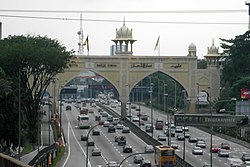
A limited-access road, known by various terms worldwide, including limited-access highway, dual-carriageway, expressway, and partial controlled access highway, is a highway or arterial road for high-speed traffic which has many or most characteristics of a controlled-access highway, including limited or no access to adjacent property, some degree of separation of opposing traffic flow, use of grade separated interchanges to some extent, prohibition of slow modes of transport, such as bicycles, (draught) horses, or self-propelled agricultural machines; and very few or no intersecting cross-streets or level crossings. The degree of isolation from local traffic allowed varies between countries and regions. The precise definition of these terms varies by jurisdiction.
The North–South Expressway is a network of tolled controlled-access highways running through the west coast of Peninsular Malaysia. The expressway network consists of the northern route and southern route, having a total length of 772 kilometres. Running through seven states and connecting the Thailand and Singapore borders, the North–South Expressway is an important thoroughfare for local, interstate and international traffic. The expressway is part of route AH2, a designation of the Asian Highway Network.
Federal Highway is a Malaysian controlled-access highway connecting the capital city of Kuala Lumpur, and Klang, Selangor. The highway starts from Seputeh in Kuala Lumpur to Klang, Selangor. It is the busiest highway in Klang Valley during rush hour from/to Kuala Lumpur. The Federal Highway is coded as Federal Route 2.
Sprint Expressway is the main expressway network in Klang Valley, Malaysia. The 26.5 km (16.5 mi) of expressway is divided into three sections: the Kerinchi Link, Damansara Link and Penchala Link. It is a three-lane dual carriageway that was built to disperse traffic from congested inner city roads and narrow residential roads leading into the city of Kuala Lumpur from the Western suburbs of Petaling Jaya and Damansara and surrounding areas. This expressway is also known as Western Dispersal Link Scheme. It is one of the busiest expressway during rush hour from/to Kuala Lumpur.
Malaysian Federal Roads System, is the main national road network in Malaysia. All Federal Roads in Malaysia are under the purview of the Ministry of Works (MOW). According to the Ministerial Functions Act 1969, the MOW is responsible to plan, build and maintain all Federal Roads gazetted under the Federal Roads Act 1959. However, most of the Federal roads' projects were built and maintained by the Malaysian Public Works Department (JKR), which is also one of the implementing agencies under the MOW.
Pasir Gudang Highway, also known as Federal Route 17, is a highway in Johor Bahru District, Johor, Malaysia that connects Tampoi North in the west to Pasir Gudang and Tanjung Langsat in the east. Pasir Gudang Highway is a four-laned highway, unlike the wider Skudai Highway which has six lanes. Many cargo trucks travel along the highway daily. Pasir Gudang Highway became the backbone of the road system linking Johor Bahru to Pasir Gudang before being surpassed by the Senai–Desaru Expressway, SDE 22, and the Johor Bahru East Coast Highway 35.
North Klang Straits Bypass, Federal Route 20, AH 141, is the main highway bypass to Port Klang in Klang, Selangor, Malaysia. Federal Route 20 became the backbone of the road system linking Sungai Rasau to Port Klang before being surpassed by the New North Klang Straits Bypass 30. Many cargo trucks travel along the highway daily.
Putrajaya–Cyberjaya Expressway, Federal Route 29, is a major expressway in Klang Valley, Malaysia. The 21.2 km (13.2 mi) expressway connects Serdang interchange on Damansara–Puchong Expressway to Kuala Lumpur International Airport (KLIA) in Sepang. It was named after the two sides of the MSC cities, Putrajaya and Cyberjaya.
The Federal Route 1 is the first federal road in Malaysia, the oldest federal road in Malaysia, and among the nation's earliest public roadways ever constructed. The Federal Route 1 was the backbone of the road system in the western states of Peninsular Malaysia before being supplanted by the North–South Expressway.
Federal Route 5 is one of the three north–south oriented backbone federal road running along the west coast of Peninsular Malaysia, Malaysia. The 655.85 kilometres (408 mi) federal highway runs from Jelapang, Perak in the north to Skudai, Johor in the south.
Muar Bypass, or Federal Route 224, is a major highway bypass and the first highway built in Bandar Maharani Muar, a royal town in Johor, Malaysia. The 13.8 km (8.6 mi) highway bypass linking Parit Bunga in the northwest to Parit Sakai in the southeast. The Kilometre Zero of the Federal Route 224 starts at Parit Sakai junctions.
Tun Razak Highway, Federal Route 12(Lebuhraya Tun Razak), also known as Segamat-Kuantan Highway(Lebuhraya Segamat-Kuantan), Asian Highway Route 142, is a 146.8 kilometres (91 mi) federal highway running from the town of Segamat, Johor to Gambang before proceeding another 38 kilometres (24 mi) via Federal Route 2 to Gambang near Kuantan, Pahang. This two-lane federal road is named in honor of Tun Abdul Razak, Malaysia's second Prime Minister which was known as Malaysia's Father of Development. The highway is part of the Asian Highway Network of route 142.
Butterworth–Kulim Expressway, BKE, AH140, is the only opened toll system's expressway in Penang, Malaysia. The 17 km (11 mi) expressway connects Butterworth, Penang in the west to Lunas, Kedah in the east. It is also a main route to East–West Highway via Baling, Kedah and Gerik, Perak.
Lebuh Ayer Keroh, Federal Route 143, also known as Lebuhraya Ayer Keroh or Ayer Keroh Highway, is the main dual-carriageway highway that connects Malacca City of Malacca, Malaysia to the North–South Expressway via Ayer Keroh Interchange. Ayer Keroh, the main satellite town of Malacca City is located along the road. Lebuh Ayer Keroh used to be Melaka State Route M31 before being recommissioned by Malaysian Public Works Department (Jabatan Kerja Raya ). Before 1993, most of the road was a two-lane road before it was upgraded to a dual-carriageway in 1993 and in 1997.
Road signs in Malaysia are standardised road signs similar to those used in Europe but with certain distinctions. Until the early 1980s, Malaysia closely followed Australian, Irish and Japanese practice in road sign design, with diamond-shaped warning signs and circular restrictive signs to regulate traffic. Signs usually use the FHWA Series fonts typeface also used in the United States, Canada, and Australia, as well as New Zealand, although some signs on recently completed expressways use Transport Heavy. However, the new format signs use a font specially designed for the Malaysian Highway Authority (LLM). The font is called LLM Lettering. It has two type of typefaces, LLM Narrow and LLM Normal.
Second East–West Highway, also known as Simpang Pulai–Kuala Berang Highway, Federal Route 185 and Federal Route 36, is a highway in Peninsular Malaysia which connects Simpang Pulai in Perak to Kuala Jeneris in Terengganu. It overlaps with Federal Route 8 Federal Route 8 between Gua Musang and Sungai Relau. It is notorious for its many sharp corners which increase the risk of road accidents.
The Kuala Lumpur–Karak Expressway is a 60-kilometre (37 mi) interstate controlled-access highway in Peninsular Malaysia. It runs between the town of Gombak in Selangor to the southwest and Karak in Pahang to the northeast. The expressway was previously a single-carriageway trunk road forming part of federal route 2; this designation is kept after the upgrade in 1997.
The Malaysian Expressway System is a network of national controlled-access expressways in Malaysia that forms the primary backbone network of Malaysian national highways. The network begins with the Tanjung Malim–Slim River tolled road which was opened to traffic on 16 March 1966, later North–South Expressway (NSE), and is being substantially developed. Malaysian expressways are built by private companies under the supervision of the government highway authority, Malaysian Highway Authority.
The Iskandar Coastal Highway (ICH) or the stretch of road that includes Lebuhraya Sultan Iskandar, Persiaran Sultan Abu Bakar and Persiaran Sultan Ismail is a highway in Johor Bahru District, Johor, Malaysia. The 23 km (14 mi) highway connects Iskandar Puteri in the west to Johor Bahru in the east. It is a toll free highway and part of the Iskandar Malaysia project. The Iskandar Coastal Highway is the fifth east–west-oriented expressway in the Iskandar Malaysia area after the Pasir Gudang Highway, the Pontian–Johor Bahru Link of the Second Link Expressway, the Senai–Desaru Expressway and the Johor Bahru East Coast Highway.
Setiawangsa–Pantai Expressway (SPE), is partially-opened, under construction and one of the expressways in Klang Valley, Malaysia. The 29.8-kilometre (18.5 mi) expressway connects Taman Melati and Klang Gates from Kuala Lumpur Middle Ring Road 2 to Kerinchi Link near Pantai and University of Malaya. The alignment of Setiawangsa–Pantai Expressway will traverse north to south of Kuala Lumpur and will serve areas such as University Tunku Abdul Rahman, Wangsa Maju, Setiawangsa, Ampang, the Tun Razak Exchange & Bandar Malaysia development corridor and Kerinchi as well as providing a connection to Kuala Lumpur-Karak Experessay to the east coast. It was built and maintained by Ekovest Berhad. It is formerly known as DUKE Phase 3.