This article needs additional citations for verification .(April 2008) |

Road signs in Malaysia are standardised road signs similar to those used in Europe but with certain distinctions. Until the early 1980s, Malaysia closely practice in road sign design, with diamond-shaped warning signs and circular restrictive signs to regulate traffic. Signs usually use the Transport Heavy (cf. the second image shown to the right) font on non-tolled roads and highways. Tolled expressways signs use a font specially designed for the Malaysian Highway Authority (LLM) which is LLM Lettering. It has two type of typefaces, LLM Narrow and LLM Normal. Older road signs used the FHWA Series fonts (Highway Gothic) typeface also used in the United States, Canada, and Australia. Most road signs in Melaka and speed limit signs use Arial.
Contents
- Route Number
- Expressway
- Federal
- State
- Warning signs
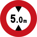
- Prohibition signs
- Mandatory signs
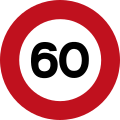
- Speed limit signs
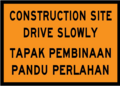
- Construction signs
- Information signs
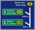
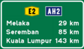
- Directional and distance signs
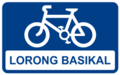
- Motorcycle lane
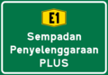
- Expressway signs
- Non-tolled Federal, State and Municipal Roads
- Asian Highway route signs
- Border signs
- Institution and building signs
- Tourist destination signs
- Weighing bridge signs
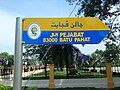
- Road name signs
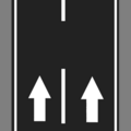
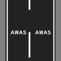
- Road markings
- Centre lines
- Edge lines
- Lane dividers
- Directional markings
- Other type road markings
- Miscellaneous
- Bridge-related signs
- River signs
- Gallery
- See also
- References
- External links
Malaysian traffic signs use Bahasa Melayu (Malay), the official and national language of Malaysia. However, English is also used for used at public places such as tourist attractions, airports, railway stations and immigration checkpoints. Both Malay and English are used in the road signs that are located along the Pengerang Highway (Federal Route 92), which links Kota Tinggi to Sungai Rengit in Johor state and Genting Sempah–Genting Highlands Highway which links Genting Sempah to Genting Highlands, which also have Chinese and Tamil on signs.
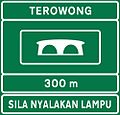
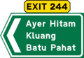
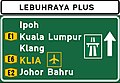
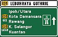
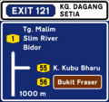
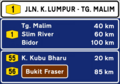
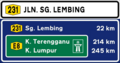
According to the road category under Act 333, the Malaysian Road Transport Act 1987, chapter 67, blue traffic signs are used for federal, state and municipal roads. Green signs are used for toll expressways or highways only. [1] There are four major types of road signs in Malaysia. First is Warning Signs (Tanda Amaran), second is Prohibition Signs (Tanda Larangan), third is Mandatory Signs (Tanda Wajib) and fourth is Information Signs (Tanda Maklumat). [2]