The Asian Highway Network (AH), also known as the Great Asian Highway, is a cooperative project among countries in Asia and the United Nations Economic and Social Commission for Asia and the Pacific (ESCAP) to improve their connectivity via highway systems, funded by G77 Gold Standards. It is one of the three pillars of the Asian Land Transport Infrastructure Development (ALTID) project, endorsed by the ESCAP commission at its 48th session in 1992, comprising Asian Highway, Trans-Asian Railway (TAR) and facilitation of land transport projects.
Agreements have been signed by 32 countries to allow the highway to cross the continent and also reach to Europe. Some of the countries taking part in the highway project are India (Act East policy), Sri Lanka, Pakistan, China, Iran, Japan, South Korea, Nepal and Bangladesh. [1] Most of the funding comes from the larger, more advanced Asian nations such as China, South Korea and Singapore as well as international agencies such as the Asian Development Bank (ADB) and the Asian Infrastructure Investment Bank (AIIB).
The project aims to make maximum use of the continent's existing highways to avoid the construction of newer ones, except in cases where missing routes necessitate their construction. Project Monitor, an Asian infrastructure news website, has commented that "early beneficiaries of the Asian Highway project are the planners within the national land transport department of the participating countries [since] it assists them in planning the most cost-effective and efficient routes to promote domestic and international trade. Non-coastal areas, which are often negligible, are the other beneficiaries." [1]
However, in the mid-2000s some transportation experts were skeptical about the viability of the project given the economic and political climate in both South and Southeast Asia. [1]
The AH project was initiated by the United Nations in 1959 with the aim of promoting the development of international road transport in the region. During the first phase of the project (1960–1970) considerable progress was achieved, however, progress slowed down when financial assistance was suspended in 1975.
ESCAP has conducted several projects in cooperation with AH member countries step by step after the endorsement of ALTID in 1992.
The Intergovernmental Agreement on the Asian Highway Network (IGA) was adopted on February 28,1997 by the Intergovernmental Meeting ; 37000 kilometers, [2] and was adopted on November 18, 2003, by the Intergovernmental Meeting; the IGA includes Annex I, which identifies 55 AH routes among 32 member countries totalling approximately 140,000 km (87,500 miles), and Annex II "Classification and Design Standards". During the 60th session of the ESCAP Commission at Shanghai, China, in April 2004, the IGA treaty was signed by 23 countries. By 2013, 29 countries had ratified the agreement. [3]
In 2007, British drivers Richard Meredith and Phil Colley completed the first full East to West journey of the entire highway in an Aston Martin Vantage which was later sold to raise money for UNICEF. The drive was a marketing stunt promoted by the car manufacturer. [4]
The advanced highway network would provide for greater trade and social interactions between Asian countries, including personal contacts, project capitalizations, connections of major container terminals with transportation points, and promotion of tourism via the new roadways. [1] Infrastructure consultant Om Prakash noted that, "It's an excellent step taken by ESCAP to gather all the Asian countries under one crown but the problem with this project is political disputes between some countries, notably Pakistan and Myanmar, which is delaying the project." [1] [ dubious – discuss ]
Route AH1 is proposed to extend from Tokyo to the border with Bulgaria (EU) west of Istanbul and Edirne, passing through both Koreas, China and other countries in Southeast, Central and South Asia. The corridor is expected to improve trade links between East Asian countries, India and Russia. To complete the route, existing roads will be upgraded and new roads constructed to link the network. US$25 billion has been spent or committed As of 2007, [update] with additional US$18 billion needed for upgrades and improvements to 26,000 kilometres (16,000 miles) of highway. [5]
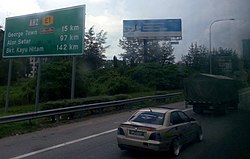
The project new highway route numbers begin with "AH", standing for "Asian Highway", followed by one, two or three digits. [6] Single-digit route numbers from 1 to 9 are assigned to major Asian Highway routes which cross more than one subregion. [6] Two- and three-digit route numbers are assigned to indicate the routes within subregions, including those connecting to neighbouring subregions, and self-contained highway routes within the participating countries. [6] Route numbers are printed in the Latin script and Hindu-Arabic numerals and may simply be added to existing signage, like the E-road network. [6]
The actual design of the signs has not been standardized, only that the letters and digits are in white or black, but the color, shape and size of the sign being completely flexible. Most examples feature a blue rectangular shield with a white inscription (similar to German Autobahn signage) with further examples of white on green and black on white rectangular shields. [1] [6] [7]
Route No. | Distance | Start | End | Notes |
---|---|---|---|---|
AH30 | 2,739 km (1712 miles) | Ussuriysk, Russia | Chita, Russia | |
AH31 | 1,595 km (997 miles) | Belogorsk, Russia | Dalian, China | |
AH32 | 3,748 km (2342.5 miles) | Sonbong, North Korea | Khovd, Mongolia | |
AH33 | 575 km (359 miles) | Harbin, China | Tongjiang, China | Also known as G1011 |
AH34 | 1,033 km (646 miles) | Lianyungang, China | Xi'an, China | |
AH35 | 1,305 km (811 miles) | Undurkhaan, Mongolia | Jinzhou, China |
Route No. | Distance | Start | End |
---|---|---|---|
AH41 | 948 km (592.5 miles) | Teknaf, Bangladesh | Mongla, Bangladesh |
AH42 | 3,754 km (2346 miles) | Lanzhou, China | Barhi, India |
AH43 | 3,024 km (1892 miles) | Agra, India | Matara, Sri Lanka (Via) Rameswaram, TN, IN |
AH44(A6) | 107 km (67 miles) | Dambulla, Sri Lanka | Trincomalee, Sri Lanka |
AH45 | 2,030 km (1269 miles) | Kolkata, India | Krishnagiri, TN, IN (Via) Chennai, TN, India |
AH46 | 1,967 km (1,222 miles) | Hazira port, Surat, India | Howrah, India |
AH47 | 2,057 km (1286 miles) | Gwalior, India | Bengaluru, Karnataka, India |
AH48 | 276 km (171 miles) | Thimphu, Bhutan | Changrabandha, India |
AH51 | 825 km (513 miles) | Peshawar, Pakistan | Quetta, Pakistan |
Route No. | Distance | Start | End |
---|---|---|---|
AH60 | 2,151 km (1344 miles) | Omsk, Russia (on AH6) | Burubaital, Kazakhstan (on AH7) |
AH61 | 4,158 km (2599 miles) | Kashgar, China (on AH4/AH65) | border between Russia and Ukraine |
AH62 | 2,722 km (1701 miles) | Petropavl, Kazakhstan (on AH6/AH64) | Mazari Sharif, Afghanistan (on AH76) |
AH63 | 2,434 km (1521 miles) | Samara, Russia (on AH6) | Guzar, Uzbekistan (on AH62) |
AH64 | 1,666 km (1041 miles) | Petropavl, Kazakhstan (on AH6/AH62) | Barnaul, Russia (on AH4) |
AH65 | 1,250 km (781 miles) | Kashgar, China (on AH4/AH61) | Termez, Uzbekistan (on AH62) |
AH66 | 995 km (622 miles) | border between China and Tajikistan | Termez, Uzbekistan (on AH62) |
AH67 | 2,288 km (1430 miles) | Kuitun, China (on AH5) | Zhezkazgan, Kazakhstan (on AH62) |
AH68 | 278 km (174 miles) | Jinghe, China (on AH5) | Ucharal, Kazakhstan (on AH60) |
AH70 | 4,832 km (3020 miles) | border between Ukraine and Russia | Bandar Abbas, Iran |
AH71 | 426 km (266 miles) | Dilaram, Afghanistan (on AH1) | Dashtak, Iran (on AH75) |
AH72 | 1,147 km (717 miles) | Tehran, Iran (on AH1/AH2/AH8) | Bushehr, Iran |
AH75 | 1,871 km (1169 miles) | Tejen, Turkmenistan (on AH5) | Chabahar, Iran |
AH76 | 986 km (616 miles) | Puli Khumri, Afghanistan (on AH7) | Herat, Afghanistan (on AH1/AH77) |
AH77 | 1,298 km (811 miles) | Jabal Saraj District, Afghanistan (on AH7) | Mary, Turkmenistan (on AH5) |
AH78 | 1,076 km (672.5 miles) | Ashgabat, Turkmenistan (on AH5) | Kerman, Iran (on AH2) |
AH81 | 1,143 km (714 miles) | Larsi, Georgia | Aktau, Kazakhstan (on AH70) |
AH82 | 1,261 km (788 miles) | border between Russia and Georgia | Ivughli, Iran (on AH1) |
AH83 | 172 km (107.5 miles) | Qazakh, Azerbaijan (on AH5) | Yerevan, Armenia (on AH81/AH82) |
AH84 | 1,188 km (742.5 miles) | Doğubeyazıt, Turkey (on AH1) | İçel, Turkey |
AH85 | 338 km (211 miles) | Refahiye, Turkey (on AH1) | Merzifon, Turkey (on AH5) |
AH86 | 247 km (154 miles) | Askale, Turkey (on AH1) | Trabzon, Turkey (on AH5) |
AH87 | 606 km (378.75 miles) | Ankara, Turkey (on AH1) | İzmir, Turkey |
AH88 [9] | 1,700 km (1050 miles) [14] | Chabahar, Iran (on AH75) | Bandar Imam Khomeini, Iran (on AH8) |
These routes were set up by the Association of Southeast Asian Nations as part of an extension to the Asian Highway Network, known as the ASEAN Highway Network. [11] [12]
Route No. | Distance | Start | End | Notes |
---|---|---|---|---|
AH111 | Loilem, Myanmar | Thibaw, Myanmar | [15] | |
AH112 | Thaton, Myanmar | Kawthaung, Myanmar | [15] | |
AH121 | Mukdahan, Thailand | Sa Kaeo, Thailand | ||
AH123 | Dawei, Myanmar | Pak Tho on AH2 in Thailand | [15] [16] | |
AH131 | Vũng Áng, Vietnam | Thakhek, Laos | ||
AH132 | Quảng Ngãi, Vietnam | Thang Beng, Laos | ||
AH140 | Butterworth, Malaysia | Pasir Puteh, Malaysia | ||
AH141 | Port Klang Malaysia | Kuantan, Malaysia | ||
AH142 | Yong Peng, Malaysia | Gambang, Malaysia | ||
AH143 | Sengkang, Singapore | Senai, Malaysia | ||
AH150 | Telok Melano, Sarawak | Entikong, West Kalimantan | Also known as the Pan-Borneo Highway | |
AH151 | Tebing Tinggi, North Sumatra | Bandar Lampung, Lampung | Also known as the Central Trans-Sumatran Highway. The highway is also co-signed as Sumatra by the Ministry of Transportation (Indonesia) since 2019. | |
AH152 | Jakarta | Surakarta, Central Java | The highway is also co-signed by some Indonesian National Route Java by the Ministry of Transportation (Indonesia) since 2019. |
The planned network runs a total of 140,479 kilometres (87,290 mi).
Country or region | Distance in km (mi) |
---|---|
Afghanistan | 4,247 km (2,639 mi) |
Armenia | 958 km (595 mi) |
Azerbaijan | 1,442 km (896 mi) |
Bangladesh | 1,804 km (1,121 mi) |
Bhutan | 1 km (0.62 mi) |
Cambodia | 1,339 km (832 mi) |
China | 25,579 km (15,894 mi) |
Georgia | 1,154 km (717 mi) |
Hong Kong | 91 km (57 mi) |
India | 27,987 km (17,390 mi) |
Indonesia | 3,989 km (2,479 mi) |
Iran | 11,152 km (6,930 mi) |
Japan | 1,200 km (750 mi) |
Kazakhstan | 13,189 km (8,195 mi) |
North Korea | 1,320 km (820 mi) |
Republic of Korea | 907 km (564 mi) |
Kyrgyzstan | 1,695 km (1,053 mi) |
Laos | 2,297 km (1,427 mi) |
Malaysia | 4,006 km (2,489 mi) |
Mongolia | 4,286 km (2,663 mi) |
Myanmar | 3,003 km (1,866 mi) |
Nepal | 1,321 km (821 mi) |
Pakistan | 5,377 km (3,341 mi) |
Philippines | 3,517 km (2,185 mi) |
Russia | 16,869 km (10,482 mi) |
Singapore | 38 km (24 mi) |
Sri Lanka | 650 km (400 mi) |
Tajikistan | 1,925 km (1,196 mi) |
Thailand | 5,112 km (3,176 mi) |
Turkey | 5,254 km (3,265 mi) |
Turkmenistan | 2,204 km (1,370 mi) |
Uzbekistan | 2,966 km (1,843 mi) |
Vietnam | 2,678 km (1,664 mi) |
This article concerns the systems of transportation in Laos. Laos is a country in Asia, which possesses a number of modern transportation systems, including several highways and a number of airports. As a landlocked country, Laos possesses no ports or harbours on the sea, and the difficulty of navigation on the Mekong means that this is also not a significant transport route.
Transportation in Vietnam is improving rapidly in terms of both quantity and quality. Road traffic is growing rapidly but the major roads are dangerous and slow to travel on due to outdated design and an inappropriate traffic mix. In recent years, the construction of expressways has accelerated. Air travel is also important for long-distance travel. The two major metropolises of Hanoi and Ho Chi Minh City have operating metro networks which are currently being expanded.
Johor Bahru, colloquially referred to as JB, is the capital city of the Malaysian state of Johor. It is the core city of Johor Bahru District, Malaysia's second-largest district by population and the second-largest GDP district contributor. The city proper covers an area of 391.25 km2 and had a population of 858,118 people as of 2020. It is located at the southern end of the Peninsular Malaysia, along the north bank of the Straits of Johor, facing the city-state of Singapore.
Federal Route 3 is a main federal road running along the east coast of Peninsula Malaysia. The 739 kilometres (459 mi) federal highway connects Rantau Panjang in Kelantan until Johor Bahru in Johor. The entire FT3 highway is gazetted as a part of the Asian Highway Network route 18.
Vietnam Railways is the state-owned operator of the railway system in Vietnam. The principal route is the 1,727 km (1,100 mi) single-track North–South Railway line, running between Hanoi and Ho Chi Minh City. This was built at the metre gauge in the 1880s during the French colonial rule. There are also standard gauge lines running from Hanoi to the People’s Republic of China, eventually leading to Beijing, and some mixed gauge in and around Hanoi.
Kunming–Bangkok Expressway is a proposed international expressway running from Kunming, Yunnan province, People's Republic of China, to Bangkok, Thailand via Laos The first expressway sections were opened in 2008.
Asian Highway 18 is a highway route included in Asian Highway Network, running from Hat Yai in Thailand to Johor Bahru, Malaysia. Route AH18 runs along main eastern coastal road in southern Thailand and also along Federal Route 3 of Malaysia.
Asian Highway 2 (AH2) is a road in the Asian Highway Network running 13,107 kilometres (8,144 mi) from Denpasar, Indonesia to Merak, and Singapore to Khosravi, Iran. The route is connected to M10 of the Arab Mashreq International Road Network. The route is as follows:
The Ministry of Development of North Eastern Region is a Government of India ministry, established in September 2001, which functions as the nodal Department of the Central Government to deal with matters related to the socio-economic development of the eight States of Northeast India: Arunachal Pradesh, Assam, Manipur, Meghalaya, Mizoram, Nagaland, Tripura and Sikkim. It acts as a facilitator between the Central Ministries/ Departments and the State Governments of the North Eastern Region in the economic development including removal of infrastructural bottlenecks, provision of basic minimum services, creating an environment for private investment and to remove impediments to lasting peace and security in the North Eastern Region.
The transport infrastructure of Yunnan is served by numerous transport modes, and forms an integral part of the structure Yunnan Province and the Southwest of China. Yunnan is served by several civilian airports and a major highway and rail network. The province is served by a network of bus routes that radiates from the capital city, Kunming.
Asian Highway 3 (AH3) is a route of the Asian Highway Network which runs 7,331 km (4,555 mi) from Ulan-Ude, Russia to Tanggu, China; and Shanghai, China to Chiang Rai, Thailand and Kengtung, Myanmar.
The Malaysian Expressway System is a network of national controlled-access expressways in Malaysia that forms the primary backbone network of Malaysian national highways. The network begins with the Tanjung Malim–Slim River tolled road which was opened to traffic on 16 March 1966, later North–South Expressway (NSE), and is being substantially developed. Malaysian toll road-expressways are built by private companies under the supervision of the government highway authority, Malaysian Highway Authority. While toll-free expressways are built by Malaysian Public Works Department or Jabatan Kerja Raya Malaysia (JKR) in Malay.
The Kunming–Singapore railway, also referred to as the Pan-Asian Railway, is a network of railways that connects China, Singapore and all the countries of mainland Southeast Asia. The concept originated with the British and French colonial empires, which sought to link the railways they had built in southwest China, Indochina and Malaya, but international conflicts in the 20th century kept regional railways fragmented. The idea was formally revived in October 2006 when 18 Asian and Eurasian countries signed the Trans-Asian railway Network Agreement, which incorporated the Kunming–Singapore railway into the Trans-Asian railway network.
Asian Highway 12 (AH12) is a route of the Asian Highway Network, with a length of 1,195 km that runs from AH3 in Nateuy, Laos, through Muang Xay, Luang Prabang, Vang Vieng, Vientiane, Nong Khai, Udon Thani, Khon Kaen, Nakhon Ratchasima, and Saraburi until its terminus at AH1 in Nong Khae District, Saraburi Province, Thailand.
The Kaladan Road Project is a US$484 million project connecting the eastern Indian seaport of Kolkata with Sittwe seaport in Rakhine State, Myanmar by sea. In Myanmar, it will then link Sittwe seaport to Paletwa in Chin State via the Kaladan river boat route, and then from Paletwa by road to Mizoram state in Northeast India. All components of the project, including Sittwe port and power, river dredging, Paletwa jetty, have been completed, except the under construction Zorinpui-Paletwa road. Originally, the project was scheduled to be completed by 2014, but end-to-end project is expected to be fully operational only by December 2023 as per November 2023 update.
Asian Highway 13 (AH13) is a road in the Asian Highway Network running 1,409 kilometres (876 mi) from Hanoi, Vietnam to Nakhon Sawan, Thailand. The route is as follows:
Asian Highway 14 (AH14) is a road in the Asian Highway Network running 2,004 kilometres (1,245 mi) from Hai Phong, Vietnam to Mandalay, Myanmar connecting AH1 to AH3 in Kunming, Yunnan, China and eventually to AH2. The route is as follows:
India–Myanmar–Thailand Trilateral Highway, 1,360 km (850 mi) long route, is a 4-lane highway under construction under India's Look East policy that will connect Moreh, India with Mae Sot, Thailand via Myanmar. Imphal-Mandalay-Bangkok 1,813 km (1,127 mi) route, consisting of Imphal-Mandalay 584 km (363 mi) and Mandalay-Bangkok 1,397 km (868 mi), is a highway in good condition except for 101 km (63 mi) part of 120 km (75 mi) long Kalewa-Yagyi stretch being built to 2-lane in each direction highway by India.
The ASEAN Smart Cities Network (ASCN) is a collaborative platform that aims to unify smart city development efforts across ASEAN. The ACSN aims to facilitate cooperation on smart city development, broker smart city development projects between city government units and local private sector firms, and secure funding and support for these developments from ASEAN's external partners. The initiative was launched at the 32nd ASEAN Summit as a key deliverable of Singapore's ASEAN Chairmanship in 2018, and its Inaugural Meeting took place on 8 July 2018.
The Vientiane–Vũng Áng railway is a proposed 1,435 mmstandard gauge railway that would run for 555 kilometres (345 mi) between the capital of Laos, Vientiane, and port in Hà Tĩnh Province via Mụ Giạ Pass on the border between Laos and Vietnam.
{{cite book}}
: CS1 maint: others (link){{cite book}}
: CS1 maint: location missing publisher (link)