Kon Tum

Last updated
Kon Tum
Thành phố Kon Tum
Kon Tum City
Nha rong Kon Klor Kon Tum.png
Rông House Kon Klor
Kon Tum
Vietnam location map.svg
Red pog.svg
Kon Tum
Location in Vietnam
Coordinates: 14°21′42″N108°0′30″E / 14.36167°N 108.00833°E / 14.36167; 108.00833
CountryFlag of Vietnam.svg  Vietnam
Province Kon Tum
Area
  Total432.9815 km2 (167.1751 sq mi)
Elevation
[1]
525 m (1,722 ft)
Population
 (2020)
  Total205.762
  Density475/km2 (1,230/sq mi)
Climate Aw

Kon Tum City is the capital city of Kon Tum Province in Vietnam. It is located inland in the Central Highlands region of Vietnam, near the borders of Laos and Cambodia.

Contents

Historically, this area has been inhabited by the indigenous Ba Na people, which led to the name Kon Tum, meaning "Village by the Lake" in the Ba Na language. Its unique location features flat and fertile land, enriched by the Dak Bla River, and a convergence of various ethnic groups over time. Among these, the Kinh people, hailing from provinces such as Quang Nam, Quang Ngai, and Binh Dinh, have settled here. In the years 1841-1850, French missionaries, en route to the Central Highlands, established the first Christian mission in this region. By 1893, the colonial French authorities established the Kon Tum administrative agency, headed by Father Vialleton, and from that point, the name Kon Tum became officially used. Subsequently, the provincial administrative unit adopted this name. Kon Tum City, once a sparsely populated and desolate area, has evolved into a hub for settlement, commerce, and governance throughout the province's rich history. Currently, Kon Tum City holds the status of City (Class-2).

Geography

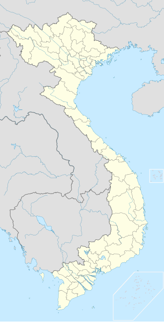
Kon Tum City is situated in the southern part of Kon Tum Province, within a basin landscape at an elevation of approximately 525 meters above sea level. It is encircled by the Dak Bla River valley. The city is located 654 kilometers north of Ho Chi Minh City, 292 kilometers south of Da Nang, and 1,237 kilometers south of the capital Hanoi. Additionally, it is 50 kilometers from Pleiku and 229 kilometers from Buon Ma Thuot. Kon Tum City shares its geographical boundaries as follows:

The city covers an area of 433 square kilometers and had a population of 205,762 [2] people in the year 2021, with a population density of 475 people per square kilometer.

In 2019, Kon Tum City had a land area of 432.98 square kilometers and a population of 168,264 people. Among these, 102,051 residents lived in urban areas, constituting 61% of the population, while 66,213 people resided in rural areas, making up the remaining 39%. The population density in the city was approximately 389 people per square kilometer.

Kon Tum City is home to 20 different ethnic groups living together.

Chu Hreng Mountain

Chu Hreng mountain range is located in the south of Kon Tum city with a total length of about 11km, the mountain direction runs in the Northwest - Southeast direction, starting from Kon K'Tu Village, Dak Ro Wa commune and ending. Ending at Sao Mai Pass, Hoa Binh commune, Kon Tum city, adjacent to Chu Pao mountain range in Ia Khui commune, Chu Pah district, Gia Lai province. Mostly along the top of the mountain range is the administrative boundary between Gia Lai and Kon Tum provinces. Chu Hreng Mountain has the highest point equivalent to 1,152m above sea level. [3]

History

After the People's Army of Vietnam invaded South Vietnam on March 30, 1972 during the Easter Offensive, two divisions attempted to capture Kon Tum, but failed. In March 1975, however, Kon Tum was overrun during the Ho Chi Minh Campaign and large numbers of refugees were forced to flee east to the south central coast.

Kon Tum has several vestiges of the French colonial period, as well as several tribal villages directly in the suburbs of the Vietnamese-reconstructed town. Among the town's landmarks, there is a Roman Catholic wooden church on discrete stilts and a large French-built seminary which hosts a small museum on local hill tribes. French missionary presence in Kon Tum traces back to 1851.

Climate

Kon Tum has a tropical savanna climate (Köppen Aw) with a wet season from April to November, a dry season from November to April, and consistently very warm-to-hot temperatures with high-to-oppressive humidity year-round.

Climate data for Kon Tum, elevation 536 m (1,759 ft)
MonthJanFebMarAprMayJunJulAugSepOctNovDecYear
Record high °C (°F)35.5
(95.9)
38.2
(100.8)
39.8
(103.6)
39.5
(103.1)
39.5
(103.1)
35.6
(96.1)
34.2
(93.6)
34.0
(93.2)
34.5
(94.1)
35.0
(95.0)
33.7
(92.7)
35.1
(95.2)
39.8
(103.6)
Mean daily maximum °C (°F)28.0
(82.4)
30.3
(86.5)
32.4
(90.3)
33.2
(91.8)
31.7
(89.1)
29.8
(85.6)
29.1
(84.4)
28.9
(84.0)
29.1
(84.4)
29.1
(84.4)
28.1
(82.6)
27.0
(80.6)
29.7
(85.5)
Daily mean °C (°F)21.1
(70.0)
22.8
(73.0)
24.8
(76.6)
25.9
(78.6)
25.7
(78.3)
25.0
(77.0)
24.5
(76.1)
24.2
(75.6)
24.0
(75.2)
23.6
(74.5)
22.6
(72.7)
21.1
(70.0)
23.8
(74.8)
Mean daily minimum °C (°F)15.6
(60.1)
16.9
(62.4)
19.3
(66.7)
21.3
(70.3)
22.1
(71.8)
22.2
(72.0)
21.9
(71.4)
21.8
(71.2)
21.4
(70.5)
20.1
(68.2)
18.5
(65.3)
16.5
(61.7)
19.8
(67.6)
Record low °C (°F)4.9
(40.8)
5.9
(42.6)
8.5
(47.3)
13.3
(55.9)
15.9
(60.6)
13.9
(57.0)
16.9
(62.4)
17.8
(64.0)
16.3
(61.3)
11.9
(53.4)
8.9
(48.0)
5.9
(42.6)
4.9
(40.8)
Average rainfall mm (inches)1.0
(0.04)
7.0
(0.28)
39.6
(1.56)
97.3
(3.83)
237.2
(9.34)
257.0
(10.12)
314.1
(12.37)
336.1
(13.23)
313.1
(12.33)
180.3
(7.10)
58.0
(2.28)
8.0
(0.31)
1,854.7
(73.02)
Average rainy days0.51.14.79.418.221.224.225.622.313.86.11.5148.3
Average relative humidity (%)70.868.368.271.778.783.685.186.585.781.276.773.377.2
Mean monthly sunshine hours 269.3253.6264.8235.6203.6152.6138.6127.4125.9181.5208.1241.72,569.6
Source 1: Vietnam Institute for Building Science and Technology [4]
Source 2: The Yearbook of Indochina (1932-1933) [5]

Related Research Articles

<span class="mw-page-title-main">Montagnard (Vietnam)</span> Indigenous people of the Central Highlands of Vietnam

Montagnard is an umbrella term for the various indigenous peoples of the Central Highlands of Vietnam. The French term Montagnard ( ) signifies a mountain dweller, and is a carryover from the French colonial period in Vietnam. In Vietnamese, they are known by the term người Thượng, although this term can also be applied to other minority ethnic groups in Vietnam. In modern Vietnam, both terms are archaic, and indigenous ethnic groups are referred to as đồng bào or người dân tộc thiểu số. Earlier they were referred to pejoratively as the mọi. Sometimes the term Degar is used for the group as well. Most of those living in the United States refer to themselves as Montagnards, while those living in Vietnam refer to themselves by their individual ethnic group.

<span class="mw-page-title-main">Provinces of Vietnam</span>

On the first tier, Vietnam is divided into fifty-eight provinces and five municipalities under the command of the central government. Municipalities are the highest-ranked cities in Vietnam. Municipalities are centrally-controlled cities and have special status equal to the provinces.

Articles related to Vietnam and Vietnamese culture include:

<span class="mw-page-title-main">Điện Biên province</span> Province of Vietnam

Điện Biên is a province in the Northwest region of Vietnam. It is bordered by Lai Châu to the northeast, Sơn La to the southeast, Pu'er City, Yunnan, China, to the northwest, and Phongsaly province in Laos to the west. The province covers an area of about 9,540 km2 (3,683 sq mi) and as of 2022 it had a population of 635,920 people.

<span class="mw-page-title-main">Quảng Nam province</span> Province of Vietnam

Quảng Nam is a coastal province near northernmost part of the South Central Coast region, the Central of Vietnam. It borders Thừa Thiên Huế to the north, Đà Nẵng to the northeast, Kon Tum to the southwest, Quảng Ngãi to the southeast, Sekong of Laos to the west and the East Sea to the east.

<span class="mw-page-title-main">Đắk Lắk province</span> Province of Vietnam

Đắk Lắk is a central mountainous province in the Central Highlands region, the Central of Vietnam. It borders Gia Lai to the north, Phú Yên and Khánh Hòa to the east, Lâm Đồng and Đắk Nông to the south, and Mondulkiri of Cambodia to the west.

<span class="mw-page-title-main">Kon Tum province</span> Province of Vietnam

Kon Tum is the northernmost mountainous province in the Central Highlands region, the Central of Vietnam. It borders Quảng Nam to the north, Gia Lai to the south, Quảng Ngãi to the east, Sekong, Attapeu of Laos and Ratanakiri of Cambodia in the west.

<span class="mw-page-title-main">Quảng Ngãi province</span> Province of Vietnam

Quảng Ngãi is a northern coastal province in the South Central Coast region, the Central of Vietnam. It borders Quảng Nam to the north, Bình Định to the south, Kon Tum to the west, Gia Lai to the southwest and the East Sea to the east.

<span class="mw-page-title-main">Pleiku</span> City in Gia Lai, Vietnam

Pleiku is a city in central Vietnam, located in the Central Highlands region. It is the capital of the Gia Lai Province. Many years ago, it was inhabited primarily by the Bahnar and Jarai ethnic groups, sometimes known as the Montagnards or Degar, although now it is inhabited primarily by the Kinh ethnic group. The city is the centre of the urban district of Pleiku which covers an area of 260.77 km².

<span class="mw-page-title-main">Central Highlands (Vietnam)</span> Mountainous region of Vietnam

The Central Highlands, South Central Highlands, Western Highlands or Midland Highlands is a region located in the south central part of Vietnam. It contains the provinces of Đắk Lắk, Đắk Nông, Gia Lai, Kon Tum, and Lâm Đồng.

<span class="mw-page-title-main">Gia Lai province</span> Province of Vietnam

Gia Lai is a northern mountainous province in the Central Highlands region, the Central of Vietnam. It borders Kon Tum in the north, Quảng Ngãi in the northeast, Bình Định in the east, Phú Yên in the southeast, Đắk Lắk in the south and Ratanakiri of Cambodia in the west.

<span class="mw-page-title-main">Vietnam Football Federation</span> Sports governing body

The Vietnam Football Federation is the governing body of football in Vietnam. It is responsible for the all Vietnamese teams of association football, futsal and beach soccer as well as national competitions.

Kon Ka Kinh National Park is a national park of Vietnam, established by the decision (167/2002/QĐ-TTg) on November 25, 2002 of the then Prime Minister, Phan Văn Khải.

The Bahnar language or Ba-Na language is a Central Bahnaric language. It has nine vowel qualities and phonemic vowel length.

The 5th Military Region of Vietnam People's Army, is directly under the Ministry of Defence of Vietnam, tasked to organise, build, manage and command armed forces defending the South Central Vietnam include the Tây Nguyên and southern central coastal provinces.

<span class="mw-page-title-main">Côn River</span> River in Vietnam

Côn River is a river of Vietnam. With a length of 171 km, it is the longest river in Bình Định Province. Much of it can be used as an inland waterway for transportation.

LPBank Hoang Anh Gia Lai Football Club, commonly known as Hoang Anh Gia Lai and simply known as LPBank HAGL, is a Vietnamese professional football club based in Pleiku, Gia Lai. Owned by Đoàn Nguyên Đức, a prominent Vietnamese businessman and founder of Hoang Anh Gia Lai Group, HAGL play in the top division of Vietnamese football, V.League 1. Their home stadium is Pleiku Stadium.

<span class="mw-page-title-main">Hà Ngại</span> Nguyễn dynasty official (1890–1976)

Hà Ngại was an official in the Nguyễn dynasty, Vietnam.

References

  1. Vietnam City Maps 1:12,500, Series L909, Edition 4-DMATC, Defense Mapping Agency, Washington, 1972.
  2. dựng, Báo Xây (2022-11-25). "Thẩm định Đề án đề nghị công nhận thành phố Kon Tum, tỉnh Kon Tum là đô thị loại II". Báo Xây dựng (in Vietnamese). Retrieved 2023-10-15.
  3. "NÚI CHƯ HRENG – ĐIỂM ĐẾN HẤP DẪN GIỚI TRẺ KON TUM". NÚI CHƯ HRENG – ĐIỂM ĐẾN HẤP DẪN GIỚI TRẺ KON TUM. Retrieved 2024-01-13.
  4. "Vietnam Institute for Building Science and Technology" (PDF).
  5. The Yearbook of Indochina (1932-1933)