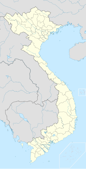
Pleiku

Last updated
Pleiku
Thành phố Pleiku
Pờ-lây-cu/Plây-cu
Pleiku City
Mot goc TP. Pleiku.jpg
Minh Thanh Pagoda.jpg
Quang truong Dai doan ket (17-3).jpg
Ho Duc An.jpg
Bien Ho.jpg
From top to bottom, from left to right: Pleiku at night, Minh Thành pagoda, Đại đoàn kết square, Đức An lake, Biển Hồ
Logo TP. Pleiku.svg
Pleiku
Vietnam location map.svg
Red pog.svg
Pleiku
Location of Pleiku in Vietnam
Coordinates: 13°59′N108°0′E / 13.983°N 108.000°E / 13.983; 108.000
CountryFlag of Vietnam.svg  Vietnam
Province Gia Lai
Area
  Total260.77 km2 (100.68 sq mi)
Elevation
[1]
740 m (2,420 ft)
Population
 (2019 census)
  Total254,802
  Density980/km2 (2,500/sq mi)
Climate Aw

Pleiku is a city in central Vietnam, located in the Central Highlands region. It is the capital of the Gia Lai Province. Many years ago, it was inhabited primarily by the Bahnar and Jarai ethnic groups, sometimes known as the Montagnards or Degar, although now it is inhabited primarily by the Kinh ethnic group. The city is the centre of the urban district of Pleiku which covers an area of 261 km² (100 mi²).

Contents

As of 2019, the city has a population of around 254,802 people. [2]

Name

The name "Pleiku" first appeared in the Governor-General of French Indochina records in 1905, in the decree that established the province of Gia Lai. The Decree of the Governor-General of Indochina dated July 4, 1905, established an autonomous province in the western mountainous region of Binh Dinh province, naming it "Plei-Kou-Derr". This marked the first official use of the name "Plei-Kou" in writing.

The word "Plơi" means "village" in Jarai, while "Kơdưr" can mean either "north" or "upper". Therefore, the name "Pleiku" can be translated as "upper village" or "village in the north".

The word "Derr" is likely a Jarai word that was added to the name "Pleiku" by the French to distinguish it from other villages in the area. The name "Pleiku" has been used since the colonial period and is still the official name of the city today.

History

First Indochina War

At the end of the First Indochina War, in June 1954, the French Army Groupe Mobile 100 was ordered to fall back from An Khê to Pleiku and then to reopen Route Coloniale 14 between Pleiku and Buôn Ma Thuột. This led to the last battle of the war: the Battle of Mang Yang Pass.

Second Indochina War

T' Nung Lake in outskirt of Pleiku To Nung Lake.jpg
T' Nung Lake in outskirt of Pleiku
Pleiku Square in Pleiku Pleiku Square.jpg
Pleiku Square in Pleiku
Minh Thanh Pagoda in Pleiku Minh Thanh Temple in Pleiku.jpg
Minh Thanh Pagoda in Pleiku

Pleiku was strategically important during the Vietnam War because it was the primary terminus of the military supply logistics corridor extending westwards along Highway 19 from the coastal population centre and port facilities of Qui Nhơn. Additionally, its central location on the plateau, between Kon Tum to the North, Buôn Ma Thuột to the south, and the North Vietnamese Army's base areas inside Cambodia to the west made Pleiku the main centre of defense of the entire highland region of the Republic of Vietnam. This was obvious to both sides; the United States established an armed presence very early in the conflict at Camp Holloway, and the Việt Cộng attack on this base in early 1965 was one of the key escalating events that brought U.S. troops into the conflict. [3]

On 15 June 1972, Cathay Pacific Flight 700Z, operating a Convair 880 (VR-HFZ) from Bangkok to Hong Kong, disintegrated and crashed while the aircraft was flying at 29,000 feet (8,800 m) over Pleiku, Vietnam after a bomb exploded in a suitcase placed under a seat in the cabin, killing all 81 people on board.

After the fall of Buôn Ma Thuột to a major North Vietnamese assault in early 1975, and the resulting insecurity of National Route 19 leading from Qui Nhơn, the president, Nguyễn Văn Thiệu, ordered the hasty evacuation of Pleiku. The military operation to attempt the withdrawal of ARVN forces, down the poorly maintained tertiary road LTL-7B through Ayun Pa to Tuy Hòa, led to a catastrophe in which over 100,000 evacuees from Pleiku and Kon Tum were killed or left stranded without support. [ citation needed ]

Geography

Pleiku is located in the center of Gia Lai province and borders:

Pleiku is located between National Highway 14 and National Route 19 near the Indochina intersection of neighboring Cambodia and Laos on the Ho Chi Minh Highway. Pleiku occupies 26,076.8 hectares, and is the economic, political, cultural and social center of Gia Lai province. Pleiku is 465 km north of Ho Chi Minh City, 1,287 km south of Hanoi, 181 km from Buôn Ma Thuột and 377 km from Da Nang.

Pleiku is located at an average altitude of 700m - 800m; Ham Rong junction, or the junction of National Highway 14 and National Highway 19 south of Pleiku, has an altitude of 785m.

Climate

Climate data for Pleiku
MonthJanFebMarAprMayJunJulAugSepOctNovDecYear
Record high °C (°F)33.2
(91.8)
35.0
(95.0)
36.3
(97.3)
36.3
(97.3)
35.1
(95.2)
33.1
(91.6)
32.5
(90.5)
31.6
(88.9)
32.5
(90.5)
32.8
(91.0)
32.0
(89.6)
32.0
(89.6)
36.3
(97.3)
Mean daily maximum °C (°F)26.4
(79.5)
28.5
(83.3)
30.5
(86.9)
31.1
(88.0)
29.5
(85.1)
27.4
(81.3)
26.7
(80.1)
26.4
(79.5)
26.9
(80.4)
27.1
(80.8)
26.4
(79.5)
25.8
(78.4)
27.7
(81.9)
Daily mean °C (°F)19.0
(66.2)
20.6
(69.1)
22.7
(72.9)
24.2
(75.6)
23.9
(75.0)
23.1
(73.6)
22.5
(72.5)
22.3
(72.1)
22.3
(72.1)
21.9
(71.4)
20.8
(69.4)
19.4
(66.9)
21.9
(71.4)
Mean daily minimum °C (°F)14.0
(57.2)
15.1
(59.2)
17.4
(63.3)
19.4
(66.9)
20.5
(68.9)
20.5
(68.9)
20.1
(68.2)
20.1
(68.2)
19.8
(67.6)
18.6
(65.5)
17.1
(62.8)
15.2
(59.4)
18.1
(64.6)
Record low °C (°F)5.6
(42.1)
6.8
(44.2)
5.9
(42.6)
10.0
(50.0)
14.6
(58.3)
16.6
(61.9)
15.6
(60.1)
14.8
(58.6)
13.7
(56.7)
11.0
(51.8)
5.8
(42.4)
5.8
(42.4)
5.6
(42.1)
Average rainfall mm (inches)2.4
(0.09)
6.7
(0.26)
24.2
(0.95)
92.8
(3.65)
249.2
(9.81)
322.9
(12.71)
396.1
(15.59)
462.7
(18.22)
358.9
(14.13)
190.8
(7.51)
62.8
(2.47)
10.8
(0.43)
2,179.9
(85.82)
Average rainy days0.60.83.18.117.723.026.627.424.815.97.22.3157.5
Average relative humidity (%)76.673.772.075.182.989.190.891.990.486.182.179.082.5
Mean monthly sunshine hours 263.2260.1272.1240.8210.1155.5146.2127.9136.1178.1199.1229.32,415.3
Source 1: Vietnam Institute for Building Science and Technology [4]
Source 2: The Yearbook of Indochina (1930-1931) [5]

Demography

In 1971, during the Republic of Vietnam, Pleiku provincial capital had 34,867 residents. According to the statistical yearbook, the city's population includes 28 ethnic groups; The Kinh people make up the majority (87.5%), the rest are other ethnic groups, mainly the Gia Rai and Ba Na ethnic groups (12.5%). The number of people of working age is about 328,240 people, accounting for 65% of the population.

The natural population growth rate decreased rapidly, reaching 1.12% in 2008. The above results have contributed positively to the work of hunger eradication and poverty reduction, creating jobs and improving the quality of life for the people.

Ethnic minorities live mainly in villages such as Plei Op village (Hoa Lu ward), Kep village (Dong Da ward), Brúk Ngol village (Yen The ward), and some other villages. The entire urban area has 62,829 households with 274,048 people with permanent residence. Including the converted population, there are about 504,984 people.

Administrative Divisions

Pleiku city is divided into 22 commune-level administrative units, including 14 wards: Chi Lang, Dien Hong, Dong Da, Hoa Lu, Hoi Phu, Hoi Thuong, Ia Kring, Phu Dong, Tay Son, Thang Loi, Thong Nhat, Tra Ba, Yen Do, Yen The and 8 communes: An Phu, Bien Ho, Chu A, Dien Phu, Gao, Ia Kenh, Tan Son, Tra Da.

Sports

The city is home to the Hoàng Anh Gia Lai football club.

Transport

The city sits at the junction of several national roads—National Route 14 to Kon Tum in the north and Buôn Ma Thuột in the south and National Route 19 to Stung Treng in Cambodia in the west (via Ratanakiri Province) and to Bình Định Province in the east.

In addition, Pleiku is served by Pleiku Airport in the near outskirts of the city.

Related Research Articles

<span class="mw-page-title-main">Montagnard (Vietnam)</span> Indigenous people of the Central Highlands of Vietnam

Montagnard is an umbrella term for the various indigenous peoples of the Central Highlands of Vietnam. The French term Montagnard ( ) signifies a mountain dweller, and is a carryover from the French colonial period in Vietnam. In Vietnamese, they are known by the term người Thượng, although this term can also be applied to other minority ethnic groups in Vietnam. In modern Vietnam, both terms are archaic, and indigenous ethnic groups are referred to as đồng bào or người dân tộc thiểu số. Earlier they were referred to pejoratively as the mọi. Sometimes the term Degar is used for the group as well. Most of those living in the United States refer to themselves as Montagnards, while those living in Vietnam refer to themselves by their individual ethnic group.

Articles related to Vietnam and Vietnamese culture include:

<span class="mw-page-title-main">Đắk Lắk province</span> Province of Vietnam

Đắk Lắk is a central mountainous province in the Central Highlands region, the Central of Vietnam. It borders Gia Lai to the north, Phú Yên and Khánh Hòa to the east, Lâm Đồng and Đắk Nông to the south, and Mondulkiri of Cambodia to the west.

<span class="mw-page-title-main">Kon Tum</span> City in Vietnam

Kon Tum City is the capital city of Kon Tum Province in Vietnam. It is located inland in the Central Highlands region of Vietnam, near the borders of Laos and Cambodia.

<span class="mw-page-title-main">Kon Tum province</span> Province of Vietnam

Kon Tum is the northernmost mountainous province in the Central Highlands region, the Central of Vietnam. It borders Quảng Nam to the north, Gia Lai to the south, Quảng Ngãi to the east, Sekong, Attapeu of Laos and Ratanakiri of Cambodia in the west.

<span class="mw-page-title-main">Central Highlands (Vietnam)</span> Mountainous region of Vietnam

The Central Highlands, South Central Highlands, Western Highlands or Midland Highlands is a region located in the south central part of Vietnam. It contains the provinces of Đắk Lắk, Đắk Nông, Gia Lai, Kon Tum, and Lâm Đồng.

<span class="mw-page-title-main">Gia Lai province</span> Province of Vietnam

Gia Lai is a northern mountainous province in the Central Highlands region, the Central of Vietnam. It borders Kon Tum in the north, Quảng Ngãi in the northeast, Bình Định in the east, Phú Yên in the southeast, Đắk Lắk in the south and Ratanakiri of Cambodia in the west.

<span class="mw-page-title-main">Jarai people</span> Austronesian ethnic group of Vietnam and Cambodia

Jarai people or Jarais are an Austronesian indigenous people and ethnic group native to Vietnam's Central Highlands, as well as in the Cambodian northeast Province of Ratanakiri. During the Vietnam War, many Jarai persons, as well as members of other Montagnard groups, worked with US Special Forces, and many were resettled with their families in the United States, particularly in North Carolina, after the war.

<span class="mw-page-title-main">South Central Coast</span> Region of Vietnam

In Vietnam, South Central Coast and South Central Region are two terms which can refer to the same region or two regions that do not correspond to each other. South Central Coast consists of the independent municipality of Đà Nẵng and seven other provinces, which means South Central Coast doesn't include Central Highlands. Nevertheless, the term "South Central Region" can also be used to include Central Highlands as it is part of southern part of Central Vietnam.

Jarai is a Malayo-Polynesian language spoken by the Jarai people of Vietnam and Cambodia. The speakers of Jarai number approximately 530,000, not including other possible Jarai communities in countries other than Vietnam and Cambodia such as United States of America. They are the largest of the upland ethnic groups of Vietnam's Central Highlands known as Degar or Montagnards, and 25 per cent of the population in the Cambodian province of Ratanakiri.

<span class="mw-page-title-main">United Front for the Liberation of Oppressed Races</span> Vietnamese guerrilla organization (1964-1992)

The United Front for the Liberation of Oppressed Races was an organization whose objective was autonomy for various indigenous peoples and ethnic minorities in South Vietnam, including the Montagnards in the Central Highlands, the Chams in Central Vietnam, and the Khmer Krom in Southern Vietnam. Initially a political movement, after 1969 it evolved into a fragmented guerrilla group that carried on simultaneous insurgencies against the governments of South Vietnam under President Nguyen Van Thieu and North Vietnam of Ho Chi Minh. Opposed to all forms of Vietnamese rule, FULRO fought against both sides in the Vietnam War against the Soviet-aligned North and the American-aligned South at the same time. FULRO's primary supporter during the 1960s and early 1970s conflict in Southeast Asia was Cambodia, with some aid sent by the People's Republic of China during the period of the Third Indochina War.

The Bahnar language or Ba-Na language is a Central Bahnaric language. It has nine vowel qualities and phonemic vowel length.

<span class="mw-page-title-main">23rd Division (South Vietnam)</span> Division of the Army of the Republic of Vietnam

The 23rd Division of the Army of the Republic of Vietnam (ARVN)—the army of the nation state of South Vietnam that existed from 1955 to 1975—was part of the II Corps that oversaw the Central Highlands.

<span class="mw-page-title-main">22nd Division (South Vietnam)</span> Military unit

The 22nd Division of the Army of the Republic of Vietnam (ARVN) was part of the II Corps that oversaw the region of the Central Highlands north of the capital Saigon. The 22nd Division was based in Ba Gi near the south central coast.

<span class="mw-page-title-main">Ba River (Vietnam)</span> River in Phú Yên province, Vietnam

Ba River is a river in the South Central Coast region of Vietnam. It has its source in Kon Tum Province and flows into the South China Sea in Tuy Hòa, Phú Yên Province. It has the largest river valley area in central Vietnam and one of the largest river systems in central Vietnam with a total basin area of 13,900 km² or 4.19% of Vietnam's total area. It has a total length of 374 km.

The Battle of Duc Lap took place during the Vietnam War where North Vietnamese forces attempted to overrun the Civilian Irregular Defense Group (CIDG) Duc Lap Camp between 24 and 27 August 1968.

Rade is an Austronesian language of southern Vietnam. There may be some speakers in Cambodia. It is a member of the Chamic subgroup, and is closely related to the Cham language of central Vietnam.

Tân Hòa may refer to several places in Vietnam, including:

The 968th Infantry Division was a division of the People's Army of Vietnam, first formed in the 1960s.

References

  1. Pleiku, Sheet L7014 6636-IV, Defense Mapping Agency, Washington, 1965.
  2. "Pleiku (District-level City, Gia Lai, Vietnam) - Population Statistics, Charts, Map and Location". www.citypopulation.de. Retrieved 2024-02-07.
  3. Karnow, Stanley. Vietnam: A History, New York: Penguin Books, (1984), p. 428, ISBN   0670842184
  4. "Vietnam Institute for Building Science and Technology" (PDF).
  5. The Yearbook of Indochina (1930-1931)

13°59′N108°00′E / 13.983°N 108.000°E / 13.983; 108.000