Petrapole

Last updated

Petrapole
Border Checkpoint
Jessore Road - Petrapole - North 24 Parganas 2015-05-29 1329.JPG
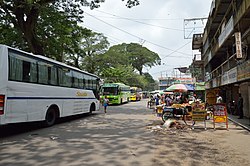
Jessore Road, Petrapole
West Bengal location map.svg
Red pog.svg
Petrapole
Location in West Bengal, India
India location map 3.png
Red pog.svg
Petrapole
Petrapole (India)
Coordinates: 23°00′N88°50′E / 23.0°N 88.83°E / 23.0; 88.83
CountryFlag of India.svg  India
State West Bengal
District North 24 Parganas
Elevation
6 m (20 ft)
Languages
  Official Bengali, English
Time zone UTC+5:30 (IST)
Vehicle registration WB
Website north24parganas.nic.in

Petrapole is the Indian side of Petrapole-Benapole border checkpoint between India and Benapole of Bangladesh, on the Bangladesh-India border, near Bongaon in North 24 Parganas district of West Bengal. Petrapole border is the only land port in south Bengal. It is also the largest land customs station in Asia. [1]

Contents

Geography

Petrapole
This is a stopgap mapping solution, while attempts are made to resolve technical difficulties with {{ OSM Location map }}
Cities, towns and locations in Bangaon subdivision, North 24 Parganas district
M: municipal town, CT: census town, R: rural/ urban centre, T: place of tourist interest
Owing to space constraints in the small map, the actual locations in a larger map may vary slightly

Location

Petrapole is in the district of North 24 Parganas and is about 95 km from Kolkata on the National Highway 112 (formerly NH 35). The nearest town and passenger rail station is Bongaon. [1]

Area overview

The area shown in the map was a part of Jessore district from 1883. [2] [3] At the time of Partition of Bengal (1947) the Radcliffe Line placed the police station areas of Bangaon and Gaighata of Jessore district in India and the area was made a part of 24 Parganas district. [4] The renowned novelist, Bibhutibhushan Bandopadhyay (of Pather Panchali fame) belonged to this area and many of his writings portray his experience in the area. [5] It is a flat plain located in the lower Ganges Delta. [6] In the densely populated area, 16.33% of the population lives in the urban areas and 83.67% lives in the rural areas. [7] [8]

Note: The map alongside presents some of the notable locations in the subdivision. All places marked in the map are linked in the larger full screen map.

Significance

This check post accounts for more than half of the $4-billion (nearly double the trade volume with Pakistan) trade with Bangladesh. This is the largest land port of Asia. [9] The landport alone accounts for nearly 60 per cent of the bilateral trade between India and Bangladesh. [10] [11]

International trade and logistics accounts for majority of the occupation. Notable companies like PSZ Logistics have a strong presence in the Petrapole area.

Communication

The Petrapole-Benapole rail link was opened in 2001 after being closed for 24 years. [12] There is a proposal to construct a by-pass road to ease congestion on the present road, connecting Benapole to NH 112 (earlier NH 35), bypassing Bangaon. [13] On 9 November 2017, Nearly 10 years after Kolkata-Dhaka passenger train was flagged off after a gap of 43 years, a new train – Bandhan Express – was inaugurated between Kolkata and Khulna in Bangladesh (via Petrapole and Benapole), covering a distance of about 172 km. This is a weekly train and runs on Thursdays from both sides.

See also

Related Research Articles

<span class="mw-page-title-main">Barasat</span> City in West Bengal, India

Barasat is a city and a municipality of North 24 Parganas district in the state of West Bengal, India. It is the headquarters of Barasat Sadar subdivision. It is a part of the area covered by Kolkata Metropolitan Development Authority (KMDA). Located in the Ganges delta, Barasat is a regional transportation hub as a rail and road junction. National Highway 12, NH 112, Taki Road and Barrackpore-Barasat Road are the main connectivity links to the city.

<span class="mw-page-title-main">North 24 Parganas district</span> District in West Bengal, India

North 24 Parganas (abv. 24 PGS (N)) or sometimes North Twenty Four Parganas is a district in southern West Bengal, of eastern India. North 24 Parganas extends in the tropical zone from latitude 22° 11′ 6″ north to 23° 15′ 2″ north and from longitude 88º20' east to 89º5' east. Barasat is the district headquarters of North 24 Parganas. North 24 Parganas is West Bengal's most populous district and also (since 2014) the most populated district in the whole of India. It is the tenth-largest district in the State by area.

<span class="mw-page-title-main">Bangaon</span> City and municipality in West Bengal, India

Bangaon is a city and a municipality in North 24 Parganas district in the state of West Bengal, India. It is the headquarters of the Bangaon subdivision.

<span class="mw-page-title-main">Habra</span> City in West Bengal, India

Habra is a city and a municipality under Barasat sadar subdivision in North 24 Parganas district of the Indian state of West Bengal. It is situated on the Jessore Road between Kolkata and the Bangladesh border at Petrapole. Its location makes it an important town for export and import of goods between India and Bangladesh.

Ashoknagar Kalyangarh is a city and a municipality in Barasat Sadar subdivision of North 24 Parganas district in the state of West Bengal, India. Ashoknagar is the first discovered oil field in West Bengal and East India. The oil field was discovered in 2018 by ONGC.

Bangaon subdivision is an administrative subdivision of the North 24 Parganas district in the Indian state of West Bengal.

<span class="mw-page-title-main">Thakurnagar</span> Town in West Bengal, India

Thakurnagar is a town in the Indian state of West Bengal. It is close to the border with Bangladesh. It is situated on the east side of the Jessore Road. Thakurnagar is famous for "Baruni Mela".

Bangaon is a community development block that forms an administrative division in Bangaon subdivision of North 24 Parganas district in the Indian state of West Bengal.

Bangaon is a Kolkata Suburban Railway junction station on the Sealdah–Bangaon line and Ranaghat–Bangaon line. It is located in North 24 Parganas district in the Indian state of West Bengal. It serves Bangaon and its surrounding areas.

<span class="mw-page-title-main">Chandpara</span> Census Town in West Bengal, India

Chandpara is a census town in the Gaighata CD block in the Bangaon subdivision of the North 24 Parganas district in the state of West Bengal, India.

<span class="mw-page-title-main">National Highway 112 (India)</span> National highway in India

National Highway 112 is a highway in the Indian state of West Bengal. It runs from Barasat to Petrapole border with Bangladesh.

Helencha is one of the largest colony village in the Bagdah CD block in the Bangaon subdivision of the North 24 Parganas district in the state of West Bengal, India. It is divided among many small area namely Old Helencha, Dakshin Helencha, Helencha 1 to 5 Colony.

Gopalnagar is a village and a gram panchayat in the Bangaon CD block in the Bangaon subdivision of the North 24 Parganas district in the state of West Bengal, India.

Gaighata is a village in the Gaighata CD block in the Bangaon subdivision of the North 24 Parganas district in the state of West Bengal, India.

<span class="mw-page-title-main">Birati railway station</span> Railway station in West Bengal, India

Birati railway station is a Kolkata Suburban Railway station in Birati. It serves the local areas of Birati and Nimta in North 24 Parganas district, West Bengal, India. It lies between the Durganagar railway station and the Bisharpara Kodaliya railway station. Madhusudan Banerjee Road connects the Barrackpore Trunk Road and Jessore Road through Birati.

Bibhuti Bhushan Halt railway station is a small railway station in North 24 Parganas district, West Bengal. Its code is BNAA. It serves the surrounding areas of Bongaon town. The station consists of two platforms. The platform area is not well sheltered. It lacks many facilities including water and sanitation. The station is named after the famous Bengali writer Bibhutibhusan Bandopadhyay.

<span class="mw-page-title-main">Sealdah–Bangaon line</span> Railway Route in West Bengal, India

The Sealdah–Bangaon line is a 78 km (48 mi) long broad gauge railway line that connects the Sealdah Main and North terminus of Kolkata with Bangaon of North 24 Parganas district of West Bengal, India. Once a part of the old Calcutta–Jessore–Khulna line, today it is a busy suburban section of the Kolkata Suburban Railway's Sealdah North section. It is under the jurisdiction of the Sealdah railway division of the Eastern Railway zone of the Indian Railways.

Chhekati is a census town in the Gaighata CD block in the Bangaon subdivision of North 24 Parganas district in the state of West Bengal, India.

<span class="mw-page-title-main">Benapole Border Crossing</span> International border crossing between Bangladesh and India

The Benapole Border Crossing also known as the Petrapole Crossing is an international border crossing between Benapole, Jessore, Bangladesh, and Petrapole, North 24 Parganas, West Bengal, India.

<span class="mw-page-title-main">Petrapole railway station</span> Railway station in West Bengal

Petrapole railway station is a railway station of the Indian Railways located in the North 24 Parganas district, West Bengal. Its station code is PTPL. It is located near the Indo-Bangladesh border and serves as a major border crossing point for freight trains to Bangladesh, with Benapole being the Bangladesh Railways counterpart.

References

  1. 1 2 "Chief secretary visits Petrapole border". The Times of India. 15 November 2010. Retrieved 8 February 2019.
  2. "Bengal District Gazetteers, Jessore by L.S.S. O'Malley". Chapter II: History, Page/ Section 44. Bengal Secretariat Book Depot, 1912. Retrieved 11 May 2018.
  3. "District Gazetteer" (PDF). Chapter IX: General Administration, Page 150. Egiye Bangla. Retrieved 11 May 2018.
  4. "Jessore District Information". Khujbo.com. Retrieved 11 May 2018.
  5. "Bibhutibhusan Bandopadhyay". Banglapedia. Retrieved 22 June 2021.
  6. "District Census Handbook North Twenty Four Parganas, Census of India 2011, Series 20, Part XII A" (PDF). Page 13. Directorate of Census Operations, West Bengal. Retrieved 16 April 2018.
  7. "District Statistical Handbook". North 24 Parganas 2013, Tables 2.1, 2.2, 2.4b. Department of Statistics and Programme Implementation, Government of West Bengal. Archived from the original on 21 January 2019. Retrieved 2 May 2018.
  8. "District Census Handbook North Twenty Four Parganas, Census of India 2011, Series 20, Part XII A" (PDF). Map of North Twenty Four Parganas with CD Block HQs and Police Stations (on the fifth page). Directorate of Census Operations, West Bengal. Retrieved 2 May 2018.
  9. Bose, Pratim Ranjan; Law, Abhishek (12 March 2018). "Customs wants better rail link thru Petrapole". The Hindu Business Line. Retrieved 8 February 2018.
  10. Integrated check post planned at Petrapole to boost trade with Dhaka. thehindubusinessline.com. Retrieved 6 May 2013.
  11. Petrapole infrastructure to be beefed up. thehindubusinessline.com. Retrieved 6 May 2013.
  12. Petrapole-Benapole rail link re-opens after 24 years hindu.com. Retrieved 6 May 2013
  13. Bypass to ease border traffic telegraphindia.com. Retrieved 6 May 2013