Shyamnagar | |
---|---|
Census Town | |
Coordinates: 22°49′31″N88°23′03″E / 22.8254°N 88.3842°E | |
Country | India |
State | West Bengal |
District | North 24 Parganas |
Area | |
• Total | 1.08 km2 (0.42 sq mi) |
Population (2011) | |
• Total | 7,611 |
• Density | 7,000/km2 (18,000/sq mi) |
Languages | |
• Official | Bengali, English |
Time zone | UTC+5:30 (IST) |
Telephone code | +91 33 |
ISO 3166 code | IN-WB |
Vehicle registration | WB |
Lok Sabha constituency | Barrackpore |
Vidhan Sabha constituency | Noapara |
Website | north24parganas |
Shyamnagar is a census town in Barrackpore I CD Block in Barrackpore subdivision [1] in North 24 Parganas district in the state of West Bengal, India. It is a part of Kolkata Urban Agglomeration.
Shyamnagar, Noapara, Kaugachhi and Paltapara form an urban cluster east of Garulia and North Barrackpur. Ichhapur Defence Estate lies on the west of North Barrackpur. [2]
96% of the population of Barrackpore subdivision (partly presented in the map alongside) live in urban areas. In 2011, it had a density of population of 10,967 per km2 The subdivision has 16 municipalities and 24 census towns. [3]
For most of the cities/ towns information regarding density of population is available in the Infobox. Population data is not available for neighbourhoods. It is available for the entire municipal area and thereafter ward-wise.
All places marked on the map are linked in the full-screen map.
Naihati police station under Barrackpore Police Commissionerate has jurisdiction over Naihati municipal area and Barrackpore I CD Block, including Barrackpur Cantonment Board. [4] [5]
As per 2011 Census of India Shyamnagar had a total population of 7,611, of which 3,840 (50%) were males and 3,771 (50%) were females. Population below 6 years was 558. The total number of literates in Shyamnagar was 6,417 (90.98% of the population over 6 years). [6]
As of 2001 [update] India census, [7] Shyamnagar had a population of 7,354. Males constitute 50% of the population and females 50%. Shyamnagar has an average literacy rate of 79%, higher than the national average of 59.5%: male literacy is 84%, and female literacy is 75%. In Shyamnagar, 8% of the population is under 6 years of age.
The following Municipalities, Census Towns and other locations in Barrackpore subdivision were part of Kolkata Urban Agglomeration in the 2011 census: Kanchrapara (M), Jetia (CT), Halisahar (M), Balibhara (CT), Naihati (M), Bhatpara (M), Kaugachhi (CT), Shyamnagar (CT), Garulia (M), Ichhapur Defence Estate (CT), North Barrackpur (M), Barrackpur Cantonment (CB), Barrackpore (M), Jafarpur (CT), Ruiya (CT), Titagarh (M), Khardaha (M), Bandipur (CT), Panihati (M), Muragachha (CT) New Barrackpore (M), Chandpur (CT), Talbandha (CT), Patulia (CT), Kamarhati (M), Baranagar (M), South Dumdum (M), North Dumdum (M), Dum Dum (M), Noapara (CT), Babanpur (CT), Teghari (CT), Nanna (OG), Chakla (OG), Srotribati (OG) and Panpur (OG). [8]
As per the District Census Handbook 2011, Shyamnagar covered an area of 1.08 km2. Amongst the medical facilities it had there were 4 medicine shops. Amongst the educational facilities It had there were 3 primary schools, the nearest middle and secondary schools were available 2.5 km away at Gurdaha, and the nearest senior secondary school was available 12 km away at Naihati. [9]
North 24 Parganas district has been identified as one of the areas where ground water is affected by arsenic contamination. [10]
Ichapore or Ichhapur is a locality in North Barrackpur Municipality of North 24 Parganas district in the Indian state of West Bengal. It is a part of the area covered by Kolkata Metropolitan Development Authority (KMDA). Ichhapur Defence Estate has two ordnance factories, the Rifle Factory Ishapore (RFI) and the Metal and Steel Factory (MSF) of the Ordnance Factories Board.
Jagaddal is a locality in Bhatpara Municipality of North 24 Parganas district in the Indian state of West Bengal. It is a part of the area covered by Kolkata Metropolitan Development Authority (KMDA). It is also a manufacturing hub of jute industry, there are 7 big jute mills in this city.
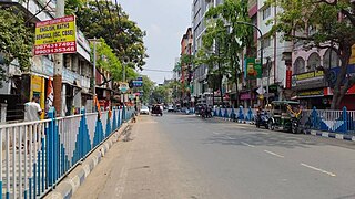
Garulia is a city and a municipality of North 24 Parganas district in the Indian state of West Bengal. It is a part of the area covered by Kolkata Metropolitan Development Authority (KMDA).
Ichhapur Defence Estate is a census town in Barrackpore I CD Block in Barrackpore subdivision in North 24 Parganas district in the Indian state of West Bengal. It is a part of Kolkata Urban Agglomeration.
Jafarpur is a census town in Barrackpore II CD Block in Barrackpore subdivision in North 24 Parganas district in the Indian state of West Bengal. It is close to Kolkata and also part of Kolkata Urban Agglomeration.
Jetia is a census town in Barrackpore I CD Block in Barrackpore subdivision in North 24 Parganas district in the Indian state of West Bengal. It is a part of Kolkata Urban Agglomeration.
Kaugachhi is a census town in Barrackpore I CD Block in Barrackpore subdivision in North 24 Parganas district in the Indian state of West Bengal. It is a part of Kolkata Urban Agglomeration.
Muragachha is a census town in Barrackpore II CD Block in Barrackpore subdivision in North 24 Parganas district in the Indian state of West Bengal. It is close to Kolkata and also a part of Kolkata Urban Agglomeration.
North Barrackpur is a Town and a municipality of North 24 Parganas district in the Indian state of West Bengal. It is a part of the area covered by Kolkata Metropolitan Development Authority (KMDA). It is situated north of Barrackpore.
Bijpur is a locality in Kanchrapara Municipality of North 24 Parganas district in the Indian state of West Bengal. It is a part of the area covered by Kolkata Metropolitan Development Authority (KMDA).
Noapara is a census town in Barrackpore I CD Block in Barrackpore subdivision of North 24 Parganas district in the Indian state of West Bengal. It is a part of Kolkata Urban Agglomeration.
Bangur Avenue is a locality in South Dumdum of North 24 Parganas district in the Indian state of West Bengal. It is a part of the area covered by Kolkata Metropolitan Development Authority (KMDA).
Balibhara is a census town in Barrackpore I CD Block of Barrackpore subdivision in North 24 Parganas district in the Indian state of West Bengal. It is a part of Kolkata Urban Agglomeration.
Dogachhia is a census town in Barrackpore I CD Block of Barrackpore subdivision in North 24 Parganas district in the Indian state of West Bengal. It is a part of Kolkata Urban Agglomeration.
Nagdaha is a census town in Barrackpore I CD Block of Barrackpore subdivision in North 24 Parganas district in the Indian state of West Bengal. It is a part of Kolkata Urban Agglomeration.
Palashi is a census town in Barrackpore I CD Block of Barrackpore subdivision in North 24 Parganas district in the Indian state of West Bengal. It is a part of Kolkata Urban Agglomeration.
Palladaha is a census town in Barrackpore I CD Block of Barrackpore subdivision in North 24 Parganas district in the Indian state of West Bengal. It is a part of Kolkata Urban Agglomeration.
Paltapara, also Palta, is a census town in Barrackpore I CD Block of Barrackpore subdivision in North 24 Parganas district in the Indian state of West Bengal. It is a part of Kolkata Urban Agglomeration.
Babanpur is a census town in Barrackpore II CD Block in Barrackpore subdivision of North 24 Parganas district in the state of West Bengal, India. It is close to Kolkata and also a part of Kolkata Urban Agglomeration.
Panpur is an outgrowth of Bhatpara in Barrackpore I CD Block in Barrackpore subdivision of North 24 Parganas district in the state of West Bengal, India. Panpur-Keutia is a gram panchayat. It is a part of Kolkata Urban Agglomeration.