Deganga, North 24 Parganas

Last updated

Deganga
Village
West Bengal location map.svg
Red pog.svg
Deganga
Location in West Bengal, India
India location map.svg
Red pog.svg
Deganga
Deganga (India)
Coordinates: 22°41′40″N88°38′59″E / 22.694363°N 88.649656°E / 22.694363; 88.649656
CountryFlag of India.svg  India
State West Bengal
District North 24 Parganas
Population
 (2011)
  Total3,377
Languages
  Official Bengali, English
Time zone UTC+5:30 (IST)
PIN
743423 (Beliaghata Bridge BO & Deganga SO)
Telephone/STD code03217
Lok Sabha constituency Basirhat
Vidhan Sabha constituency Haroa
Website north24parganas.nic.in

Deganga is a village and a gram panchayat in the Deganga CD block in the Barasat Sadar subdivision of the North 24 Parganas district in the state of West Bengal, India. Berachampa and Deulia are located nearby.

Contents

Geography

Deganga, North 24 Parganas
Cities, towns and locations in Barasat subdivision, North 24 Parganas
M: municipal town, CT: census town, R: rural/ urban centre, H: historical centre
Owing to space constraints in the small map, the actual locations in a larger map may vary slightly

Location

Deganga is located at 22°41′40″N88°38′59″E / 22.694363°N 88.649656°E / 22.694363; 88.649656 .

Area overview

The area covered in the map alongside is largely a part of the north Bidyadhari Plain. located in the lower Ganges Delta. [1] The country is flat. It is a little raised above flood level and the highest ground borders the river channels. [2] 54.67% of the people of the densely populated area lives in the urban areas and 45.33% lives in the rural areas. [3]

Note: The map alongside presents some of the notable locations in the subdivision. All places marked in the map are linked in the larger full screen map.

Civic administration

Police station

Deganga police station covers an area of 202.09 km2 and serves a total population of 319,213. It has jurisdiction over Deganga CD block. There is a police out post at Swetpur. [4]

Demographics

According to the 2011 Census of India, Deganga had a total population of 3,377, of which 1,719 (51%) were males and 1,658 (49%) were females. Population in the age range 0–6 years was 342. The total number of literate perons in Deganga was 2,509 (82.67% of the population over 6 years). [5]

Transport

State Highway 2 passes through Deganga. [6]

Healthcare

Biswanathpur Rural Hospital at Deganga with 30 beds functions as the main medical facility in Deganga CD Block. There are primary health centres at Ajinagar (Hadipur-Jhikra PHC with 6 beds), Chakla (Raypur Chakla PHC with 10 beds), Deganga (Kolsur PHC with 10 beds) and Kartickpur (6 beds) [7]

See also

Map Deganga CD Block on Page 445 of District Census Handbook. [8]

Related Research Articles

<span class="mw-page-title-main">Baduria</span> City in West Bengal, India

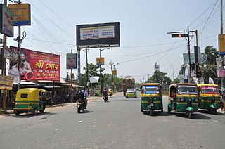
Baduria is a city and a municipality in Basirhat subdivision of North 24 Parganas district in the Indian state of West Bengal.

<span class="mw-page-title-main">Muragachha</span> Census Town in West Bengal, India

Muragachha is a census town in Barrackpore II CD Block in Barrackpore subdivision in North 24 Parganas district in the Indian state of West Bengal. It is close to Kolkata and also a part of Kolkata Urban Agglomeration.

<span class="mw-page-title-main">Taki (India)</span> City in West Bengal, India

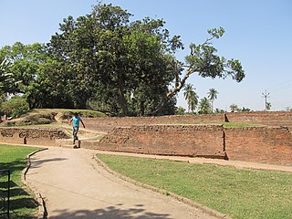
Taki is a city and a municipality under the Hasnabad police station of the Basirhat subdivision in North 24 Parganas district in the Indian state of West Bengal.

<span class="mw-page-title-main">Deganga</span> Community development block in North 24 Parganas, West Bengal, India

Deganga is a community development block that forms an administrative division in North 24 Parganas district in the Indian state of West Bengal.

<span class="mw-page-title-main">Barasat Sadar subdivision</span> Subdivision in West Bengal, India

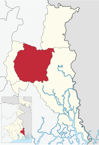
Barasat Sadar subdivision is an administrative subdivision of the North 24 Parganas district in the Indian state of West Bengal. After transferring Rajarhat-Gopalpur Municipality and Rajarhat to Bidhannagar subdivision, Barasat Sadar subdivision's total area became 894.61 sq km, population became 2,196,874 and density became 2,500/sq km.

<span class="mw-page-title-main">Barasat II</span> Community development block in West Bengal, India

Barasat II is a community development block that forms an administrative division in Barasat Sadar subdivision of North 24 Parganas district in the Indian state of West Bengal.

<span class="mw-page-title-main">Baduria (community development block)</span> Community development block in West Bengal, India

Baduria is a community development block that forms an administrative division in Basirhat subdivision of North 24 Parganas district in the Indian state of West Bengal.

Haroa is a village in the Haroa CD block in the Basirhat subdivision of the North 24 Parganas district in the state of West Bengal, India.

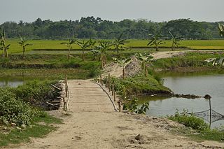
Sandeshkhali is a village in the Sandeshkhali II CD block in the Basirhat subdivision of the North 24 Parganas district in the state of West Bengal, India.

Chatta Baria is a census town in the Barasat I CD block in the Barasat Sadar subdivision in the North 24 Parganas district in the Indian state of West Bengal. It is a part of Kolkata Urban Agglomeration.

<span class="mw-page-title-main">Chandpara</span> Census Town in West Bengal, India

Chandpara is a census town in the Gaighata CD block in the Bangaon subdivision of the North 24 Parganas district in the state of West Bengal, India.

Bagdah is a village in the Bagdah CD block in the Bangaon subdivision of the North 24 Parganas district in the state of West Bengal, India.

Minakhan is a census town in the Minakhan CD block in the Basirhat subdivision of the North 24 Parganas district in the state of West Bengal, India.

Shasan is a village and a gram panchayat in the Barasat II CD block in the Barasat Sadar subdivision of the North 24 Parganas district in the state of West Bengal, India.

Amdanga is a village and a gram panchayat in the Amdanga CD block in the Barasat Sadar subdivision of the North 24 Parganas district in the state of West Bengal, India.

Deulia is a census town in the Deganga CD block in the Barasat Sadar subdivision of the North 24 Parganas district in the state of West Bengal, India.

Sabdalpur is a village in the Habra II CD block in the Barasat Sadar subdivision of the North 24 Parganas district in the state of West Bengal, India.

Bandipur is a census town in Barrackpore II CD Block in Barrackpore subdivision of North 24 Parganas district in the state of West Bengal, India. It is close to Kolkata and also a part of Kolkata Urban Agglomeration.

Nanna is an outgrowth of Kanchrapara in Barrackpore I CD Block in Barrackpore subdivision of North 24 Parganas district in the state of West Bengal, India. It is a part of Kolkata Urban Agglomeration.

Baneshwarpur is a census town within the jurisdiction of the Falta police station in the Falta CD block in the Diamond Harbour subdivision of the South 24 Parganas district in the Indian state of West Bengal.

References

  1. "District Census Handbook North Twenty Four Parganas, Census of India 2011, Series 20, Part XII A" (PDF). Page 13. Directorate of Census Operations, West Bengal. Retrieved 16 April 2018.
  2. LSS O’Malley (2009). Bengal District Gazetteers: 24 Parganas. ISBN   9788172681937 . Retrieved 3 May 2018.{{cite book}}: |work= ignored (help)
  3. "District Statistical Handbook". North 24 Parganas 2013, Tables 2.1, 2.2, 2.4b. Department of Statistics and Programme Implementation, Government of West Bengal. Archived from the original on 21 January 2019. Retrieved 2 May 2018.
  4. "North 24 Parganas Dist. Police". Know Your Police Station. District Police. Retrieved 17 May 2018.
  5. "C.D. Block Wise Primary Census Abstract Data(PCA)". West Bengal – District-wise CD Blocks. Registrar General and Census Commissioner, India. Retrieved 11 May 2018.
  6. Google maps
  7. "Health & Family Welfare Department". Health Statistics. Government of West Bengal. Retrieved 17 May 2018.
  8. "District Census Handbook North Twenty Four Parganas, Census of India 2011, Series 20, Part XII A" (PDF). Page 445 - Map of Deganga CD Block. Directorate of Census Operations, West Bengal. Retrieved 1 June 2018.