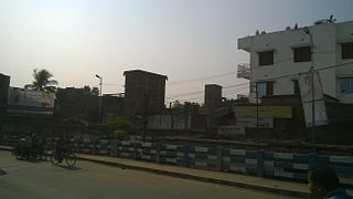
Chikanpara

Last updated

Chikanpara
Census Town
West Bengal location map.svg
Red pog.svg
Chikanpara
Location in West Bengal, India
India location map 3.png
Red pog.svg
Chikanpara
Chikanpara (India)
Coordinates: 22°56′10″N88°46′16″E / 22.936231°N 88.771246°E / 22.936231; 88.771246 Coordinates: 22°56′10″N88°46′16″E / 22.936231°N 88.771246°E / 22.936231; 88.771246
CountryFlag of India.svg  India
State West Bengal
District North 24 Parganas
Population
 (2011)
  Total9,594
Languages
  Official Bengali, English
Time zone UTC+5:30 (IST)
PIN
743287
Vehicle registration WB
MLAPhulin Bihary Roy
Website north24parganas.nic.in

Chikanpara is a census town in the Gaighata CD block in the Bangaon subdivision of the North 24 Parganas district in state of West Bengal, India.

Contents

Geography

Cities, towns and locations in Bangaon subdivision, North 24 Parganas district
M: municipal town, CT: census town, R: rural/ urban centre, T: place of tourist interest
Owing to space constraints in the small map, the actual locations in a larger map may vary slightly

Location

Chikanpara is bounded by Katakhali and Ganti villages on the north, Shimulpur census town on the east, Karola village on the south, and Gutri, Kaya, Pansila and Hudasimulpur villages on the west. Thakurnagar has not been identified as a separate location in 2011 census. [1]

Area overview

The area shown in the map was a part of Jessore district from 1883. [2] [3] At the time of Partition of Bengal (1947) the Radcliffe Line placed the police station areas of Bangaon and Gaighata of Jessore district in India and the area was made a part of 24 Parganas district. [4] The renowned novelist, Bibhutibhushan Bandopadhyay (of Pather Panchali fame) belonged to this area and many of his writings portray his experience in the area. [5] It is a flat plain located in the lower Ganges Delta. [6] In the densely populated area, 16.33% of the population lives in the urban areas and 83.67% lives in the rural areas. [7] [8]

Note: The map alongside presents some of the notable locations in the subdivision. All places marked in the map are linked in the larger full screen map.

Demographics

According to the 2011 Census of India, Chikanpara had a total population of 9,594, of which 4,784 (50%) were males and 4,810 (50%) were females. The population in the age range 0-6 years was 760. The total number of literate persons in Chikanpara was 8,058 (91.22% of the population over 6 years). [9]

Education

P. R. Thakur Government College, Thakurnagar High School and Thakurnagar Girls High School at Thakurnagar are located nearby. [10]

Related Research Articles

Bangaon City and municipality in West Bengal, India

Bangaon is a city and a municipality in North 24 Parganas district in the state of West Bengal, India. It is the headquarters of the Bangaon subdivision.

Habra City in West Bengal, India

Habra is a city and a municipality under Barasat sadar subdivision in North 24 Parganas district of the Indian state of West Bengal. It is situated on the Jessore Road between Kolkata and the Bangladesh border at Petrapole. Its location makes it an important town for export and import of goods between India and Bangladesh.
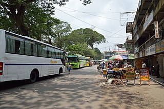
Petrapole Border Checkpoint in West Bengal, India

Petrapole is the Indian side of Petrapole-Benapole border checkpoint between India and Benapole of Bangladesh, on the Bangladesh-India border, near Bongaon in North 24 Parganas district of West Bengal. Petrapole border is the only land port in south Bengal. It is also the largest land customs station in Asia.
Sonatikiri Census Town in West Bengal, India

Sonatikiri is a census town in the Gaighata CD block of the Bangaon subdivision in North 24 Parganas district in the Indian state of West Bengal.

Gaighata Community development block in West Bengal, India

Gaighata is a community development block that forms an administrative division in Bangaon subdivision of North 24 Parganas district in the Indian state of West Bengal.

Dhakuria, North 24 Parganas Census Town in West Bengal, India

Dhakuria is a census town in Gaighata CD Block in Bangaon subdivision in North 24 Parganas district in the state of West Bengal, India.

Bangaon subdivision Subdivision in West Bengal, India

Bangaon subdivision is an administrative subdivision of the North 24 Parganas district in the Indian state of West Bengal.

Thakurnagar City / Town in West Bengal, India

Thakurnagar is a Town in the Indian state of West Bengal. It is close to the border with Bangladesh. It is situated on the east side of the Jessore Road.

Bangaon (community development block) Community development block in West Bengal, India

Bangaon is a community development block that forms an administrative division in Bangaon subdivision of North 24 Parganas district in the Indian state of West Bengal.

Chandpara Census Town in West Bengal, India

Chandpara is a census town in the Gaighata CD block in the Bangaon subdivision of the North 24 Parganas district in the state of West Bengal, India.

Nahata Village in West Bengal, India

Nahata is a village in the Bangaon CD Block in the Bangaon subdivision of the North 24 Parganas, West Bengal.

Manikhira Village in Bangaon, India

Manikhira is a village near Thakurnagar in Gaighata CD Block in Bangaon subdivision of the North Twenty Four Parganas district in the West Bengal state of India.

Shimulpur Census Town in West Bengal, India

Shimulpur is a census town in the Gaighata CD block in the Bangaon subdivision of North 24 Parganas district in the state of West Bengal, India.

Bagdah, North 24 Parganas Village in West Bengal, India

Bagdah is a village in the Bagdah CD block in the Bangaon subdivision of the North 24 Parganas district in the state of West Bengal, India.

Helencha Village in West Bengal, India

Helencha is a village in the Bagdah CD block in the Bangaon subdivision of the North 24 Parganas district in the state of West Bengal, India.

Gopalnagar, North 24 Parganas Village in West Bengal, India

Gopalnagar is a village and a gram panchayat in the Bangaon CD block in the Bangaon subdivision of the North 24 Parganas district in the state of West Bengal, India.

Gaighata, North 24 Parganas Village in West Bengal, India

Gaighata is a village in the Gaighata CD block in the Bangaon subdivision of the North 24 Parganas district in the state of West Bengal, India.

Palla, North 24 Parganas Village in West Bengal, India

Palla is a village and a gram panchayat in the Bangaon CD block in the Bangaon subdivision of the North 24 Parganas district in the state of West Bengal, India.

Chhekati Census Town in West Bengal, India

Chhekati is a census town in the Gaighata CD block in the Bangaon subdivision of North 24 Parganas district in the state of West Bengal, India.

Bara, North 24 Parganas Census Town in West Bengal, India

Bara is a census town in the Gaighata CD block in the Bangaon subdivision of North 24 Parganas district in the state of West Bengal, India.

References

  1. "Census of India 2011, Series 20, Part XIIA, District Census Handbook, North 24 Parganas" (PDF). CD Block map on page 227, and alphabetical list of villages on pages 229-231. Directorate of Census Operations, West Bengal. Retrieved 26 May 2018.
  2. "Bengal District Gazetteers, Jessore by L.S.S. O'Malley". Chapter II: History, Page/ Section 44. Bengal Secretariat Book Depot, 1912. Retrieved 11 May 2018.
  3. "District Gazetteer" (PDF). Chapter IX: General Administration, Page 150. Egiye Bangla. Retrieved 11 May 2018.
  4. "Jessore District Information". Khujbo.com. Archived from the original on 16 May 2018. Retrieved 11 May 2018.
  5. "Bibhutibhusan Bandopadhyay". Banglapedia. Retrieved 22 June 2021.
  6. "District Census Handbook North Twenty Four Parganas, Census of India 2011, Series 20, Part XII A" (PDF). Page 13. Directorate of Census Operations, West Bengal. Retrieved 16 April 2018.
  7. "District Statistical Handbook". North 24 Parganas 2013, Tables 2.1, 2.2, 2.4b. Department of Statistics and Programme Implementation, Government of West Bengal. Archived from the original on 21 January 2019. Retrieved 2 May 2018.
  8. "District Census Handbook North Twenty Four Parganas, Census of India 2011, Series 20, Part XII A" (PDF). Map of North Twenty Four Parganas with CD Block HQs and Police Stations (on the fifth page). Directorate of Census Operations, West Bengal. Retrieved 2 May 2018.
  9. "C.D. Block Wise Primary Census Abstract Data(PCA)". West Bengal – District-wise CD Blocks. Registrar General and Census Commissioner, India. Retrieved 23 May 2018.
  10. Google maps