Anarbaria

Last updated

Anarbaria
Census Town
West Bengal location map.svg
Red pog.svg
Anarbaria
Location in West Bengal, India
India location map 3.png
Red pog.svg
Anarbaria
Anarbaria (India)
Coordinates: 22°48′55″N88°37′49″E / 22.8154°N 88.6302°E / 22.8154; 88.6302
Country Flag of India.svg  India
State West Bengal
District North 24 Parganas
Area
  Total1.574 km2 (0.608 sq mi)
Population
 (2011)
  Total5,895
  Density3,700/km2 (9,700/sq mi)
Languages
  Official Bengali, English
Time zone UTC+5:30 (IST)
PIN
743263
Telephone code03216
Vehicle registration WB
Lok Sabha constituency Barasat
Vidhan Sabha constituency Habra

Anarbaria is a census town in the Habra I CD block in the Barasat Sadar subdivision of the North 24 Parganas district in the state of West Bengal, India.

Contents

Geography

Anarbaria
Cities, towns and locations in Barasat subdivision, North 24 Parganas
M: municipal town, CT: census town, R: rural/ urban centre, H: historical centre
Owing to space constraints in the small map, the actual locations in a larger map may vary slightly

Location

Anarbaria is located at 22°48′55″N88°37′49″E / 22.8154°N 88.6302°E / 22.8154; 88.6302 .

Area overview

The area covered in the map alongside is largely a part of the north Bidyadhari Plain. located in the lower Ganges Delta. [1] The country is flat. It is a little raised above flood level and the highest ground borders the river channels. [2] 54.67% of the people of the densely populated area lives in the urban areas and 45.33% lives in the rural areas. [3]

Note: The map alongside presents some of the notable locations in the subdivision. All places marked in the map are linked in the larger full screen map.

Demographics

According to the 2011 Census of India, Anarbaria had a total population of 5,895, of which 2,973 (50%) were males and 2,922 (50%) were females. Population in the age range 0-6 years was 582. The total number of literate persons in Anarbaria was 4,432 (83.42% of the population over 6 years). [4]

As per the 2011 Census of India, Habra Urban Agglomeration had a total population of 304,584, of which 154,863 (51%) were males and 149,723 (49%) were females. Population below 6 years was 23,023. The total number of literates in Habra UA was 256,313 (91.03% of the population over 6 years). [5] The constituents of Habra Urban Agglomeration were Habra (M), Ashoknagar Kalyangarh (M), Bara Bamonia (CT), Guma (CT), Anarbaria (CT) and Khorddabamonia (CT). [6]

Infrastructure

According to the District Census Handbook, North Twenty Four Parganas, 2011, Anarberia covered an area of 1.574 km2. The protected water-supply involved hand pump, tank, pond, lake. It had 545 domestic electric connections. Among the medical facilities it had 1 medicine shop. Among the educational facilities, it had 2 primary schools, other schools at Prithiba 4  km away. The nearest college was 5 km away at Habra. It specialises in tailoring and pottery. It has the branch office of 1 nationalised bank. [7]

Related Research Articles

<span class="mw-page-title-main">Habra</span> City in West Bengal, India

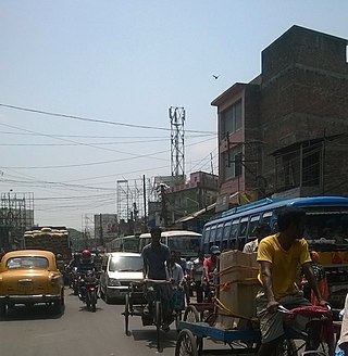
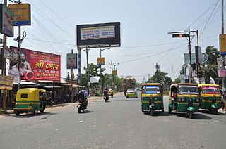
Habra is a city and a municipality under Barasat sadar subdivision in North 24 Parganas district of the Indian state of West Bengal. It is situated on the Jessore Road between Kolkata and the Bangladesh border at Petrapole. Its location makes it an important town for export and import of goods between India and Bangladesh.

Bara Bamonia is a census town in the Habra II CD block of Barasat Sadar subdivision in North 24 Parganas district in the state of West Bengal, India.

Garshyamnagar is a census town in Barrackpore I CD Block in Barrackpore subdivision in North 24 Parganas district in the state of West Bengal, India. It is a part of Kolkata Urban Agglomeration.

Garulia is a city and a municipality of North 24 Parganas district in the Indian state of West Bengal. It is a part of the area covered by Kolkata Metropolitan Development Authority (KMDA).

Guma is a census town(CT) in the Habra II CD block of Barasat sadar subdivision in North 24 Parganas district in the Indian state of West Bengal.

Jafarpur is a census town in Barrackpore II CD Block in Barrackpore subdivision in North 24 Parganas district in the Indian state of West Bengal. It is close to Kolkata and also part of Kolkata Urban Agglomeration.

Jetia is a census town in Barrackpore I CD Block in Barrackpore subdivision in North 24 Parganas district in the Indian state of West Bengal. It is a part of Kolkata Urban Agglomeration.

Kaugachhi is a census town in Barrackpore I CD Block in Barrackpore subdivision in North 24 Parganas district in the Indian state of West Bengal. It is a part of Kolkata Urban Agglomeration.

<span class="mw-page-title-main">Muragachha</span> Census Town in West Bengal, India

Muragachha is a census town in Barrackpore II CD Block in Barrackpore subdivision in North 24 Parganas district in the Indian state of West Bengal. It is close to Kolkata and also a part of Kolkata Urban Agglomeration.

North Barrackpur is a city and a municipality of North 24 Parganas district in the Indian state of West Bengal. It is a part of the area covered by Kolkata Metropolitan Development Authority (KMDA). It is situated north of Barrackpore.

Patulia is a census town in Barrackpore II CD Block in Barrackpore subdivision in North 24 Parganas district in the Indian state of West Bengal. It is close to Kolkata and also a part of Kolkata Urban Agglomeration.

Ruiya is a census town in Barrackpore II CD Block in Barrackpore subdivision in North 24 Parganas district in the Indian state of West Bengal. It is close to Kolkata and also a part of Kolkata Urban Agglomeration.

Talbandha is a census town in Barrackpore II CD Block in Barrackpore subdivision in North 24 Parganas district in the Indian state of West Bengal. It is close to Kolkata and also a part of Kolkata Urban Agglomeration.

Chandpur is a census town in Barrackpore II CD Block in Barrackpore subdivision in North 24 Parganas district in the state of West Bengal, India. It is close to Kolkata and also a part of Kolkata Urban Agglomeration.

Noapara is a census town in Barrackpore I CD Block in Barrackpore subdivision of North 24 Parganas district in the Indian state of West Bengal. It is a part of Kolkata Urban Agglomeration.

Balibhara is a census town in Barrackpore I CD Block of Barrackpore subdivision in North 24 Parganas district in the Indian state of West Bengal. It is a part of Kolkata Urban Agglomeration.

Bandipur is a census town in Barrackpore II CD Block in Barrackpore subdivision of North 24 Parganas district in the state of West Bengal, India. It is close to Kolkata and also a part of Kolkata Urban Agglomeration.

Teghari is a census town in Barrackpore II CD Block in Barrackpore subdivision of North 24 Parganas district in the state of West Bengal, India. It is close to Kolkata and also a part of Kolkata Urban Agglomeration.

Babanpur is a census town in Barrackpore II CD Block in Barrackpore subdivision of North 24 Parganas district in the state of West Bengal, India. It is close to Kolkata and also a part of Kolkata Urban Agglomeration.

Khorddabamonia is a census town in the Habra II CD block in the Barasat Sadar subdivision of the North 24 Parganas district in the state of West Bengal, India.

References

  1. "District Census Handbook North Twenty Four Parganas, Census of India 2011, Series 20, Part XII A" (PDF). Page 13. Directorate of Census Operations, West Bengal. Retrieved 16 April 2018.
  2. LSS O’Malley (2009). Bengal District Gazetteers: 24 Parganas. ISBN   9788172681937 . Retrieved 3 May 2018.{{cite book}}: |work= ignored (help)
  3. "District Statistical Handbook". North 24 Parganas 2013, Tables 2.1, 2.2, 2.4b. Department of Statistics and Programme Implementation, Government of West Bengal. Archived from the original on 21 January 2019. Retrieved 2 May 2018.
  4. "District Census Handbook, North Twnty Four Parganas, Series 20, Part XII B" (PDF). Rural PCA-C.D. blocks wise Village Primary Census Abstract, location no. 322903, page 26-27. Directorate of Census Operations West Bengal. Retrieved 18 June 2021.
  5. "Urban Agglomeration/ Cities having population above 1 lakh" (PDF). Provisional Population Totals, Census of India, 2011. Government of India. Retrieved 3 June 2018.
  6. "Constituents of Urban Agglomeration having population of 1 lakh and bove" (PDF). Provisional Population Totals, Census of India, 2011. Government of India. Retrieved 3 June 2018.
  7. "District Census Handbook North Twenty Four Parganas, Census of India 2011, Series 20, Part XII A" (PDF). Section II Town Directory, Pages 781-783 Statement I: Growth History, Pages 799-803: Statement IV: Medical Facilities 2009, Pages 803-805 Section V: Educational, Recreational and Cultural Facilities. Directorate of Census Operations, West Bengal. Retrieved 16 June 2021.