Under the Indian Constitution and laws, the states of India are self-governing administrative divisions, each having a state government. The legal power to manage affairs in each state is shared or divided between the particular state government on one hand and the national union government on the other. The union territories are directly governed by the union government; no state level government (and thus no division of power) exists in these jurisdictions.[a]
History
1876–1919
The administrative divisions of the Indian Empire in 1909
The British Raj was a very complex political entity consisting of various imperial divisions and states and territories of varying autonomy. At the time of its legal establishment in 1876, it was made up of 584 constituent states and the directly ruled territories of the Crown. The entire empire was divided into provinces and agencies.
The governor or lieutenant-governor also served as the Emperor's representative to the constituent states of the province. The first three of the lieutenant-governorships were territories annexed to India from other powers and temporarily governed by the erstwhile Bengal Presidency, before being made into their own separate provinces. Agra and Bengal were still considered de jure parts of the defunct Bengal Presidency for judicial and legal purposes. Agra was separated in 1878 and merged with Oudh.
The Bengal Presidency was re-established in 1912 as a governorship. All these provinces had their own legislatures established by the Indian Councils Acts, and high courts established by Indian High Courts Acts. Laws passed by these legislatures needed the dual assent of the governor or lieutenant-governor of the province and the governor-general of India, who functioned as the representative of the Emperor.
There were three governor's provinces in 1912, styled "Presidencies" as a historical memento that they had been once governed by presidents. These were:
There were territories ruled directly by the Government of India through nominated chief commissioners. These were former independent states annexed to India and since ruled directly by the Supreme Government.
There were the three chief commissioner's provinces. These did not have a legislature or a high court. These were:
The vast majority of the Indian states in the late nineteenth century were, in terms of imperial divisions, organised within the provinces. A good number of states were organised into imperial structures called agencies, or residencies. An Agent to the Governor-General (AGG) functioned as the Emperor's representative to all the states in the agency.
At the time of establishment of the empire, there were only two agencies:
In 1919, the fourth Government of India was enacted by the Crown. This saw many major changes. The legislatures of the provinces were made elected ones rather than nominated ones. Some provinces were given bicameral legislatures. All provinces were elevated to governorships and all lieutenant governors were made governors. Burma was given a special status and made an autonomous province.
There were ten governor's provinces now. These were:
The Chamber of Princes was established by Emperor George V in 1920. One of the major consequences of this was the creation of many more agencies from the states of the provinces, granting them direct relations with the Emperor instead of with the Governors.
There were now 8 imperial agencies and residencies. These were:
This saw the separation of all the states from the provinces and addition to before-mentioned agencies. This left all the provinces with only territories under direct Crown rule.
Several states continued their direct relations with the Emperor through this period, including:
The latter years of the Indian Empire saw the enactment of the last Government of India Act by the Crown. This act granted full autonomy to Indian provinces. Provincial laws no longer needed the assent of the governor-general. This act created the office of a Premier in each province, who functioned as the new head of government and was responsible to the provincial legislature.
Bengal, Madras and Bombay which had been till now styled Presidencies, were now officially styled as provinces. The provinces of Orissa and Sind were created from Bihar and Bombay respectively. The Province of Burma which had previously functioned as an autonomous province of India was now separated from the Indian Empire, and established as the Crown Colony of Burma.
The new Constitution of India, which came into force on 26 January 1950, made India a sovereign democratic republic. The new republic was also declared to be a "Union of States". The constitution of 1950 distinguished between three main types of states:[3]
Part A states, which were the former governors' provinces of India, were ruled by an elected governor and state legislature. The nine Part A states were:
The eight Part B states were former princely states or groups of princely states, governed by a rajpramukh, who was usually the ruler of a constituent state, and an elected legislature. The rajpramukh was appointed by the President of India. The Part B states were:
The ten Part C states included both the former chief commissioners' provinces and some princely states, and each was governed by a chief commissioner appointed by the President of India. The Part C states were:
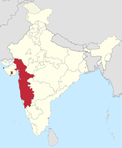
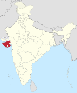
Bombay State was split into the linguistic states of Gujarat and Maharashtra on 1 May 1960 by the Bombay Reorganisation Act.[10] The former Union Territory of Nagaland achieved statehood on 1 December 1963.[11] The Punjab Reorganisation Act, 1966 resulted in the creation of Haryana on 1 November and the transfer of the northern districts of Punjab to Himachal Pradesh.[12] The act designated Chandigarh as a union territory and the shared capital of Punjab and Haryana.[13]
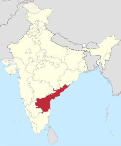
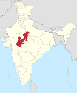
↑Andhra Pradesh was divided into two states, Telangana and a residual Andhra Pradesh on 2 June 2014.[43][21]Hyderabad, located entirely within the borders of Telangana, is to serve as the capital for both states for a period of time not exceeding ten years.[44] The Government of Andhra Pradesh and the Andhra Pradesh Legislature completed the process of relocating to temporary facilities in the envisaged new capital city Amaravati in early 2017.[45]
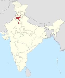
↑Bengali and Nepali are the official languages in the Darjeeling and Kurseong sub-divisions of the Darjeeling district.
↑Hindi, Odia, Punjabi, Santali, Urdu, Kamatapuri, Rajbanshi, Kurmali and Kurukh are treated as additional official languages in blocks, divisions or districts where the speakers exceed 10% of the population.
The Constitution of India distributes the sovereign executive and legislative powers exercisable with respect to the territory of any state between the Union Government and that state's own State Government.[63]
↑Reorganisation of states(PDF) (Report). Economic Weekly. 15 October 1955. Archived(PDF) from the original on 18 February 2016. Retrieved 31 December 2015.
↑Balwant Singh Malik (1998). "Territoriality of executive powers of states in India". Constitutional Law. Archived from the original on 31 December 2009. Article 73 broadly stated, provides that the executive power of the Union shall extend to the matters with respect to which Parliament has power to make laws. Article 162 similarly provides that the executive power of a State shall extend to the matters with respect to which the Legislature of a State has power to make laws. The Supreme Court has reiterated this position when it ruled in the Ramanaiah case that the executive power of the Union or of the State broadly speaking, is coextensive and coterminous with its respective legislative power
This page is based on this Wikipedia article Text is available under the CC BY-SA 4.0 license; additional terms may apply. Images, videos and audio are available under their respective licenses.