This is the alphabetical list of the highest points of the Indian states and union territories .
This is the alphabetical list of the highest points of the Indian states and union territories .
| Union Territory | Peak | Range/Region | Height | Coordinates | Source | |
|---|---|---|---|---|---|---|
| In m | In ft | |||||
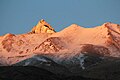
| Ladakh | Saltoro Kangri | Saltoro Mountains section of Karakoram | 7,742 | 25,400 | 35°23′56″N76°50′56″E / 35.399°N 76.849°E | Saltoro Kangri lies on the Actual Ground Position Line between India and Pakistan on the Siachen Glacier. It is the highest peak in the Saltoro Mountains. The highest peak claimed by India as part of Ladakh is K2 which has the elevation of 8,611 m (28,251 ft). K2 is located in the Pakistan-administered territory of Gilgit-Baltistan. [31] [32] [33] |
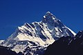
| Jammu and Kashmir | Nun Peak | Western Himalayas | 7,135 | 23,409 | 33°58′51″N76°01′14″E / 33.9809°N 76.0205°E | [34] |
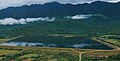
| Andaman and Nicobar Islands | Saddle Peak | North Andaman Island | 732 | 2,402 | 13°09′31″N93°00′21″E / 13.1586°N 93.0058°E | [35] |
| Chandigarh | Unnamed point near Khuda Ali Sher Village | Sivalik Hills | 479 | 1,572 | 30°46′21″N76°49′13″E / 30.7724°N 76.8204°E | Located on the border between Punjab and Chandigarh.[ citation needed ] |
| Dadra and Nagar Haveli and Daman and Diu | Unnamed point near Bedpa Village | Western Ghats | 465 | 1,526 | 20°04′49″N73°12′21″E / 20.0802°N 73.2057°E | Located in Dadra and Nagar Haveli District on the border between Dadra and Nagar Haveli and Daman and Diu and Maharashtra.[ citation needed ] |
| Delhi | Deheri | Delhi Ridge section of the Aravalli Range | 315 | 1,033 | 28°24′39″N77°12′13″E / 28.4108°N 77.2037°E | Located in South Delhi District on the border between Delhi and Haryana.[ citation needed ] |
| Puducherry | Unnamed point near Chalakara Village | West Coast Hillocks | 67 | 219 | 11°43′06″N75°31′54″E / 11.7183°N 75.5317°E | Located in Mahé District on the border between Puducherry and Kerala.[ citation needed ] |
| Lakshadweep | Unnamed point | Agatti Island | 15 | 49 | ||