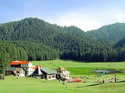
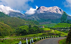
Hill stations are high-altitude towns for recreation, enjoyment and used as a place of refuge to escape the blistering heat in India during summertime. As India is a vast country with limited amounts of the coastal area most of its towns and districts face continental type of climate with summer being very hot so hill stations (as situated on high altitude due to which it faces low temperature) becomes a spot to escape such hot and humid conditions.
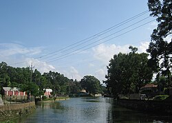
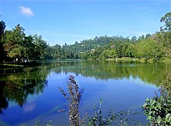
Most hill stations in India were developed by the British around a central mall to get respite from the oppressive summer heat. Many have picturesque lakes as their focal point, making them excellent places for boating activities.
Since a number of these hill stations attract large numbers of tourists in summer as well as other times of the year, they are well connected by rail, road, and air services to major Indian cities.
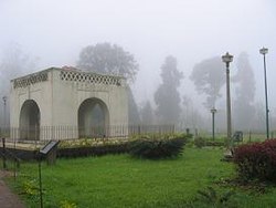
Hill stations in British India were established for a variety of reasons. After the revolt of 1857 the "British sought further distance from what they saw as a "disease-ridden" land by escape to the Himalayas in the north and Nilgiri Hills in the south", a pattern which started even before 1857. Other factors included anxieties about the dangers of life in India, among them "fear of degeneration brought on by too long residence in a debilitating land." The hill stations were meant to reproduce the home country, illustrated in Lord Lytton's statement about Ootacamund, in the 1870s, "such beautiful English rain, such delicious English mud."[6]Shimla was officially made the "summer capital of India" in the 1860s and hill stations "served as vital centers of political and military power, especially after the 1857 revolt."[7]:2
Dane Kennedy, following Monika Bührlein, identifies three stages in the evolution of hill stations in India: high refuge to hill station, and hill station to town. The first settlements started in the 1820s, primarily as sanitoria. In the 1840s and 1850s, there was a wave of new hill stations, with the main impetus being "places to rest and recuperate from the arduous life on the plains". In the second half of the 19th century, there was a period of consolidation with few new hill stations. In the final phase, "hill stations reached their zenith in the late nineteenth century. The political importance of the official stations was underscored by the inauguration of large and costly public-building projects."[7]:14
Siddharth Pandey analyses the femininity often ascribed to Indian hills stations, in their nomenclature (such as 'the Queen of hills', as claimed by Shimla, Ooty, and several other hill stations) as well as the visual aesthetic of their landscapes. He argues that compared to the 'terrifying, sublime landscape' of the high Himalayan peaks and ridges, the hill stations have a gentler aspect, manageable and conducive for domestication. With ideas of domesticity having been traditionally associated with the feminine and household spheres, hill stations, which were developed by the colonialists as 'homes away from home', acquired over time a sense of being feminine, in terms of both their natural as well as their architectural beauty.[8]
This page is based on this Wikipedia article Text is available under the CC BY-SA 4.0 license; additional terms may apply. Images, videos and audio are available under their respective licenses.