Icche Gaon

Last updated

Ichhe Gaon
Village
Icche Gaon, Kalimpong View 2.jpg
Ichhe Gaon village
West Bengal location map.svg
Red pog.svg
Ichhe Gaon
Location in West Bengal, India
India location map.svg
Red pog.svg
Ichhe Gaon
Ichhe Gaon (India)
Coordinates: 27°08′01″N88°34′32″E / 27.13361°N 88.57556°E / 27.13361; 88.57556
CountryFlag of India.svg  India
State West Bengal
District Kalimpong
Time zone UTC+5:30 (IST)
Vehicle registration WB
Lok Sabha constituency Darjeeling
Vidhan Sabha constituency Kalimpong
Website kalimpongdistrict.in

Icche Gaon or Echey Gaon is a village in the Kalimpong II CD block in the Kalimpong Sadar subdivision of the Kalimpong district of the state of West Bengal, India.

Contents

Geography

Icche Gaon
Places in the Kalimpong Sadar subdivision in Kalimpong district
CT: census town, R: rural/ urban centre, M: municipality, F: facility, NP: national park
Abbreviations used in names – TG for Tea Garden (town/village)
Owing to space constraints in the small map, the actual locations in a larger map may vary slightly

Location

Icche Gaon is located at 27°08′01″N88°34′32″E / 27.13361°N 88.57556°E / 27.13361; 88.57556 .

Icche Gaon, situated at 5800 ft above mean sea level, has a view of Mount Kangchenjunga and nearby peaks. Icche Gaon is located 89 km from New Jalpaiguri.

Area overview

The map alongside shows the Kalimpong Sadar subdivision of Kalimpong district. Physiographically, this area forms the Kalimpong Range, with the average elevation varying from 300 to 3,000 metres (980 to 9,840 ft). This region is characterized by abruptly rising hills and numerous small streams. [1] It is a predominantly rural area with 77.67% of the population living in rural areas and only 22.23% living in the urban areas. While Kalimpong is the only municipality, Dungra is the sole census town in the entire area. [2] The economy is agro-based and there are 6 tea gardens in the Gorubathan CD block. [3] In 2011, Kalimpong subdivision had a literacy rate of 81.85%, comparable with the highest levels of literacy in the districts of the state. [4] [5] While the first degree college in the subdivision was established at Kalimpong in 1962 [6] the entire subdivision (and now the entire district), other than the head-quarters, had to wait till as late as 2015 (more than half a century) to have their first degree colleges at Pedong and Gorubathan. [7] [8]

Note: The map alongside presents some of the notable locations in the subdivision. All places marked in the map are linked in the larger full screen map.

Avi Flora and Fauna

In October this hilly region is flooded with different colors like white, orange, maroon and golden yellow Marigolds. Different types of ferns including tree fern and countless types of flowerless plants, mosses, algae, fungi, birches, orchids and among trees; oaks, pines, chestnuts, maples are seen here. Ichche Gaon is the home of varieties of beautiful birds like flycatchers, orioles, finches, sunbirds, woodpeckers, rufous sibia, emerald cuckoos, three-toed kingfisher and blue whistling thrush [9]

Tourism

Ichche Gaon is surrounded by many trekking courses. Those trekking courses leads towards the absolute most pictorial view points of Ichche Gaon like Ramitey Dara, Tinchuley and Jalsa. Ramitey Dara offers the all encompassing perspective on river Teesta making the unbelievable 14 turns through the rugged Himalayan valley. On a clear day tourists can get perspective on Mt. Kanchenjunga alongside the towns of Sikkim, Jelep La and Nathula from Tinchuley. Damsang fortress, the last home of the Lepcha King-GyaboAchuk, situated at a distance of 6 km from Icche Gaon is additionally a fascination in the sightseers. Another fascination here is the Sangchen Dorjee Monastery worked around 300 years back, this Monastery gives an understanding into the history and culture of Pedong and the surroundings. Another well known perspective here is Rikisum. 15 km from Pedong Bazaar, are the Reshi Bridge and Reshi Khola, are additionally worth visiting. Rishi and Mudum Khola combine to frame Rishi Khola just before the scaffold, and has an enchanting sentimental vibe, along these lines being a well known decision for the travelers.

Related Research Articles

<span class="mw-page-title-main">Lava, West Bengal</span> Village Hill station in West Bengal, India

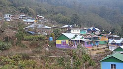
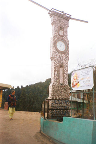
Lava is a town in the Kalimpong II CD block in the Kalimpong subdivision of the Kalimpong district in the Indian state of West Bengal. As it lies in the high altitude, so it is also visible from high altitude towns and villages of East Sikkim, high areas of Bhutan and also from Pakyong Airport. The climate of the town is usually very cold because of high altitude making it a perfect place for tourists during summer season.

Jaldhaka is a small town in the Gorubathan CD block in the Kalimpong Sadar subdivision of the Kalimpong district in the state of West Bengal, India. It lies on the bank of Jaldhaka River.

Loleygaon is a village in the Kalimpong II CD block in the Kalimpong Sadar subdivision of the Kalimpong district in the Indian state of West Bengal.

<span class="mw-page-title-main">Suntalekhola</span> Village in West Bengal, India

Suntalekhola or Suntaley Khola is a village and a tourist spot in the Gorubathan CD block in the Kalimpong Sadar subdivision of Kalimpong District in the state of West Bengal, India.

Bindu is a village in the Gorubathan CD block in the Kalimpong subdivision of the Kalimpong district in West Bengal, India. Bindu lies in the Indo-Bhutan border, India's second oldest dam is situated at Bindu on River Jaldhaka. It is located 121 Km from Kalimpong Town, 103 Km from Siliguri City and 85 km from Jalpaiguri city. It takes around 4hrs from Siliguri to reach Bindu. Roadway is the only option to reach Bindu. The roads are good for most part of the journey but during the last 15-20 Km it's mostly off road. As of 2023, a road is under construction by the Border Road Organization and is due to connect Bindu and surrounding area with NH17.

Mongpong is a village in the Kalimpong I CD block in the Kalimpong subdivision of the Kalimpong district of West Bengal, India.

<span class="mw-page-title-main">Jhalong</span> Village in West Bengal, India

Jholung or Jholong is a village in the Gorubathan CD block in the Kalimpong subdivision of the Kalimpong district in West Bengal, India.

Bich Kagay is a village in the Kalimpong II CD block in the Kalimpong Sadar subdivision of the Kalimpong district in West Bengal, India

Sillery Gaon is a village in the Kalimpong II CD block in the Kalimpong Sadar subdivision of the Kalimpong district in the state of West Bengal, India.

<span class="mw-page-title-main">Rishyap</span> Village in West Bengal, India

Rishyap is a village in the Kalimpong II CD block in the Kalimpong subdivision of the Kalimpong district in the Indian state of West Bengal.

Kolakham is a village in the Kalimpong II CD block in the Kalimpong Sadar subdivision of Kalimpong district in the state of West Bengal, India.

Ramdhura is a village in Kalimpong II CD block in the Kalimpong Sadar subdivision of the Kalimpong district in the state of West Bengal, India.

Kumai Tea Garden is a village in the Gorubathan CD block in the Kalimpong Sadar subdivision of the Kalimpong district in the state of West Bengal, India.

Samabiyong Tea Garden is a village in the Gorubathan CD block in the Kalimpong Sadar subdivision of the Kalimpong district in the state of West Bengal, India.

Dungra is a census town in the Kalimpong I CD block in the Kalimpong Sadar subdivision of the Kalimpong district in the state of West Bengal, India.

Rongo is a village in the Gorubathan CD block in the Kalimpong Sadar subdivision of the Kalimpong district in the state of West Bengal, India.

Bhalukhop is a village in the Kalimpong I CD block in the Kalimpong Sadar subdivision of the Kalimpong district in the state of West Bengal, India.

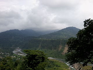
Kalijhora is an urban village in the Kalimpong I CD block that lies on the bank of River Teesta, in the Kalimpong Sadar subdivision of the Kalimpong district in the state of West Bengal, India. National Highway 10 connecting Siliguri and Gangtok passes through Kalijhora. Teesta Low Dam - IV Hydropower Plant Dam lies in Kalijhora.

Nimbong is a village in the Kalimpong I CD block in the Kalimpong Sadar subdivision of the Kalimpong district in the state of West Bengal, India.

Mansong is a village in the Kalimpong II CD block in the Kalimpong Sadar subdivision of the Kalimpong district in the state of West Bengal, India.

References

  1. "District Census Handbook, Darjeeling, Series 20, Part XII A, 2011 Census of India" (PDF). Page 13: Physiography. Directorate of Census Operations, West Bengal. Retrieved 6 April 2020.
  2. "District Statistical Handbook 2013 Darjeeling". Table 2.4b. Department of Statistics and Programme Implementation, Government of West Bengal. Retrieved 6 April 2020.[ permanent dead link ]
  3. "About Kalimpong District". Tea Gardens. District administration. Retrieved 6 April 2020.
  4. "District Statistical Handbook 2013 Darjeeling". Table 4.5. Department of Statistics and Programme Implementation, Government of West Bengal. Retrieved 6 April 2020.[ permanent dead link ]
  5. "Provisional Population Totals Paper 1 of 2011 : West Bengal". Statement-4 Ranking of Districts by Literacy Rate in 2001 and 2011. Office of the Registrar General and & Census Commissioner, India, Ministry of Home Affairs, Government of India. Retrieved 20 June 2012.
  6. "Kalimpong College". College Admission. Retrieved 6 April 2020.
  7. "Government General Degree College at Pedong". GGDC. Retrieved 6 April 2020.
  8. "Government General Degree College, Gorubathan". GGDC. Retrieved 6 April 2020.
  9. "Flora and fauna of Darjeeling". darjeeling.gov.in. Archived from the original on 24 August 2007.