Lower Fagu Tea Garden

Last updated

Lower Fagu Tea Garden
Village
West Bengal location map.svg
Red pog.svg
Lower Fagu Tea Garden
Location in West Bengal, India
India location map.svg
Red pog.svg
Lower Fagu Tea Garden
Lower Fagu Tea Garden (India)
Coordinates: 26°56′59″N88°42′48″E / 26.9498°N 88.7132°E / 26.9498; 88.7132 Coordinates: 26°56′59″N88°42′48″E / 26.9498°N 88.7132°E / 26.9498; 88.7132
CountryFlag of India.svg  India
State West Bengal
District Kalimpong
Time zone UTC+5:30 (IST)
Vehicle registration WB
Lok Sabha constituency Darjeeling
Vidhan Sabha constituency Kalimpong
Website kalimpongdistrict.in

Lower Fagu Tea Garden is a village in the Gorubathan CD block in the Kalimpong Sadar subdivision of Kalimpong district in West Bengal, India.

Contents

Geography

Places in the Kalimpong Sadar subdivision in Kalimpong district
CT: census town, R: rural/ urban centre, M: municipality, F: facility, NP: national park
Abbreviations used in names – TG for Tea Garden (town/village)
Owing to space constraints in the small map, the actual locations in a larger map may vary slightly

Location

Lower Fagu Tea Garden is located at 26°56′59″N88°42′48″E / 26.9498°N 88.7132°E / 26.9498; 88.7132

Area overview

The map alongside shows the Kalimpong Sadar subdivision of Kalimpong district. Physiographically, this area forms the Kalimpong Range, with the average elevation varying from 300 to 3,000 metres (980 to 9,840 ft). This region is characterized by abruptly rising hills and numerous small streams. [1] It is a predominantly rural area with 77.67% of the population living in rural areas and only 22.23% living in the urban areas. While Kalimpong is the only municipality, Dungra is the sole census town in the entire area. [2] The economy is agro-based and there are 6 tea gardens in the Gorubathan CD block. [3] In 2011, Kalimpong subdivision had a literacy rate of 81.85%, comparable with the highest levels of literacy in the districts of the state. [4] [5] While the first degree college in the subdivision was established at Kalimpong in 1962 [6] the entire subdivision (and now the entire district), other than the head-quarters, had to wait till as late as 2015 (more than half a century) to have their first degree colleges at Pedong and Gorubathan. [7] [8]

Note: The map alongside presents some of the notable locations in the subdivision. All places marked in the map are linked in the larger full screen map.

The place

The area falls under the 43rd constituency of Gorkhaland Territorial Administration (GTA). It is situated on the eastern part of Chel river, Sombaray Bazar. The area is bordered in the south by Bhuttabari forest area, in the north by Ahaley Busty and in the east by Mission Hill Tea Estate. It lies about 60 km far from Siliguri, 20 km from Mal Bazar and 2 km from Sombaray Bazar. It comes under Gorubathan police station.

Demographics

According to the 2011 Census of India, Lower Fagu Tea Garden had a total population of 2,070 of which 1,017 (49%) were males and 1,053 (51%) were females. There were 218 persons in the age range of 0 to 6 years. The total number of literate people in Lower Fagu Tea Garden was 1,356 (73.22% of the population over 6 years). [9]

Transport

The area is well connected by road. The nearest railway station is New Mal Junction which is about 20 km far from Fagu. Fagu can be reached via bus, small vehicles, hired taxi, etc. from Siliguri, Jalpaiguri, Darjeeling, Kakarvitta (Nepal), Mal Bazar, Gangtok and Kalimpong. National Highway 717A Passes through Fagu.

Economy

The nearest market of Lower Fagu is Sombaray Bazar (Weekly Market organised on Monday/Sombaar). People go for weekly marketing on Monday and purchase their necessary household items. Ganti (Village market) is organised every Saturday just in front of Fagu tea factory where some local vendors sell locally cultivated items like vegetables, food items etc.

The area is one of the leading supplier of Areca Nut ( betel nut). The people generally sell their respective Areca nut garden to various businessmen who later supply it to different locations.

Education

The one and only school of Lower Fagu is Lower Fagu Primary School (Estd-1956) being run by District Primary Board. Many of students enrolled are mainly children of Tea Garden worker. Apart from this another school namely Sanatan Vedic Primary School (Estd 1986) which is situated near Lower Fagu also attended by some students of Lower Fagu. One Private school namely Morning Glory English School is also run by some individual here. After completing the primary school, the students enrol themselves either in Judhabir Higher Secondary School or at other private schools as well as educational institutions at Kalimpong, Darjeeling & Siliguri etc. The one and only Degree College of Gorubathan is Government General Degree College, Gorubathan and offers Arts & Science courses. It was established in the year 2015 and is located in Lower Fagu (Fagu - Mission Hill Road).

Major attraction

The major attraction of Lower Fagu is green Tea Garden. The green foothills around Fagu are really breathtaking. Apart from this one can enjoy at Fagu bungalow which is located at the northernmost tip of Lower Fagu. The Fagu Bungalow was constructed by the then British tea garden owner during colonial era. Now it has been converted as The Fagu Reserve (website - www.thereserve.in). One can enjoy the beauty of some parts of Tarai areas, rivers and Dooars from here. [10]

Gupteswar Temple of Lord Shiva is also located at Lower Fagu. It is one of the famous Hindu temples in the area. One Roman Catholic Church named St. Francis of Assisi also located here in the heart of Lower Fagu. A temple of Sri Satya Sai Baba is also situated here at top line.

Related Research Articles

Teesta Bazaar Village in West Bengal, India

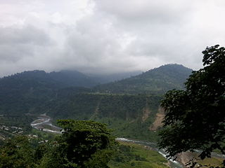
Teesta Bazaar is a village located 4 km (2.5 mi) downstream from the town of Melli on the right bank of Teesta River in the Kalimpong I CD block in the Kalimpong subdivision of Kalimpong district of the state of West Bengal, India.

Lava, West Bengal Village Hill station in West Bengal, India

Lava is a town in the Kalimpong II CD block in the Kalimpong subdivision of the Kalimpong district in the Indian state of West Bengal. As it lies in the high altitude, so it is also visible from high altitude towns and villages of East Sikkim, high areas of Bhutan and also from Pakyong Airport. The climate of the town is usually very cold because of high altitude making it a perfect place for tourists during summer season.

Pedong Town in West Bengal, India

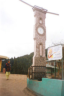
Pedong is a town in the Kalimpong II CD block in the Kalimpong subdivision of the Kalimpong district in the Indian state of West Bengal. The town is very close to Resi-Sikkim border. Pedong lies on the National Highway-717A connecting Bagrakote to Gangtok via Pakyong Airport.

Algarah Town in West Bengal, India

Algarah is a town in Kalimpong II CD block in the Kalimpong subdivision of the Kalimpong district of West Bengal, India. The town lies on National Highway-717A connecting Bagrakote to Gangtok.

Jaldhaka Town in West Bengal, India

Jaldhaka is a small town in the Gorubathan CD block in the Kalimpong Sadar subdivision of the Kalimpong district in the state of West Bengal, India. It lies on the bank of Jaldhaka River.

Loleygaon Village in West Bengal, India

Loleygaon is a village in the Kalimpong II CD block in the Kalimpong Sadar subdivision of the Kalimpong district in the Indian state of West Bengal.

Gorubathan Town in West Bengal, India

Gorubathan is a small town in the Gorubathan CD block in the Kalimpong Sadar subdivision of the Kalimpong district in the Indian state of West Bengal.

Mongpong Village in West Bengal, India

Mongpong is a village in the Kalimpong I CD block in the Kalimpong subdivision of the Kalimpong district of West Bengal, India.

Kalimpong Sadar subdivision Subdivision in West Bengal, India

Kalimpong Sadar is the only subdivision of the Kalimpong district in the state of West Bengal, India. It was initially formed as 'Kalimpong subdivision' when the British annexed the territory from Bhutan in 1864. It was then part of Darjeeling district. The subdivision has its headquarters at Kalimpong Town. On 14 February 2017 the subdivision was promoted to a district, becoming Kalimpong district independent of Darjeeling.

Jhalong Village in West Bengal, India

Jholung or Jholong is a village in the Gorubathan CD block in the Kalimpong subdivision of the Kalimpong district in West Bengal, India.

Bich Kagay Village in West Bengal, India

Bich Kagay is a village in the Kalimpong II CD block in the Kalimpong Sadar subdivision of the Kalimpong district in West Bengal, India

Sillery Gaon Village in West Bengal, India

Sillery Gaon is a village in the Kalimpong II CD block in the Kalimpong Sadar subdivision of the Kalimpong district in the state of West Bengal, India.

Rishyap Village in West Bengal, India

Rishyap is a village in the Kalimpong II CD block in the Kalimpong subdivision of the Kalimpong district in the Indian state of West Bengal.

Kumai Tea Garden Village in West Bengal, India

Kumai Tea Garden is a village in the Gorubathan CD block in the Kalimpong Sadar subdivision of the Kalimpong district in the state of West Bengal, India.

Samabiyong Tea Garden Village in West Bengal, India

Samabiyong Tea Garden is a village in the Gorubathan CD block in the Kalimpong Sadar subdivision of the Kalimpong district in the state of West Bengal, India.

Rambi Bazar Village in West Bengal, India

Rambi Bazar is a village in the Kalimpong I CD block in the Kalimpong Sadar subdivision of the Kalimpong district in the state of West Bengal, India. The town lies on the National Highway 10 connecting Siliguri and Gangtok.

Rongo, Kalimpong Village in West Bengal, India

Rongo is a village in the Gorubathan CD block in the Kalimpong Sadar subdivision of the Kalimpong district in the state of West Bengal, India.

Bhalukhop Village in West Bengal, India

Bhalukhop is a village in the Kalimpong I CD block in the Kalimpong Sadar subdivision of the Kalimpong district in the state of West Bengal, India.

Kalijhora Village in West Bengal, India

Kalijhora is a village in the Kalimpong I CD block that lies on the bank of River Teesta, in the Kalimpong Sadar subdivision of the Kalimpong district in the state of West Bengal, India. National Highway 10 connecting Siliguri and Gangtok passes through Kalijhora.

Nimbong Village in West Bengal, India

Nimbong is a village in the Kalimpong I CD block in the Kalimpong Sadar subdivision of the Kalimpong district in the state of West Bengal, India.

References

  1. "District Census Handbook, Darjeeling, Series 20, Part XII A, 2011 Census of India" (PDF). Page 13: Physiography. Directorate of Census Operations, West Bengal. Retrieved 6 April 2020.
  2. "District Statistical Handbook 2013 Darjeeling". Table 2.4b. Department of Statistics and Programme Implementation, Government of West Bengal. Retrieved 6 April 2020.
  3. "About Kalimpong District". Tea Gardens. District administration. Retrieved 6 April 2020.
  4. "District Statistical Handbook 2013 Darjeeling". Table 4.5. Department of Statistics and Programme Implementation, Government of West Bengal. Retrieved 6 April 2020.
  5. "Provisional Population Totals Paper 1 of 2011 : West Bengal". Statement-4 Ranking of Districts by Literacy Rate in 2001 and 2011. Office of the Registrar General and & Census Commissioner, India, Ministry of Home Affairs, Government of India. Retrieved 20 June 2012.
  6. "Kalimpong College". College Admission. Retrieved 6 April 2020.
  7. "Government General Degree College at Pedong". GGDC. Retrieved 6 April 2020.
  8. "Government General Degree College, Gorubathan". GGDC. Retrieved 6 April 2020.
  9. "2011 Census – Primary Census Abstract Data Tables". West Bengal – District-wise. Registrar General and Census Commissioner, India. Retrieved 1 April 2020.
  10. "Fagu Tea Bungalow, Gorubathan, 75 km from Siliguri". Weekend Destinations. Retrieved 19 July 2020.