Mahendragarh

Last updated • 3 min readFrom Wikipedia, The Free Encyclopedia

Mahendragarh
City
India Haryana location map.svg
Red pog.svg
Mahendragarh
Location in Haryana, India
India location map.svg
Red pog.svg
Mahendragarh
Mahendragarh (India)
Coordinates: 28°17′N76°09′E / 28.28°N 76.15°E / 28.28; 76.15
CountryFlag of India.svg  India
State Haryana
District Mahendragarh
Elevation
262 m (860 ft)
Population
 (2011)
  Total
29,128
Languages
  Official Hindi
  Spoken Haryanvi
Time zone UTC+5:30 (IST)
PIN
123029
ISO 3166 code IN-HR
Vehicle registration HR-34
Website www.mahendragarh.gov.in

Mahendragarh is a city and a municipal committee in Mahendragarh district in the Indian state of Haryana. [1] It is 100 kilometres (62 mi) from Gurgaon and comes under National Capital Region (India). [2]

Contents

Etymology

Earlier earlier was known as Kanaud because its was founded and inhabited by Kanaudia Brahmins. [3] In 1860s it was renamed after Maharaja Mahendra Singh (r. 1721-1748 CE) of Patiala State who was gifted this area by the British East India Company rule for his help in crushing the Indian Rebellion of 1857 in this area. [4]

Geography

Mahendragarh is located at 28°17′N76°09′E / 28.28°N 76.15°E / 28.28; 76.15 . [5] It has an average elevation of 262 metres (859 feet). Mahendragarh district is bounded on the north by Charkhi DadriBhiwani and jhajjar districts, on the east by Rewari district and Alwar district of Rajasthan, on the south by Alwar, Jaipur and Sikar districts of Rajasthan, and on the west by Sikar and Jhunjhunu districts of Rajasthan. It has five tehsils of Kanina, Narnaul, Ateli, Nangal Choudhary And Mahendergarh.

It is situated at the bank of Dohan River (which was a seasonal river), which is at the verge of extinction.

History

Kannud Fort Kannud fort.jpg
Kannud Fort

Fort of Kanod was built by Maratha ruler Tatya Tope in 1755 CE. In 1860, it came under the Patiala State during the British raj. ruler of Patiala, Narendra Singh, changed the name of Kanod Fort to Mahandragarh after his son Mahendra. Because of the name of the fort, this town came to be known as Mahendragarh and the name of Narnaul Nizam was changed to Mahendragarh Nizam. [6]

It is said that Malik Mahadud Khan, a servant of Babar had settled a habitation here.

In 1948, with the formation of PEPSU, Mahendragarh territory from Patiala State, Dadri territory (Now Charkhi Dadri) from Jind and Bawal territory from Nabha State were constituted into Mahendragarh district with the headquarters at Narnaul. At that time, there were three tehsils, namely; Narnaul, Charkhi Dadri and Bawal and Mahendragarh was a sub-tehsil.

In 1949, Mahendragarh sub-tehsil was made a tehsil. In 1950, Bawal tehsil was broken up and 78 villages were transferred to Gurgaon district forming Bawal as a sub-tehsil and remaining villages were added to Narnaul and Mahendragarh. In 1956 the Rewari tehsil (except 61 villages ) was excluded from Gurgaon district and included in Mahendragarh district. The Charkhi-Dadri sub-division was excluded from Mahendragarh district and included in the newly constituted district of Bhiwani. In 1977, 81 villages of Rewari tehsil was constituted into Bawal tehsil. In 1978 the district comprised 4 tehsils (Mahendragarh, Rewari, Narnaul and Bawal). On 1 November 1989, Rewari and Bawal tehsils (taken from Mahendragarh district) and Kosli tehsil except 10 villages (taken from Rohtak district) were constituted into a new district of Rewari. Presently Mahendragarh district has 3 sub-divisions (Kanina, Narnaul and Mahendergarh), 5 tehsils (Kanina, Mahendragarh, Nangal Chaudhary, Ateli, Narnaul) and 1 sub-tehsil (Satnali).

Demographics

As of 2011 India census, [7] Mahendragarh had a population of 23,977. Males constitute 53% of the population and females 47%. Mahendragarh has an average literacy rate of 76, higher than the national average of 75%: male literacy is 89%, and female literacy is 67%. In Mahendragarh, 14% of the population is under 6 years of age. Hindus constitute 98% of the population, in which Yaduvanshi Ahirs are in majority. This area produce good and strong built soldiers. Maximum house found with participation in WW-1 & WW-2.

In spite of being a district headquarters, there is no administrative office. All the relevant work is done in Narnaul. The very first guggul (Commiphora wightii) vatika (place where medicinal plants are planted) was established here.

Now many government offices have opened in Mahendragarh near Government Boys college in new Court.

Education

Social groups

According to Haryana District Gazetteers: Mahendragarh Yadavs form the agricultural backbone of the district. However Yadavs are in majority in the district. [8] [9]

Notable people

Related Research Articles

<span class="mw-page-title-main">Mahendragarh district</span> District in Haryana, India

Mahendragarh district is one of the 22 districts of Haryana state in northern India. The district occupies an area of 1,899 km² and has a population of 922,088 (2021census). District have 4 Sub-divisions : Narnaul, Mahendragarh, Nangal Chaudhary and Kanina

<span class="mw-page-title-main">Rewari</span> City in Haryana, India

Rewari is a city and a municipal council in Rewari district in the Indian state of Haryana. It is district headquarter of Rewari district. It is located in south-west Haryana around 82 km from Delhi and 51 km from Gurgaon. It lies in Ahirwal region.

<span class="mw-page-title-main">Ateli</span> Town in Haryana, India

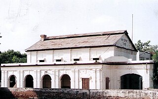
Ateli is a small town and a municipal committee near Narnaul in Mahendragarh district in the north Indian state of Haryana. 8 villages are in Ateli tehsil.

Nangal Choudhary is an important town and a Sub Division in the District Mahendragarh near Narnaul in India, within the National Capital Region of India. It comes in Ahirwal region. It is a municipal committee in Mahendragarh district.

Kanina is a famous town and a sub division in Mahendragarh district in the Indian state of Haryana, within the National Capital Region of India.It is one of three administrative blocks of Mahendragarh district and is adjacent to Rewari, Narnaul,Charkhi Dadri, and Jhajjar. It comes in Ahirwal region. It is a municipal committee of Kanina Subdivision in Mahendragarh district.

<span class="mw-page-title-main">Administrative divisions of Haryana</span> Regional divisions in Haryana

Haryana, formed on 1 November 1966, is a state in North India. For the administrative purpose, Haryana is divided into 6 revenue divisions which are further divided into 22 districts. For Law and Order maintenance, it is divided into 5 Police Ranges and 4 Police Commissionerates.

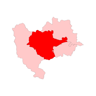
Bhiwani–Mahendragarh is one of the ten Lok Sabha (parliamentary) constituencies in Haryana state in northern India. This constituency came into existence in 2008 as a part of the implementation of the recommendations of the Delimitation Commission of India constituted in 2002.

<span class="mw-page-title-main">Tosham Assembly constituency</span> Constituency of the Haryana legislative assembly in India

Tosham Assembly constituency is one of the 90 Vidhan Sabha constituencies in Haryana state in northern India.

<span class="mw-page-title-main">Dadri, Haryana Assembly constituency</span> Constituency of the Haryana legislative assembly in India

Charkhi Dadri Assembly constituency is one of the 90 Vidhan Sabha constituencies in Haryana state in northern India.

Kotia is a village located in Kanina tehsil, district Mahendragarh, Haryana state of India. It is on the Kosli–Kanina road and is 17 kilometres from Kosli and 3 kilometres from Kanina.

<span class="mw-page-title-main">Bawwa</span> Village in Haryana, India

Bawwa is a village in the Nahar Block of the Rewari District in Haryana, India. It is located 50 kilometres (31 mi) northwest of the district headquarters of Rewari, 10 kilometres (6.2 mi) west-southwest of Nahar, and 320 kilometres (200 mi) from the state capital Chandigarh. Karoli, Garhs, Sihor, Bahala, Naya-Gaon, and Gadhi are the neighboring villages. Bawwa is situated approximately 3 km from Karoli mod on Kanina-Bahu-Jholri road in the Rewari District.

Gahra is a village in Kanina on an approach road 4 km in Mahendragarh District of Haryana State, India. It is located 47 km to the north of District headquarters Narnaul. 4 km from Kanina. 312 km from State capital Chandigarh.

Jhook is a village in Mahendragarh Tehsil in Mahendragarh District of Haryana State, India. It belongs to Gurgaon Division. It is located 37.0 kilometres (23.0 mi) north of the district headquarters at Narnaul and 7.0 kilometres (4.3 mi) from Mahendragarh, its postal head office. It is near to Rewari-Kanina- Mahendergarh road on approach road.

Guwani is a village in Narnaul Tehsil, Mahendragarh District, Haryana, India, in Gurgaon division. Guwani is near the Rewari-Kanina- Mahendergarh road, 11.0 kilometres (6.8 mi) east of the district headquarters at Narnaul. Its postal head office is at Narnaul.

Pota is a village panchayat located in the Mahendragarh district in the Indian state of Haryana.

<span class="mw-page-title-main">Badhra Assembly constituency</span> Constituency of the Haryana legislative assembly in India

Badhra Assembly constituency is one of the 90 Vidhan Sabha constituencies in Haryana state in northern India.

National Highway 148B starts at Kotputli, state of Rajasthan and ends at Bathinda, state of Punjab. The major towns are in succession of distance on this highway: Narnaul, Mahendergarh, Charkhi Dadri, Bhiwani, Hansi, Barwala, Bhimewala Tohana, Moonak, Jakhal, Bareta, Budhlada, Bhikhi, Mansa and Maur. This highway meets with National Highway 54 at Bathinda. The highway is 427 km (265 mi) long and runs all within the states of Haryana, Punjab and Rajasthan.

<span class="mw-page-title-main">Rail transport in Haryana</span> Train service in the northern Indian state

Rail transport in the state of Haryana, India, is conducted by five rail divisions in three zones: the North Western Railway zone, Northern Railway zone, and North Central Railway zone. The Diamond Quadrilateral high-speed rail network, Eastern Dedicated Freight Corridor, and Western Dedicated Freight Corridor pass through Haryana.

The Trans-Haryana Expressway or the Ambala–Narnaul Expressway (NH-152D) is a 227-km long, 6-lane wide greenfield access-controlled expressway, connecting the cities of Ambala and Narnaul in the state of Haryana. The expressway connects Gangheri village in Kurukshetra district with Surana village on Narnaul Bypass (NH-148B) in Mahendragarh district. It passes via Kaul, Pundri, Pillu khera, Julana, Kalanaur, Charkhi Dadri and Kanina. It will reduce the distance from Chandigarh to Delhi, Narnaul, and Jaipur, thus decongesting NH-44 and NH-48.

References

  1. "Gurgaon per capita income 10 times that of Mahendragarh". Indian Express. 19 January 2013. Retrieved 6 July 2014.
  2. "Mahendragarh, Bhiwani included in NCR". Hindustan Times. Archived from the original on 7 September 2013. Retrieved 6 July 2014.
  3. Publication, Mocktime. Haryana General Knowledge - A Comprehensive Coverage. by Mocktime Publication.
  4. Magnificent havelis of Nangal-Sirohi, The Tribune, 22 June 2002.
  5. Falling Rain Genomics, Inc - Mahendragarh
  6. Sohan Singh Khattar and Reena Kar, 2021, Know Your State Haryana, Arihant Publications, pp 308.
  7. "Census of India 2001: Data from the 2001 Census, including cities, villages and towns (Provisional)". Census Commission of India. Archived from the original on 16 June 2004. Retrieved 1 November 2008.
  8. Haryana (India) (1988). Haryana District Gazetteers: Mahendragarh. Haryana Gazetteers Organization.
  9. Haryana District Gazetteers: Mahendragarh-page-67