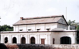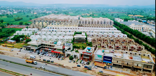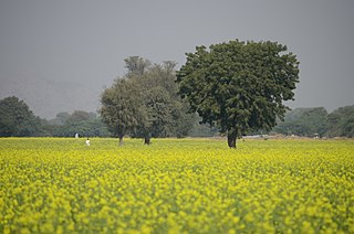
Rewari district is one of the 22 districts in the state of Haryana, India. It was carved out of Gurgaon district by the Government of Haryana on 1 November 1989. It is also part of the National Capital Region. The administrative headquarter of the district is the city of Rewari, which is also the biggest city in the district. In medieval times, it was an important market town. It is located in southern Haryana. As of 2011, it is the second least populous district of Haryana after Panchkula.

Mahendragarh district is one of the 22 districts of Haryana state in northern India. The district occupies an area of 1,899 km² and has a population of 922,088 (2021census). District have 4 Sub-divisions : Narnaul, Mahendragarh, Nangal Chaudhary and Kanina
Mahendragarh is a city and a municipal committee in Mahendragarh district in the Indian state of Haryana. It is 100 kilometres (62 mi) from Gurgaon and comes under National Capital Region (India).

Rewari is a city and a municipal council in Rewari district in the Indian state of Haryana. It is district headquarter of Rewari district. It is located in south-west Haryana around 82 km from Delhi and 51 km from Gurgaon. It lies in Ahirwal region.
Bawal is a big industrial town located, near Rewari city in Rewari district in Indian state of Haryana. It lies in the National Capital Region (NCR) of India. It is located on national highway NH 48, 11 km from Rewari, the district headquarter, 50 km from Gurugram and 91 km from New Delhi railway station. Bawal Tehsil is a part of the Rewari district. It was one of the three districts of the erstwhile Nabha State under British Raj.

Behror is a city in the Kotpulti-Behror district of Rajasthan of the Jaipur division. It serves as the administrative headquarters of the eponymous Behror Tehsil and shares headquarters for Kotputli-Behror district with Kotputli. It is equidistant from both state capital Jaipur and national capital New Delhi. Located 120 km south-west of New Delhi and as a part of National Capital Region, it is regulated under National Capital Region Planning Board which is a federal authority for urban planning purposes in NCR. Along with Shahjahanpur and Neemrana it is grouped as SNB Complex (Shahjahanpur-Neemrana-Behror) of NCR- which includes 137 revenue villages, in which Behror municipality is the largest urban conglomeration. This region is also known as 'Ahirwal region' or simply as Raath and is an important industrial hub for the state of Rajasthan. Behror municipality spreads out in an area of 15 km2 is divided into four revenue villages namely Behror tarf Gangabishan, Behror tarf Doongrasi, Behror tarf Nainsukh, Behror tarf Balram.
Mandawar is a town in the Dausa district in the Indian state of Rajasthan. It is located about 140 km (87 mi) from the state capital, Jaipur and 250 km (160 mi) from Delhi.for ro sale and service please make call 9024242690
National Highway 11 or NH 11 is a National Highway in India that links Jaisalmer (Rajasthan) and Rewari (Haryana). This 848 km-long highway passes through Myajlar, Pithala, Jaisalmer, Pokaran, Ramdevara, Phalodi, Bap, Diyatra Gajner, Bikaner, Sri Dungargarh, Rajaldesar, Ratangarh, Rolsabsar, Fatehpur, Tajsar, Mandawa, Jhunjhunu, Bagar, Chirawa, Singhana, Pacheri, Narnaul, Ateli and Rewari.
Nangli Godha is a village in Rewari tehsil of Rewari in the Indian state of Haryana.
Karoli is a village located in Kosli Tehsil, Rewari District, Haryana, India. It is on the 1.5-kilometre approach road boarded to Bahu-Jholri on the Kosli–Kanina road and is 12 kilometres from Kosli and 7 kilometres from Kanina. The villages is 125 kilometres from Delhi, the capital of India. It is a large village with an approximate population of 5,000 to 5,500. There is an average of one person in the army from each family. Smt. Kamala Devi is second ladies sarpanch of the village after Smt. Bhoori Devi. There are numerous temples in the village, of which that of Baba Thakur Ji and Baba Lal Das Hanuman Mandir has a special importance. All the villagers used to have dinner in the temple on Holi. The village school was earlier up to class 10 and due to excellent results in the entire district, the school has been upgraded to Senior Secondary School. The village was the birthplace of Hari Ram Arya, the Chairman of Haryana Azad Hind Fouj who participated in the Indian Independence Movement.

Kotkasim is a Nagar Palika of Khairtal of the Indian state, Rajasthan.
Kotia is a village located in Kanina tehsil, district Mahendragarh, Haryana state of India. It is on the Kosli–Kanina road and is 17 kilometres from Kosli and 3 kilometres from Kanina.

Bawwa is a village in the Nahar Block of the Rewari District in Haryana, India. It is located 50 kilometres (31 mi) northwest of the district headquarters of Rewari, 10 kilometres (6.2 mi) west-southwest of Nahar, and 320 kilometres (200 mi) from the state capital Chandigarh. Karoli, Garhs, Sihor, Bahala, Naya-Gaon, and Gadhi are the neighboring villages. Bawwa is situated approximately 3 km from Karoli mod on Kanina-Bahu-Jholri road in the Rewari District.
Mamaria is a village in Rewari mandal of the Rewari district, in the Indian state of Haryana. It consists of three adjacent settlements. It is on the Rewari-Narnaul road at about 30 kilometres (19 mi) on the approach District Road. Mamaria can be also accessed through Rewari-Mahendergarh road.
Gothra is a village on the Rewari-Narnaul road, 15 kilometres (9.3 mi) from Rewari in the Rewari, Haryana, India. It is also known as Gothra Pali. It is also part of the Delhi Mumbai Freight Corridor Project that is planned to be India's future trade corridor.
Guwani is a village in Narnaul Tehsil, Mahendragarh District, Haryana, India, in Gurgaon division. Guwani is near the Rewari-Kanina- Mahendergarh road, 11.0 kilometres (6.8 mi) east of the district headquarters at Narnaul. Its postal head office is at Narnaul.
Mahtawas is a village in Neemrana tehsil, Alwar district, Rajasthan state, India. It is a part of the National Capital Region.
Pota is a village panchayat located in the Mahendragarh district in the Indian state of Haryana.
Devli Kalan is a village in Nawa Tehsil in Didwana Kuchaman district of Rajasthan State, India. It belongs to Ajmer Division. It is located 176 km towards East from District headquarters Nagaur, 60 km from State capital Jaipur. Devli Kalan Pin code is 341507 and postal head office is Maroth. Renwal, Jaipur, Sambhar, Phulera, Reengus are the nearby Cities to Devli Kalan. Minda, Loonwa, Shyamgarh & KANCHANPURA 1.5 km are the nearby Villages to Devli Kalan. As per constitution of India and Panchyati Raaj Act, Devli Kalan village is administrated by Sarpanch who is elected representative of village.
Deroli Jat is one of the largest Jat village in Mahendragarh district, Haryana, India.


