
Kasaragod, formerly Kassergode, is a municipal town and administrative headquarters of Kasaragod district in the state of Kerala, India. Established in the year 1966, Kasaragod was the first municipal town in the district. It is the northernmost district of Kerala and is also known as Saptha Bhasha Sangama Bhoomi.
Kannur is one of the 14 districts along the west coast in the state of Kerala, India. The city of Kannur is the district headquarters and gives the district its name. The old name, Cannanore, is the anglicized form of the Malayalam name "Kannur". Kannur district is bounded by Kasaragod District to the north, Kozhikode district to the south, Mahé district to the southwest and Wayanad District to the southeast. To the east, the district is bounded by the Western Ghats, which forms the border with the state of Karnataka. The Arabian Sea lies to the west. Paithalmala is the highest point in Kannur District (1,372m). Enclosed within the southern part of the district is the Mahé district of the Union Territory of Puducherry. The district was established in 1957.
Kanhangad is located in the Kasaragod District, state of Kerala, India.

Kannur, formerly known in English as Cannanore, Arabic as Kannanur, and Portuguese as Cananor, is a city and a Municipal Corporation in the state of Kerala, India. It is the administrative headquarters of the Kannur district and situated 274 kilometres (170 mi) north of the major port city & commercial hub Kochi & 137 kilometres (85 mi) south of the major port city & a commercial hub, Mangalore. During the period of British colonial rule in India, when Kannur was a part of the Malabar District, the city was known as Cannanore. Kannur is 6th largest urban agglomeration in Kerala. As of 2011 census, Kannur Municipal Corporation, the local body which administers mainland area of city, had a population of 232,486.

Payyannur, [പയ്യന്നൂർ], is a Municipal town and a Taluk in Kannur district of Kerala, India. On 10 March 2018, Kerala Chief Minister Pinarayi Vijayan inaugurated Payyannur as the fifth taluk in the district. Payyanur taluk comprises 22 villages including 16 de-linked from the Taliparamba taluk and six from the Kannur taluk. The town is situated on the banks of the Perumba River.

Udma is a census town in Kasaragod district in the Indian state of Kerala.

Uppala is a town and Headquarters of Manjeshwaram Taluk in Kasaragod district, Kerala, India. It is geographically located midway from Kasaragod to Mangalore. Easy Geographical access and lack of major towns nearby are the key reasons for the town to develop exponentially, especially in the past decade. Population of Manjeshwaram Taluk alone is over 268,642 as of 2011. Uppala is 22 km north of Kasaragod and one of the fastest growing urban settlements in Kasaragod district. It is well known as an important trade hub in the northernmost part of Kerala state.

Kasaragod is one of the 14 districts in the southern Indian state of Kerala. Its northern border Thalappady is located just 10 km south to Ullal, which is the southernmost portion of the major port city Mangalore, on the southwestern Malabar coast of India.

Cherupuzha is a town in Kannur district, Kerala, India. It is the headquarters of the Cherupuzha Panchayat which is a special grade panchayat in Kerala.
Karindalam is a village in Kasaragod district in the state of Kerala, India.
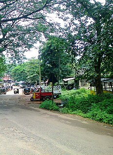
Kayyur is a village in Kasaragod district in the state of Kerala, India.Nearest town is Cheemeni.
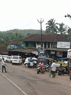
Kinanoor is a Village situated in Hill area of Kasaragod district in the state of Kerala, India.It is situated between Nileshwar and Parappa.

Hosdurg is one of four taluks that constitute the Kasaragod District, Kerala. Others are Kasaragod, Manjeshwaram and Vellarikundu taluks. In the north, it borders Kasaragod taluk; in south, the Kannur District; in the east, Vellarikundu taluk; and in the west, the Arabian sea. With an area of 900.3 km2, it was the smaller of the two taluks. Then Hosdurg bifurcated into Vellarikund and Hosdurg taluks in 2013 for ease of administration. Kanhangad and Nileshwaram are the municipalities within the taluk. Hosdurg is a kilometer south of Kanhangad town, the latter being the taluk headquarters. Other major settlements include Trikarpur, Cheruvathur and Udma. Bekal Fort tourism is situated in the taluk. The name Hosdurg comes from the Kannada word hosa ("new") and Sanskrit word durg ("fort").
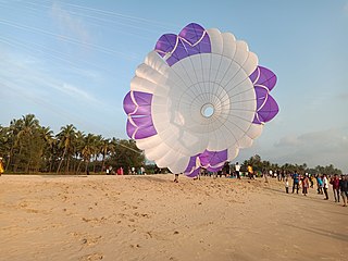
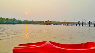
Pallikkara is a census town and a grama panchayat in Hosdurg Taluk of Kasargod district in the state of Kerala, India. This place was once famous for its Tobacco plants until the late 1980s and the Historical landmark Bekal Fort lies in this Village. A beach park near to the fort also attracts tourists to this place.

The Thiruvananthapuram–Kasaragod Semi High Speed Rail Corridor, also known as the Silver Line, is a proposed higher-speed railway in India that would connect Thiruvananthapuram, the capital city of Kerala, with Kasaragod, also in Kerala. It will have a operating speed of 200 kilometres per hour (120 mph), [Maximum Design Speed: 220 kmph, ] allowing trains to cover the 532-kilometre (331 mi) distance in less than four hours, compared to the present 10 to 12 hours it takes to traverse this distance. Thiruvananthapuram, Kollam, Chengannur, Kottayam, Ernakulam, Nedumbassery Airport, Thrissur, Tirur, Kozhikode, Kannur and Kasaragod will be the stations in this corridor.
Vellarikundu is a town and taluk headquarters in the Hill range of Kasaragod District in the state of Kerala. Vellarikundu is located between Odayanchal and Chittarikkal on Odayanchal-Cherupuzha Road.

Kasaragod District is the northernmost district in the southwestern Indian coastal state of Kerala. The district has a long history starting from pre-historic times to modern period.
Mulleria is a small town located in Karadka Panchayath, Kasaragod district in Kerala, India.
Kolthur is a village in Kasaragod taluk of Kasaragod district in Indian state of Kerala.
Thimiri is a village in Hosdurg taluk of Kasaragod district in Kerala state, India. Thimiri is located 3 km east of Cheruvathur on Cheruvathur-Cheemeni road.

