Kishtwar district

Last updated

Kishtwar district
District of Jammu and Kashmir administered by India [1]
Gullabgarh Paddar.jpg
View of Gulabgarh Town in Kishtwar
Kishtwar district
Interactive map of Kishtwar district
Kashmir region. LOC 2003626427 - showing Jammu division administered by India in neon blue.jpg
Kishtwar district is in the Jammu division (shown with neon blue boundary) of Indian-administered Jammu and Kashmir (shaded in tan in the disputed Kashmir region [1]
Coordinates(Kishtwar): 33°34′N75°53′E / 33.567°N 75.883°E / 33.567; 75.883
Administering country India
Union territory Jammu and Kashmir
Division Jammu
Region Chenab Valley
Headquarters Kishtwar
Tehsils [2] 1. Kishtwar 2. Chhatroo 3. Marwah 4. Paddar 5. Warwan 6. Nagseni 7. Drabshalla 8. Bunjwah 9. Mughalmaidan 10. Dachhan 11. Machail
Government
   Lok Sabha Constituency Udhampur
   MP Dr. Jitendra Singh, BJP [3]
   Vidhan Sabha constituencies 3 constituences
   District Magistrate Sh. Devansh Yadav IAS
Area
[4]
  Total7,737 km2 (2,987 sq mi)
Population
 (2011)
  Total230,696
  Density30/km2 (77/sq mi)
Demographics
   Literacy [5] 56.2%
   Sex ratio [5] 920 / 1000
Languages
  Official Dogri, English, Hindi, Kashmiri, Urdu
  Spoken Kashmiri, Padri, Urdu, Kishtwari, Dogri, Gojri
Time zone UTC+05:30 (IST)
Vehicle registration JK-17
Major highways NH244-IN.svg NH 244
Website kishtwar.nic.in

Kishtwar district is an administrative district of the Jammu division of Indian-administered Jammu and Kashmir in the Jammu Division. [1] As of 2011, it is the largest and the least populous district of Jammu and Kashmir.

Contents

Geography

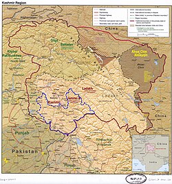
Kishtwar district has a total area of 7,737 square kilometres (2,987 sq mi). The district is bordered by Kargil district in the east and north, Chamba district to the south, and Anantnag and Doda districts to the west. The Chenab river flows through the district, forming the Chenab valley in the southern areas of the district. The Marusudar river, a tributary of Chenab, also flows through the district.

History

Kishtwar is first referred to in the Rajatarangini by the ancient name Kashthavata [8] [9] during the reign of Raja Kalsa of Kashmir (1063–1089), when "Uttamaraja", the ruler of Kashthavata visited the court of the Kashmir King in company with several other hill chiefs to pay their respects to the Raja. This place, as said by people, is also mentioned in the epic Mahabharata . [10]

Kishtwar was part of the Jammu state during the rule of Maharaja Ranjit Dev.

Kishtwar became part of the Jammu Dogra state of Raja Gulab Singh, when he annexed it in 1821.

Funeral procession: Kishtwar locals honor departed with drum beats. Photographed by Ralph Randles Stewart in 1913 Kishtwar Funeral.jpg
Funeral procession: Kishtwar locals honor departed with drum beats. Photographed by Ralph Randles Stewart in 1913

The local ruler of this place, Mohammed Tegh Singh, was sent to prison in Lahore jail, where he killed himself. [10] The Dogra state eventually became the princely state of Jammu and Kashmir. With the passage of time, Kishtwar became a Tehsil of the Udhampur district and remained so until 1948, when it became part of the newly created District Doda in the wake of first re-organization of the state during the post-independence period. In 2008 it became a newly district as a part of Jammu Division. Now District Kishtwar has become the largest district in term of area in union territory of Jammu & Kashmir with least population.

Administration

Kishtwar district consists of 4 Sub-Divisions, 11 tehsils, and 13 blocks.

Following are the blocks: Marwah, Warwan, Dachhan, Kishtwar, Nagseni, Drabshalla, Inderwal, Mughal Maidan, Bonjwah, Machail, Palmar, Thakrie Trigham, and Paddar. [11]

Each block consists of several panchayats. Block Kishtwar is the 1st block of Kishtwar District and Bairoon Town 1st Kishtwar is the 1st panchayat of Block Kishtwar, Bairoon town panchayat consists of Panditgam, Zewar, Nagdera, Bucherwal Mohalla, Semmna and Wazgwari. Marwah consists of 12 panchayats 1. Nowpachi, 2.Nowgam, 3.Yourdu, 4. Pethgam, 5.Ranie A, 6. Ranie B, 7. Quderna A, 8 Quderna B, 9 Chanjer, 10. Dehrana, 11. Hanzal, 12.Teller.

Following are the sub-divisions and tehsils:

Kishtwar Sub-district:

Chhatroo Sub-district:

Marwah Sub-district:

Atholi (Paddar) Sub-district:

Politics

Kishtwar District has 3 assembly constituencies: Gulabgarh, Inderwal and Kishtwar. [12] It is the part of the Udhampur (Lok Sabha constituency). The present MP of Udhampur Constituency is Dr. Jitendra Singh of the BJP. [3]

Demographics

Historical populations
YearPop.±%
1901 42,124    
1911 45,534+8.1%
1921 45,929+0.9%
1931 52,211+13.7%
1941 56,066+7.4%
1951 65,330+16.5%
1961 74,594+14.2%
1971 97,843+31.2%
1981 118,661+21.3%
1991 151,247+27.5%
2001 190,843+26.2%
2011 230,696+20.9%
source: [13]
† 1951 and 1991 populations are estimated

According to the 2011 census Kishtwar district has a population of 230,696. This gives it a ranking of 586th in India (out of a total of 640). The district has a population density of 29 inhabitants per square kilometre (75/sq mi) . Its population growth rate over the decade 2001-2011 was 21.06%. Kishtwar has a sex ratio of 938 females for every 1000 males, and a literacy rate of 58.54% (Male 71.75%, Female 44.13%). The Scheduled Castes and Scheduled Tribes account for 6.2% and 16.5% of the population of the district. [14]

The demography of the district is complex as compared to its neighboring districts primarily because of the wide diversity in its population. In the past, Kishtwar was largely inhabited by Kishtwari people before people started settling here from Kashmir and other adjoining areas. The reasons for Kashmiri people settling here in the past in 17th and 18th century is matter of ambiguity between historians. However, Sumantra Bose says it was repression by feudal class that drew people to the district of Doda, Ramban and Kishtwar. [15]

Muslims are in majority with nearly 58%. Hindus are 41%. There is a small percentage of Buddhists in the far-eastern areas of the district who are the Ladakhis.

Kishtwar district: religion, gender ratio, and % urban of population, according to the 2011 Census. [16]
HinduMuslimChristianSikhBuddhistJainOtherNot statedTotal
Total93,931133,2252774502,0943514202230,696
40.72%57.75%0.12%0.20%0.91%0.00%0.22%0.09%100.00%
Male49,60468,6551642961,0560273117120,165
Female44,32764,5701131541,038324185110,531
Gender ratio (% female)47.2%48.5%40.8%34.2%49.6%100.0%46.9%42.1%47.9%
Sex ratio
(no. of females per 1,000 males)
894940983883920
Urban4,39810,288349724002414,865
Rural89,533122,9372433532,0703514178215,831
 % Urban4.7%7.7%12.3%21.6%1.1%0.0%0.0%11.9%6.4%
Religion in Kishtwar district (2011) [16]
ReligionPercent
Islam
57.75%
Hinduism
40.72%
Buddhism
0.91%
Other or not stated
0.62%

Languages of Kishtwar district (2011) [17]

   Kashmiri (44.60%)
   Kishtwari (20.67%)
   Gojri (14.36%)
   Dogri (10.03%)
   Padari (7.44%)
   Hindi (1.31%)
   Siraji (1.25%)
   Bhaderwahi (0.34%)

Economy

Sex Ratio in Kishtwar District in 2011 Census. [16]
(no. females per 1,000 males)
Religion (and population)Sex Ratio
Muslim (pop 133,225)
940
Hindu (pop 93,931)
894
Other (pop 1,446)
701
Total (pop 230,696)
920

The economy of the area is not regularized with no visible investment from the government. The area is rural in nature has an agricultural-based economy. Due to the dry nature of the climate, the village peasant population usually grows wheat and barley in Rabi (winter) season and Rajma (kidney bean) and maize in Kharif (rainy) season. Kishtwar has the distinction of producing world-class blue Diamond Sapphire and its Kashmir sapphire was mined at Padder valley. The area is although rich in natural mineral resources but poor infrastructure has posed difficulty in its extraction. Mineral gypsum is mined at Village Trigam. The river sand of Chenab is of the best quality and used extensively for construction purposes.

The Padder area produces world-class Pine nuts called chilgoza which is a delicacy and costly dry fruit. In Marwah, Chhatroo, Mughalmaidan and Bounjwah tehsils, walnut production of best quality walnuts in thousands of tons is recorded, but due to the absence of any fruit Mandi, exact figures are not available. Besides walnut, Marwah tehsil produces thousands of tons of Rajma (kidney beans) which is the cash crop of the area. Villages of Pochhal, Matta and Hidyal produce saffron of good quality. Rural households are also abundantly gifted by nature through cash crops of edible mushrooms and morchella called guchhi in the local language. Some families have been reported to earn more than Rs. 100,000 per year by just selling the dried Morchella in local markets. Edible ferns are also a natural cash crop of the area. Apples are produced in some areas.

The rivers are a rich source of hydroelectricity and the site of the hydroelectric power projects of Dul Hasti 390 MW, Ratle Hydroelectric Project 850 MW, Kirthai 1400 MW, Pakal Dool 1,000 MW, Lower Kalnai 48 MW and Chaudhary 15MW, Keeru HEPP and Kwar HEPP with the highest per capita wattage production in the world for such a small area. These projects have been the largest source of employment in the area and have immensely contributed to the prosperity of the area.

Tourism

The Chenab River flows through the district and is joined by tributaries such as the Marvisudar river of Marwah, Fambar

Nallah, Chingam Nallah which meet at the confluence near Bhandarkoot. The rivers have cut steep gorges and wide plains on the way. Warwan and Marwah valleys are unique in being located in the way of river Marusudar. [ clarification needed ] The area is also known for its high mountain passes which have been the mountaineer's delight since the British era. [ tone ] Many illustrations are found in the travelogue written by British writers including Otto Rothfield's With pen and Rifle in Kashmir.[ citation needed ]

View from Aarse (Pochal, Kishtwar) View from pochal, kishtwar (aarse).jpg
View from Aarse (Pochal, Kishtwar)

The Kishtwar–Anantnag National Highway passes through the Sinthan Pass and Daksum Nowpachi Road passes through the Margan top a 13 km long and 5100-metre-high pass. The Steep Brahma mountain peak is situated at Dachhan which is documented by British mountaineers. The Warwan Valley has been rated among India's top ten trekking destinations with a wide range of landscapes. Saffron of purest quality is produced in the iron-rich soil at Pochhal, Matta, Lachdayaram and Hidyal. Kishtwar National Park, in the northeast region of the district, has a large number of peaks and glaciers. The town has a small airstrip under the control and management of the Indian Army which caters to civil and military Helicopters. The 33-hectare Chowgan is the largest natural ground located in the centre of the city and is used as a venue for recreation and religious and political gatherings. Mini Secretariat housing all the offices of Kishtwar district administration is located 3 km from the main bus stand in Kuleed area. Kishtwar is endowed with dense forests of deodar, pine and fir. High altitude mountains are ranging between 20,000 feet to 21,000 feet like Nun Kun, Barhma. there are many peaks in Paddar like Cerro Kishtwar, Tipendai, Gupta Peak, Shivling Peak, Aushuko Peak, Omasla Peak etc.

There are many trekking routes in Paddar like Omasla trek, Kabbanla trek, Potla trek, Ashuko trek, Tundupla trek, Sarsangla trek, Mounla trek and many sights like Darllang Nalla, Bujas Nalla, Barnaj Nalla, Chandi Mata Mandir, Lossani Gompa, Naag Stone at Darlang Nalla.[ citation needed ]

Transportation

Air

Kishtwar Airport is a proposed airport in the district headquarters. The nearest airport to Kishtwar is Jammu airport which is 211 km away from Kishtwar. [18]

Rail

There is no railway connectivity to Kishtwar yet. The Udhampur–Doda–Kishtwar is a planned railway line for Doda and Kishtwar districts. [15] The nearest major railway station is Udhampur railway station which is located 150 kilometres from district headquarters Kishtwar.

Road

Kishtwar district is well-connected to the winter capital Jammu and summer capital Srinagar by the NH 244 alongside other intra-district roads. The road to Srinagar passes through the picturesque Sinthan pass.

Notable people

See also

Related Research Articles

<span class="mw-page-title-main">Anantnag district</span> District of Jammu and Kashmir, India

Anantnag district is an administrative district of Indian-administered Jammu and Kashmir in the disputed Kashmir region. It is one of ten districts which make up the Kashmir Valley. The district headquarters is Anantnag city. As of 2011, it was the third most populous district of Jammu and Kashmir, after Jammu and Srinagar.

<span class="mw-page-title-main">Baramulla district</span> District in Jammu and kashmir, India

Baramulla district or Varmul is one of the 20 districts in the Indian-administered union territory of Jammu and Kashmir in the disputed Kashmir region. Baramulla town is the administrative headquarters of this district. The district covered an area of 4,588 km2 (1,771 sq mi) in 2001, but it was reduced to 4,243 km2 (1,638 sq mi) at the time of 2011 census. In 2016, the district administration said that the area was 4,190 km2 (1,620 sq mi). Muslims constitute about 98% of the population.

<span class="mw-page-title-main">Bhimber District</span> District in Azad Jammu and Kashmir, Pakistan

Bhimber District is a district of Pakistan-administered Azad Kashmir in the disputed Kashmir region. It is the southernmost of the 10 districts of Pakistan's territory of Azad Kashmir. It has an area of 1,516 km², and the district headquarter is the town of Bhimber.

<span class="mw-page-title-main">Poonch District, Pakistan</span> District of Azad Kashmir administered by Pakistan

Poonch District is a district of Pakistan-administered Azad Kashmir in the disputed Kashmir region. It is one of the 10 districts of this Pakistan-administered territory. It is bounded on the north by Bagh District, on the north-east by Haveli District, on the south-east by the Poonch District of Indian-administered Kashmir, on the south by Azad Kashmir's Sudhanoti and Kotli districts, and on the west by Rawalpindi District of Pakistan's Punjab Province. The Poonch District is part of the greater Kashmir dispute between India and Pakistan. The district headquarters is the city of Rawalakot. It is the third most populous district of Azad Kashmir.

<span class="mw-page-title-main">Doda district</span> District in Jammu and Kashmir

Doda district is an administrative district of the Jammu division of Indian-administered Jammu and Kashmir in the disputed Kashmir region.

<span class="mw-page-title-main">Doda, Jammu and Kashmir</span> A town and district headquarters in Jammu and Kashmir

Doda is a town and a notified area committee in Doda district in the Indian union territory of Jammu and Kashmir. Doda has an average elevation of 1,107 metres (3,632 ft).

<span class="mw-page-title-main">Udhampur district</span> District of Jammu and Kashmir administered by India

Udhampur is an administrative district in the Jammu division of Indian-administered Jammu and Kashmir in the disputed Kashmir region. Covering an area of 4,550 square kilometres (1,760 sq mi) in the Himalayan mountains, the district has its headquarters in the town of Udhampur. The Northern Command headquarters of the Indian Army is located in the district.

<span class="mw-page-title-main">Gilgit District</span> District of Gilgit-Baltistan in Pakistan

The Gilgit District is one of the 14 districts of Pakistan-administered territory of Gilgit-Baltistan in the disputed Kashmir region. The headquarters of the district is the town of Gilgit. At the 1998 census, the Gilgit District had a population of 243,324. The district includes Gilgit, the Bagrot Valley, Juglot, Danyore, Sultanabad, Naltar Peak, and the Nomal Valley. The highest peak in the district is Distaghil Sar 7,885 metres (25,869 ft), which is the seventh-highest peak in Pakistan and 19th highest in the world.

<span class="mw-page-title-main">Kathua district</span> District of Jammu and Kashmir administered by India

Kathua district is an administrative district in the Jammu division of Indian-administered Jammu and Kashmir in the disputed Kashmir region. It is surrounded by Jammu to the northwest, the Doda and Udhampur districts to the north, the state of Himachal Pradesh to the east, Punjab to the south, and Pakistan's working boundary to the west. Its terrain is diverse, consisting of rich agricultural areas along the Punjab/Kashmir border, plains sweeping eastward to the foothills of the Himalaya, and the mountainous Pahari region in the east.

<span class="mw-page-title-main">Samba, Jammu and Kashmir</span> Town administered by India in Jammu & Kashmir

Samba is a town, municipal committee, and administrative headquarter of Samba district of the Indian-administered Jammu and Kashmir in the disputed Kashmir region. Samba has his own railway station are Samba railway station on Jammu-Delhi railway line.

<span class="mw-page-title-main">Reasi district</span> District of Jammu and Kashmir administered by India

Reasi district is an administrative district in the Jammu division of Indian-administered Jammu and Kashmir in the disputed Kashmir region. The Reasi district is bordered by Udhampur district and Ramban district in the east, Jammu district in the south, Rajouri district in the west and by Kulgam district on the north. The Reasi and Rajouri tehsils formed a joint district called the "Reasi district" at the time of the princely state's accession to India in 1947. As part of the reorganisation, the two tehsils were separated and Reasi was merged with the Udhampur district. It again became a separate district in 2006.

<span class="mw-page-title-main">Samba district</span> District of Jammu and Kashmir administered by India

Samba district is an administrative district in the Jammu division of Indian-administered Jammu and Kashmir in the disputed Kashmir region. It was formed in 2006. Before its formation, this area was part of Jammu district and Kathua district.

<span class="mw-page-title-main">Ramban district</span> District of Jammu and Kashmir administered by India

Ramban district is an administrative district in the Jammu division of Indian-administered Jammu and Kashmir in the disputed Kashmir region. It is located in a valley surrounded the Pir Panjal range. It was carved out as a separate district from erstwhile Doda district in 2007. It is located in the Jammu division. The district headquarters are at Ramban town, which is located midway between Jammu and Srinagar along the Chenab river in the Chenab valley on National Highway-44, approximately 151 km from Jammu and Srinagar.

<span class="mw-page-title-main">Chenab Valley</span> Valley and proposed administrative division in Jammu and Kashmir, India

The Chenab Valley is a river valley formed by the Chenab River. The term is also used collectively for Doda, Kishtwar and Ramban districts of Jammu Division in the Indian-administered Jammu and Kashmir. These districts were formerly part of a single district, called Doda.

<span class="mw-page-title-main">Sinthan Top</span> Indian mountain pass

Sinthan Top is a mountain pass, a popular tourist destination located between South Kashmir's Breng Valley in Kishtwar district of Chenab Valley in the Indian union territory of Jammu and Kashmir. Majority of the area lies on the Kishtwar side. The top acts as a sort of base camp to several alpine lakes in the region.

<span class="mw-page-title-main">Warwan Valley</span> Valley in Jammu and Kashmir, India

The Warwan Valley is a Himalayan sub-valley and a tehsil in Kishtwar District in the Jammu division in union territory of Jammu and Kashmir in India. The Valley lies 68 kilometres (42 mi) northeast of Kishtwar and 150 kilometres (93 mi) from Srinagar, the summer capital of Jammu and Kashmir.

<span class="mw-page-title-main">Jammu and Kashmir (union territory)</span> Region administered by India

Jammu and Kashmir is a region administered by India as a union territory and consists of the southern portion of the larger Kashmir region, which has been the subject of a dispute between India and Pakistan since 1947 and between India and China since 1959. The Line of Control separates Jammu and Kashmir from the Pakistani-administered territories of Azad Kashmir and Gilgit-Baltistan in the west and north. It lies to the north of the Indian states of Himachal Pradesh and Punjab and to the west of Ladakh which is administered by India as a union territory.

<span class="mw-page-title-main">Ghizer District (2019–)</span> District of Gilgit-Baltistan administered by Pakistan

Ghizer District is a district of Pakistan-administered Gilgit-Baltistan region in the disputed Kashmir region. It is one of the 14 districts of Gilgit-Baltistan. The former Ghizer District that existed from 1974 to 2019 spanned the entire upper Gilgit River Valley. In 2019, the former district was divided into the Gupis-Yasin District in the west and the present, smaller Ghizer District in the east.

<span class="mw-page-title-main">Marwah valley</span> Village in Jammu and Kashmir

Marwah is a valley and sub-division in the Kishtwar district of Jammu and Kashmir in India. Marwah is surrounded by the Warwan valley to the northwest, Ladakh and Zanskar to the east, Chatroo and Kishtwar to the south, and Anantnag in the west. The area is drained by river Marusudar, which is the largest tributary of Chenab.

References

  1. 1 2 3 The application of the term "administered" to the various regions of Kashmir and a mention of the Kashmir dispute is supported by the tertiary sources (a) through (d), reflecting due weight in the coverage. Although "controlled" and "held" are also applied neutrally to the names of the disputants or to the regions administered by them, as evidenced in sources (f) through (h) below, "held" is also considered politicized usage, as is the term "occupied," (see (i) below).
    (a) Kashmir, region Indian subcontinent, Encyclopaedia Britannica, retrieved 15 August 2019 (subscription required) Quote: "Kashmir, region of the northwestern Indian subcontinent ... has been the subject of dispute between India and Pakistan since the partition of the Indian subcontinent in 1947. The northern and western portions are administered by Pakistan and comprise three areas: Azad Kashmir, Gilgit, and Baltistan, the last two being part of a territory called the Northern Areas. Administered by India are the southern and southeastern portions, which constitute the state of Jammu and Kashmir but are slated to be split into two union territories.";
    (b) Pletcher, Kenneth, Aksai Chin, Plateau Region, Asia, Encyclopaedia Britannica, retrieved 16 August 2019 (subscription required) Quote: "Aksai Chin, Chinese (Pinyin) Aksayqin, portion of the Kashmir region, at the northernmost extent of the Indian subcontinent in south-central Asia. It constitutes nearly all the territory of the Chinese-administered sector of Kashmir that is claimed by India to be part of the Ladakh area of Jammu and Kashmir state.";
    (c) "Kashmir", Encyclopedia Americana, Scholastic Library Publishing, 2006, p. 328, ISBN   978-0-7172-0139-6 C. E Bosworth, University of Manchester Quote: "KASHMIR, kash'mer, the northernmost region of the Indian subcontinent, administered partlv by India, partly by Pakistan, and partly by China. The region has been the subject of a bitter dispute between India and Pakistan since they became independent in 1947";
    (d) Osmańczyk, Edmund Jan (2003), Encyclopedia of the United Nations and International Agreements: G to M, Taylor & Francis, pp. 1191–, ISBN   978-0-415-93922-5 Quote: "Jammu and Kashmir: Territory in northwestern India, subject to a dispute betw een India and Pakistan. It has borders with Pakistan and China."
    (e) Talbot, Ian (2016), A History of Modern South Asia: Politics, States, Diasporas, Yale University Press, pp. 28–29, ISBN   978-0-300-19694-8 Quote: "We move from a disputed international border to a dotted line on the map that represents a military border not recognized in international law. The line of control separates the Indian and Pakistani administered areas of the former Princely State of Jammu and Kashmir.";
    (f) Kashmir, region Indian subcontinent, Encyclopaedia Britannica, retrieved 15 August 2019 (subscription required) Quote: "... China became active in the eastern area of Kashmir in the 1950s and has controlled the northeastern part of Ladakh (the easternmost portion of the region) since 1962.";
    (g) Bose, Sumantra (2009), Kashmir: Roots of Conflict, Paths to Peace, Harvard University Press, pp. 294, 291, 293, ISBN   978-0-674-02855-5 Quote: "J&K: Jammu and Kashmir. The former princely state that is the subject of the Kashmir dispute. Besides IJK (Indian-controlled Jammu and Kashmir. The larger and more populous part of the former princely state. It has a population of slightly over 10 million, and comprises three regions: Kashmir Valley, Jammu, and Ladakh.) and AJK ('Azad" (Free) Jammu and Kashmir. The more populous part of Pakistani-controlled J&K, with a population of approximately 2.5 million. AJK has six districts: Muzaffarabad, Mirpur, Bagh, Kodi, Rawalakot, and Poonch. Its capital is the town of Muzaffarabad. AJK has its own institutions, but its political life is heavily controlled by Pakistani authorities, especially the military), it includes the sparsely populated "Northern Areas" of Gilgit and Baltistan, remote mountainous regions which are directly administered, unlike AJK, by the Pakistani central authorities, and some high-altitude uninhabitable tracts under Chinese control."
    (h) Fisher, Michael H. (2018), An Environmental History of India: From Earliest Times to the Twenty-First Century, Cambridge University Press, p. 166, ISBN   978-1-107-11162-2 Quote: "Kashmir’s identity remains hotly disputed with a UN-supervised “Line of Control” still separating Pakistani-held Azad (“Free”) Kashmir from Indian-held Kashmir.";
    (i) Snedden, Christopher (2015), Understanding Kashmir and Kashmiris, Oxford University Press, p. 10, ISBN   978-1-84904-621-3 Quote:"Some politicised terms also are used to describe parts of J&K. These terms include the words 'occupied' and 'held'."
  2. "Tehsils in Kishtwar district". Kishtwar district website. Retrieved 13 July 2021.
  3. 1 2 "Lok Sabha Members". Lok Sabha. Retrieved 13 July 2021.
  4. "About District, District Kishtwar, Government of Jammu and Kashmir" . Retrieved 7 August 2020.
  5. 1 2 "Kishtwar Census 2011" (PDF). Govt of India Census. Retrieved 13 July 2021.
  6. "The Jammu and Kashmir Official Languages Act, 2020" (PDF). The Gazette of India. 27 September 2020. Retrieved 27 September 2020.
  7. "Parliament passes JK Official Languages Bill, 2020". Rising Kashmir. 23 September 2020. Archived from the original on 24 September 2020. Retrieved 23 September 2020.
  8. "Kishtwar High Altitude National Park" . Retrieved 8 August 2021.
  9. Development Institute, MSME. "Brief Industrial Profile of Kishtwar District" (PDF). Archived from the original (PDF) on 17 November 2020. Retrieved 8 August 2021.
  10. 1 2 District Census 2011 Handbook of Kishtwar (PDF). 16 June 2014. p. 26. Retrieved 8 August 2021.
  11. Statement showing the number of blocks in respect of 22 Districts of Jammu and Kashmir State including newly Created Districts Archived 2008-09-10 at the Wayback Machine dated 2008-03-13, accessed 2008-08-30
  12. "ERO's and AERO's". Chief Electoral Officer, Jammu and Kashmir. Archived from the original on 22 October 2008. Retrieved 28 August 2008.
  13. "A-2 Decadal Variation In Population Since 1901". Censusindia.gov.in. Retrieved 9 August 2019.
  14. "Kishtwar District Population, Jammu & Kashmir, List of Tehsils in Kishtwar". Censusindia2011.com. Retrieved 10 June 2023.
  15. 1 2 "Prabhu agrees to hold survey on 3 new rail lines in J&K". Daily Excelsior. Retrieved 13 June 2015.
  16. 1 2 3 C-1 Population By Religious Community – Jammu & Kashmir (Report). Office of the Registrar General & Census Commissioner, India. Retrieved 28 July 2020.
  17. C-16 Population By Mother Tongue – Jammu & Kashmir (Report). Office of the Registrar General & Census Commissioner, India. Retrieved 18 July 2020.
  18. "Jammu and Kashmir administration signs MoU with Army to operationalise Kishtwar airstrip". WION News. Retrieved 21 September 2020.

Further reading