Kathua district

Last updated

Kathua district
District of Jammu and Kashmir administered by India
Dhaggar village view.jpg
Mountainous areas in the east of Kathua
Kathua district
Interactive map of Kathua district
Kashmir region. LOC 2003626427 - showing Jammu division administered by India in neon blue.jpg
Kathua district is in the Jammu division (shown with neon blue boundary) of Indian-administered Jammu and Kashmir (shaded in tan in the disputed Kashmir region [1]
Coordinates(Kathua): 32°35′N75°30′E / 32.583°N 75.500°E / 32.583; 75.500
Administering countryIndia
Union territory Jammu and Kashmir
Division Jammu Division
Parliamentary Constituency Udhampur-Doda-Kathua Constituency
District Headquarter Kathua
Tehsils Bani, Basholi, Billawar, Hiranagar, Kathua, Nagri-Parole, Marheen, Dinga Amb, Mahanpur, Lohai Malhar, Ramkote.
Government
  District Development Council ChairpersonMann Singh (BJP)
  District CollectorRahul Yadav(IAS)
Area
[2]
  Total2,502 km2 (966 sq mi)
  Urban
43.16 km2 (16.66 sq mi)
  Rural
2,458.84 km2 (949.36 sq mi)
Population
 (2011) [3]
  Total616,435
  Density250/km2 (640/sq mi)
   Urban
89,713
   Rural
526,722
Demographics
   Literacy 73.09%
  Sex ratio890
Time zone UTC+05:30 (IST)
Vehicle registration JK-08
Major highways NH 44(Pathankot-Jammu), Bhaderwah-Basoli Highway, Border Road(Kathua-Bishnah).
Average annual precipitation921cm ( Annual-Billawar) mm
Website https://kathua.nic.in/

Kathua district is an administrative district in the Jammu division of Indian-administered Jammu and Kashmir in the disputed Kashmir region. [1] It is surrounded by Jammu to the northwest, the Doda and Udhampur districts to the north, the state of Himachal Pradesh to the east, Punjab to the south, and Pakistan's working boundary to the west. Its terrain is diverse, consisting of rich agricultural areas along the Punjab/Kashmir border, plains sweeping eastward to the foothills of the Himalaya, and the mountainous Pahari region in the east.

Contents

Kathua district is divided into 8 blocks: Bani, Barnoti, Basholi, Billawar, Duggan, Ghagwal, Hiranagar, Kathua and Lohai Malhar. It has approximately 512 villages.

The traditional language of Kathua is Dogri. Pahari languages are prevalent in the mountainous area of the east. The principal media of education are English, Hindi, and Urdu.

History

Kathua district
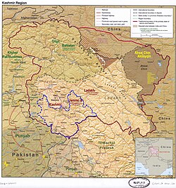
Kathua district in J & K

Jodh Singh of the Andotra clan(shares ancestry with Tomar and Som Rajputs) is believed to have migrated from Hastinapur to [Kathua] nearly 2,000 years ago.

His three sons established the three Hamlets of Taraf Tajwal, Taraf Manjali and Taraf Bhajwal. Their descendants are now called as Tajwalia, Bhajwalia and Khanwalia Rajputs of ANDOTRA sub-caste. Prior to 1921, the Kathua district was known as the Jasrota district. Between 1921–1931, the headquarters of the district was shifted to Kathua without any alteration in the area of governance. [4] [5]

Greek historians, who provide an insight into the ancient history of Jammu hills, prominently record the existence in this area of two powerful empires - Abhisara (present day Poonch) and Kathaioi - at the time of invasion of India by Alexander. Strabo describes Kathaioi as a mighty republic of that era,located in the foothills along the Ravi River. The topography of Kathaioi corresponds with the present day Kathua. Strabo describes the people of this republic as the epitome of bravery and courage, and records that they gave a tough fight to invading army of Alexander.

There are many places which commemorate a visit to Kathua by Pandavas. Lord Krishna is also said to have come to this area, in order to get back from Jamawant the Syamantaka Mani.

Because of its close proximity to the Pakistan border, Kathua District has had a significant Indian Army presence since independence. The Army units were camped at Kathua during militancy in the state when the ultras (extremists) carried out attacks against government installations. Some of these ultras were Lashkar-e-Taiba (LeT) and infiltration across the border from Pakistan was a major concern. [6] There were many attacks in the region beginning in the late 1980s. Among them, in 2002, in March ten people were killed in an attack in Kathua at a temple, in May thirty-two people were killed in an attack on a bus and Army residential complex, in July twenty-nine people were killed in an attack near Qasim Nagar, in September twelve people were killed when ultras attacked a bus at Hiranagar Morh. [7] In 2005, three terrorists attacked on army camp in front of District Hospital in Kathua killing two people. By 2008 the attacks had ceased. [8] But in 2013, ultras attacked a police station, killing four policemen and a civilian, stole a truck and then attacked an army camp in the neighboring Samba District. [8] [9]

Basohli Paintings

Basohli, a town of Kathua district, is widely known for its paintings. Immortalised by their artistic eminences and their connoisseur patrons, Basohli today is a metaphor for a vigorous, bold and imaginative artistic style, rich, stylish and unconventional.

A style of painting characterized by vigorous use of primary colours and a peculiar facial formula prevailed in the seventeenth and early eighteenth centuries in the foothills of the Western Himalayas in the Jammu and Punjab States.

The earliest paintings in this style originated in Basohli from where the style spread to the Hill States of Mankot, Nurpur, Kulu, Mandi, Suket, Bilaspur, Nalagarh, Chamba, Guler and Kangra. The first mention of Basohli painting is in the annual report of the Archaeological Survey of India published in 1921.

Administration

Kathua is divided into four subdivisions: Bani, Basohli, Billawar/Badnota, and Hiranagar. These sub-divisions are further divided into 11 tehsils: [10]

Politics

Kathua District has five assembly constituencies: Bani, Basohli, Kathua, Billawar and Hiranagar (S.C). [11]

Demographics

Historical populations
YearPop.±%
1901 144,722    
1911 142,404−1.6%
1921 144,675+1.6%
1931 151,394+4.6%
1941 166,940+10.3%
1951 180,968+8.4%
1961 194,997+7.8%
1971 256,755+31.7%
1981 340,494+32.6%
1991 419,120+23.1%
2001 511,455+22.0%
2011 616,435+20.5%
source: [12]
† 1951 and 1991 populations are estimated
Religion in Kathua district (2011) [3]
ReligionPercent
Hinduism
87.61%
Islam
10.42%
Sikhism
1.55%
Other or not stated
0.42%
Sex Ratio in Kathua District in 2011 Census. [3]
(no. females per 1,000 males)
Religion (and population)Sex Ratio
Hindu (pop 540,063)
890
Muslim (pop 64,234)
904
Sikh (pop 9,551)
809
Other (pop 2,587)
873
Total (pop 616,435)
890

Languages of Kathua district (2011) [13]

   Dogri (81.92%)
   Pahadi (6.94%)
   Gojri (3.50%)
   Kashmiri (2.01%)
   Punjabi (1.86%)
   Hindi (1.03%)
  Others (2.74%)

According to the 2011 census Kathua district has a population of 616,435, roughly equal to the nation of Solomon Islands [14] or the US state of Vermont. [15] This gives it a ranking of 521st in India (out of a total of 640). The district has a population density of 246 inhabitants per square kilometre (640/sq mi) . [14] Its population growth rate over the decade 2001-2011 was 20.53%. Kathua has a sex ratio of 890 females for every 1000 males, [14] and a literacy rate of 73.09%. [14] The Scheduled Castes and Scheduled Tribes account for 22.9% and 8.6% of the population of the district. [14]

Kathua district: religion, gender ratio, and % urban of population, according to the 2011 Census. [3]
HinduMuslimChristianSikhBuddhistJainOtherNot statedTotal
Total540,06364,2341,8289,55124162717616,435
87.61%10.42%0.30%1.55%0.00%0.00%0.00%0.12%100.00%
Male285,72033,7289415,2801291418326,109
Female254,34330,5068874,2711271299290,326
Gender ratio (% female)47.1%47.5%48.5%44.7%50.0%43.8%50.0%41.7%47.1%
Sex ratio
(no. of females per 1,000 males)
890904943809715890
Urban82,1623,2721,1113,015136113389,713
Rural457,90160,9627176,53611101584526,722
 % Urban15.2%5.1%60.8%31.6%54.2%37.5%50.0%18.5%14.6%

At the time of the 2011 census, 81.92% of the population spoke Dogri, 6.94% Pahari, 3.50% Gojri, 2.01% Kashmiri, 1.86% Punjabi and 1.03% Hindi as their first language. [13]

See also

Related Research Articles

<span class="mw-page-title-main">Muzaffarabad</span> Capital of Azad Kashmir, a region administered by Pakistan

Muzaffarabad is a city in Pakistani-administered Azad Kashmir in the disputed Kashmir region. It is the largest city and the capital of Azad Kashmir, which is a Pakistani-administered administrative territory.

<span class="mw-page-title-main">Kathua</span> City administered by India in Jammu and Kashmir

Kathua is a city and municipal council of the Jammu division of Indian-administered Jammu and Kashmir in the disputed Kashmir region. The city is the headquarters of Kathua district and is divided into 27 wards which constitute the Kathua Municipal Council. It is situated along NH-44 The city has a bustling industrial area and an army cantonment adjoining it. Being a transit hub for industrial activity in the state, the city has a large industrial base with textile park, Biotechnology and Pharma industrial and research park, Cement industry and many medium scale MSMEs.

<span class="mw-page-title-main">Anantnag district</span> District of Jammu and Kashmir, India

Anantnag district is an administrative district of Indian-administered Jammu and Kashmir in the disputed Kashmir region. It is one of ten districts which make up the Kashmir Valley. The district headquarters is Anantnag city. As of 2011, it was the third most populous district of Jammu and Kashmir, after Jammu and Srinagar.

<span class="mw-page-title-main">Bagh District</span> District of Azad Kashmir administered by Pakistan

Bagh District is a district of Pakistan-administered Azad Kashmir in the disputed Kashmir region. It is one of the ten districts of Azad Jammu and Kashmir. Previously part of Poonch District, it was established as a separate district in 1988.

<span class="mw-page-title-main">Kotli District</span> District in Azad Kashmir, Pakistan

Kotli District is a district of Pakistan-administered Azad Kashmir in the disputed Kashmir region. It is one of the 10 districts of Pakistan's dependent territory of Azad Kashmir. It is bounded on the north by the Sudhanoti District and the Poonch District, on the north-east by the Poonch District of Indian-administered Jammu and Kashmir, on the south by the Mirpur District and the Bhimber District, and on the west by the Rawalpindi District on Pakistan's Punjab Province. It is the biggest district of Azad Kashmir by population and the second biggest by land area, after the Neelum District. The district headquarters is the city of Kotli. Kaladab The main native languages are Pahari, and Gujari.

<span class="mw-page-title-main">Muzaffarabad District</span> District of Azad Kashmir administered by Pakistan

The Muzaffarabad District is a district of Pakistan-administered Azad Kashmir in the disputed Kashmir region. It is one of the 10 districts of this dependent territory. The district is located on the banks of the Jhelum and Neelum rivers and is very hilly. The total area of the Muzaffarabad District is 1,642 square kilometres (634 sq mi). The district is part of the Muzaffarabad Division, and the city of Muzaffarabad serves as the capital of Azad Kashmir. The district is bounded on the north-east by the Neelum District and the Kupwara District of Indian-administered Jammu and Kashmir, on the south-east by the Hattian Bala District, on the south by the Bagh District, and on the west by the Mansehra District and the Abbottabad District of Pakistan's Khyber Pakhtunkhwa Province.

<span class="mw-page-title-main">Mirpur District</span> District of Azad Jammu and Kashmir, Pakistan

Mirpur District is a district of Pakistan-administered Azad Kashmir in the disputed Kashmir region. It is one of the 10 districts of Pakistan's dependent territory of Azad Kashmir. The Mirpur District is bounded on the north by the Kotli District, on the east by the Bhimber District, on the south by the Gujrat District of Punjab, Pakistan, on the south-west by the Jhelum District of Punjab, Pakistan, and on the west by its Rawalpindi District. The district is named after its main city, Mirpur. The Mirpur District has a population of 456,200 and covers an area of 1,010 km2 (390 sq mi). The district is mainly mountainous with some plains. The Mirpur District has a humid subtropical climate which closely resembles that of the Gujrat District and the Jhelum District, the adjoining districts of Pakistan's Punjab Province.

Pulwama is a city and notified area council in the Pulwama district of Indian-administered Jammu and Kashmir in the disputed Kashmir region. It is located approximately 25 kilometres (16 mi) south of the summer capital of the state, Srinagar.

<span class="mw-page-title-main">Poonch district, India</span> District of Jammu and Kashmir administered by India in Jammu & Kashmir

Poonch or Punch is a district of the Jammu division of Indian-administered Jammu and Kashmir in the disputed Kashmir region. With headquarters in the town of Poonch, it is bounded by the Line of Control on three sides. The 1947-48 war between India and Pakistan divided the earlier district into two parts. One went to Pakistan and the other became part of the then-Indian state of Jammu and Kashmir.

<span class="mw-page-title-main">Rajouri district</span> District of Jammu and Kashmir administered by India.

Rajouri or Rajpur is a district in the Jammu division of Indian-administered Jammu and Kashmir in the disputed Kashmir region. The Line of Control lies to its west, Poonch to its north, the Reasi district to the east and the Jammu district to its south. Rajouri is famous for its "Kalari". Representing an ancient principality, Rajouri was a joint district, along with Reasi, at the time of princely state's accession to India in 1947. The two tehsils were separated and Rajouri was merged with the Poonch district. Rajouri again became a separate district in 1968. The Rajouri district comprises 13 tehsils (boroughs). The land is mostly fertile and mountainous. Maize, wheat and rice are the main crops of the area and the main source of the irrigation is the river Tawi that originates from the mountains of Pir Panjal.

<span class="mw-page-title-main">Kupwara district</span> District of Jammu and Kashmir administered by India

Kupwara district is an administrative district of Indian-administered Jammu and Kashmir in the disputed Kashmir region. It is one of the 10 districts located in the Kashmir Valley Division of Indian administered Kashmir. The Pohru River and Mawar river are two main rivers in the district. Both of them meet Jhelum river in Baramulla district.

<span class="mw-page-title-main">Sudhanoti District</span> District of Azad Kashmir administered by Pakistan

The Sudhanoti District, meaning the "heartland of Sudhans" or "Sudhan heartland"), is a district of Pakistan-administered Azad Kashmir in the disputed Kashmir region. It is one of the 10 districts of Pakistan-administered dependent territory of Azad Kashmir. The Sudhanoti District is bounded on the north and east by the Poonch District, on the south by the Kotli District, and on the west by the Rawalpindi District of Pakistan's Punjab Province. It is located 90 kilometres (56 mi) from Islamabad, the capital of Pakistan. It is connected with Rawalpindi and Islamabad via the Azad Pattan Road.

<span class="mw-page-title-main">Samba, Jammu and Kashmir</span> Town administered by India in Jammu & Kashmir

Samba is a town, municipal committee, and administrative headquarter of Samba district of the Indian-administered Jammu and Kashmir in the disputed Kashmir region. Samba has his own railway station are Samba railway station on Jammu-Delhi railway line.

<span class="mw-page-title-main">Reasi district</span> District of Jammu and Kashmir administered by India

Reasi district is an administrative district in the Jammu division of Indian-administered Jammu and Kashmir in the disputed Kashmir region. The Reasi district is bordered by Udhampur district and Ramban district in the east, Jammu district in the south, Rajouri district in the west and by Kulgam district on the north. The Reasi and Rajouri tehsils formed a joint district called the "Reasi district" at the time of princely state's accession to India in 1947. As part of the reorganisation, the two tehsils were separated and Reasi was merged with the Udhampur district. It again became a separate district in 2006.

<span class="mw-page-title-main">Samba district</span> District of Jammu and Kashmir administered by India in Jammu & Kashmir

Samba district is an administrative district in the Jammu division of Indian union territory of Jammu and Kashmir. It was formed in 2006. Before its formation, this area was part of Jammu district and Kathua district.

<span class="mw-page-title-main">Bandipore district</span> District of Jammu and Kashmir administered by India

Bandipore district is an administrative district of Indian-administered Jammu and Kashmir in the disputed Kashmir region. It is one of the 20 districts in the Jammu and Kashmir. Bandipore town is the administrative headquarters of the district. Bandipore is located in the foothills of the snow-clad peaks of Harmukh overlooking the shores of Wular Lake and has produced hundreds of scholars and intellectuals. The district is known for its tourist places such as Wular Vintage Park, Athwatoo and Gurez valley. Before 1947, this town was a big trade and literary centre of Kashmir. This district was carved out from the erstwhile Baramulla district in 2007. The district is bounded by Kupwara district from the north, Baramulla district from west and Kargil district in Ladakh and Ganderbal district from the east. This district occupies an area of 398 km2. The district has a population of 392,232 as per 2011 census.

<span class="mw-page-title-main">Hattian Bala District</span> District of Azad Kashmir, administered by Pakistan

Known as the Hattian Bala District', a district located in the disputed Kashmir region, it is administered by Pakistan. The district is located in Pakistan's Azad Kashmir. The town of Hattian Bala is where its headquarters are situated. The Hattian Bala District was a part of the Muzaffarabad District until 2009 when it became its own entity.

<span class="mw-page-title-main">Kashmir division</span> Administrative division in Indian-administered Jammu and Kashmir

The Kashmir division is a revenue and administrative division of the Indian-administered Jammu and Kashmir in the disputed Kashmir region. It comprises the Kashmir Valley, bordering the Jammu Division to the south and Ladakh to the east. The Line of Control forms its boundary with the Pakistani-administered territories of Gilgit−Baltistan and Azad Jammu and Kashmir to the north and west and west, respectively.

<span class="mw-page-title-main">Gilgit Division</span> Administrative division of Pakistan-administered Gilgit-Baltistan

Gilgit Division is an administrative division of Pakistan-administered Gilgit-Baltistan in the disputed Kashmir region. Gilgit is the divisional headquarters of Gilgit Division. Since divisions were restored back in 2008, the division currently consists on six districts:

<span class="mw-page-title-main">Baltistan Division</span> Administrative division of Pakistan-administered Gilgit−Baltistan

Baltistan Division is a first-order administrative division of Pakistan-administered Gilgit-Baltistan in the disputed Kashmir region. It overlaps with the historical Baltistan.

References

  1. 1 2 The application of the term "administered" to the various regions of Kashmir and a mention of the Kashmir dispute is supported by the tertiary sources (a) through (d), reflecting due weight in the coverage. Although "controlled" and "held" are also applied neutrally to the names of the disputants or to the regions administered by them, as evidenced in sources (f) through (h) below, "held" is also considered politicized usage, as is the term "occupied," (see (i) below).
    (a) Kashmir, region Indian subcontinent, Encyclopaedia Britannica, retrieved 15 August 2019 (subscription required) Quote: "Kashmir, region of the northwestern Indian subcontinent ... has been the subject of dispute between India and Pakistan since the partition of the Indian subcontinent in 1947. The northern and western portions are administered by Pakistan and comprise three areas: Azad Kashmir, Gilgit, and Baltistan, the last two being part of a territory called the Northern Areas. Administered by India are the southern and southeastern portions, which constitute the state of Jammu and Kashmir but are slated to be split into two union territories.";
    (b) Pletcher, Kenneth, Aksai Chin, Plateau Region, Asia, Encyclopaedia Britannica, retrieved 16 August 2019 (subscription required) Quote: "Aksai Chin, Chinese (Pinyin) Aksayqin, portion of the Kashmir region, at the northernmost extent of the Indian subcontinent in south-central Asia. It constitutes nearly all the territory of the Chinese-administered sector of Kashmir that is claimed by India to be part of the Ladakh area of Jammu and Kashmir state.";
    (c) "Kashmir", Encyclopedia Americana, Scholastic Library Publishing, 2006, p. 328, ISBN   978-0-7172-0139-6 C. E Bosworth, University of Manchester Quote: "KASHMIR, kash'mer, the northernmost region of the Indian subcontinent, administered partlv by India, partly by Pakistan, and partly by China. The region has been the subject of a bitter dispute between India and Pakistan since they became independent in 1947";
    (d) Osmańczyk, Edmund Jan (2003), Encyclopedia of the United Nations and International Agreements: G to M, Taylor & Francis, pp. 1191–, ISBN   978-0-415-93922-5 Quote: "Jammu and Kashmir: Territory in northwestern India, subject to a dispute betw een India and Pakistan. It has borders with Pakistan and China."
    (e) Talbot, Ian (2016), A History of Modern South Asia: Politics, States, Diasporas, Yale University Press, pp. 28–29, ISBN   978-0-300-19694-8 Quote: "We move from a disputed international border to a dotted line on the map that represents a military border not recognized in international law. The line of control separates the Indian and Pakistani administered areas of the former Princely State of Jammu and Kashmir.";
    (f) Kashmir, region Indian subcontinent, Encyclopaedia Britannica, retrieved 15 August 2019 (subscription required) Quote: "... China became active in the eastern area of Kashmir in the 1950s and has controlled the northeastern part of Ladakh (the easternmost portion of the region) since 1962.";
    (g) Bose, Sumantra (2009), Kashmir: Roots of Conflict, Paths to Peace, Harvard University Press, pp. 294, 291, 293, ISBN   978-0-674-02855-5 Quote: "J&K: Jammu and Kashmir. The former princely state that is the subject of the Kashmir dispute. Besides IJK (Indian-controlled Jammu and Kashmir. The larger and more populous part of the former princely state. It has a population of slightly over 10 million, and comprises three regions: Kashmir Valley, Jammu, and Ladakh.) and AJK ('Azad" (Free) Jammu and Kashmir. The more populous part of Pakistani-controlled J&K, with a population of approximately 2.5 million. AJK has six districts: Muzaffarabad, Mirpur, Bagh, Kodi, Rawalakot, and Poonch. Its capital is the town of Muzaffarabad. AJK has its own institutions, but its political life is heavily controlled by Pakistani authorities, especially the military), it includes the sparsely populated "Northern Areas" of Gilgit and Baltistan, remote mountainous regions which are directly administered, unlike AJK, by the Pakistani central authorities, and some high-altitude uninhabitable tracts under Chinese control."
    (h) Fisher, Michael H. (2018), An Environmental History of India: From Earliest Times to the Twenty-First Century, Cambridge University Press, p. 166, ISBN   978-1-107-11162-2 Quote: "Kashmir’s identity remains hotly disputed with a UN-supervised “Line of Control” still separating Pakistani-held Azad (“Free”) Kashmir from Indian-held Kashmir.";
    (i) Snedden, Christopher (2015), Understanding Kashmir and Kashmiris, Oxford University Press, p. 10, ISBN   978-1-84904-621-3 Quote:"Some politicised terms also are used to describe parts of J&K. These terms include the words 'occupied' and 'held'."
  2. District Census Handbook Kathua (PDF). Census of India 2011, Part A (Report). 18 June 2014. p. 8. Retrieved 21 November 2020.
  3. 1 2 3 4 C-1 Population By Religious Community – Jammu & Kashmir (Report). Office of the Registrar General & Census Commissioner, India. Retrieved 28 July 2020.
  4. Agrarian Legislation in India, Gokhale Institute of Politics and Economics, 1973, p. 232
  5. Office of the Registrar General, Census of India, 1961: Jammu and Kashmir, Manager of Publications, p. 142
  6. Kak. M. L. (29 August 2001). "Kathua next target of ultras ISI shifts officer to Sialkot Sector". The Tribune. Chandigarh, India. Archived from the original on 18 January 2002.
  7. Sharma, S. P. (1 October 2002). "Attack shows chinks in police set-up". The Tribune. Chandigarh, India. Archived from the original on 21 December 2002.
  8. 1 2 Singh, Ajit Kumar (2013). "J&K: Escalating Failures". South Asia Intelligence Review: Weekly Assessments & Briefings. 12 (13). Archived from the original on 8 January 2014.
  9. Hassan, Ishfaq ul (26 September 2013). "All three ultras in J&K terror attack killed, search operations over". DNA (Diligent Media Corporation). Archived from the original on 8 January 2014.
  10. "Kathua - Official Site". kathua.nic.in. Retrieved 7 January 2017.
  11. "ERO's and AERO's". Chief Electoral Officer, Jammu and Kashmir. Archived from the original on 22 October 2008. Retrieved 28 August 2008.
  12. "A-2 Decadal Variation In Population Since 1901". Censusindia.gov.in. Retrieved 9 August 2019.
  13. 1 2 C-16 Population By Mother Tongue – Jammu & Kashmir (Report). Office of the Registrar General & Census Commissioner, India. Retrieved 18 July 2020.
  14. 1 2 3 4 5 "Kathua District Population Census 2011, Jammu and Kashmir literacy sex ratio and density". www.census2011.co.in. Retrieved 16 January 2017.
  15. "2010 Resident Population Data". U. S. Census Bureau. Archived from the original on 1 January 2011. Retrieved 30 September 2011. Vermont 625,741