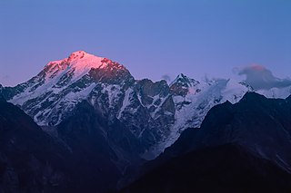
Himachal Pradesh is a state in the northern part of India. Situated in the Western Himalayas, it is one of the thirteen mountain states and is characterised by an extreme landscape featuring several peaks and extensive river systems. Himachal Pradesh is the northernmost state of India and shares borders with the union territories of Jammu and Kashmir and Ladakh to the north, and the states of Punjab to the west, Haryana to the southwest, Uttarakhand to the southeast and a very narrow border with Uttar Pradesh to the south. The state also shares an international border to the east with the Tibet Autonomous Region in China. Himachal Pradesh is also known as Dev Bhoomi or Dev Bhumi, meaning 'Land of Gods' and Veer Bhoomi which means 'Land of the Brave'.

Solan is a city in the Indian state of Himachal Pradesh and the district headquarters of Solan district. It is located 45.5 kilometres (28 mi) south of the state capital, Shimla. Solan has an average elevation of 1,550 metres (5,090 ft). The city is situated between Chandigarh and Shimla on the Kalka-Shimla National Highway-5. The narrow-gauge Kalka-Shimla railway passes through Solan. Located on the Punjab-Himachal Border, Solan is nestled in the Shivalik hills of the Himalayas.

Kangra district is the most populous district of the Indian state of Himachal Pradesh. Dharamshala is the administrative headquarters of the district.

Una district is a district in the Indian state of Himachal Pradesh. Una shares its border with the Hoshiarpur and Rupnagar districts of Punjab and Kangra, Hamirpur, and Bilaspur districts of Himachal Pradesh. The terrain is generally plain with semi hills.

Una is a City and a Municipal Council in Una district in the Indian state of Himachal Pradesh. It serves as the headquarters of Una district. There are 11 wards under Municipal Council. Una City is home to the Kila, which is a historical fort and an ancestral home of the descendants of the first guru of the Sikhs, Guru Nanak.

Solan district is one of the twelve districts of the Himachal Pradesh state in northern India. The city of Solan is the administrative headquarters of the district. The district occupies an area of 1936 km2.

Bilaspur State or Kahlur State, sometimes Kahloor Riyasat, was a kingdom (697–1849) and later princely state (1849–1948) in the Punjab Province ruled by a separate branch of Chandravanshi Chandel rajput dynasty. Raja Bir Chand 697–730 was the founder of the state but it was named Kahlur only after the Construction of Kahlur Fort by Raja Kahal Chand around 890–930CE and Raja Anand Chand the 44th Raja was the last ruler.

Rupnagar is a city and a municipal council in Rupnagar district in the Indian state of Punjab. Rupnagar is a newly created fifth Divisional Headquarters of Punjab comprising Rupnagar, Mohali, and its adjoining districts. It is also one of the bigger sites belonging to the Indus Valley civilization. Rupnagar is nearly 43 km (27 mi) to the northwest of Chandigarh. It is bordered by Himachal Pradesh to the north and Shahid Bhagat Singh Nagar district to its west.

Baddi is an industrial town and Nagar parishad, near Solan City in the southwestern Solan district of Himachal Pradesh, India. The town lies on the border of Himachal Pradesh, Punjab and Haryana states in the Shivalik Hills, around 35 kilometres west of Solan City. Baddi is largest pharmaceutical hub of Asia

East Punjab was a province of India from 1947 until 1950. It consisted parts of the Punjab province that remained in India following the partition of the province between the new dominions of Pakistan and the Indian Union by the Radcliffe Commission in 1947. The mostly Muslim western parts of the old Punjab became Pakistan's West Punjab, later renamed as Punjab Province, while the mostly Hindu and Sikh eastern parts remained with India.
Kotkhai is a town and a Nagar Panchayat in Shimla district in the Indian state of Himachal Pradesh.The name Kotkhai is derived from Hindi and Urdu language where the name "Kot" means Kings Palace and "Khai" means depth, therefore "Kotkhai" means "Kings palace situated in depth". It is a tehsil with around 40 villages under its administration. The whole tehsil is known for quality apple production. Kotkhai is also known for its fairs and traditional values, people of Kotkhai are really devotional towards Devtas where each villages believes in different forms of Devtas.

Puadh is a historic region in north India that comprises parts of present-day Punjab, Haryana, Uttar Pradesh, Himachal Pradesh and the U.T. of Chandigarh, India. It has the Sutlej river in its north and covers the regions immediately south of the Ghaggar river. The people of the area are known as Puadhi and speak the Puadhi dialect of Punjabi. The capital cities of Puadh region are Rupnagar, Fatehgarh Sahib, Mohali, Patiala, Chandigarh, Nalagarh,Panchkula, Baddi ,Ambala, Yamunanagar
Punjab is home to 2.3% of India's population; with a density of 551 persons per km2. According to the provisional results of the 2011 national census, Punjab has a population of 27,743,338, making it the 16th most populated state in India. Of which male and female are 14,639,465 and 13,103,873 respectively. 32% of Punjab's population consists of Dalits. In the state, the rate of population growth is 13.9% (2011), lower than national average. Out of total population, 37.5% people live in urban regions. The total figure of population living in urban areas is 10,399,146 of which 5,545,989 are males and while remaining 4,853,157 are females. The urban population in the last 10 years has increased by 37.5%. According to the 2011 Census of India, Punjab, India has a population of around 27.7 million.

Mandi is a major city and a municipal corporation in Mandi District in the Indian state of Himachal Pradesh. It is situated 145 kilometres (90 mi) north of state capital, Shimla in the north-west Himalayas at an average altitude of 880 m (2,890 ft) Mandi is connected to the Pathankot through National Highway 20 and to Manali and Chandigarh through National Highway 21. Mandi is approximately 184.6 km (114.7 mi) from Chandigarh, the nearest major city, and 440.9 km (274.0 mi) from New Delhi, the national capital. In the 2011 Indian census, Mandi city had a population of 26,422. Mandi district is currently the 4th largest economy in the state. Mandi has the second highest sex ratio of 1013 females per thousand males, in the state.

Chamba State was one of the oldest princely states in present-day Republic of India, having been founded during the late 6th century. It was part of the States of the Punjab Hills of the Punjab Province in India from 1859 to 1947. Its last ruler signed the instrument of accession to the Indian Union of 15 April 1948.

Guler was a small precolonial Indian hill state in the Lower Himalayas. Its capital was the town of Haripur Guler, in modern-day Himachal Pradesh. The kingdom was founded in 1415 by Raja Hari Chand, a scion of the ancient royal family of Kangra. The etymology of the word Guler can be traced to the word Gwalior, meaning the abode of cowherds. One of the foremost schools of Pahari miniatures is named after this small principality.

Kumarsain, also known as Kumharsain, is a town in Shimla District in the Indian state of Himachal Pradesh. Formerly under the British Raj, it was the capital of princely state of Kumharsain, which was one of the several states of the Punjab States Agency. It is about 80 km from Shimla and famous for apple and cherry orchards.
His Highness Raja Sir Anand Chand was the 44th Raja of Bilaspur. He was a Member of Parliament, representing Bihar in the Rajya Sabha, the upper house of India's Parliament as a member of the Indian National Congress.
Dadwal, also written as Dadhwal and Dhadwal, is a surname prevalent in Punjab, Himachal Pradesh and Jammu. The surname is prevalent in the Rajput community. It is also prevalent in the Jatt community and is a clan name amongst Hindus and Sikhs.
Jubbal State was a non-salute state of the Simla Hill States Superintendency of the Punjab States Agency. Thought to have been founded in the twelfth century, it merged with the Indian Union in 1948.


