Central India Agency

Last updated

Central India Agency
1854–1947
Central India Agency in the Indian Empire.png
The Central India Agency in the Indian Empire in 1942
Central India Agency Map.jpg
Detailed map of Central India Agency in 1909 before separation of Gwalior Residency
Capital Indore
States under AGG for Central India
Government Indirect imperial rule over a group of hereditary monarchies
Agent to the Governor-General  
 1854–1857 (first)
Sir Robert Hamilton [1]
History 
 Merger of previous political offices
1854
1947
Area
1901200,452 km2 (77,395 sq mi)
Population
 1901
9261907
Preceded by
Succeeded by
Blank.png Malwa
Gwalior Residency Blank.png
Malwa Union Flag of India.svg
Bhopal State Flag of India.svg
Baghelkhand and Bundelkhand States Union Flag of India.svg
Wikisource-logo.svg This article incorporates text from a publication now in the public domain:  Chisholm, Hugh, ed. (1911). "Central India". Encyclopædia Britannica (11th ed.). Cambridge University Press.
View of the Agency House in Dhar State, one of the former centres southwest. Lalitpur District, part of the United Provinces, split the Central India Agency into eastern and western portions. Agency House 2010.jpg
View of the Agency House in Dhar State, one of the former centres southwest. Lalitpur District, part of the United Provinces, split the Central India Agency into eastern and western portions.

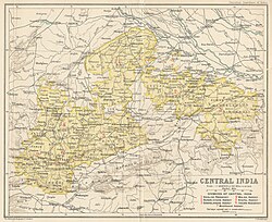
The Central India Agency was created in 1854, by amalgamating the Western Malwa Agency with other smaller political offices which formerly reported to the Governor-General of India. The agency was overseen by a political agent who maintained relations of the Government of India with the princely states and influence over them on behalf of the Governor-General. The headquarters of the agent were at Indore.

Contents

List of Divisions and Princely States/districts of Agency

Bundelkhand Agency

The Bundelkhand Agency was bounded by Bagelkhand to the east, the United Provinces to the north, Lalitpur District to the west, and the Central Provinces to the south. Bagelkhand Agency was separated from Bundelkhand in 1871. In 1900 it included 9 states, the most important of which were Orchha, Panna, Samthar, Charkhari, Chhatarpur, Datia, Bijawar and Ajaigarh. The agency also included 13 estates and the pargana of Alampur, the latter belonging to Indore State. [2]

In 1931, all of the states under the Baghelkhand Agency apart from Rewa and Singrauli were transferred back to Bundelkhand.

Salute states, by precedence:

Non-salute states, alphabetically:

Jagirs  :

Former princely States that were annexed or seized by the British :

Bagelkhand Agency

Bagelkhand Agency, the easternmost charge, was established in March 1871, when it was separated from Bundelkhand agency. In 1900, it covered the area of twelve states, including :

Salute states, by precedence :

Non-salute states (alphabetically) :

Zamindari Estates (alphabetically) :

In 1931, all of the states but Rewa were transferred back to Bundelkhand, and in 1933 Rewa was transferred to the Indore Residency.

Gwalior Residency

Gwalior Residency was placed under the Central India Agency in 1854, and separated from Central India Agency in 1921. It included the following, among other smaller states, plus Chhabra pargana (district) of Tonk State  : Include Jagirs Chhadawad, Bagli, Dattigaon, Balipur/chikli, Nimkheda, Pathari, Tonk Khurd, etc.

Salute states :

Non-salute states :

Furthermore, lesser estates (under Thakurs or diwans)

Bhopal Agency

Bhopal Agency, 11,653 sq mi (30,180 km2), which included the following :

Salute states, by precedence :

Non-salute states, alphabetically :

Indore Residency

Indore Residency included most of Indore (Holkar) and after 1933 also Rewa State, the largest state from the Baghelkhand Agency.

Malwa Agency

Malwa Agency, 8,919 sq mi (23,100 km2), which included parts of Gwalior, Indore and Tonk states and the states of:

Salute states, by precedence :

Non-salute states :

Estates :

In 1925, the Malwa Agency was amalgamated with Bhopawar Agency.

Bhopawar Agency

Bhopawar Agency included the princely states of Malwa region: It also included territories of Gwalior and Indore States. In 1927 the agency was renamed the Southern States Agency, later the Southern States and Malwa Agency, and after 1934 Malwa Agency.

Salute states, by precedence :

The following were the jagirs (estates), ruled by the Bhilala tribes, that were under the Suzerainty of Dhar State.: [4]

  1. Kali-Baori
  2. Nimkhera (alias Tirla)
  3. Rajgadh

Estates :

Discontinued :

Jagirs (incomplete) :

Post-independence

Upon the British withdrawal from India in 1947, the rulers of the princely states in this area all chose to accede to the new Union of India. The eastern portion of Central India Agency, including Bagelkhand and Bundelkhand agencies, became the new state Vindhya Pradesh. The western portion, including Bhopal, Malwa, and Bhopawar agencies and the Gwalior and Indore residencies, became the new state of Madhya Bharat. Bhopal became a separate state. Makrai was transferred to Madhya Pradesh, which had been created from the former Central Provinces and Berar in 1950. In 1956, the states of Vindhya Pradesh, Madhya Bharat, and Bhopal were merged into Madhya Pradesh. Later another state, Chhattisgarh, was formed from the area that was formerly Madhya Pradesh.

See also

Related Research Articles

<span class="mw-page-title-main">Madhya Pradesh</span> State in central India

Madhya Pradesh is a state in central India. Its capital is Bhopal, and the largest city is Indore, with Gwalior, Jabalpur, Ujjain, Dewas, Sagar, Satna, and Rewa being the other major cities. Madhya Pradesh is the second largest Indian state by area and the fifth largest state by population with over 72 million residents. It borders the states of Uttar Pradesh to the northeast, Chhattisgarh to the east, Maharashtra to the south, Gujarat to the west, and Rajasthan to the northwest.

<span class="mw-page-title-main">Central Provinces and Berar</span> Province of British India, and later, Dominion of India (1903–1950)

The Central Provinces and Berar was a province of British India and later the Dominion of India which existed from 1903 to 1950. It was formed by the merger of the Central Provinces with the province of Berar, which was territory leased by the British from the Hyderabad State. Through an agreement signed on 5 November 1902, 6th Nizam Mahbub Ali Khan, Asaf Jah VI leased Berar permanently to the British for an annual payment of 25 lakhs rupees. Lord Curzon decided to merge Berar with the Central Provinces, and this was proclaimed on 17 September 1903.

<span class="mw-page-title-main">Vindhya Pradesh</span> Former State of India

Vindhya Pradesh was a former state of India. It occupied an area of 61,131.5 km2. It was created in 1948 as Union of Baghelkhand and Bundelkhand States, shortly after Indian independence, from the territories of the princely states in the eastern portion of the former Central India Agency. It was named as Vindhya Pradesh on 25 January 1950 after the Vindhya Range, which runs through the centre of the province. The capital of the state was the former princely state of Rewa. It lays between Uttar Pradesh to the north and Madhya Pradesh to the south, and the enclave of Datia, which lay a short distance to the west, was surrounded by the state of Madhya Bharat.

<span class="mw-page-title-main">Datia</span> City in Madhya Pradesh, India


Datia is the district headquarter of the Datia District in north central Madhya Pradesh,a state of Central India. It is an ancient town, mentioned in the Mahabharata ruled by King Dantavakra. The city is 78 km from Gwalior, 325 km south of New Delhi and 344 km north of Bhopal. About 18 km from Datia is Sonagiri, a sacred Jain hill. Datia is also about 31 km from Jhansi and 52 km from Orchha. The nearest airport is at Gwalior. It was formerly the seat of the eponymous princely state in the British Raj. Datia is situated near Gwalior and on the border with Uttar Pradesh.

<span class="mw-page-title-main">Datia district</span> District of Madhya Pradesh in India

Datia District is in Gwalior Division in the Indian state of Madhya Pradesh. The town of Datia is its district headquarters.

Satna is a city in the Indian state of Madhya Pradesh. It serves as the headquarters of Satna district. It is 7th largest city and 8th most populous city of the state. The city is 500 km east of the state capital Bhopal. The city is distributed over a land area of 111.9 square kilometres.

<span class="mw-page-title-main">Bhopawar Agency</span>

Bhopawar Agency was a sub-agency of the Central India Agency in British India with the headquarters at the town of Bhopawar, so the name. Bhopawar Agency was created in 1882 from a number of princely states in the Western Nimar and Southern Malwa regions of Central India belonging to the former Bhil Agency and Bhil Sub-agency with the capitals at Bhopawar and Manpur. The agency was named after Bhopawar, a village in Sardarpur tehsil, Dhar District of present-day Madhya Pradesh state. Manpur remained a strictly British territory.

<span class="mw-page-title-main">Bhopal Agency</span>

The Bhopal Agency was a section of British India's colonial Central India Agency, a British political unit which managed the relations of the British with a number of autonomous princely states existing outside British India.

<span class="mw-page-title-main">Eastern States Agency</span> Agency of India from 1933 to 1947

The Eastern States Agency was an agency or grouping of princely states in eastern India, during the latter years of the Indian Empire. It was created in 1933, by the unification of the former Chhattisgarh States Agency and the Orissa States Agency; the agencies remained intact within the grouping. In 1936, the Bengal States Agency was added.

<span class="mw-page-title-main">Deccan States Agency</span>

The Deccan States Agency, also known as the Deccan States Agency and Kolhapur Residency, was a political agency of India, managing the relations of the Government of India with a collection of princely states and jagirs in western India.

Malwa Agency was an administrative section of British India's Central India Agency. The headquarters of the political agent was at Mandsaur (Mandasor) / Neemuch (Nimach). The other chief towns of the region were : Ratlam and Jaora.

<span class="mw-page-title-main">Bundelkhand Agency</span>

The Bundelkhand Agency was a political agency of the British Raj, managing the relations of the British government with the protected princely states of the Bundelkhand region.

<span class="mw-page-title-main">Gwalior Residency</span> Gwalior State political office

Gwalior Residency was a political office in the British Indian Empire, which existed from 1782 until the British withdrawal from India in 1947.

<span class="mw-page-title-main">Gwalior State</span> Semi-autonomous Maratha state (1731–1948)

Gwalior state was a semi-autonomous Maratha state. It was centred in modern-day Madhya Pradesh, arising due to the rise of the Maratha Empire and fragmentation of the Mughal Empire.

<span class="mw-page-title-main">Rewa (princely state)</span> Princely state in India

Rewa State, also known as Rewah, was a Rajput princely state of India, surrounding its eponymous capital, the town of Rewa.

<span class="mw-page-title-main">Bagelkhand Agency</span> British political unit in India

The Bagelkhand Agency was a British political unit which managed the relations of the British with a number of autonomous princely states existing outside British India, namely Singrauli, Rewa and 11 minor states, of which the most prominent were Maihar, Nagod and Sohawal. Other principalities included Jaso, Kothi, Baraundha as well as the Kalinjar Chaubes, consisting of the princely estates of Paldeo, Kamta-Rajaula, Taraon, Pahra and Bhaisaunda.

<span class="mw-page-title-main">Daly College</span> Private boarding school in India

The Daly College is a group of institutions consisting of a co-educational private boarding, day school, a private junior school, an undergraduate management school and a postgraduate business school, located in Indore, Madhya Pradesh, India. It was founded by Sir Henry Daly of the British Indian Army during India's colonial British Raj, following an English public school model. The school started in 1870 as the Residency School. It was then renamed as the East Rajkumar College in 1876, and in 1882, it came to be known as The Daly College. It was established by the Resident Governor of the erstwhile Presidency, to educate the children of the royalty, nobility and aristocracy of Central Indian Princely States of the 'Marathas', 'Rajputs', 'Mohameddans' and 'Bundelas'. It is one of the oldest co-educational boarding schools in the world.

<span class="mw-page-title-main">Datia State</span> Princely state of India

Datia State was a princely state in subsidiary alliance with British India.

<span class="mw-page-title-main">Sailana State</span> Princely state of India

Sailana State was an 11 gun salute princely state in India, part of the Malwa Agency of Central India during the British Raj. The state enjoyed an estimated revenue of Rs.5,00,000.

References

  1. Madhya Pradesh District Gazetteers: Supplement. A few weeks before the out – break at Meerut took place, Sir Robert Hamilton, the first Agent to the Governor – General in Central India, obtained leave.
  2. Imperial Gazetteer of India, v. 9, p. 74.
  3. Orchha state The Imperial Gazetteer of India, 1909, v. 19, p. 241.
  4. Imperial Gazetteer of India pg.51

26°13′N78°10′E / 26.22°N 78.17°E / 26.22; 78.17