
The Central India Agency was created in 1854, by amalgamating the Western Malwa Agency with other smaller political offices which formerly reported to the Governor-General of India. The agency was overseen by a political agent who maintained relations of the Government of India with the princely states and influence over them on behalf of the Governor-General. The headquarters of the agent were at Indore.

Ratlam District is a district of Madhya Pradesh state in central India. The town of Ratlam is administrative headquarters of the district.

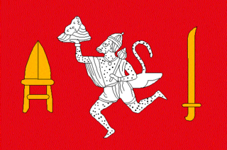
Panth-Piploda was a province of British India. It is located in present-day Ratlam district of Madhya Pradesh state of central India.
Piploda is a town and a Nagar Parishad in Ratlam district in the Indian state of Madhya Pradesh.
Malwa Agency was an administrative section of British India's Central India Agency. The headquarters of the political agent was at Neemuch (Nimach). The other chief towns of the region were : Ratlam and Jaora.
The Kingdom of Narsinghgarh or later Narsinghgarh State was a kingdom and later a princely state in subsidiary alliance with British India. It was ruled by Umath branch of the Parmar Rajputs.

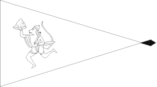
Ratlam State was a 13 gun salute princely state in India, part of the Malwa Agency of Central India during the British Raj.

Jaora State was a 13 gun-salute princely state of the British Raj. It was part of the Malwa Agency.

Alirajpur State was formerly a princely state of India, administratively under the Bhopawar Agency subdivision of the Central India Agency. The state covered an area of 2165 square kilometres, with a population of 50,185 in 1901 and its capital at Alirajpur. The average revenue of the state was Rs.100,000 in 1901.
Khilchipur State was a 9 gun salute princely state in India. The seat was in Khilchipur. It had an area of 710 square kilometres (273 sq mi), and a population of 31,143 in 1901. Its estimated revenue in 1901 was Rs.1,14,000.

Sailana State was an 11 gun salute princely state in India, part of the Malwa Agency of Central India during the British Raj. The state enjoyed an estimated revenue of Rs.5,00,000.

Saraikela State also spelt Seraikela, Saraikella or Seraikella, was a small princely state in India during the British Raj, in the region that is now the Jharkhand state. Its capital was at Saraikela.

Barwani State was a princely state in India. It is ruled by Sisodiya rajput. The seat was at Barwani.

Bikaner State was a princely state in the Rajputana from 1465 to 1947. The founder of the state, Rao Bika, was the eldest son of Rao Jodha, ruler of Jodhpur. Rao Bika chose to build his own kingdom instead of inheriting his father's. Bika defeated the Jat clans of Jangladesh along with his uncle Rao Kandhal and his adviser Vikramji Rajpurohit and founded his own kingdom. Its capital was the city of Bikaner in the northern area of present-day Rajasthan State in India. Karni Mata has been designated as the kuldevi of the royal family of Bikaner.
The Kingdom of Rajgarh or later Rajgarh State was a kingdom and later a princely state in India, named after its capital Rajgarh, Madhya Pradesh. It was part of the colonial Bhopal Agency of the Central India Agency during the British Raj. It lay in the region of Malwa known as Umatwara after the ruling Umat clan, a branch of the Parmar Rajputs. The neighbouring Narsinghgarh State was ruled by a cadet branch of this family, after being partitioned in 1681.

Dewas Senior was established by Tukoji Rao I Pawar during the Maratha conquest of Central India. It was a 15 Gun Salute Maratha princely state. On 12 December 1818 it became a British protectorate.

Indore State was a principality within the Maratha Confederacy ruled by the Maratha Holkar dynasty. After 1857, Indore became a 19-gun salute princely state within the Central India Agency of the Indian Empire under British protection.

Raigarh was a princely state in India during the British Raj. The state was ruled by the Gond dynasty of Gond clan.

Jhabua State was one of the princely states of India during the period of the British Raj. It had its capital in Jhabua town. Most of the territory of the princely state was inhabited by the Bhil people, who constituted a majority of the population. The revenue of the state in 1901 was Rs.1,10,000.

Radhanpur State was a kingdom and later princely state in India during the British Raj. Its rulers belonged to a family of Babi House, the state was once a polity within the Mughal Empire. The last ruling Nawab of Radhanpur, Nawab Murtaza Khan, signed the instrument of accession to the Indian Union on 10 June 1948.
