Jaora State

Last updated

Jaora State
जावरा रियासत
Princely State of British India
1818–1948
Jaoraflag.png
Flag
Jaora CoA.png
Coat of arms
Central India Agency 1909.jpg
Jaora located within the Malwa Agency near 4
Area 
 1901
1,471 km2 (568 sq mi)
Population 
 1901
84,202
Government
   Motto "Dil o daulat"
(Heart and wealth).
History 
 Established
1818
1948
Succeeded by
India Flag of India.svg
Today part of Madhya Pradesh, India [1]
Ratlami Gate, Jaora India1 526.jpg
Ratlami Gate, Jaora
The Jaora state flag was a green triangle between 1865 and 1895. Flag of the Princely State of Jaora.svg
The Jaora state flag was a green triangle between 1865 and 1895.

Jaora State was a 13 gun-salute princely state of the British Raj. It was part of the Malwa Agency. [2]

Contents

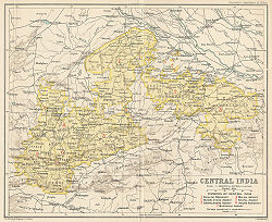
The total area of the princely state, with the dependencies of Piploda and Panth-Piploda, was 1,471 km2 (568 sq mi). Jaora state was divided into four tehsils, Jaora, Barauda, Tal, and Barkhera. The chief crops were millets, cotton, maize and opium. The revenue of the state was Rs.8,50,000 in 1901.

History

Jaora State was established by the British and was handed over to Abdul Ghafur Muhammad Khan in 1818, so that he can maintain an army of 1,000 soldiers for the East India Company. Abdul Ghafur Khan's family was settled in Uttar Pradesh/Hindustan before migrating to Rajasthan, while they traced their ancestry to the Swati tribe. [3] [4] 'Abdu'l Ghafur Muhammad Khan was a cavalry officer serving the North Indian Pathan leader Muhammad Amir Khan Pindari of Sambhal, Uttar Pradesh. [5] He later served the Holkar maharaja of Indore State and defected to the British in the Battle of Mahidpur resulting in the victory of the British and the surrender of Holkar forces. [6] The state was confirmed by the British government in 1818 by the Treaty of Mandsaur. [1] The Nawab of Jaora was confirmed the possession of Jaora, Sanjit, Tal, Malhargarh, Bharauda and the right to levy tribute from Piploda. The Nawab was expected to serve the British by providing them with 500 horsemen, 500 footmen and 4 artillery whenever required. [2] Most of the soldiers and population of the Jaora State came from United Provinces of Agra and Oudh region of Hindustan. [7] One of his fellow soldiers, Mir Zafar Ali, was an Indian Muslim of the Sadaat-e-Bara tribe, born in the Bahera village of the Fatehpur Haswa in Oudh. He gained Bilaud in the Sanjit Pargana as his jagir. [8] [9]

Muhammad Ismail Khan was not a good administrator and the state fell in heavy debts with a sum of 16 lakhs due. The state also had to pay nazarana fee of 2 lakhs to Holkar when a new ruler was installed and a yearly tribute of 1.6 lakhs to the British when Jaora failed to provide troops. This tribute was later reduced to 1.4 lakhs and was preferred by the state. The army was then reduced to 59 cavalry, 124 infantry and 36 irregulars. There was also a regular police force present in the state. [10]

Nawab Muhammad Ismail (ruled 1865-1895) was an honorary major in the British Army. [1] During the reign of Nawab Muhammad Iftekhar Ali Khan (ruled 1895-1947), Piploda became a separate state in 1924, and Panth-Piploda became a province of British India in 1942. Nawab Muhammad Usman 'Ali Khan (ruled 1947-1948) acceded to the Government of India on 15 June 1948.

Jagirdars of Jaora

The chieftains of several petty estates who once paid tribute to Amir Khan Pindari and the other surrounding powers came under the suzerainty of Jaora State after the Treaty of Mandsaur. The Jagirdars were mostly Rajputs apart from Bilaud and Numan Nagdi who were Pathans and Barha Sayyids and Sidri whose thakur was a Mahajan. [11]

See also

Related Research Articles

<span class="mw-page-title-main">Central India Agency</span> Agency of princely states in India

The Central India Agency was created in 1854, by amalgamating the Western Malwa Agency with other smaller political offices which formerly reported to the Governor-General of India. The agency was overseen by a political agent who maintained relations of the Government of India with the princely states and influence over them on behalf of the Governor-General. The headquarters of the agent were at Indore.

<span class="mw-page-title-main">Mandsaur</span> Town in Madhya Pradesh, India

Mandsaur is a city and a municipality in Mandsaur district located on the border of Mewar and Malwa regions of Madhya Pradesh, a state in Central India. It is the administrative headquarters of Mandsaur District. The ancient Pashupatinath Temple is located in Mandsaur.

<span class="mw-page-title-main">Holkar</span> Dhangar clan in India

The Holkars were a family that was part of the Maratha Empire, which held the rank of subahdar under Peshwa Baji Rao I. When the Maratha Empire began to weaken due to internal clashes, the Holkars declared themselves the rulers of Indore in Central India, existing as an autonomous member of the Maratha Empire until 1818. Later, their kingdom became a princely state under the protectorate of British India.

<span class="mw-page-title-main">Amir Khan (Nawab of Tonk)</span> Pashtun general, ruler of the Princely State of Tonk in India from 1798–1834

Nawab Muhammad Amir Khan (1769–1834) was a military general in the service of Yashwantrao Holkar of the Maratha Empire and later became the first ruler of the princely state of Tonk. Amir Khan was a Hindustani Pathan and a North Indian Muslim. Born and bred in Sambhal, Amir Khan was the son of a Zamindar in Uttar Pradesh, Hayat Khan, while his grandfather Taleh Khan was a Pashtun from Salarzai sub-clan of the Yusufzai tribe of District Buner in modern-day Pakistan who had migrated to and acquired land in Rohilkhand.

<span class="mw-page-title-main">Rohilla</span> Pashtun-descended ethnic group of Uttar Pradesh, India

Rohillas are a mixed Indian community of Pashtun heritage, historically found in Rohilkhand, a region in the state of Uttar Pradesh, India. It forms the largest Pashtun diaspora community in India, and has given its name to the Rohilkhand region. The Rohilla military chiefs settled in this region of northern India in the 1720s, the first of whom was Ali Mohammed Khan.

<span class="mw-page-title-main">Jaora</span> City in Madhya Pradesh, India

Jaora is a city and a municipality in Ratlam district in the Indian state of Madhya Pradesh. Jaora is located in the Malwa region, between Ratlam and Mandsaur. It was the capital of the Jaora princely state of Jaora before Independence. During the Mourning of Muharram, thousands of people from all over the world visit the shrine of Hussain Tekri. Jains visit Jaora as a place that the Jain ascetic Rajendrasuri practiced tapasya.

<span class="mw-page-title-main">Ratlam district</span> District of Madhya Pradesh in India

Ratlam District is a district of Madhya Pradesh state in central India. The town of Ratlam is administrative headquarters of the district.

<span class="mw-page-title-main">Battle of Mahidpur</span>

The Battle of Mahidpur was fought during the Third Anglo-Maratha War between the Holkar faction of the Maratha Confederacy and the British East India Company at Mahidpur, a town in the Malwa region, on 21 December 1817.

<span class="mw-page-title-main">Panth-Piploda Province</span>

Panth-Piploda was a province of British India. It is located in present-day Ratlam district of Madhya Pradesh state of central India.

Malwa Agency was an administrative section of British India's Central India Agency. The headquarters of the political agent was at Neemuch (Nimach). The other chief towns of the region were : Ratlam and Jaora.

<span class="mw-page-title-main">Tonk State</span> Princely State of India

Tonk was a princely state of India at the time of the British Raj. The town of Tonk, which was the capital of the state, had a population of 273,201 in 1901. The town was surrounded by a wall and had a mud fort. It had a high school, the Walter hospital for women, under a matron, and a separate hospital for men. It has a bridge on the river Banas.

<span class="mw-page-title-main">Battles involving the Maratha Empire</span> Military conflicts between the Maratha empire and Nizam of Hyderabad in India

The Maratha Conquests were a series of conquests in the Indian subcontinent which led to the building of the Maratha Empire. These conquests were started by Shivaji in 1659, from the victory at the Battle of Pratapgad against Bijapur. The expansion of the empire was limited and interrupted by the Mughal conquests of south India by Mughal ruler Aurangzeb until he eventually died in 1707 in Deccan itself. Marathas were forced to defend their territories against the overwhelmingly strong Mughal army in the 27 years long Deccan wars. They were able to defend their territories and gain an upper hand over Mughals in the sustained conflict.

<span class="mw-page-title-main">History of Bareilly</span>

According to the epic Mahābhārata, Bareilly region (Panchala) is said to be the birthplace of Draupadi, who was also referred to as 'Panchali' by Kṛṣṇā. When Yudhishthira becomes the king of Hastinapura at the end of the Mahābhārata, Draupadi becomes his queen. The folklore says that Gautama Buddha had once visited the ancient fortress city of Ahicchattra in Bareilly. The Jain Tirthankara Parshva is said to have attained Kaivalya at Ahichhatra.

<span class="mw-page-title-main">Kurwai State</span>

Kurwai State was a princely state of British India under the Bhopal Agency and centered around Kurwai town. The town of Kurwai was founded by Mohammed Diler Khan in 1715. The state was 368 km2 in area and had a population of 30,631 in 1892.

<span class="mw-page-title-main">Piploda State</span>

Piploda State was an estate in India at the time of the British Raj. It belonged to the Malwa Agency, part of the Central India Agency. The state was initially a tributary of Jaora State. In 1924 Piploda became an independent non-gun salute state through British mediation.

<span class="mw-page-title-main">Mohammadgarh State</span>

Mohammadgarh State, also spelt as 'Muhammadgarh', was a former princely state in Central India, under the Bhopal Agency during the British Raj. It was situated in the Malwa Plateau. The state had an area of 29 square miles (75 km2), and a population of 2,944. Its headquarters were at Mohammadgarh town.

<span class="mw-page-title-main">Oudh State</span> Princely state in the Awadh region of North India (1732-1856)

The Oudh State was a Mughal subah, then an independent kingdom, and lastly a princely state in the Awadh region of North India until its annexation by the British in 1856. The name Oudh, now obsolete, was once the anglicized name of the state, also written historically as Oudhe.

<span class="mw-page-title-main">Basoda State</span>

Basoda State was a former princely state in Central India, part of the Bhopal Agency during the British Raj in India, with its capital at Haidergarh. It was also known as Nawab-Basoda or Haidargarh-Basoda in order to distinguish it from a place with the same name in Gwalior State.

<span class="mw-page-title-main">Kingdom of Rohilkhand</span> Early modern kingdom in North India (1721–1774)

The Kingdom of Rohilkhand was a late modern Indian kingdom under nominal Mughal suzerainty, that rose under the declining Mughal Empire in 1721 and continued to exist until 1774 when it was defeated by Oudh the British transformed its significantly reduced borders into the princely state of Rampur. Nawab Ali Mohammed Khan became the first Nawab of Rohilkhand, having been previously elected as overlord by various Afghan chiefs at the age of fourteen. He would carve out the future kingdom from the collapsing Mughal Empire and go on to the found the Rohilla dynasty. The crown would go on being held by the Rohillas until the kingdom came to an end in 1774, and thereafter the same dynasty would rule over Rampur.

References

  1. 1 2 3 Wikisource-logo.svg One or more of the preceding sentences incorporates text from a publication now in the public domain :  Chisholm, Hugh, ed. (1911). "Jaora". Encyclopædia Britannica . Vol. 15 (11th ed.). Cambridge University Press. p. 156.
  2. 1 2 Imperial Gazetteer of India, v. 14, p. 63., Digital South Asia Library
  3. A. Vadivelu (1915). The Ruling Chiefs, Nobles & Zamindars of India Volume 1.
  4. Jasim Khan. Being Salman.
  5. Edwin [Felix] Thomas Atkinson (1879). Statistical Descriptive and Historical Account of the North-Western Provinces of India · Volume 5, Issue 1. the Bavarian State Library (4 H.as. 1026 h-5,1). p. 357.
  6. Madhya Pradesh (India) (1827). Madhya Pradesh District Gazetteers: Hoshangabad. Government Central Press. pp. 77–78.
  7. The Journal of Academy of Indian Numismatics & Sigillography Volumes 17-18. p. XXXI. Most of the population of Jaora State(founded in 1818 AD) came from the United Province and Jodhpur.
  8. A Collection of Treaties, Engagements and Sanads, Relating to India and Neighbouring Countries:Volume 4, Part 1. India. Foreign and Political Department. 1909. Hakim Zafar Ali, a saiyid by caste, and a native of Bahera, a village in the district of Fatehpur Haswa, in the United Provinces of Agra and Oudh. He was in the service of Nawab Ghafur Khan of Jaora, by whom the village of Bilaud was granted to him in Jagir.
  9. A Collection of Treaties, Engagements and Sanads Relating to India and Neighbouring Countries. p. XVIII.
  10. A. Vadivelu (2011). The Ruling Chiefs, Nobles & Zamindars of India Volume 1.
  11. Leading Famlies And Officials In The States Of Central India p. 136

23°38′N75°08′E / 23.63°N 75.13°E / 23.63; 75.13