Satna is a city in the Indian state of Madhya Pradesh. It serves as the headquarters of Satna district. It is 7th largest city and 8th most populous city of the state. The city is 500 km east of the state capital Bhopal. The city is distributed over a land area of 111.9 square kilometres.
Bijawar is a city the state of Madhya Pradesh, India. It is the administrative headquarters of Bijawar Taluk, and was formerly the capital of a princely state of British India of the same name. The people of Bijawar are demanding the district status from their state government. It is the 53rd proposed district of Madhya Pradesh

The Imperial Legislative Council (ILC) was the legislature of British India from 1861 to 1947. It was established under the Government of India Act 1858 by providing for the addition of six additional members to the Governor General Council for legislative purposes. Thus, the act separated the legislative and executive functions of the council and it was this body within the Governor General's Council which came to known as the Indian/Central Legislative Council. In 1861 it was renamed as Imperial Legislative Council and the strength was increased.

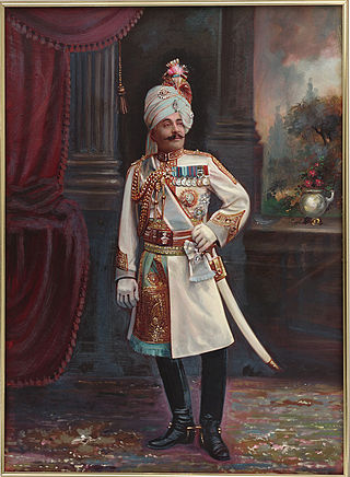
Lieutenant-General Sir Pratap Singh,, was a Maharaja of the princely state of Idar (Gujarat), administrator and Regent of Jodhpur and heir to Ahmednagar later renamed as Himmatnagar from 1902 to 1911.

Baraundha was a princely state of colonial India, located in modern Satna district of Madhya Pradesh. Although historically far larger, at the time of Indian independence in 1950, it was a saluted state of 9 guns.

Bikaner State was the Princely State in the north-western most part of the Rajputana province of imperial British India from 1465 to 1947. The founder of the state Rao Bika was a younger son of Rao Jodha ruler of and founder of the city of Jodhpur in Marwar. Rao Bika chose to establish his own kingdom instead of inheriting his father's. Bika defeated the Jat clans of Jangladesh which today refers to the north and north-western Rajasthan along with his uncle Rao Kandhal and his adviser Vikramji Rajpurohit and founded his own kingdom. Its capital was the city of Bikaner.

Jaso or Jassu, formerly known as Yashogarh was a princely state of the Bundelkhand Agency in British India located in present-day Nagod tehsil, Satna district, Madhya Pradesh, 44 km west from the district headquarters. It was surrounded in the north, east and south by Nagod State and in the east by Ajaigarh.

Khaniadhana or Khaniyadhana was a princely state of British India ruled by the Judev dynasty of Bundela Rajputs. The capital of the State was Khaniadhana. It was part of the Bundelkhand Agency and later the Central India Agency.

Chhatarpur was one of the princely states of India during the period of the British Raj. The state was founded in 1785 and its capital was located in Chhatarpur, Madhya Pradesh.

Ajaigarh State was one of the princely states of India during the period of the British Raj. The state was ruled by Bundela clan of Rajput But later on this place was ruled by Yadav (Dauwa) kings.. The state was founded in 1765 by Guman Singh and its capital was located in Ajaigarh, Madhya Pradesh. Sawai Maharaja Punya Pratap Singh signed the accession to the Indian Union on 1 January 1950.

Udaipur State was one of the princely states of India during the British Raj. The town of Dharamjaigarh was the former state's capital.

Gaurihar State was a princely state in India, ruling a territory that is now in Madhya Pradesh. Gaurihar is a tehsil of Chhatarpur district.

Nagod State was a princely state of colonial India, located in modern Satna district of Madhya Pradesh. The state was known as 'Unchahara' after Unchehara, its original capital until the 18th century.

Bijawar State was a princely state of colonial India, located in modern Chhatarpur district of Madhya Pradesh.

The Chaube Jagirs, also known as Kalinjar Chaubes, jagir states were a group of five feudal states of Central India during the period of the British Raj. They were a British protectorate from 1823 to 1947 and belonged to the Bagelkhand Agency. Their last rulers acceded to India in 1948.

Surguja State was one of the main princely states of Central India during the period of the British Raj, even though it was not entitled to any gun salute. Formerly, it was placed under the Central India Agency, but in 1905 it was transferred to the Eastern States Agency.

Sohawal State was a princely state of the Bagelkhand Agency of the British Raj. It was a relatively small Sanad state of about 552 km2 with a population of 32,216 inhabitants in 1901. Its capital was at Sohawal, a small town — 2,108 inhabitants in 1901 — located in modern Satna district of Madhya Pradesh.
Garrouli; Hindi Name गर्रौली) is a fort and former princely state in present Madhya Pradesh, central India.


