Gwalior Residency

Last updated

Gwalior Residency
Agency of British India
1782–1947
Central India Agency Map.jpg
Map of Central India in 1909 with the Gwalior Residency in its northern and western sectors
Area 
 1901
46,167 km2 (17,825 sq mi)
Population 
 1901
2187612
History
History 
1782
  Gwalior separated from Central India Agency
1921
  Rampur and Benaras transferred to Gwalior Residency
1936
1947
Preceded by
Succeeded by
Flag of the Maratha Empire.svg Maratha Empire
India Flag of India.svg

Gwalior Residency was a political office in the British Indian Empire, which existed from 1782 until the British withdrawal from India in 1947.

Contents

The Gwalior Residency was placed under the Central India Agency in 1854, and separated from it in 1921.

States under the residency

The Gwalior residency dealt with a number of Princely States of Central India. Salute states, in order of precedence :

Non-salute states :

Also the Chhabra pargana (district) of Tonk State

History

After the Treaty of Salbai was concluded in 1782 between the British and Maharaja Mahadji Sindhia of Gwalior, David Anderson, who contributed to drafting the treaty, was appointed resident at the Gwalior court. The court was a moving camp until 1810, when Mahadji's successor Daulat Rao Sindhia permanently fixed his headquarters near the fortress of Gwalior, on the spot where Lashkar city now stands. Daulat Rao Sindhia was forced to sign a treaty of subsidiary alliance with the government of British India in 1817 at the conclusion of the Third Anglo-Maratha War. The Resident at Gwalior answered directly to the Governor-General of India until 1854, when Gwalior Residency was placed under the authority of the Central India Agency. The fortress of Gwalior was captured by rebels during the Indian Rebellion of 1857, and recaptured by British troops in 1858, who occupied the fortress until 1886. In 1860 the smaller states were made into a separate charge, under the officer commanding the Central India Horse at Guna. This arrangement was abolished in 1896, when these states were again placed under the resident, with the officer commanding at Guna continuing to act as ex officio assistant to the Resident, with very limited powers. In 1888 Khaniadhana state was transferred from the Bundelkhand Agency to the Resident at Gwalior, and in 1895 the Gwalior State districts of Bhilsa and Isagarh were transferred from Bhopal Agency to the Gwalior Residency. In 1921 Gwalior Residency was separated from the Central India Agency, and the resident again answered directly to the Governor-General. In 1936 the princely states of Benares and Rampur, which had previously been under the authority of the United Provinces, were placed under the authority of the Gwalior resident.

The Resident, as the officer accredited to the Gwalior ruler, was also in all matters of general policy the channel of communication between the ruler and other political officers, such as the agents of Malwa and Bhopawar, within whose charges isolated portions of Gwalior State were situated. He exercised a close supervision over the minor holdings of the residency, all criminal cases of any importance in which were either dealt with by him personally or submitted for his sanction and approval. He also had the powers of a District and Session Judge for portions of the Midland and Bina-Baran sections of the Great Indian Peninsula Railway, which passed through the states of Gwalior, Datia, Samthar, Khaniadhana, and the Chhabra pargana.

The headquarters of the political officer were situated in the area known as The Residency, a piece of land measuring 1.17 square miles (3.0 km2) situated close to Morar, about four miles (6 km) to the east of Gwalior fort. The area was administered by the resident, and included three villages, the revenue from which were devoted to the upkeep of the Residency limits. In 1901 the population of the Residency was 1,391. The Great Indian Peninsula Railroad and Gwalior Light Railways and the Agra-Bombay and Bhind-Jhansi high roads traversed the charge.

The Gwalior residency was abolished upon Indian Independence at the stroke of midnight on 15 August 1947, when all treaty relations between the British crown and the princely states of India were nullified. The rulers of the states acceded to the Government of India between 1947 and 1950, and most of the Gwalior Residency, including Gwalior State, were incorporated into the new Indian state of Madhya Bharat, with Rampur and Benares going to Uttar Pradesh. Madhya Bharat was merged into Madhya Pradesh state on 1 November 1956. [1]

Population and Geography

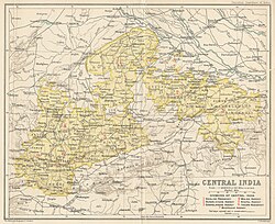
The population of the residency was 2,187,612 in 1901, of whom Hindus numbered 1,883,038, or 86 percent; animists 170,316, or 8 percent; Muslims 103,430, or 4 percent; and Jains 30,129, or 1 percent. In 1901 the residency had an area of 17,825 square miles (46,170 km2), 17,020 square miles (44,100 km2) of which belonged to Gwalior State. The density of population was 123 persons per square mile. By 1931 the population of the areas covered by the Residency had grown to over 3.5 million.

The charge contained 6820 villages and sixteen towns in 1901, of which the chief were Lashkar, Morar, Gwalior, Guna, Bhind, Bhilsa, Narwar, Ujjain and Chanderi. Bhilsa, Morena, Ujjain and Guna were the chief centres for the sale of grain, and Chanderi for the manufacture of fine cloth. [2]

See also

Related Research Articles

<span class="mw-page-title-main">Rajputana Agency</span> Former political office of the British Indian Empire

The Rajputana Agency was a political office of the British Indian Empire dealing with a collection of native states in Rajputana, under the political charge of an Agent reporting directly to the Governor-General of India and residing at Mount Abu in the Aravalli Range. The total area of the states falling within the Rajputana Agency was 127,541 square miles (330,330 km2), with eighteen states and two estates or chiefships.

<span class="mw-page-title-main">Princely state</span> Type of vassal state in British India

A princely state was a nominally sovereign entity of the British Indian Empire that was not directly governed by the British, but rather by an Indian ruler under a form of indirect rule, subject to a subsidiary alliance and the suzerainty or paramountcy of the British crown.

<span class="mw-page-title-main">Madhya Bharat</span> Former state of India (1947–1957)

Madhya Bharat, also known as Malwa Union, was an Indian state in west-central India, created on 28 May 1948 from twenty-five princely states which until 1947 had been part of the Central India Agency, with Jiwajirao Scindia as its Rajpramukh.

Scindia dynasty was a Hindu Maratha dynasty that ruled the erstwhile Gwalior State in central India. It had the patil-ship of Kumberkerrab in Wai and was founded by Ranoji Scindia, who started as a personal servant of the Peshwa Bajirao I. Ranoji and his descendents, along with their rivals the Holkars, played a leading role during the Maratha ascendency in northern India in the 18th-century. The Gwalior State became a princely state under the British Raj during the 19th and the 20th-centuries. After India's independence in 1947 and the abolition of princely states, several members of the Scindia family went on to enter Indian politics.

<span class="mw-page-title-main">Central India Agency</span> Agency of princely states in India

The Central India Agency was created in 1854, by amalgamating the Western Malwa Agency with other smaller political offices which formerly reported to the Governor-General of India. The agency was overseen by a political agent who maintained British relations with the princely states and influence over them on behalf of the Governor-General. The headquarters of the agent were at Indore.

<span class="mw-page-title-main">Datia district</span> District of Madhya Pradesh in India

Datia District is in Gwalior Division in the Indian state of Madhya Pradesh. The town of Datia is its district headquarters.

<span class="mw-page-title-main">Bhopawar Agency</span>

Bhopawar Agency was a sub-agency of the Central India Agency in British India with the headquarters at the town of Bhopawar, so the name. Bhopawar Agency was created in 1882 from a number of princely states in the Western Nimar and Southern Malwa regions of Central India belonging to the former Bhil Agency and Bhil Sub-agency with the capitals at Bhopawar and Manpur. The agency was named after Bhopawar, a village in Sardarpur tehsil, Dhar District of present-day Madhya Pradesh state. Manpur remained a strictly British territory.

<span class="mw-page-title-main">Bhopal Agency</span>

The Bhopal Agency was a section of British India's colonial Central India Agency, a British political unit which managed the relations of the British with a number of autonomous princely states existing outside British India.

<span class="mw-page-title-main">Eastern States Agency</span> Agency of India from 1933 to 1947

The Eastern States Agency was an agency or grouping of princely states in eastern India, during the latter years of the Indian Empire. It was created in 1933, by the unification of the former Chhattisgarh States Agency and the Orissa States Agency; the agencies remained intact within the grouping. In 1936, the Bengal States Agency was added.

Malwa Agency was an administrative section of India's Central India Agency. The headquarters of the political agent was at Mandsaur (Mandasor) / Neemuch (Nimach). The other chief towns of the region were : Ratlam and Jaora.

<span class="mw-page-title-main">Salute state</span> Princely state under the British Raj

A salute state was a princely state under the British Raj that had been granted a gun salute by the British Crown ; i.e., the protocolary privilege for its ruler to be greeted—originally by Royal Navy ships, later also on land—with a number of cannon shots, in graduations of two salutes from three to 21, as recognition of the state's relative status. The gun-salute system of recognition was first instituted during the time of the East India Company in the late 18th century and was continued under direct Crown rule from 1858.

<span class="mw-page-title-main">Jayajirao Scindia</span> Maharaja of Gwalior (1834–1886)

Jayajirao Scindia GCB, GCSI, CIE of the Scindia dynasty of the Marathas was the ruling Maharaja of Gwalior under the British rule from 1843 to 1886.

<span class="mw-page-title-main">Madras States Agency</span>

The Madras States Agency was an agency of India. Founded in 1923, it consisted of these five princely states :

<span class="mw-page-title-main">Bundelkhand Agency</span>

The Bundelkhand Agency was a political agency of the British Raj, managing the relations of the British government with the protected princely states of the Bundelkhand region.

<span class="mw-page-title-main">Gwalior State</span> Semi-autonomous Maratha state (1731–1948)

Gwalior state was a semi-autonomous Maratha state. It was centred in modern-day Madhya Pradesh, arising due to the rise of the Maratha Empire and fragmentation of the Mughal Empire.

<span class="mw-page-title-main">Daulat Rao Sindhia</span> Maharaja of Gwalior (1779–1827)

Shrimant Daulat Rao Shinde was the Maharaja (ruler) of Gwalior state in central India from 1794 until his death in 1827. His reign coincided with struggles for supremacy within the Maratha Empire, and wars with the expanding East India Company. Daulatrao played a significant role in the Second and Third Anglo-Maratha wars.

<span class="mw-page-title-main">Chanderi District</span>

Chanderi District was a former administrative district of British India. It covered most of present-day Lalitpur District of Uttar Pradesh state and the eastern portion of Ashoknagar District of Madhya Pradesh state.

<span class="mw-page-title-main">Chanderi fort</span> Fort in India

Chanderi Fort located at Chanderi in Ashoknagar District of Madhya Pradesh state in India is situated at a distance of 127 km from Shivpuri and 37 km from Lalitpur and about 45 km from Esagarh and 38 km from Mungoali It is located on a hill southwest of the Betwa River. Chanderi is surrounded by hills, lakes and forests and there are several monuments. Chanderi finds mention in Mahabharata. Shishupal was the king of Mahabharata period.

<span class="mw-page-title-main">Khilchipur State</span> Princely state of India

Khilchipur State was a 9 gun salute princely state in India. The seat was in Khilchipur. It had an area of 710 square kilometres (273 sq mi), and a population of 31,143 in 1901. Its estimated revenue in 1901 was Rs.1,14,000.

<span class="mw-page-title-main">Sailana State</span> Princely state of India

Sailana State was an 11 gun salute princely state in India, part of the Malwa Agency of Central India during the British Raj. The state enjoyed an estimated revenue of Rs.5,00,000.

References

  1. Markovits, Claude (ed.) (2004). A History of Modern India: 1480-1950. Anthem Press, London.
  2. Hunter, William Wilson, Sir, et al. (1908). Imperial Gazetteer of India, Volume 12. 1908-1931; Clarendon Press, Oxford.