Chhatarpur State

Last updated

Chhatarpur State
Pawar (Parmar) Rajput Princely State of British India
1785–1950
Flag of Chhatarpur.svg
Flag
JaitpurKart.jpg
Chhatarpur State in the Imperial Gazetteer of India
Capital Chhatarpur
Area 
 1901
2,927 km2 (1,130 sq mi)
Population 
 1901
10,029
History 
 Established
1785
1950
Succeeded by
India Flag of India.svg

Chhatarpur was one of the princely states of India during the period of the British Raj. The state was founded in 1785 and its capital was located in Chhatarpur, Madhya Pradesh.

Contents

Chhatarpur's last ruler signed the accession to the Indian Union on 1 January 1950.[ citation needed ]

History

Chhatarpur was founded in 1785. It is named after the Chhatrasal, the founder of Bundelkhand, and contains his cenotaph. The state was ruled by his descendants until 1785. The state was guaranteed to Kunwar Sone Singh Ponwar in 1806 by the British Raj.
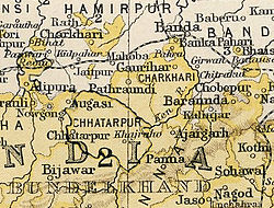
 In 1854 Chhatarpur would have lapsed to the British government for want of direct heirs under the doctrine of lapse, but was conferred on Jagat Raj as a special act of grace. The Rajas ruled a princely state with an area of 1,118 square miles (2,900 km2), and population of 156,139 in 1901, which was part of the Bundelkhand agency of Central India.[ citation needed ]

In 1901 the town of Chhatarpur had a population of 10,029, a high school and manufactured paper and coarse cutlery. The state also contained the British cantonment of Nowgaon. After the independence of India in 1947, the Rajas of Chhatarpur acceded to India, and Chhatarpur, together with the rest of Bundelkhand Agency, became part of the Indian state of Vindhya Pradesh. Vindhya Pradesh was merged into the state of Madhya Pradesh in 1956.[ citation needed ]

Rulers

The rulers bore the title of Raja and latter Maharaja. [1]

Rajas

The Pawar (Parmar) Rajput dynasty ruled Chhatarpur State.

Maharajas

Titular Maharajas

See also

Related Research Articles

Ajaigarh or Ajaygarh is a town and a nagar panchayat in the Panna District of Madhya Pradesh state in central India.

<span class="mw-page-title-main">Vindhya Pradesh</span> Former State of India

Vindhya Pradesh was a former state of India. It occupied an area of 61,131.5 km2. It was created in 1948 as Union of Baghelkhand and Bundelkhand States, shortly after Indian independence, from the territories of the princely states in the eastern portion of the former Central India Agency. It was named as Vindhya Pradesh on 25 January 1950 after the Vindhya Range, which runs through the centre of the province. The capital of the state was the former princely state of Rewa. It lays between Uttar Pradesh to the north and Madhya Pradesh to the south, and the enclave of Datia, which lay a short distance to the west, was surrounded by the state of Madhya Bharat.

<span class="mw-page-title-main">Chhatarpur</span> City in Madhya Pradesh, India

Chhatarpur is a city and a municipality in Chhatarpur district in the state of Madhya Pradesh, India. It is the administrative headquarters of Chhatarpur District. Chhatarpur is a city and a municipality in Chhatarpur district in the state of Madhya Pradesh, India. It is the administrative headquarters of Chhatarpur District.

<span class="mw-page-title-main">Central India Agency</span> Agency of princely states in India

The Central India Agency was created in 1854, by amalgamating the Western Malwa Agency with other smaller political offices which formerly reported to the Governor-General of India. The agency was overseen by a political agent who maintained relations of the Government of India with the princely states and influence over them on behalf of the Governor-General. The headquarters of the agent were at Indore.

<span class="mw-page-title-main">Datia</span> City in Madhya Pradesh, India


Datia is the district headquarter of the Datia District in north central Madhya Pradesh,a state of Central India. It is an ancient town, mentioned in the Mahabharata ruled by King Dantavakra. The city is 78 km from Gwalior, 325 km south of New Delhi and 344 km north of Bhopal. About 18 km from Datia is Sonagiri, a sacred Jain hill. Datia is also about 31 km from Jhansi and 52 km from Orchha. The nearest airport is at Gwalior. It was formerly the seat of the eponymous princely state in the British Raj. Datia is situated near Gwalior and on the border with Uttar Pradesh.

<span class="mw-page-title-main">Tikamgarh</span> City in Madhya Pradesh, India

Tikamgarh is a town and a tehsil in Tikamgarh district in the Indian state of Madhya Pradesh. The city serves as a district headquarters. The earlier name of Tikamgarh was Tehri consisting of three hamlets, forming a rough triangle. In Tikamgarh town there is locality still known as 'Purani Tehri'. Until Indian independence in 1947, Tikamgarh, formerly called Tehri, was part of the kingdom of Orchha, which was founded in the 16th century by the Bundeli chief Rudra Pratap Singh, who became the first King of Orchha. In 1783 the capital of the state was moved to Tehri, about 40 miles (64 km) south of Orchha, which was home to the fort of Tikamgarh, and the town eventually took the name of the fort. The district is famous for the old fort of Kundar known as Garh Kundar, which was built by Khangars and remained the capital of Khangar rulers from 1180 to 1347.

Bijawar is a city the state of Madhya Pradesh, India. It is the administrative headquarters of Bijawar Taluk, and was formerly the capital of a princely state of British India of the same name. The people of Bijawar are demanding the district status from their state government. It is the 53rd proposed district of Madhya Pradesh

<span class="mw-page-title-main">Rewa (princely state)</span> Princely state in India

Rewa State, also known as Rewah, was a Rajput princely state of India, surrounding its eponymous capital, the town of Rewa.

<span class="mw-page-title-main">Alipura State</span> Princely state in the Indian state of Madhya Pradesh

Alipura was a princely state in what is today the Chhatarpur District in the Indian state of Madhya Pradesh.

<span class="mw-page-title-main">Datia State</span> Princely state of India

Datia State was a princely state in subsidiary alliance with British India.

<span class="mw-page-title-main">Orchha State</span> Princely state of India

Orchha State was a kingdom situated in the Bundelkhand region and later a princely state in British India. The state was ruled by Bundela clan of Rajputs. It was located within what is now the state of Madhya Pradesh.

<span class="mw-page-title-main">Sitamau State</span> Princely state of India

Sitamau State was a princely state of the British Raj before 1947. Its capital was in Sitamau town, Mandsaur district, Madhya Pradesh. The total area of the state was 350 square miles. The average revenue of the state was Rs.130,000.

<span class="mw-page-title-main">Khaniadhana State</span> Indian Princely State

Khaniadhana or Khaniyadhana was a princely state of British India ruled by the Judev dynasty of Bundela Rajputs. The capital of the State was Khaniadhana. It was part of the Bundelkhand Agency and later the Central India Agency.

<span class="mw-page-title-main">Bijawar State</span> Princely state of colonial India

Bijawar State was a princely state of colonial India, located in modern Chhatarpur district of Madhya Pradesh.

<span class="mw-page-title-main">Panna State</span> Princely state of India

Panna State was a princely state of colonial India, located in modern Panna district of Madhya Pradesh.

<span class="mw-page-title-main">Jigni State</span>

Jigni State was a princely state of the Bundelkhand Agency of the British Raj. It was a small Sanad state of about 82.87 km2 with a population of 4,297 inhabitants in 1901. The state was surrounded by the Hamirpur and Jhansi districts of the United Provinces.

Multhan is a village in the Dhar district of Madhya Pradesh.

Maheba, is a village and a tehsil in Chhatarpur district in the state of Madhya Pradesh, India. It is located 3.5km from National Highway 39.

Maharaja Vishwanath Singh Bahadur KCSI was Maharaja of the salute state of Chhatarpur from 1867 to 1932.

<span class="mw-page-title-main">Naigaon Rebai State</span>

The Naigaon-Rebai or Naigawan-Rebai was one of the small estate of India during the period of the British Raj. It was a non-salute princely state in the Bundelkhand Agency. The state was founded in 1807 by Thakur Lakshman Singh. He received charter (sanad) to rule from the British Raj.

References

  1. 1 2 3 Rathore, Abhinay. "Chhatarpur (Princely State)". Rajput Provinces of India. Retrieved 16 August 2022.

24°54′57″N79°34′56″E / 24.915709°N 79.582214°E / 24.915709; 79.582214