
Mansehra District is a district in the Hazara Division, Khyber Pakhtunkhwa, northern Pakistan. Mansehra city serves as the headquarters of the district.

Peshawar District is a district in the Peshawar Division of the Khyber Pakhtunkhwa province of Pakistan. It is located about 160 km west of the Pakistan's capital Islamabad. The district headquarter is the city of Peshawar, which is also the capital of Khyber Paktunkhwa.

Lucknow district is a district located in the state of Uttar Pradesh in northern India. The city of Lucknow is the district headquarters and the district is part of Lucknow Division. It also is the capital of Uttar Pradesh Lucknow is Bounded on the east by Barabanki district, on the west by Unnao and Hardoi districts, on the south by Raebareli district and in the north by Sitapur district.

Khandeshi is an Indo-Aryan language spoken in the Khandesh region of north-west Maharashtra and also in Gujarat. It consists of Khandeshi proper, and the Dangri and Ahirani dialects. Kunbi and Rangari also are dialects. Ahirani dialect of this language is mostly spoken. Devanagari script is used to write Khandeshi language. The words "Ahirani" and "Khandeshi" are sometimes used interchangeably: Ahirani as the caste-based name, and Khandesh as the region-based name. The Census of 1911, 1921 and 1931 counted the Ahirani speaking people as Gujaratis but in latter decades they've been recognized as a different language.
Rohida is a historic village situated in Sirohi district of Indian state of Rajasthan. The village is known for Audichya Rodwal Brahman Community residing there. The Maharaja of Sirohi State has provided the land to the Rodwal Brahmins. Rohida has been named after King Rohida, the Son of Satayavadi Raja Harish Chandra who lived his last years of life at Rohida. Rohida is the birthplace of the historian Gaurishankar Hirachand Ojha. In 1922 Motilal Tejawat started Eki Movement to unit tribals at Rohida. The village is known for historical temples of Hindu community such as Somnath Mahadev, Rajrajeshwar Mahadev and Sugreeveshwar Mahadev. After independence, when Panchayati Raj established, the village elected Ravishankar Yagnik, one of freedom fighters from Rodwal community as first Sarpanch of the village, who also has been elected the first Tehsil Pradhan of the Pindwara Tehsil, after he represented the constituency to Rajasthan Assembly and requested for Backward Status for Sirohi District that has been approved by Assembly. Here, Marwadi language is spoken which is quite similar to Mewadi & Gujarati language in pronunciation and words. Devnagari script has been used to write the history of Rohida. Rohida is also related to Lord Parshuram, at the period of Mahabharata, Parshuram visited Rohida and established Lord Shiva temple and named it Jabeshwar Mahadev Mandir which is around 4 km from Rohida.

Asind is a city and a municipality in Bhilwara district, Rajasthan, India. It is a Tehsil (sub-division) for many villages The city have a magistrate office, lower justice court and many administrative hub for many major villages.
Ramnagar may refer to the following places:

Bali is a town and a municipality in Pali district in the state of Rajasthan, India. The town is situated on the left bank of the Mithari River. This walled town was the headquarters of a district having the same name in the Jodhpur State. Bali is a tehsil and panchayat samiti with the same name. Bali is also a sub-divisions among the 10 sub-divisions of the Pali district. It is known for its fort. Nearest towns are Falna & Sadri and nearest villages are Shri Sela and Boya.
Chak No. 128 NB is a village situated in the Sillanwali Tehsil of the Sargodha District in Punjab, Pakistan. Its neighbouring villages are Chak 130 NB, Chak 125 NB, Chak No. 129 NB and Jahanawala. The village is in a mainly agricultural area. The nearest city is Sillanwali, which is also the Tehsil headquarters and location of the nearest police station.
A tehsil is a local unit of administrative division in India and Pakistan. It is a subdistrict of the area within a district including the designated populated place that serves as its administrative centre, with possible additional towns, and usually a number of villages. The terms in India have replaced earlier terms, such as pargana (pergunnah) and thana.
Samundri Tehsil is an administrative subdivision of Faisalabad District in the Punjab province of Pakistan. Samundri is the city and headquarters of the tehsil. Samundri Tehsil farms are irrigated by Gugera Branch Canal and Burala Branch Canal.

In India, a Community development block or simply Block is a sub-division of Tehsil, administratively earmarked for planning and development. In tribal areas, similar sub-divisions are called tribal development blocks. The area is administered by a Block Development Officer (BDO), supported by several technical specialists and village-level workers. A community development block covers several gram panchayats, the local administrative units at the village level.

{{Infobox settlement
| official_name = Lalian Tehsil
Behak Mekan is a small town located in the Sargodha District ضلع سرگودھا of the Punjab province, Pakistan, that was formed when the area was part of the British Empire. The town is placed 16.5 kilometres (10.3 mi) away from the city of Sargodha and 10 kilometres (6.2 mi) away from Dhreema. Due to the town's ecological site, the British Royal Air Force (RAF) built an airstrip near "godhay wala" that become of great significance to the Pakistan Air Force after the Pakistan Movement independence of Pakistan.
Boniyar(بونیار) is a town and a municipal committee in Boniyar tehsil, Baramulla district in India's northernmost union territory of Jammu and Kashmir. It is located 20 km towards west from district headquarters Baramulla. Boniyar was given tehsil status in 2006. Prominent villages in tehsil Boniyar are Noorkhah, Bagna, Salamabad, Wopal Haq Marg, Athishampora, Bijhama, Trikanjan, Barnate, Uranbuha, Chandanwari, Rampur, Chahla and Nowshera. A major tourist attraction is Lower Jhelum hydropower project at Chalah Boniyar, having a capacity of generating 105 MW. Lachipora wildlife sanctuary has been established for conserving markhoor and other vulnerable animals.
Munda is an administrative subdivision (Tehsil) of Lower Dir District in the Khyber Pakhtunkhwa province of Pakistan. Munda is an administrative Tehsil under the jurisdiction of Samar Bagh, sub-division of Lower Dir District. It is listed among:
- Adenzai Tehsil
- Balambat Tehsil
- Khall Tehsil
- Lal Qilla Tehsil
- Munda Tehsil
- Samar Bagh Tehsil
- Timergara Tehsil
The Ujh river is a tributary of the Ravi River that flows through the Pathankot in the Indian state of Punjab.
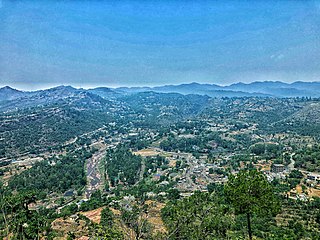
Kalakote is a town located in Rajouri district of Jammu region in the Indian union territory of Jammu and Kashmir. Kalakote is noted for its coal mines and has first Thermal Power Plant of North India. Additionally, the town serves as the headquarters for various administrative entities, including a tehsil, sub-division, block, municipal committee, and constituency, all bearing the name Kalakote.

Khalil Ismail Makrani, popularly known by his pen-name, Khalil Dhantejvi was a poet and novelist from Gujarat, India. He wrote poems in Gujarati and Urdu. He was awarded the Padma Shri in 2022 by the government of India.


