Jammu and Kashmir was a region formerly administered by India as a state from 1952 to 2019, constituting the southern and southeastern portion of the larger Kashmir region, which has been the subject of a dispute between India, Pakistan and China since the mid-20th century. The underlying region of this state were parts of the former princely state of Jammu and Kashmir, whose western districts, now known as Azad Kashmir, and northern territories, now known as Gilgit-Baltistan, are administered by Pakistan. The Aksai Chin region in the east, bordering Tibet, has been under Chinese control since 1962.

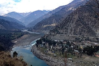
The Chenab River is a major river that flows in India and Pakistan, and is one of the 5 major rivers of the Punjab region. It is formed by the union of two headwaters, Chandra and Bhaga, which rise in the upper Himalayas in the Lahaul region of Himachal Pradesh, India. The Chenab flows through the Jammu region of Jammu and Kashmir, India, into the plains of Punjab, Pakistan, before ultimately flowing into the Indus River. The Battle of Chenab was fought between Sikhs and Afghans on the bank of the river.

Doda district is an administrative district of the Jammu division of Indian-administered Jammu and Kashmir in the disputed Kashmir region.

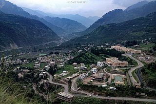
Doda is a town and a notified area committee in Doda district in the Indian union territory of Jammu and Kashmir. Doda has an average elevation of 1,107 metres (3,632 ft).

Kishtwar is a town, municipality and administrative headquarter of the Kishtwar district in the Indian-administered Jammu and Kashmir. The district was carved out of the Doda district in 2007. and is located in the Jammu division. The town of Kishtwar is situated at a distance of 211.5 km (131.4 mi) from the winter capital of Jammu. A large ground locally called as Chowgan ground is located in the heart of the town.

Ramban district is an administrative district in the Jammu division of Indian-administered Jammu and Kashmir in the disputed Kashmir region. It is located in a valley surrounded the Pir Panjal range. It was carved out as a separate district from erstwhile Doda district in 2007. It is located in the Jammu division. The district headquarters are at Ramban town, which is located midway between Jammu and Srinagar along the Chenab river in the Chenab valley on National Highway-44, approximately 151 km from Jammu and Srinagar.
Udhampur Lok Sabha constituency is one of the six Lok Sabha (parliamentary) constituencies in Jammu and Kashmir in northern India. The constituency covers 20,230 square kilometres of mountainous Himalayan terrain, and is comparable to the size of Israel. It is composed of the districts of Kishtwar, Ramban, Kathua, Doda, Reasi, and Udhampur. Udhampur constituency's population is over 2,400,000, and exceeds the population of New Mexico. The seat from 1967-1980 was held by Karan Singh, the former crown prince of Jammu and Kashmir.

Kishtwar district is an administrative district of the Jammu division of Indian-administered Jammu and Kashmir in the Jammu Division. As of 2011, it is the largest and the least populous district of Jammu and Kashmir.

Chenab Valley is a loosely-defined controversial term sometimes used to refer to parts of the Jammu Division in Jammu and Kashmir, India. The term is used to refer to the present-day districts of Doda, Kishtwar, Ramban, and, at times, Reasi and parts of Udhampur and Kathua. The first three districts used to be part of a single former district called Doda, which was created in 1948 out of the eastern parts of Udhampur district of the princely state of Jammu and Kashmir, and are sometimes collectively referred to as the Doda belt. The term is seen to be aimed at a communal break-up of the Jammu Division and iteration of Kashmiri Muslim irredentism.

The Jammu division is a revenue and administrative division of the Indian-administered Jammu and Kashmir in the disputed Kashmir region. It is bordered by the Kashmir division to the north. It consists of the districts of Jammu, Doda, Kathua, Ramban, Reasi, Kishtwar, Poonch, Rajouri, Udhampur and Samba. Most of the land is hilly or mountainous, including the Pir Panjal Range which separates it from the Kashmir Valley and part of the Great Himalayas in the eastern districts of Doda and Kishtwar. Its principal river is the Chenab.

Thathri is a town and a notified area committee in Doda district in the Indian union territory of Jammu and Kashmir. Thathri valley is located in the foothills of the Himalayan mountains, about 85 km from Batote. Apart from having ample forests, the town contains many small streams flowing through its various parts. It is located on the banks of the Chenab River and the town area is spread over 1.50 sq. Km².
Sazar is a village in Paddar tehsil of Kishtwar district in the union territory of Jammu and Kashmir, India.

Kishtwari or Kashtwari is a Northern Indo-Aryan language closely related to the Kashmiri language, with strong influences from neighbouring Western Pahari varieties. It is spoken by Hindus in Kishtwar district of Jammu division in Jammu and Kashmir, India.

Dool is one of the largest villages, located in Kishtwar district of Jammu and Kashmir, India. The village is divided into two wards namely Dool A and Dool B with total 874 householders living. Its district headquarters are pinpointed in Kishtwar and sub-district administrative units are located in "Kishtwar tehsil" which is situated on the banks of Chenab River. The distance between Dool village and Kishtwar town is 13.4 kilometres (8.3 mi).

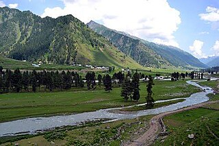
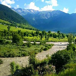
The Warwan Valley is a Himalayan sub-valley and a tehsil in Kishtwar District in the Jammu division in union territory of Jammu and Kashmir in India. The Valley lies 68 kilometres (42 mi) northeast of Kishtwar and 150 kilometres (93 mi) from Srinagar, the summer capital of Jammu and Kashmir.

Jammu and Kashmir is a region administered by India as a union territory and consists of the southern portion of the larger Kashmir region, which has been the subject of a dispute between India and Pakistan since 1947 and between India and China since 1959. The Line of Control separates Jammu and Kashmir from the Pakistani-administered territories of Azad Kashmir and Gilgit-Baltistan in the west and north. It lies to the north of the Indian states of Himachal Pradesh and Punjab and to the west of Ladakh which is administered by India as a union territory.
Kishtwar Assembly constituency is one of the 90 constituencies in the Jammu and Kashmir Legislative Assembly of Jammu and Kashmir a north state of India. Kishtwar is also part of Udhampur Lok Sabha constituency.

Marwah is a valley and sub-division in the Kishtwar district of Jammu and Kashmir in India. Marwah is surrounded by the Warwan valley to the northwest, Ladakh and Zanskar to the east, Chatroo and Kishtwar to the south, and Anantnag in the west. The area is drained by river Marusudar, which is the largest tributary of Chenab.
Kishtwaris are an ethnolinguistic group inhabiting the Kishtwar district of Jammu and Kashmir, India.


