Thodupuzha is a municipality and Taluka in the Idukki district of Kerala, India. It is located 55 km (34.2 mi) west of the district headquarters in Painavu and about 192 km (119.3 mi) north of the state capital Thiruvananthapuram. As per the 2011 Indian census, Thodupuzha has a population of 52,045 people, and a population density of 1,468/km2 (3,800/sq mi).

Idukki is one of the 14 districts in the Indian state of Kerala in the southwest of the country. It is the largest district in Kerala and lies amid the Cardamom Hills of Western Ghats in Kerala. Idukki district contains two municipal towns – Kattappana and Thodupuzha, and five taluks.

Muvattupuzha is a municipality in the Ernakulam district of Kerala, India. It is located 26 km (16.2 mi) east of the district headquarters in Thrikkakara and about 170 km (105.6 mi) north of the state capital Thiruvananthapuram. As per the 2011 Indian census, Muvattupuzha has a population of 30,397 people, and a population density of 2,306/km2 (5,970/sq mi).
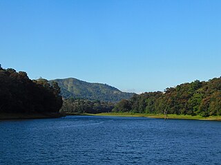
Thekkady is a town near Periyar National Park, an important tourist attraction in the Kerala state of India. The name Thekkady is derived from the word "thekku" which means teak. Temperatures are lowest in the months of December–January and highest in the months of April–May.

Peermade, also spelt Peerumedu is a village, Grama Panchayat and hill station in the state of Kerala, in southwestern India. It lies 915 metres (3,002 ft) above sea level in the Western Ghats (Sahyadri) about 85 kilometres (53 mi) east of Kottayam on the way to Thekkady through the nearby city of Kanjirappally.

Kumily, also spelt as Kumaly is a revenue village and Gram Panchayat in the Idukki district of the state of Kerala. It is a town in Cardamom Hills near Thekkady and Periyar Tiger Reserve. Kumily is a gateway town into Kerala from Tamil Nadu.
Nedumkandam is the headquarters of Udumbanchola taluk which is situated in Idukki district of the Indian state of Kerala. Nedumkandam is among the fastest growing towns in the Idukki district. Nedumkandam is well known for its spices production and is a major contributor to the production of spices like cardamom and pepper. This town situated an average elevation of 900 meter above sea level and maximum elevation respectively 1190 meter 1100 meter and 975 meter and is a destination for economical stay and shopping for tourists in the popular Kumily-Munnar tourist route.
Udumbanchola is a taluk in Idukki district of the Indian state of Kerala. This is in the high ranges. Nedumkandam is the major town and capital of Udumbanchola taluk. Mathikettan Shola National Park is located in Udumbanchola.

Kuttampuzha is a village and gram panchayat in Ernakulam district in the Indian state of Kerala. Situated 71 km east of Kochi, Kuttampuzha panchayat is home to the 17.7% of total area of the Ernakulam District.
Chakkupallam is a Grama Panchayat and Village in Idukki district in the Indian state of Kerala. The administrative capital(Panchayat Office) and village center of Chakkupallam Grama Panchayat is Anakkara, located on Kumily-Munnar state highway.

Chathurangapara is a village in Idukki district in the Indian state of Kerala. The village is part of Udumbanchola and Senapathy Panchayats.

Chinnakanal is a village in Idukki district in the Indian state of Kerala. It has waterfalls which are popularly known as the Power House Waterfalls. Arikomban is a famous elephant that lived in Chinnakanal.

Elappara is a town in Idukki district in the southwestern Indian state of Kerala. It is one of the panchayaths in Peerumedu taluk. The area is marked by a cool climate as the region is situated at an elevation of over 1,000 m (3,300 ft) above sea level. Elappara is famous for its vast tea plantations.

Karunapuram is a village in Idukki district in the Indian state of Kerala.
Kunchithanny is a village situated in the Idukki district in the Indian state of Kerala. The village is located on the banks of the river Muthirappuzha.

Pallivasal is a village in Idukki district in the southwestern Indian state of Kerala.
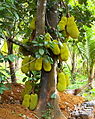
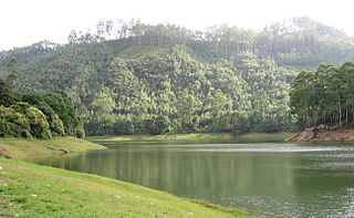
Poopara is a village in Idukki district in the Indian state of Kerala. It is located in the cardamom-growing region of Kerala, and also houses a number of tea and coffee plantations. The place also intersects the Munnar - Kumily state highway (SH-19) and Kochi - Dhanushkodi national highway (NH-49). The Anayirankal reservoir is 4 km up the road from Poopara.
Rajakkad is a town in the Idukki district in the Indian state of Kerala situated in the Western Ghats.

Vandiperiyar, IPA:[ʋɐɳɖipːeɾijɐːr], is a spice village in Idukki district, in the Indian state of Kerala. It is known for tourism, tea and coffee plantations, black pepper and other spice products. It is also known as an educational city and a number of tea factories are situated in the town. The Periyar River flows through the town. Colleges: govt poly technic college. Schools : phss, st Joseph, high range, goodluck educations, govt upper primary, fathima school, govt lower primary, trinity garden.
Devikulam taluk is one of the 5 taluks in Idukki district of the Indian state of Kerala. Devikulam taluk comprises 13 villages.