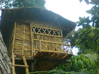
Padiyoor is a small town in Kannur district of Kerala state, India. Padiyoor village is part of Padiyoor-Kalliad Grama Panchayat in Iritty taluk.

Peralasseri is a census town and Panchayat headquarters in Kannur district in the Indian state of Kerala, situated on the Kannur-Kuthuparamba State Highway 38 (Kerala), 12 km from Kannur city, on the bank of Anjarakandy river.
Peringathur is a census town in Thalassery taluk of Kannur district in the Indian state of Kerala. It is a part of the municipality of Panoor.

Kumily, also spelt as Kumaly is a revenue village and Gram Panchayat in the Idukki district of the state of Kerala. It is a town in Cardamom Hills near Thekkady and Periyar Tiger Reserve. Kumily is a gateway town into Kerala from Tamil Nadu.

Udumbanchola is a taluk in Idukki district of the Indian state of Kerala. This is in the high ranges. Nedumkandam is the major town and capital of Udumbanchola taluk. Mathikettan Shola National Park is located in Udumbanchola.

Bison valley is a village in Udumbanchola Taluk in the Idukki district of the southwestern Indian state of Kerala. Bison valley is situated at around 914 metres (3000 ft) above mean sea level, in the Western Ghats range of mountains.
Kunchithanny is a village situated in the Idukki district in the Indian state of Kerala. The village is located on the banks of the river Muthirappuzha.

Aralam is a village and Grama Panchayat in Kannur district in the Indian state of Kerala.
Ayyankunnu is a village in Kannur district in the Indian state of Kerala.The name ayyankunnu came from the five hills "Anchu Kunnu".

Kanichar is a village and Grama Panchayat in Kannur district in the Indian state of Kerala.

Karivellur is a census town and Gram Panchayat in Kannur district of Kerala state, India.

Manathana is a village in Peravoor Grama Panchayat of Kannur district, Kerala, India.
Mokeri is a census town in Mokeri panchayat of Kannur district in the Indian state of Kerala.
Pattannur is a village in Kannur district in the Indian state of Kerala. It is 4 km away from Irikkur and 7 km away from Mattanur.

Thirumeni is a village in Kannur district in the Kerala state of India. It is known for its hill station Chathamangalam Hills. The village has several recently migrated families from various parts of the erstwhile political entity (state) of Travancore who settled here in the famed "Malabar migration period" in the nineteenth century. Most of the inhabitants of the village reside in the valley of three major hills by name Chathamangalam Theruvamala alias Alumbumala, Kottathalachimala and Thevarkunnumala. Thirumeni is a small junction with a few government institutions, religious institutions and small shops in int. and is subdivided into smaller villages like Kokkadave, Prapoyil, Chathamangalam (Kannur), Thabore, Muthuvom, Korali, Chattivayal, Thannichal, Paruthikallu etc.
Vellad is a large village in Kannur district in the Indian state of Kerala.
Balal is a village and a Grama Panchayat in Kasaragod district in the state of Kerala, India.

Bandadka is a small town in Kasaragod district in the state of Kerala, India. It is also called Kottakal because of Bandadka Fort. It comes under Kuttikole Grama Panchayat. It is located 38 km (24 mi) towards east from the District headquarters Kasaragod, 568 km (353 mi) away from the State capital Thiruvananthapuram, 5 km (3.1 mi) west of Karnataka border and 20 km (12 mi) away from Sullia. Bandadka's pin code is 671541 and its postal head office is Chengala.

Paivalike is a village in Kasaragod district in the state of Kerala, India. Paivalike is 11 km (6.8 mi) east of Uppala town and 40 km (25 mi) south of Mangalore city.
Adoor is a village in Kasaragod district in the Indian state of Kerala. Adoor is located 38 km east of Kasaragod town and 7 km away from State Highway 55 or Cherkala-Jalsoor road.


