Ernakulam district

Last updated

Ernakulam district
Kochi Skyline.jpg
Kochi Metro train at Palarivattom, Aug 2017.jpg
Jewaharlal Nehru Stadium Kochi ISL.jpg
Cochin International Airport Limited.jpg
Container terminal.JPG
Kochi International Marina, Bolgatty Island, Kerala, India.jpg
Lulumall atrium.JPG
Cochin Ship Yard Cranes.JPG
India Kerala Ernakulam district.svg
Location in Kerala
Ernakulam district
Ernakulam District
Coordinates: 10°00′N76°20′E / 10.00°N 76.33°E / 10.00; 76.33
CountryFlag of India.svg  India
State Kerala
Named for Rishinagakulam[ citation needed ]
Headquarters Kakkanad, Kochi
Government
  CollectorN.S.K. Umesh , IAS
  Commissioner & IG (Kochi)C. Nagaraju, IPS
  S.P (Ernakulam Rural)K.Karthik, IPS
  DFOA. Renjan, IFS
Area
[1]
  Total2,924 km2 (1,129 sq mi)
  Rank 6th
Population
 (2018)
  Total3,427,659 [2]
  Density1,119/km2 (2,900/sq mi)
Languages
  Official Malayalam
Time zone UTC+5:30 (IST)
ISO 3166 code IN-KL-KO, IN-KL
Vehicle registration
HDI (2005)Increase2.svg0.801 [3]
very high
Website ernakulam.nic.in
Inchathotty Bridge near Kothamangalam Inchathotty Hanging Bridge - inycttotttti tuukkupaalN-1.JPG
Inchathotty Bridge near Kothamangalam

Ernakulam (IPA: [erɐɳɐːguɭɐm] ; ISO: Eṟaṇākuḷaṁ) is one of the 14 districts in the Indian state of Kerala, and takes its name from the eponymous city division in Kochi. It is situated in the central part of the state, spans an area of about 2,924 square kilometres (1,129 sq mi), and is home to over 9% of Kerala's population. Its headquarters are located at Kakkanad. The district includes Kochi, also known as the commercial capital of Kerala, which is famous for its ancient churches, Hindu temples, synagogues and mosques.

Contents

The district includes the largest metropolitan region of the state: Greater Cochin. Ernakulam district yields the highest revenue and the largest number of industries in the state. [4] Ernakulam is the third most populous district in Kerala, after Malappuram and Thiruvananthapuram (out of 14 districts). [5] The district also hosts the highest number of international and domestic tourists in Kerala state.

The most commonly spoken language in Ernakulam is Malayalam. English is widely used, mostly in business circles. Ernakulam became India's first district to have 100 percent banking or full "meaningful financial inclusion" in 2012. [6] [7]

Ernakulam has a high Human Development Index of 0.801 (UNHDP report 2005), which is one of the highest in India. [8]

Etymology

History

Rama Varma XV at the Delhi Durbar of 1903. H H Raja of Cochin.jpg
Rama Varma XV at the Delhi Durbar of 1903.
Chinese fishing nets, Fort Kochi Marine Drive View.JPG
Chinese fishing nets, Fort Kochi

Ernakulam has played a part in the political history of south India since ancient times. The Jews, Syrians, Arabs, Chinese, Dutch, British, and Portuguese seafarers followed the sea route to the Kingdom of Cochin and left their impressions on the town. The port at Kozhikode held superior economic and political position in medieval Kerala coast, while Kannur, Kollam, and Kochi, were commercially important secondary ports, where the traders from various parts of the world would gather. [9] In 1664, the municipality of Fort Kochi was established by Dutch Malabar, making it the first municipality in Indian subcontinent, which got dissolved when the Dutch authority got weaker in 18th century. [10] In 1896, the Maharaja of Cochin initiated local administration by forming a town council in Ernakulam. Initially, The district's headquarters were located in the portion of the city known as Ernakulam, which gave the district its name; the headquarters was relocated afterwards to Kakkanad.

In the year 1998, Kuttampuzha village was added to the district from Idukki district following which the district got a political boundary with neighbouring state of Tamil Nadu. There is no interstate road that connects the district with the neighbouring state through this border.

Geography

The Ernakulam district covers an area of 3,068 km2 (1,185 sq mi) on the Western Coastal Plains of India. It is surrounded by the Thrissur District to the north, the Idukki District to the east, Alappuzha and Kottayam districts to the south and the Laccadive Sea to the west. The Anamalais occupy a large part of the district, consisting of the forest areas around Pooyamkutty and the Idamalayar Dam. The range also extends into Thrissur, Palakkad, and Idukki districts, as well as Coimbatore and Tiruppur districts of Tamil Nadu. The district is divided geographically into highland, midland, and coastal area. The altitude of the highlands is about 300 m (980 ft). The Periyar River, Kerala's longest, flows through all the taluks except Muvattupuzha. The Muvattupuzha River and a branch of the Chalakkudy River also flow through the district. The average yearly rainfall in the district is 3,432 mm (135.1 in). The district has a moderate climate and mostly falls within the Malabar Coast moist forests ecoregion, while the highlands are part of the South Western Ghats moist deciduous forests ecoregion. The Anamudi is the tallest peak in South India, on the border of Ernakulam and Idukki districts. Some parts of the Idamalayar Reserve Forest and Mankulam Forest Division have Sholas but these parts are inaccessible by road. The Idamalayar Reserve Forest, and Edamalakkudy. Many types of sand, soil, and rocks are abundant here. Cochin International Airport is located in the northern part of the district at Nedumbassery, Kochi.

The district houses two Urban Agglomerations, Kochi and Kothamangalam. Kochi is the largest city in the state, and 17th most populous in the country according to the Ministry of Housing and Urban Affairs rankings based on the 2011 Census, with an area of over 843km2 and 2.12 million population.

Topography

The district is divided into three parts: lowland, midland, and the highland that consist of seaboard, plains, and hills and forests respectively. 20 percent of the total area are lowlands. The forests in the eastern part of the district are mostly remote, forming a part of the Anamalais. The highest peak is the Anamudi. The midland consists mainly of plain land and a group of islands that naturally drain water via backwaters and canals. The hilly or eastern portion is formed by a section of the Western Ghats. Muvattupuzha and Kothamangalam taluks, which were initially parts of the Kottayam district and constitute the highlands. Muvattupuzhayar and Periyar are the main rivers, of which the latter flows through Muvattupuzha, Aluva, Kunnathunad and Parur taluks. During the rainy season these rivers are full and heavy floods affect the low-lying areas on the banks, but in the summer season, they generally go dry and narrow. The Periyar is stretched over a length of 229 km (142 mi).

Forest and wildlife

The Grey hornbill Ocyceros griseus -India-8a.jpg
The Grey hornbill

The flora of this district is tropical. The heavy rainfall combined with moderate temperatures and fertile soil support abundant vegetation. Many of the common plants are found in the coastal area, which forms the lowland region. The midland region is occupied by coconut palms, paddy, tapioca, pepper, pineapple and pulses. The lower slopes of the highland region have teak and rubber.

Mangalavanam Bird Sanctuary

Mangalavanam Mangalavanam.JPG
Mangalavanam

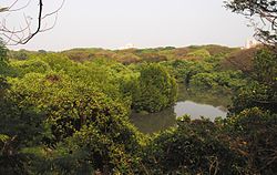
Mangalavanam Bird Sanctuary is located at the centre of Kochi. It covers 2.74 ha (6.8 acres), [11] supports many species of mangroves and is a nesting ground for a variety of migratory birds. The Managalavanam is called the "green lung of Kochi", [12] considering its role in controlling the city's air pollution. [13]

Thattekad Bird Sanctuary

Thattekad Bird Sanctuary lies on the northern bank of the Periyar River and covers about 25 km2 (10 sq mi). It was founded by ornithologist Salim Ali. The sanctuary is 80 km (50 mi) from Kochi. Birds found here include falcons, jungle fowl, water hens, and hornbills. The flora of this area consists mainly of plantations of teak, rosewood, and mahogany. Further on the road, Pooyamkutty forest of the Anamalais is reached.

Climate

Climate data for Kochi
MonthJanFebMarAprMayJunJulAugSepOctNovDecYear
Record high °C (°F)35
(95)
37
(99)
37
(99)
34
(93)
35
(95)
33
(91)
35
(95)
35
(95)
38
(100)
35
(95)
34
(93)
33
(91)
38
(100)
Mean daily maximum °C (°F)30
(86)
31
(88)
31
(88)
31
(88)
31
(88)
28
(82)
28
(82)
28
(82)
28
(82)
29
(84)
30
(86)
30
(86)
30
(86)
Mean daily minimum °C (°F)23
(73)
25
(77)
26
(79)
26
(79)
26
(79)
25
(77)
24
(75)
24
(75)
25
(77)
25
(77)
25
(77)
23
(73)
25
(77)
Record low °C (°F)17
(63)
18
(64)
20
(68)
21
(70)
22
(72)
21
(70)
21
(70)
20
(68)
22
(72)
20
(68)
20
(68)
19
(66)
17
(63)
Average precipitation mm (inches)21.9
(0.86)
22.9
(0.90)
35.3
(1.39)
124.0
(4.88)
395.7
(15.58)
720.7
(28.37)
697.2
(27.45)
367.8
(14.48)
289.4
(11.39)
302.3
(11.90)
175.1
(6.89)
48.3
(1.90)
3,228.3
(127.10)
Source 1: [14]
Source 2: [15]

Economy

Kochi Marine Drive Day View Kochi Marine Drive Day View BNC.jpg
Kochi Marine Drive Day View
The beauty in the night, Marine Drive, Kochi Marine Drive Kochi Night View DSW.jpg
The beauty in the night, Marine Drive, Kochi
Infopark, Kochi Carnival Info Park Phase - 4.jpg
Infopark, Kochi

Ernakulam district is the richest district in Kerala and is the biggest commercial centre in the state of Kerala. It contributes the most to the state exchequer in terms of GSVA and tax revenues. It has the highest literacy rate as well as the highest per capita income in the state, along with having the greatest number of commercialised banks, startups and large-scale industries & MSMEs in the state. Its M.G. Road is home to some of Kerala's most prestigious enterprises. Kochi is also the headquarters of some large companies like Federal Bank, Geojit, V-Guard, and Muthoot.

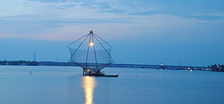
The sea along the entire coast of the district and its backwaters are the habitat of various kinds of fish that supply both marine and inland fisheries.

Agriculture

The eastern part of Ernakulam is primarily agrarian in nature. Rice is the principal crop cultivated in the wetlands. The district is the largest producer of nutmeg and pineapple in the state: more than 55% of pineapples produced in the state is cultivated in the district. Rubber is the most cultivated plantation crop in the district and the district is the second-largest producer of rubber in the state behind Kottayam. Other important crops cultivated in the district are tapioca, black pepper, areca nut, coconut, turmeric, banana, and plantain.

Education

Administrative Block of Cochin University of Science and Technology Administrative Block , Cusat.jpg
Administrative Block of Cochin University of Science and Technology

Ernakulam is the first district in India to have 100 percent literacy by 1990. In fact Kochi has the highest literacy rate for any city in the country with over 20 lakhs population. Pothanikkad is the first village in India that achieved 100 percent literacy according to state literacy programme is in this district.[ citation needed ]

There are three prominent universities in Ernakulam: Sree Sankaracharya University of Sanskrit in Kalady, Cochin University of Science and Technology in Kalamassery, and Kerala University of Fisheries and Ocean Studies in Kochi. The district has the most educational institutions in the state; as of 2019, there are 476 fully high-tech schools in Ernakulam. [16]

In 2017, Ernakulam district administration launched the Roshni project, which aims to provide Malayalam education to migrant children. It supported 1,265 migrant workers’ children from lower primary to high school. [17]

Divisions

There are two revenue divisions: Fort Kochi and Muvattupuzha. The municipal corporation is in Kochi.

Taluks

The district has the most taluks in the state. The district is divided by two revenue divisions with seven taluks.

Municipalities

Interestingly, Ernakulam district has the most municipalities in the state.

A criticism that has been centered around this fact is that despite municipalities like Aluva, Kalamassery, Thrikkakara, Maradu, Tripunithura and Eloor becoming assimilated into Kochi city, they still exist as individual municipalities instead of being under Kochi Corporation. Surprisingly the corporation has not amended its limits for over half a century, since 1967 to be precise. The corporation was the largest in area and population when it was formed, and all these regions were panchayaths back then. Instead of adding them to the corporation when these regions started developing due to the urban expansion of Kochi city, they were made into separate municipalities thus largely handicapping the corporation. Now the call to expand these outdated limits for a better unified administration for the entire city of Kochi is a strong public demand. [18]

Parliamentary Constituencies

Assembly Constituencies

Demographics

Historical population
YearPop.±% p.a.
1901646,235    
1911735,267+1.30%
1921789,311+0.71%
1931982,731+2.22%
19411,172,292+1.78%
19511,393,679+1.74%
19611,702,740+2.02%
19712,170,820+2.46%
19812,549,255+1.62%
19912,840,279+1.09%
20013,105,798+0.90%
20113,282,388+0.55%
20183,427,659+0.62%
source: [19]

According to the 2018 Statistics Report, Ernakulam has a population of 3,427,659. [2] The 2011 Census of India reports that the district is ranked 104th most populous in India out of 640. [5] The district has a population density of 1,072 inhabitants per square kilometre (2,780/sq mi). [5] Its population growth rate in 2001–2011 was 5.69%. [5] Ernakulam has a sex ratio of 1027 females for every 1000 males, [5] and a literacy rate of 95.89%. 68.07% of the population lives in urban areas. Scheduled Castes and Scheduled Tribes make up 8.18% and 0.50% of the population respectively. [5]

Languages of Ernakulam district (2011) [20]

   Malayalam (96.70%)
   Konkani (0.97%)
   Tamil (0.94%)
  Others (1.39%)

According to the 2011 census, 96.70% of the population spoke Malayalam, 0.97% Konkani and 0.94% Tamil as their first language. [20]

This district is listed as the "most advanced" district in Kerala. It had a resident population of 3,105,798 as of 2001, excluding the commuters from neighbouring districts. [21]

According to the 2011 Census of India, Ernakulam District also houses the largest city (UA) in the state (17th largest in the country) - Kochi Urban Agglomeration. Kochi UA spans across 843km2 with a population of 2,119,724 (2.12 million), [22] thereby housing approximately two thirds of the population of Ernakulam District. Government of Kerala have also marked Kochi UA as the only "first order UA" in the state, which has its influence spread across the entire state unlike the other smaller cities.

The district also houses another smaller urban agglomeration - Kothamangalam, which has an area of 81.42 km2 housing over 1,14, 639 people. The towns of Kothamangalam and Muvattupuzha form a major chunk of the Kothamangalam UA.

Religion

Religions in Ernakulam district (2011) [23]
ReligionPercent
Hinduism
45.99%
Christianity
38.03%
Islam
15.67%
Other or not stated
0.31%
Religions in Ernakulam
TalukasHindusChristiansMuslimsOthers
Kunnathunad45.3235.3919.160.13
Aluva37.7844.6417.290.29
Paravur 56.6928.9314.130.25
Kochi41.7441.1516.670.44
Kanayannur 53.1634.4911.910.44
Muvattupuzha 40.5345.1414.120.21
Kothamangalam36.1641.8221.770.25

Hindus (46%) accounts for the largest community, followed by Christians (38%) (Latin Catholic, Syro-Malabar, Jacobites, Pentecostals and Malankara Orthodox) and Muslims (15.7%). [23] A small population of Jains, Jews, and Sikhs reside in Kochi. [24] Ernakulam once had a vibrant Jewish population, with several synagogues, known as the Malabar Jews who used to dominate the trade and commercial activities in the district. After the state of Israel was formed in 1945, the entire community made aliyah to Israel in the 1950s. Today they number 8000 in Israel but very few Jews remain in the district. After a direct flight service was established between Kochi and Tel Aviv they have retained ties with the state with annual visits and gatherings.

Ernakulam also has a significant Konkani Hindu population who migrated from Goa during the Goa Inquisition. [25] There is a small Jain community in Ernakulam district, concentrated mainly in Kochi city. [26] The Sikh community in Ernakulam is also concentrated mainly in Kochi. There are more than 25 Sikh families in Kochi and there is one gurdwara. [27]

Thrikkakara Temple-one of the few temples in India and only temple in Kerala dedicated to Lord Vamana Thrikkakara Temple DSC09337.JPG
Thrikkakara Temple-one of the few temples in India and only temple in Kerala dedicated to Lord Vamana
Chottanikkara Temple Chottanikkara Temple.jpg
Chottanikkara Temple

Culture

Festivals and traditions

The Aluva Sivarathri festival at the Aluva Mahadeva Temple (situated on the banks of river Periyar) in Aluva attracts people from around the country.

St. Mary's Orthodox Syrian Cathedral, Piravom is believed to be founded in 405 A.D. and was the headquarters of Archdeacon and St Thomas until the 18th century.

Adi Shankaracharya was born in Kalady, which is considered to be a major pilgrimage centre for Hindus around the world.

Kallil Kshethram is a famous Jain temple near Perumbavoor.

Puthencruz is the regional seat of Syriac Orthodox Church in India, and is where Saint Thomas Syro-Malabar Catholic Church, Malayattoor is located.

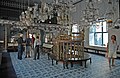
The eight-day lent (Ettunombu) festival at St Mary's Jacobite Syrian Valiyapally, Thamarachal attracts many people from all over the state. St. George Orthodox Syrian Church at Kadamattam near Muvattupuzha is very old and was founded by Mar Abo Syrian Metropolitan in the 5th century A.D. He brought a cross from Persia, which is preserved in the church. The festival at the Latin church of Vallarpadam on 24 September attracts people belonging to all religions. The icon of Virgin Mary in this church is credited with many miracles. St. George's Syro-Malabar Catholic Forane Church, Edappally was founded in 593 A.D.

Important pilgrimage sites in Ernakulam are Koonan Kurish St George Orthodox Pilgrim church, Mattancherry; Vadakken Paravoor St Thomas Catholic Church, Malayattoor Pally; and Mor Thoman Jacobite Church, Kothamangalam; and Thrikkunnathu St Mary's Seminary Church, Aluva. The relics of Gregorios Abdul Jaleel are preserved at the St. Thomas Jacobite church North Paravur. Thousands of pilgrims from Kerala culminate on 27 April for the Dhukrono of the Saint. The Feast of Eldho Mor Baselios is celebrated in the tomb church Mor Thoman Church at Kothamangalam every year on 2 and 3 October. The Feast of Paulose Mar Athanasius on 26 January at Thrikkunnathu St Mary's Seminary Church, Aluva, where he is entombed, also attracts thousands.

Gheevarghese Mar Gregorios of Parumala, also known as Parumala Thirumeni, the first saint of Malankara Orthodox Syrian Church from India was born and brought up in Mulanthuruthy.

Places of interest

Transport

Road connectivity

The three major national highways passing through Ernakulam are the Cochin-Mumbai Highway (NH 66), Salem-Kanyakumari (NH 47 part of NSEW corridor), and Cochin-Dhanushkodi highway (NH 49).

Railway station

Ernakulam has 17 railway stations. The Ernakulam Junction, Ernakulam Town and Aluva are the major stations. The other stations are Angamaly, Thripunithura, Edapally, Mulamthuruthy, Cochin Harbour Terminus, Karakutty, Chowara, Kalamassery, Nettoor, Kumbalam, Mattancherry H., Chottanikkara road, Kanjiramattom and Piravom road. The rail routes travel via Thrissur, Kottayam, Cochin H.T., Alappuzha, and Vallarpadam. The Angamaly-Erumely Sabarimala route passes through the district. Kochi Metro runs in Kochi.

Airport

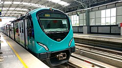
Ernakulam district has two airports: Naval airport in W.island (Old Cochin airport) and Cochin International Airport (CIAL). CIAL is the fourth largest airport in the country after Mumbai, Delhi, and Chennai, and serves International passengers.

Water transport

Ernakulam lies in the flat delta region of the Periyar and Moovattupuzha rivers. Water transport is prominent in the district via rivers and lagoons.

Notable people

See also

Related Research Articles

<span class="mw-page-title-main">Thodupuzha</span> Municipal town in Kerala, India

Thodupuzha is a municipal town located in Idukki district, in the Indian state of Kerala, that covers an area of 35.43 km2 (13.68 sq mi). It lies on the banks of Thodupuzha river, which merges with the Kaliyar and Kothamangalam rivers at Muvattupuzha to form the Muvattupuzha river. Thodupuzha is 53 km (33 mi) from Kottayam, 75 km (47 mi) from Kattappana and 60 km (37 mi) south east of Kochi. Thodupuzha is 197 km (122 mi) from the state capital, Trivandrum. The geographical classification of the Thodupuzha Region is Malanad or Keezhmalanad.

<span class="mw-page-title-main">Muvattupuzha</span> Municipality in Kerala, India

Muvattupuzha is a town, municipality in the midlands directly to the east of Kochi in Ernakulam district, Kerala, India. It is located about 36 km (22 mi) from downtown Kochi, and is a growing urban centre in central Kerala. The town is also the starting point of the Muvattupuzhayar, which is a confluence formed by three rivers: the Thodupuzhayar, Kaliyar, and Kothayar.

<span class="mw-page-title-main">Perumbavoor</span> Neighbourhood in Ernakulam, Kerala, India

Perumbavoor is a place located at the bank of Periyar in Ernakulam District in the Indian state of Kerala. It is a part of the Kochi metropolitan area. It lies in the northeastern tip of the Greater Cochin area and is also the headquarters of Kunnathunad Taluk. Perumbavoor is famed in the state for wood industries and small-scale industries. Ernakulam lies 30 km southwest of Perumbavoor. The town lies between Angamaly and Muvattupuzha on the Main Central Road (MC), which connects Thiruvananthapuram to Angamaly through the old Travancore part of Kerala.

Kothamangalam is a municipality in the Ernakulam district of Kerala, India. The town is in the foothills of the Western Ghats, and is a part of the Idukki Lok Sabha constituency.

North Paravur. formerly known as Paravur or Paravoor or Parur, is a municipality and suburb in Ernakulam district in the Indian state of Kerala. It is a northern suburb of the city of Kochi and is situated around 20 km from the city centre. It is also the first place in India to use electronic voting machine during the by-elections in 1982.

<span class="mw-page-title-main">Piravom</span> Suburb/Municipality in Ernakulam, Kerala, India

Piravom is a municipality in Ernakulam district and a suburb of Kochi in the Indian state of Kerala. It is located with in 31 km southeast of Kochi city center, at the boundary of the Ernakulam and Kottayam districts. Piravom is famous for its Hindu temples and Christian churches. Piravom has a river-front, verdant hills, and paddy fields.

<span class="mw-page-title-main">Ponkunnam</span> Town in Kerala, India

Ponkunnam is a census town in Kerala, India, part of Kottayam district under Kanjirappally taluk. Ponkunnam literally means golden mountain (ponn = gold, kunn = mountain). Nearby towns are Kanjirappalli, Manimala and Pala. This part of Kerala is famous for its fertile land and rubber plantations. It is at an altitude of 495 ft (151 m) above mean sea level. The town is at the junction of two major roads in Kerala: NH 183 and Main Eastern Highway. The climate is moderate with timely cold breezes and the town is the gateway to the Western Ghats. The town is famous for its volleyball traditions and customs. Almost every year there is an ever-rolling volleyball tournament happening in Ponkunnam Mahatma Gandhi Mini Stadium.

<span class="mw-page-title-main">Kodanad</span> Town in Kerala, India

Kodanad is a rural riverside village of Ernakulam district in Kerala, South India. It is 18 km from Angamaly. Kodanad is situated on the south bank of Periyar river, about 42 kilometers east of Kochi. The village is a major tourist destination because it houses an Elephant training center.

<span class="mw-page-title-main">Kochi metropolitan area</span> Metropolitan Area in Kerala, India

The Kochi metropolitan area or Kochi urban agglomeration is a metropolitan area consisting of Kochi and its satellite towns in Ernakulam district, Kerala, India. With a population of more than 2.1 million within an area of 440 km2, it is the most populous metropolitan area in Kerala.

This is a list of pilgrimage centres in Ernakulam district in Kerala, India.

<span class="mw-page-title-main">Syro-Malabar Catholic Eparchy of Kothamangalam</span> Eastern Catholic eparchy in Kerala, India

The Eparchy of Kothamangalam is an Syro-Malabar Church ecclesiastical jurisdiction or eparchy the Catholic Church in India. It was established by Pope Pius XII in 1957. Mar George Madathikandathil is the eparch since 10 January 2013.

<span class="mw-page-title-main">Rayamangalam, Kerala</span> Village in Kerala, India

Rayamangalam is a village in the Ernakulam district of Kerala state, India.

Rajakkad is a town in the Idukki district in the Indian state of Kerala situated in the Western Ghats.

Anikkad is a village in Ernakulam district in the state of Kerala, India. It is located near the Muvattupuzha town in Avoly Panchayat.

<span class="mw-page-title-main">Aluva railway station</span> Railway station in Aluva, Kerala, India

Aluva railway station is an NSG–3 category Indian railway station in Thiruvananthapuram railway division of Southern Railway zone. It is a railway station in the city of Aluva in the Ernakulam district in the Indian state of Kerala. The station lies in the Shoranur–Cochin Harbour section of Thiruvananthapuram railway division. It is located right aside Aluva KSRTC bus stand, one of the main bus terminals in Ernakulam district, and a kilometre away from Aluva metro station of the Kochi Metro.

<span class="mw-page-title-main">Outline of Kerala</span> Overview of and topical guide to Kerala

The following outline is provided as an overview of and topical guide to Kerala:

Kaprikad is a rural riverside village of Ernakulam district, Kerala, southern India. Kaprikad is situated on the south bank of Periyar river, about 42 kilometers east of Kochi. The nearest airport is Cochin International Airport which is about 18 km (12 mi) by road. The village is a major tourist destination in the district because it houses the Kodanad Abhayaranyam animal shelter and elephant training centre.

Ernakulam District in Kerala, India, has four types of administrative hierarchies.

Transport in Ernakulam district consists of various modes.

References

  1. "Demography -Ernakulam" (PDF). Directorate of Census Operations, Kerala. Retrieved 4 July 2020.
  2. 1 2 Annual Vital Statistics Report - 2018 (PDF). Thiruvananthapuram: Department of Economics and Statistics, Government of Kerala. 2020. p. 55. Archived from the original (PDF) on 2 November 2021. Retrieved 30 October 2020.
  3. "Kerala | UNDP in India". UNDP.
  4. Pilgrimate to Temple Heritage 2019: Ernakulam district temples. Info Kerala Communications Pvt Ltd, 2019. 2019. ISBN   9788193456781 . Retrieved 2 October 2020.
  5. 1 2 3 4 5 6 "District Census Hand Book: Ernakulam" (PDF). Census of India . Registrar General and Census Commissioner of India.
  6. "Ernakulam to be declared first district with 100% banking". The Hindu Businessline. 15 November 2012. Archived from the original on 1 February 2013. Retrieved 27 February 2013.
  7. Soundarapandian, Mookkiah (2000). Literacy Campaign in India. New Delhi: Discovery Publishing House. p. 21. ISBN   9788171415533.
  8. "Kerala". UNDP in India. Retrieved 10 October 2019.
  9. The Portuguese, Indian Ocean and European Bridgeheads 1500–1800. Festschrift in Honour of Prof. K. S. Mathew (2001). Edited by: Pius Malekandathil and T. Jamal Mohammed. Fundacoa Oriente. Institute for Research in Social Sciences and Humanities of MESHAR (Kerala)
  10. M K Sunil Kumar (26 September 2017). "50 years on, Kochi still has a long way to go". The Times of India. Retrieved 1 June 2021.
  11. "Mangalavanam Bird Sanctuary". Kerala Tourism Development Corporation . Retrieved 21 January 2018.
  12. "Green Lung of Kochi". cochin.org. Retrieved 3 April 2016.
  13. "Mangalavanam Bird Sanctuary". Kochi Servnet. Archived from the original on 23 September 2016. Retrieved 12 November 2015.
  14. "Kochi, India". Whetherbase. August 2011. Retrieved 1 July 2010.
  15. "Kochi, India". MSN India. Archived from the original on 14 July 2011. Retrieved 3 August 2010.
  16. "Now, Ernakulam has 476 fully high-tech schools". The Hindu. 7 December 2019 via www.thehindu.com.
  17. Shreehari Paliath, IndiaSpend com. "In Kerala's Ernakulam district, a programme is helping migrant children stay in school". Scroll.in.
  18. "Chamber calls for expansion of Kochi Corp - The New Indian Express".
  19. "Census of India Website : Office of the Registrar General & Census Commissioner, India". www.censusindia.gov.in.
  20. 1 2 "Table C-16 Population by Mother Tongue: Kerala". www.censusindia.gov.in. Registrar General and Census Commissioner of India.
  21. "censusindia.gov.in" (PDF).
  22. "आवासन और शहरी कार्य मंत्रालय, भारत सरकार". Mohua.gov.in. Retrieved 7 May 2022.
  23. 1 2 "Table C-01: Population by religious community: Kerala". Census of India . Registrar General and Census Commissioner of India. 2011.
  24. Official Ernakulam District Profile Archived 21 July 2011 at the Wayback Machine
  25. "Exploring Kochi through a Goan lens". The New Indian Express.
  26. "Jain festival celebrated in city | Kochi News - Times of India". The Times of India.
  27. "Sikh families: The Sikhs here love Kochi | Kochi News - Times of India". The Times of India.
  28. "Kuzhupilly Beach". www.kuzhupillybeach.com.

Further reading