| APJ Abdul Kalam Marg [1] | |
 | |
 | |
| Type | Promenade |
|---|---|
| Maintained by | Greater Cochin Development Authority |
| Length | 1.75 km (1.09 mi) |
| Addresses | Kochi, India |
| Location |  Map of Marine Drive |
| Postal code | 682011 |
| Coordinates | 9°58′48″N76°16′30″E / 9.980°N 76.275°E |
| Other | |
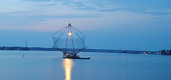
| Known for | Rainbow bridge, Chinese fishing net bridge and Kettuvellam bridge |
Marine Drive, officially the APJ Abdul Kalam Marg, [2] is a promenade in Kochi, India. [3] It is built facing the backwaters. Despite its name, no vehicles are allowed on the walkway. [4] With several shopping malls it is as an important centre of shopping activity in Kochi.
Contents
- Name and history
- Places lining Marine Drive
- Marine Drive Scheme Phase 2
- Gallery
- See also
- References
- External links
The walkway starts from the Kerala High Court junction and continues until the Rajendra Maidan. There are also several boat jetties along the walkway. [5] The walkway has three bridges: the Rainbow bridge, the Chinese Fishing Net Bridge and the House Boat Bridge. [6]