
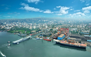
Kochi, formerly known in English as Cochin, is a major port city on the Malabar Coast of India bordering the Laccadive Sea, which is a part of the Arabian Sea. It is part of the district of Ernakulam in the state of Kerala and is commonly referred to as Ernakulam. Kochi is the most densely populated city in Kerala. As of 2011, it has a corporation limit population of 677,381 within an area of 94.88 km2 and a total urban population of more than of 2.1 million within an area of 440 km2, making it the largest and the most populous metropolitan area in Kerala. Kochi city is also part of the Greater Cochin region and is classified as a Tier-II city by the Government of India. The civic body that governs the city is the Kochi Municipal Corporation, which was constituted in the year 1967, and the statutory bodies that oversee its development are the Greater Cochin Development Authority (GCDA) and the Goshree Islands Development Authority (GIDA).

Ernakulam, IPA: [erɐɳɐːguɭɐm]; IAST: Eṟaṇākuḷaṁ, in Malayalam: എറണാകുളം) is a district of Kerala, India, that takes its name from the eponymous city division in Kochi. It is situated in the central part of the state, spans an area of about 3,000 square kilometres (1,200 sq mi), and is home to over 9% of Kerala's population. Its headquarters are located at Kakkanad. The district includes Kochi, also known as the commercial capital of Kerala, which is famous for its ancient Hindu temples, churches, synagogues and mosques. The district includes the largest metropolitan region of the state: Greater Cochin. Ernakulam is the district that yields the most revenue and the largest number of industries in the state. Ernakulam is the third most populous district in Kerala, after Malappuram and Thiruvananthapuram. The district also hosts the highest number of international and domestic tourists in Kerala state.
Perumbavoor is a historic place located at Bank of Periyar in Ernakulam District in the Indian state of Kerala. It lies in the north-eastern tip of the Greater Cochin area and is also the headquarters of Kunnathunad Taluk. Perumbavoor is famed in the state for wood industries and small-scale industries. Ernakulam lies 30 km southwest of Perumbavoor. The town lies between Angamaly and Muvattupuzha on the Main Central Road (MC), which connects Thiruvananthapuram to Angamaly through the old Travancore part of Kerala. Perumbavoor lies in the banks of river Periyar.
Edappally or Idappalli is a region in the city of Kochi, Kerala, India. It is a major commercial centre as well as a prominent residential region. Edappally junction is one of the busiest junctions in the city.
Ernakulam is the central portion of the city of Kochi in Kerala, India and has lent its name to the Ernakulam district. Many major establishments, including the Kerala High Court, the office of the Kochi Municipal Corporation and the Cochin Shipyard are situated here.

Greater Cochin Development Authority (GCDA) is the statutory body overseeing the development of the city of Kochi in the state of Kerala, India. Head quartered at Kadavanthra, GCDA oversees the development of the major part of Greater Cochin area which consists of the Kochi Municipal Corporation, surrounding municipalities and 21 intervening panchayats covering an area of 632 km2. As of 2001, the area has a population of more than 2.5 million. GCDA is one of the two development authorities in Kochi, the other being GIDA which oversees development in the islands towards west of the Kochi mainland, and north of the harbour, covering a total area of 100 km2.
Ernakulam Junction railway station is the biggest railway station in the city of Kochi in Kerala, India. Despite being the busiest station in Kochi city by passenger traffic it only the third busiest station by the number of trains in Kochi city limits. The busiest by the number of trains is Aluva followed by Ernakulam town station.Controlling 376 train routes at a time, it is the busiest railway junction station in South India. At ₹158 crore in financial year 2018–19, it is the second largest in terms of passenger revenues in Kerala and the fifth largest in Southern Railway. It is an A1 classified station operated by the Southern Railway zone of the Indian Railways and comes under the Thiruvananthapuram railway division. Ernakulam Junction is also the first fully disabled-friendly railway station in India.

Ernakulam Town is one of the main railway stations in the city of Kochi, Kerala, India.
Kochi is a major port city in the Indian state of Kerala. The city is widely known as the commercial or economic capital of the state of Kerala.

Kadavanthra is a downtown region and a major commercial centre in Kochi City, close to the city's biggest railway station 'Ernakulam Junction' and Kochi's commercial high street the M.G.Road, in the Indian state of Kerala.

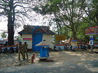
Neeleeswaram, a small village in the Ernakulam district of the Kerala state of India. It is on the way to the famous St. Thomas pilgrim centre of Malayattoor.
Thevara is a place in central Kochi in Kerala, India.
Vyttila, IPA: [ʋɐjt̺ːilɐ], is an intersection as well as the name of a region in the city of Kochi, in the state of Kerala, India. It is the busiest as well as one of the largest intersections in Kerala. This node intersects the main north–south artery of the state of Kerala, namely, the Kochi Bypass, with three city roads of Kochi viz, the S. A. Road, the Vyttila-Petta Road, and the Thammanam Road.

Kaloor is a downtown region in the city of Kochi, in the state of Kerala, India. It is 2 km from the Ernakulam North Railway Station. Kaloor Junction is also the name of a major intersection in this part of the city, intersecting the two major arteries of downtown Kochi, namely Banerji Road and the Kaloor-Kadavanthra Road. The nearest major intersections are Palarivattom to the east and Lissie Junction to the west.

Cochin Harbour Terminus (CHTS) is one of the railway stations in the city of Kochi, in the state of Kerala, India. It is located on the Willingdon Island. The Cochin Harbour Terminus is the principal station providing rail connectivity to the southern segment of the Port of Kochi located on the Willingdon Island.. And hence it mainly handles goods transport in and out of the Kochi Port. Cochin Harbour Terminus railway station is not in use after the commissioning of Vallarpadam container terminus. The station is now locked and all the trains to this station from Ernakulam Junction were stopped in 2013.

Mahatma Gandhi Road, popularly known as M. G. Road, is the main artery as well as the commercial high street of the city of Kochi, in the state of Kerala, India. The road lies north-south with its boundaries at the Venduruthy bridge, Thevara in the south, and the Madhava Pharmacy Junction in the north, where it intersects the Banerji Road. The road was earlier part of the NH 47A and was later handed over to Kochi Municipal Corporation. The highway was earlier known as Seventy Feet road. The total distance of the road is 4.5 kilometres (2.8 mi).
Sahodaran Ayyappan Road, popularly known as S.A Road is one of the most important and the second main arterial road of CBD Kochi city ; it is supposed to be the busiest and most congested road in the city of Kochi, which run in east-west direction and the shortest road connecting the two main iconic junctions in the city. The road connects the MG Road in west with Vyttila Junction & Hub in east and continues further as Tripunithura Road that connects to Tripunithura, hence termed as the back bone road of Kochi.
Park Avenue is a famous tree-lined road starting from the western end of Durbar Hall Road to Broadway in the city of Kochi, India. Two large parks, Subhash Bose Park and Indira Priyadarshini Park are situated along the road, hence the name. Several famous historical buildings are also located alongside the road. The road has more than 45 flowering trees planted on both sides, forming a thick canopy over the road. This 1.5 km stretch was considered to be a model road for the city and the road extends further north as Shanmugham Road.
This is a list of areas and neighbourhoods in Cochin by region.

Muttom is a rural area in Idukki district in the Indian state of Kerala. This place is 66 km away from Cochin. Geographically this place is part of Midland or Idanad region of Kerala. Hindus, Christians and Muslims are living peacefully in the area.
